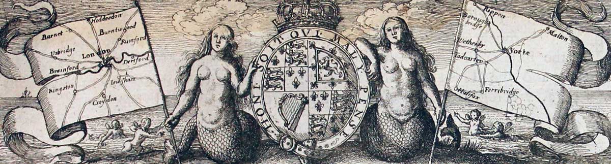
The following John Ogilby's Road Maps are currently in stock. They are all guaranteed to be genuine early specimens All in good clean condition and attractively hand coloured unless otherwise stated.
Also listed are some specimens of the original text for each road map that were only published in the first edition of Britannia
Each measuring about 17 x 13 inches
Published in 1675 and 1698
First Edition - 1675
Plate 2 John Ogilby Road Map
31757 Plate 2. The Continuation of ye Road from London to Aberistwith. Islip. Morton in Marsh, Broadway, Pershore, Bramyard, Worcester. Price: 180.00
The first edition of this 17th century strip road map. Embellished with a decorative title cartouche. 17 x 12 1/4 inches. Small slit at the bottom of the centre fold. Otherwise good condition with wide blank margins. Straight from the atlas so has never previously been sold as a single map.
From: Britannia
TEXT: The original double sided page of text from Britania to accompany this map is available to the purchaser at a reduced price of 25.00 if bought with the map.
BUYING: The purchase of this map can be by direct payment to my bank account. Or by telephoning me with your credit/debit card details. Please telephone me first to check the map is available - 01244 336004. If paying to my bank please email me afterwards advising and giving me your name and address as to where the map is to be sent.
First Edition - 1675
Plate 4 John Ogilby Road Map
31759 Plate 4. The Road from London to Arundel. London, Ewell, Dorking, Billingshurst, Amberley, Arundel, Chichester. Price: 320.00
The first edition of this 17th century strip road map. Uncoloured. Embellished with a decorative title cartouche. 17 1/4 x 12 1/2 inches. Small crease in top blank margin near centre fold. Small slit at the bottom of the centre fold. Otherwise good condition with wide blank margins. Straight from the atlas so has never previously been sold as a single map.
From: Britannia
TEXT: The original double sided page of text from Britania to accompany this map is available to the purchaser at a reduced price of 25.00 if bought with the map.
BUYING: The purchase of this map can be by direct payment to my bank account. Or by telephoning me with your credit/debit card details. Please telephone me first to check the map is available - 01244 336004. If paying to my bank please email me afterwards advising and giving me your name and address as to where the map is to be sent.
First Edition - 1675
Plate 6 John Ogilby Road Map
31761 Plate 6. The Continuation of the Road from London to Barwick. Stilton, Stamford, Grantham, Newark, Tuxford. Price: 180.00
The first edition of this 17th century strip road map. Uncoloured. Embellished with a decorative title cartouche. 17 1/2 x 12 1/2 inches. Small split at the bottom of the centre fold. Otherwise good condition with wide blank margins. Straight from the atlas so has never previously been sold as a single map.
From: Britannia
TEXT: The original double sided page of text from Britania to accompany this map is available to the purchaser at a reduced price of 25.00 if bought with the map.
BUYING: The purchase of this map can be by direct payment to my bank account. Or by telephoning me with your credit/debit card details. Please telephone me first to check the map is available - 01244 336004. If paying to my bank please email me afterwards advising and giving me your name and address as to where the map is to be sent.
First Edition - 1675
Plate 7 London to Berwick John Ogilby Road Map
29320 Plate 7. London to Berwick Plate 3. Tuxford, Doncaster, Wentbridge, Tadcaster, York. Price: 190.00
The first edition of this 17th century strip road map. No Plate number. Uncoloured. Embellished with a decorative title cartouche. 17 x 12 1/2 inches. Small repair to blank area just above the top right hand corner of the map where there is a manuscript figure 7. Small rust mark in centre fold with tine holy. Otherwise good condition with wide blank margins.
From: Britannia
First Edition - 1675
Plate 7 John Ogilby Road Map
31762 Plate 7. London to Berwick Plate 3. Tuxford, Doncaster, Wentbridge, Tadcaster, York. Price: 220.00
The first edition of this 17th century strip road map. Uncoloured. Embellished with a decorative title cartouche. 17 x 12 1/2 inches. Small split at the bottom of the centre fold. Light vertical crease on the right hand side of the map. Otherwise good condition with wide blank margins. Straight from the atlas so has never previously been sold as a single map.
From Britannia
TEXT The original double sided page of text from Britania to accompany this map is available to the purchaser at a reduced price of 25.00 if bought with the map.
BUYING The purchase of this map can be by direct payment to my bank account. Or by telephoning me with your credit/debit card details. Please telephone me first to check the map is available - 01244 336004. If paying to my bank please email me afterwards advising and giving me your name and address as to where the map is to be sent.
Rare Ogilby Text - 1675
28585 Plate 7. London to Berwick Plate 3. Tuxford, Doncaster, Wentbridge, Tadcaster, York. Price: 30.00
The rare double sided page of folio text published in 1675 describing the route in great detail. A unique opportunity as it is very unlikely that I shall able to offer this again. Some water staining otherwise good
Minimum Order £15.00
POST FREE IN THE U.K.
If the map is to be sent to an address outside the UK. I will send you a PayPal Invoice for the Postage and Packing. This single charge covers any number of items in one order. EUROPE - 14 pounds. REST OF THE WORLD - 20 pounds
Minimum Order £15.00
POST FREE IN THE U.K.
If the map is to be sent to an address outside the UK. I will send you a PayPal Invoice for the Postage and Packing. This single charge covers any number of items in one order. EUROPE - 14 pounds. REST OF THE WORLD - 20 pounds
First Edition - 1675
Plate 7. London to Berwick Plate 3. Tuxford, Doncaster, Wentbridge, Tadcaster, York
29320 Plate 7. London to Berwick Plate 3. Tuxford, Doncaster, Wentbridge, Tadcaster, York. Price: 190.00
An uncoloured 1675 edition specimen without the plate number although an manuscript number 7 has been added just above the top right hand corner of the map. Small repair in the blank margin near to this number 7. Small rust hole on the centre fold as can be seen on the illustration. Good wide blank margins.
First Edition - 1675
Plate 8 John Ogilby Road Map
31763 Plate 8. London to Berwick Plate 4. York, Boroughbridge, Northallerton, Darlington, Durham, Chester-le-Street. Price: 180.00
The first edition of this 17th century strip road map. Uncoloured. Embellished with a decorative title cartouche. 17 3/4 x 12 3/4 inches. Small split at the bottom of the centre fold. Otherwise good condition with wide blank margins. Straight from the atlas so has never previously been sold as a single map
From Britannia
TEXT The original double sided page of text from Britania to accompany this map is available to the purchaser at a reduced price of 25.00 if bought with the map.
BUYING The purchase of this map can be by direct payment to my bank account. Or by telephoning me with your credit/debit card details. Please telephone me first to check the map is available - 01244 336004. If paying to my bank please email me afterwards advising and giving me your name and address as to where the map is to be sent.
First Edition - 1675
Plate 9 John Ogilby Road Map
31764 Plate 9. London to Berwick Plate 5. Chester-le-Street, Newcastle-upon-Tyne, Morpeth, Alnwick, Belford, Berwick. Price: 180.00
The first edition of this 17th century strip road map. Uncoloured. Embellished with a decorative title cartouche. 17 1/4 x 12 1/2 inches. Small split at the bottom of the centre fold. Light crease on the right hand side of the centre fold. Otherwise good condition with wide blank margins. Straight from the atlas so has never previously been sold as a single map
From Britannia
TEXT The original double sided page of text from Britania to accompany this map is available to the purchaser at a reduced price of 25.00 if bought with the map.
The purchase of this map can be by direct payment to my bank account. Or by telephoning me with your credit/debit card details. Please telephone me first to check the map is available - 01244 336004. If paying to my bank please email me afterwards advising and giving me your name and address as to where the map is to be sent.
First Edition - 1675
Plate 13 John Ogilby Road Map 1675
31768 Plate 13. The Continuation of the Extented Road from Buckingham to Bridgnorth. Banbury, Stratford, Bromsgrove, Kidderminster, Bridgnorth. Banbury, Camden. Price: 220.00
The first edition of this 17th century strip road map. Uncoloured. Embellished with a decorative pictorial title cartouche. 17 1/2 x 13 1/4 inches. Two small light brown spots in the top left and right blank margins. Otherwise good condition with wide blank margins. Nice dark impression. Straight from the atlas so has never previously been sold as a single map
From Britannia
TEXT The original double sided page of text from Britania to accompany this map is available to the purchaser at a reduced price of 25.00 if bought with the map.
The purchase of this map can be by direct payment to my bank account. Or by telephoning me with your credit/debit card details. Please telephone me first to check the map is available - 01244 336004. If paying to my bank please email me afterwards advising and giving me your name and address as to where the map is to be sent. ption
First Edition - 1675
Plate 15 John Ogilby Road Map 1675
31770 Plate 15. The Road from London to St. David's Part 2. Abingdon, Faringdon, Fairford, Barnsley, Gloucester, Monmouth. Price: 200.00
The first edition of this 17th century strip road map. Uncoloured. Embellished with a decorative pictorial title cartouche. 17 3/4 x 12 3/4 inches. Map not printed square on to the sheet of paper. Therefore some unequal blank margins. Otherwise good condition with wide blank margins. Nice dark impression. Straight from the atlas so has never previously been sold as a single map
From Britannia
TEXT The original double sided page of text from Britania to accompany this map is available to the purchaser at a reduced price of 25.00 if bought with the map.
The purchase of this map can be by direct payment to my bank account. Or by telephoning me with your credit/debit card details. Please telephone me first to check the map is available - 01244 336004. If paying to my bank please email me afterwards advising and giving me your name and address as to where the map is to be sent.
17th Century Road Map
London to St. Davids. Monmouth, Newport, Cardiff, Cowbridge, Aberavon, Burton John Ogilby
31771 Plate 16. The Continuation of the Road from London to St. Davids Part 3. Monmouth, Newport, Cardiff, Cowbridge, Aberavon, Burton. Price: 180.00
An uncoloured specimen of the 1698 edition. Two tiny worm holes at the bottom of the centre fold in the blank margin area.
Minimum Order £15.00
POST FREE IN THE U.K.
If the map is to be sent to an address outside the UK. I will send you a PayPal Invoice for the Postage and Packing. This single charge covers any number of items in one order. EUROPE - 14 pounds. REST OF THE WORLD - 20 pounds
First Edition - 1675
Plate 16 John Ogilby Road Map 1675
31771 Plate 16. The Continuation of the Road from London to St. Davids Part 3. Monmouth, Newport, Cardiff, Cowbridge, Aberavon, Burton. Price: 200.00
The first edition of this 17th century strip road map. Uncoloured. Embellished with a decorative title cartouche. 17 1/2 x 12 3/4 inches. Slight crease in top right hand blank border. Otherwise good condition with wide blank margins. Nice dark impression. Straight from the atlas so has never previously been sold as a single map
From Britannia
TEXT The original double sided page of text from Britania to accompany this map is available to the purchaser at a reduced price of 25.00 if bought with the map.
The purchase of this map can be by direct payment to my bank account. Or by telephoning me with your credit/debit card details. Please telephone me first to check the map is available - 01244 336004. If paying to my bank please email me afterwards advising and giving me your name and address as to where the map is to be sent.
17th Century Road Map
London to St. Davids Part 4. Burton, Kidwelly, Haverfordwest, St. Davids John Ogilby
29401 Plate 17. The Road from London to St. Davids Part 4. Burton, Kidwelly, Haverfordwest, St. Davids. Price: 120.00
An uncoloured specimen of the 1698 edition. Little light soiling in one of the centre panels. Some very light soiling in part of the left and right hand blank margins.
Minimum Order £15.00
POST FREE IN THE U.K.
If the map is to be sent to an address outside the UK. I will send you a PayPal Invoice for the Postage and Packing. This single charge covers any number of items in one order. EUROPE - 14 pounds. REST OF THE WORLD - 20 pounds
First Edition - 1675
Twext Plate 17 John Ogilby Road Map 1675
28595 Plate 17. The Road from London to St. Davids Part 4. Burton, Kidwelly, Haverfordwest, St. Davids. Text only. Price: 30.00
The rare double sided page of folio text published in 1675 describing the route in great detail. Some water staining. A rare opportunity as it is very unlikely that I shall able to offer this again.
Minimum Order £15.00
POST FREE IN THE U.K.
If the map is to be sent to an address outside the UK. I will send you a PayPal Invoice for the Postage and Packing. This single charge covers any number of items in one order. EUROPE - 14 pounds. REST OF THE WORLD - 20 pounds
First Edition - 1675
Plate 17 John Ogilby Road Map 1675
31772 Plate 17. The Continuation of the Road from London to St. Davids Part 4. Burton, Kidwelly, Haverfordwest, St. Davids. Price: 180.00
The first edition of this 17th century strip road map. Uncoloured. Embellished with a decorative title cartouche. 17 1/4 x 13 inches. Good condition with wide blank margins. Nice dark impression. Straight from the atlas so has never previously been sold as a single map
From Britannia
TEXT The original double sided page of text from Britania to accompany this map is available to the purchaser at a reduced price of 25.00 if bought with the map.
The purchase of this map can be by direct payment to my bank account. Or by telephoning me with your credit/debit card details. Please telephone me first to check the map is available - 01244 336004. If paying to my bank please email me afterwards advising and giving me your name and address as to where the map is to be sent.
First Edition - 1675
Plate 18 John Ogilby Road Map 1675
31773 Plate 18. The Road from London to Dover. London, Southwark, Rochester, Canterbury, Dover. Price: 280.00
The first edition of this 17th century strip road map. Uncoloured. Embellished with a decorative title cartouche. 17 1/2 x 12 1/2 inches. Small worm hole in top blank margin and split to the bottom of the centre fold in margin area. Otherwise good condition with wide blank margins. Nice dark impression. Straight from the atlas so has never previously been sold as a single map
From Britannia
TEXT The original double sided page of text from Britania to accompany this map is available to the purchaser at a reduced price of 25.00 if bought with the map.
The purchase of this map can be by direct payment to my bank account. Or by telephoning me with your credit/debit card details. Please telephone me first to check the map is available - 01244 336004. If paying to my bank please email me afterwards advising and giving me your name and address as to where the map is to be sent.
First Edition - 1675
Plate 19 John Ogilby Road Map 1675
31775 Plate 19. The Road from London to Harwich in Essex. London, Romford, Brentford, Chelmsford, Colchester, Harwich. Price: 220.00
The first edition of this 17th century strip road map. Uncoloured. Embellished with a decorative title cartouche. 17 x 13 inches. Brown ink stain in the right hand blank margin. Small slit at the bottom of the centre fold. Otherwise good condition with wide blank margins. Nice dark impression. Straight from the atlas so has never previously been sold as a single map
From Britannia
TEXT The original double sided page of text from Britania to accompany this map is available to the purchaser at a reduced price of 25.00 if bought with the map.
The purchase of this map can be by direct payment to my bank account. Or by telephoning me with your credit/debit card details. Please telephone me first to check the map is available - 01244 336004. If paying to my bank please email me afterwards advising and giving me your name and address as to where the map is to be sent.
Rare Ogilby Text - 1675
Plate 19 text John Ogilby Road Map 1675
28597 Plate 19. London, Romford, Brentford, Chelmsford, Colchester, Harwich. Text only. Price: 30.00
The rare double sided page of folio text published in 1675 describing the route in great detail. A unique opportunity as it is very unlikely that I shall able to offer this again. Some water staining otherwise good
Minimum Order £15.00
POST FREE IN THE U.K.
If the map is to be sent to an address outside the UK. I will send you a PayPal Invoice for the Postage and Packing. This single charge covers any number of items in one order. EUROPE - 14 pounds. REST OF THE WORLD - 20 pounds
First Edition - 1675
Plate 20 John Ogilby Road Map 1675
31776 Plate 20. The Road from London to Hythe. London, Eltham, Farmingham, Maidstone, Ashford, Hythe. Price: 230.00
The first edition of this 17th century strip road map. Uncoloured. Embellished with a decorative pictorial title cartouche. 16 1/2 x 12 3/4 inches.Good condition with wide blank margins. Nice dark impression. Straight from the atlas so has never previously been sold as a single map
From Britannia
TEXT The original double sided page of text from Britania to accompany this map is available to the purchaser at a reduced price of 25.00 if bought with the map.
The purchase of this map can be by direct payment to my bank account. Or by telephoning me with your credit/debit card details. Please telephone me first to check the map is available - 01244 336004. If paying to my bank please email me afterwards advising and giving me your name and address as to where the map is to be sent.
Rare Ogilby Text - 1675
Plate 23 John Ogilby Road Map 1675
28479 Plate 23. Lichfield, Rugeley, Stone, Stableford, Nantwich, Tarporley, Chester. Text only. Price: 30.00
The rare double sided page of folio text published in 1675 describing the route in great detail. Some light water staining. A rare opportunity as it is very unlikely that I shall able to offer this again.
Minimum Order £15.00
POST FREE IN THE U.K.
If the map is to be sent to an address outside the UK. I will send you a PayPal Invoice for the Postage and Packing. This single charge covers any number of items in one order. EUROPE - 14 pounds. REST OF THE WORLD - 20 pounds
17th Century Road Map
Plate 24 John Ogilby 1698
32340 Plate 24. The Road from London to Holyhead. Chester, Denbigh, Conway, Beaumaris, Holyhead. Price: 160.00
A hand coloured specimen of the 1698 edition of this map showing the final part of the journey from London to Holyhead. This section starts at my local city of Chester and through Hawarden, Denbigh, Conway and Penmaenmawr where the traveller has to cross over the sands to Beaumaris on Anglesey. Embellished with a decorative title cartouche. Original centre fold. Hand coloured. Light toning, few small nicks on the left and right hand edges of the blank margin and a repair to the the to right hand blank margin corner. Original centre fold.
From: Britannia
Rare Ogilby Text - 1675
Plate 24 Ogilby Text
28602 Plate 24. Chester, Denbigh, Conway, Beaumaris, Holyhead. Text only. Price: 30.00
The rare double sided page of folio text published in 1675 describing the route in great detail. A unique opportunity as it is very unlikely that I shall able to offer this again. Some water staining otherwise good
Minimum Order £15.00
POST FREE IN THE U.K.
If the map is to be sent to an address outside the UK. I will send you a PayPal Invoice for the Postage and Packing. This single charge covers any number of items in one order. EUROPE - 14 pounds. REST OF THE WORLD - 20 pounds
The Nine Lives of John Ogilby by Alan Ereira
I was 19 when I got hooked on antique maps. There are quite a few of the early cartographers who we know a bit about about and their life stories make interesting reading. There is one English mapmaker who stands out as someone rather special who appears to have had a most interesting life. He is JOHN OGILBY. Yes you know he was the first to map the roads of England and Wales and yes you might have read that he had an interest in dancing. If you want to know more about the man who created that 17th century map hanging on your wall then you must read this book published in 2016 - The Nine Lives of John Ogilby by Alan Ereira. In this book the author brings a fascinating hidden history to light, and reveals that Ogilby's celebrated Britannia is far more than a harmless road atlas: it is, rather, filled with secrets designed to serve Charles II's sinister purpose.
We use cookies to improve your browsing experience on our site, analyse site traffic and understand where our audience is coming from