Antique Maps of the Mediterranean
Richard Nicholson of Chester

Established in 1961

The maps on this page are guaranteed to be genuine early specimens published in or around the year stated
MEDITERRANEAN
19th Century - Decorative
-

Malta and Mediterranean, Tallis 1853

32302 Malta and Mediterranean, John Tallis, c.1853. Price: 52.00
BRITISH POSSESSIONS IN THE MEDITERRANEAN
An attractive sheet displaying in four sections, a detailed map of Malta with a vignette view of Valletta plus an inset map of Gozo. A map of Corfu with an inset view of Corfu Town. Another area shows a map of Gibraltar with an inset view. The bottom right hand corner shows a map of a number of Greek islands including Cephalonia and Zante. All this displayed within a patterned border with title cartouche. 9 x 13 inches. Original outline hand colouring. Top of cartouche just touching outer upper edge. Original centre fold. Good clean condition on stout paper. Drawn and engraved by J. Rapkin, the vignette views by H. Winkles.
From: The Illustrated Atlas
CORSICA
18th Century - Early Hand Colouring
-

Calvi, Joseph Roux, 1764

27887 Calvi, Joseph Roux, 1764. Price: 55.00
PLAN DE LA BAYE DE CALVI SUR I’ISLE DE CORSE
A small engraved chart showing the entrance to the harbour of Calvi on the north west coast of Corsica. Depth soundings and anchorage points shown. 7 1/2 x 5 inches. Uncoloured. Good condition. Unlike most of the charts in the atlas this map does not have a plate number in the top right hand corner. There is, however, a manuscript figure 35 which fits in with the order of the maps in the atlas.
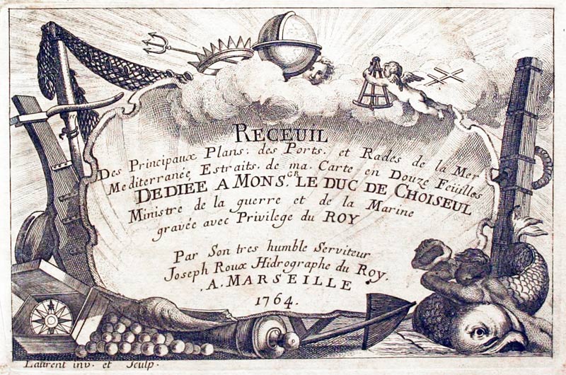
From: Receuil Des Principaux Plans; des Ports, et Rades de la Mer Mediterranée, Estraits, de ma. Carte Douze Feüilles.... Marselle 1764
17th Century - Sea Chart
-

Cape Delle Melle to Mount Argentato, John Seller, c.1785.

32164 Cape Delle Melle to Mount Argentato, John Seller, c.1785. Price: 140.00
THE SEA COAST OF ITALY FROM CAPE DELLE MELLE TO MOUNT ARGRNTATO WITH THE ISLAND OF CORSICA
An interesting engraved chart by this English mapmaker. It shows the Gulf of Liguria with the islands of Corsica and Elba and a small piece of Sardinia. The coastline starts at Nice and carries on down the Tuscan coast. Decorative title cartouche and scales panel. Two compass roses and rhumb lines. 20 1/4 x 15 1/2 inches. Uncoloured. Centre fold as issued. Straight from the atlas and not previously sold as a single map. Tiny tear on the edge of the bottom margin otherwise good condition.
From: Part 3 of the English Pilot
CRETE
18th Century - Sea Chart
-

Island of Garbugi, Joseph Roux, 1764

27965 Garbugi, Joseph Roux, 1764. Price: 45.00
ISLE GARBUGI
A small engraved chart showing the the island of Garbugi which lies off the coast of the Greek island of Crete. Shows the fortifications, anchorage points and depth soundings. 7 1/2 x 5 inches. Uncoloured. Good condition. Plate 122 From Receuil Des Principaux Plans; des Ports, et Rades de la Mer Mediterranée, Estraits, de ma. Carte Douze Feüilles.... Marselle 1764
18th Century - Sea Chart
-

Souda, Crete by Joseph Roux, 1764

27966 Souda, Joseph Roux, 1764. Price: 30.00
PORTE DE LA SUDE SUR ISLE DE CANDIE
A small engraved chart showing the bay and Port of Souda in the former municipality in Chania . Shows the depth soundings and anchorage points. 7 1/2 x 5 inches. Uncoloured. Slight trimming in the top blank margin with loss of plate number, otherwise good condition.
From Receuil Des Principaux Plans; des Ports, et Rades de la Mer Mediterranée, Estraits, de ma. Carte Douze Feüilles.... Marselle 1764
18th Century - Sea Chart
-

Island of Spinalonga Joseph Roux, 1764

27967 Spinalonga, Joseph Roux, 1764. Price: 45.00
PLAN DE L’ISLE SPINE LONGUE SUR L’ISLE CANDIE
A small engraved chart showing part of coast of Crete with the island of Spinalonga, once a powerful sea fortress in the Mediterranean. Became a leper colony in 1903 until 1957. 7 1/2 x 5 inches. Uncoloured. Good condition. From Receuil Des Principaux Plans; des Ports, et Rades de la Mer Mediterranée, Estraits, de ma. Carte Douze Feüilles.... Marselle 1764
CYPRUS
Late 16th Century
-

Cyprus, Abraham Ortelius c.1592
-

Text for Cyprus Abraham Otelius 1592


32150 Cyprus, Abraham Ortelius, c.1592. Price: 750.00
CYPRI INSULAE NOVA DESCRIPT 1573
An important early map of the island first published in 1573. There is also a decorative oval cartouche with an inset map of the island of Lemnos. Decorative title cartouche with two naked figues dated 1573. Scale cartouche. Three sailing ships. I think that some of the hand colouring may be early but there have been other later changes to the colouring. Latin text on verso. Original centre fold. 19 1/2 x 13 3/4 inches. Very light water stain in the bottom left and right hand blank border cornesr. Otherwise good clean condition.
From: Theatrum
ELBA
17th Century - Sea Chart
-

Portoferraio, Joseph Roux, 1764

27883 Portoferraio, Joseph Roux, 1764. Price: 55.00
FERRARO
A small engraved chart showing the entrance to the harbour with scale. Depth soundings and anchorage points shown. 7 1/2 x 5 inches. Uncoloured. Good condition.
Plate 31 From: Receuil Des Principaux Plans; des Ports, et Rades de la Mer Mediterranée, Estraits, de ma. Carte Douze Feüilles.... Marselle 1764
MALTA
19th Century - Decorative
-
Malta and Mediterranean, Tallis 1853
32302 Malta and Mediterranean, John Tallis, c.1853. Price: 52.00
BRITISH POSSESSIONS IN THE MEDITERRANEAN
An attractive sheet displaying in four sections, a detailed map of Malta with a vignette view of Valletta plus an inset map of Gozo. A map of Corfu with an inset view of Corfu Town. Another area shows a map of Gibraltar with an inset view. The bottom right hand corner shows a map of a number of Greek islands including Cephalonia and Zante. All this displayed within a patterned border with title cartouche. 9 x 13 inches. Original outline hand colouring. Top of cartouche just touching outer upper edge. Original centre fold. Good clean condition on stout paper. Drawn and engraved by J. Rapkin, the vignette views by H. Winkles.
From: The Illustrated Atlas
17th Century
-

North Africa Jan Jansson c.1680

33631 North Africa, Jan Jansson c.1680. Price: 95.00
AFRICAE PROPRIAE TABULA IN QUA, PINICA REGNA UIDES, TYRIOS, ET AGENORIS URBEM
An engraved map based upon an earlier map by Abraham Ortelius. It shows in ancient times part of the coast of north Africa showing the present day Tunisia and Libya. It shows part of Sicily as well as Malta and its neighbouring islands. Two decorative cartouches display the title and text. 20 1/2 x 14 1/2 inches. Uncoloured. Small Chethams Library stamp in the sea area. Original centre fold. Very lightly toned. Two spots in the wide blank margins. Smnall slit at the top of the centre fold. Otherwise good condition
This map comes from a Jansson atlas I purchased at Christies back in 1980
SARDINIA
17th Century - Sea Chart
-

Saragosa, Joseph Roux, 1764

27897 Saragosa, Joseph Roux, 1764. Price: 45.00
SARAGOSA
A small engraved chart showing the gulf and town of Saragosa in north east Sardinia. 7 1/2 x 5 inches. Uncoloured. A little light toning but otherwise good condition.
Plate 45
From: Receuil Des Principaux Plans; des Ports, et Rades de la Mer Mediterranée, Estraits, de ma. Carte Douze Feüilles.... Marselle 1764
RICHARD NICHOLSON
of CHESTER
Stoneydale
Pepper Street
Christleton
Chester
CH3 7AG
Telephone
01244 336004
International 44 1244 336004

I have been buying and selling antique maps since the early 1960's during which time I had a gallery in Watergate Street, Chester for 30 years. I am now able to offer through my websites a personal service to map and print collectors.

