Antique Maps of Artois
Richard Nicholson of Chester

Established in 1961
A World of Antique Maps and Prints

The maps on this page are guaranteed to be genuine early specimens published in or around the year stated
18th Century - Sea Chart - Early Hand Colouring
-

Dunkirk, J. N. Bellin, 1764

10529 Dunkirk, J. N. Bellin, 1764. Price: 42.00
CARTE DE LA RADE DE DUNKERQUE ET SES BANCS
An engraved chart showing the water off Dunkirk. Title panel. 6 1/2 x 9 inches. Original blue outline and wash colouring. Good condition.
From Le Petit Atlas Maritime
18th Century - Early Hand Colouring
-

Artois, Johann Baptist Homann, c.1760

21681 Artois, Johann Baptist Homann, c.1760. Price: 89.00
CARTE D'ARTOIS ET SES ENVIRONS VEL MAPPA SPECIALIS COMITATUS ARTESIAE...
A good detailed map of the region. The title appears within a large uncoloured decorative cartouche with two female figures, putti and hounds. Attribution to G. de L'Isle. 22 1/2 x 19 inches. Original outline and wash hand colouring. Good condition.
17th Century
-

Artois, Nicolaes Visscher, c.1690

22619 Artois, Nicolaes Visscher, c.1690. Price: 95.00
GEOGRAPHICA ARTESIAE COMITATUS TABULA PER NICOLAUM VISSCHER
A good engraved map of the region. Decorative title cartouche with the royal arms and four putti. Scale and explanation cartouche showing a putti by a water fountain. 22 x 18 inches. Uncoloured. Good condition.
17th Century
-

Cambrai, Willem J. Blaeu, 1631

22620 Cambrai, Willem J. Blaeu, 1631. Price 95.00
ARCHIEPISCOPATUS CAMERACENSIS. ARCHEVESCHE DE CAMBRAY
A 17th century engraved map centred on Cambrai with the towns of Douai and Valenciennes. Embellished with three decorative cartouches and a coat of arms. Latin text on verso. Slit at the bottom of the centre fold, otherwise good condition. Uncoloured.
17th Century - Early Hand Colouring
-

Douai, Nicolaes Visscher, c.1690

22621 Douai, Nicolaes Visscher, c.1690. Price: 90.00
An untitled map showing the towns of Douai, Valenciennes, Bouchain and Cambrai. Imprint of Nicolaes Visscher. 18 1/2 x 11 1/4 inches. Full original outline and wash hand colouring. Good codition.
From: Visscher's Atlas Minor
17th Century - Military
-

Aire, Joan Blaeu, 1649

22622 Aire, Joan Blaeu, 1649. Price: 96.00
PERFECTE ASBEEDING VAN DE STERCKE STAT AYRE OFTE ARIEN... PLAN D'AYRE AVEC SEZ FORTS LIGNES DE CIRCONVALATIONS.... 1641
An interesting engraved map showing the fortifications of Aire and the other fortifications. Title cartouche and two explanation cartouches. Inset map of part of Artois and Flanders with figures of two fishermen as well as weapons. Scale with figure of a soldier. 20 1/2 x 15 1/2 inches. Uncoloured. Latin text on verso.
From: Novum ac Magnum Theatrum Urbium Belgicae Foederate
16th Century - Town Plan
-

Cambrai, Luigi Guicciardini, 1582

25594 Cambrai, Ludovico Guicciardini, 1582. Price: 92.00
CAMBRAY
An interesting early bird’s eye view of the town. Decorative central title cartouche. Figure of lady and gentleman with dog in foreground. 12 1/2 x 9 1/4 inches. Uncoloured. Split at the top of the centre fold just in the blank margin.
From: Description de Touts les Pais-Bas autrement appelles la Germamie Inferieure ou Basse Allemagne
16th Century - Town Plan - Early Hand Colouring
-

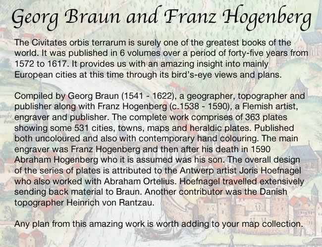
Lille, Georg Braun & Franz Hogenberg, c.1600

27147 Lille, Georg Braun & Franz Hogenberg, c.1600. Price: 300.00
LILLE
A fine 17th century bird's eye view plan of the town with three costumed figures in the foreground. The title appears across the top of the plan whilst a large decorative cartouche displays the key. Two coats of arms. French text on verso. 17 x 13 inches, 427 x 325 mm. SUPERB EARLY HAND COLOURING. Fine clean condition with wide blank margins.
From: Civitates Orbis Terrarum
18th Century - Town Plan
-

Bethune, Claude du Bosc, c.1740

29547 Bethune, Claude du Bosc, c.1740. Price: 37.00
PLAN OF BETHUNE A STRONG TOWN IN ARTOIS BESIEGED BY THE ALLIES
An engraved plan of the town showing its fortifications. The rococo cartouche displays the title and key to 14 places of interest. 17 1/4 x 13 1/2 inches. Uncoloured. Good clean condition.
18th Century - Town Plan
-

Siege of Bouchain, Claude du Bosc, c.1740

29548 Siege of Bouchain, Claude du Bosc, c.1740. Price: 35.00
PLAN OF THE TOWN OF BOUCHAIN BESIEG’D & TAKEN BY YE ALLIES IN 1711
An engraved plan of the town illustrating the siege in the War of Spanish Succession, the last major victory of John Churchill 1st Duke of Marlborough. The rococo cartouche displays the title and key to 6 places of interest. 17 x 14 inches. Uncoloured. Good clean condition.
18th Century - Military
-

Douai, Claude du Bosc, c.1740

29550 Douai, Claude du Bosc, c.1740. Price: 35.00
THE ENCAMPMENT OF THE ALLIES ARMY TO COVER THE SIEGE OF DOWAY AGAINST THE FRENCH ARMY THAT CAME TO RAISE THE SAID SIEGE IN JUNE 1710
An interesting engraved plan of the town and surrounding area showing the deployment of troops.. Rococo title cartouche. Compass pointer. 16 1/2 x 12 3/4 inches. Uncoloured. Small hole in a blank area of the map. Good clean condition.
18th Century Town Plan
-

Town plan of Bethune in Artois France by Paul de Rapin-Thoyras c.1750

29598 Bethune, Paul de Rapin - Thoyras, c.1750. Price: 55.00
PLAN OF BETHUNE
One title appears beneath the plan whilst a second is displayed within a rococo cartouche and reads Bethune A Stong Town in the Earldom of Artois in the Low Countries, Subject to the French. The cartouche also bears the name of the engraver J. Basire. Explanation panel and compass rose. 18 3/4 x 14 3/4 inches. Uncoloured. Good condition.
For Mr. Tindal’s Continuation of Mr. Rapin’s History of Britain
17th Century - Town Plan
-

Armnetières, Joan Blaeu 1649

32714 Armentières, Joan Blaeu, 1649, Price: 250.00
ARMENTIERES
A fine 17th century engraved town plan of Aermentierres. Across the top of the plan is a panoramic view of the town with two coats of arms along with a key to the notable buildings. The names of the buildings are displayed on the plan within a large banner cartouche. 19 x 15 inches. Original centre fold. Uncoloured. Latin text on verso. A few scattered very light foxing spots otherwise good clean undamaged condition with wide blank margins.
From: Novum ac Magnum Theatrum Urbium Belgicae Foederate
18th Century
-

Armnetières, Joan Blaeu 1649

33338 Aire, Paul de Rapin-Toyras, c.1745. Price: 12.00
PLAN OF THE CITY OF AIRE AND FORT ST. FRANCIS WITH A VIEW OF ST. VENANT
An interesting engraved 17th plan. The title is displayed within a decoratouche and reads “Aire A very strong City and Castle in the Low Countries, in the Earldom of Artois, taken by Allies in 1710, but restor’d to the French by the Treaty of Utrecht”. Explanation and compass rose. 19 x 14 1/2 inches. Uncoloured. Original centre fold plus some otherl ight fold creases. As you will see from the image this is not a perfect specimen having a number of worm holes across the top of the maps. And therefore a SPECIAL PRICE.
Late 16th Century
-

Artois Lodovico Guicciardini 1582

33366 Artois Region, Lodovico Guicciardini, 1582. Price: 110.00
ATREBATUM REGIONIS VERA DESCRIPTIO
An early engraved map of the Artois region of France. Embellished with decorative title and scale cartouches. 12 1/2 x 9 1/4 inches. Three sailing ships are shown on the Atlantic Ocean. Uncoloured. Two small nicks on th edge of the wide right hand blank margin repaired otherwise good condition.
From: Description de Touts les Pais-Bas autrement appelles la Germamie Inferieure ou Basse Allemagne
17th Century
-

Siege of Arras, Joan Blaeu 1649

33715 Siege of Arras, Joan Blaeu, 1649. Price: 130.00
PLAN ET SIEGE D’ARRAS
A fine 17th century engraved map showing a plan of Arras with its fortifications. The tile appears in a simple panel with a second panel giving more details of the siege and the name of Jan Blaeu. A third panel provided a key listing 28 places of interest. A pictorial view of soldiers is provided in the vignette view in the bottom right hand corner. 21 3/4 x 16 1/2 inches. Uncoloured. Latin text on verso. Wide blank margins. Small piece missing on the edge of the wide top blank margin otherwise good condition.
From: Novum ac Magnum Theatrum Urbium Belgicae Foederate
The siege of Arras took place from June to August in 1640 being part of the Thirty Years’ War. The French forces were commanded by Louis de Bourbon, Prince de Condé (then the Duke of Enghien) and Marshal de La Meilleraye. There were around 20,000–30,000 troops, supported by heavy artillery.
The city was defended by a Spanish garrison and local militia. Spain attempted to relieve the city with an army led by Cardinal-Infante Ferdinand of Austria, but failed.
Early 17th Century
-

Artois, Abraham Ortelius c.1600

33717 Artois, Abraham Ortelius, c.1600. Price: 160.00
ATREBATUM REGIONIS VERA DESCRIPTIO
A fine early engraved map of the region, embellished with two decorative cartouches. 19 x 15 inches, 490 x 380 mm. Later finely executed hand colouring. Latin text on verso. Good clean condition. From: Theatrum Orbis Terraum
Fine Early Hand Colouring
-

Artois

33726 Artois, Hainaut, Picardy, Isle de France, Nicolaes Visscher, c.1700. Price: 140.00
MORAVIAE QUAE OLIM MARCOMANNORUM SEDES COROGRAPHIA PAVLO FABRITIO MEDICO ET MATHEMATICO DESCRIPTA
A fine early engraved map of the country embellished with a handsome title cartouche. In the bottom right hand corner is the scale with a pair of divers and a coat of arms. 18 1/2 x 14 inches. Original centre fold. Uncoloured. Latin text on verso. Superb clean crisp condition having been taken straight from the atlas and not previously been sold as a single map.
From: Theatrum Orbis Terarum


RICHARD NICHOLSON
of CHESTER
Stoneydale
Pepper Street
Christleton
Chester
CH3 7AG
Telephone
01244 336004
International 44 1244 336004

I have been buying and selling antique maps since the early 1960's during which time I had a gallery in Watergate Street, Chester for 30 years. I am now able to offer through my websites a personal service to map and print collectors.

