Antique Maps of Belgium
Richard Nicholson of Chester

Established in 1961
A World of Antique Maps and Prints

The maps on this page are guaranteed to be genuine early specimens published in or around the year stated
17th Century Town Plan
-

Lierre, Joan Blaeu 1649

5435 Lierre, Joan Blaeu 1649. Price: 240.00
LIER
A fine 17th century plan of the town of Lierre near Antwerp. Title panel. Two coats of arms. 20 x 16 inches, 520 x 420 mm. Latin text on verso. Hand coloured. Good condition.
From: Novum ac Magnum Theatrum Urbium Belgicae Foederate, published in Amsterdam
Early 18th Century - Original Hand Colouring
-

Belgium, Nicolaes Visscher, c.1700

7228 Part of Belgium, Nicolaes Visscher, c.1700. Price: 150.00
TRACTUS INTER SABIM ET OSAM comprehendens Meridionales partes Leodiensis Episcopatus...
A map extending from Charleroi and Namur in the north to Rocroi in the south. Includes Phillippeville. The title, scales and explanation appear across the top of the map. 23 x 19 inches, 580 x 480 mm. Original outline and wash colouring. Good condition.
From: Visscher's Atlas Minor
Early 18th Century - Original Hand Colouring
-

Part of Belgium, Nicolaes Visscher, c.1700

7229 Part of Belgium, Nicolaes Visscher, c.1700. Price: 145.00
LEODIENSIS EPISCOPATUS PARS MEDIAcomprehendens Hasbaniae Comitatum, Franchimontis...
A detailed map including Liege, Huy, Durbuy and Verviers. The title, scales and explanation appear across the top of the map. 22 x 19 inches, 560 x 490 mm. Original outline and wash colouring. Good conditon.
From: Visscher's Atlas Minor
18th Century Town Plan
-

Netherlands John Russel 1800

26251 Namur, Paul de Rapin-Thoyras, c.1745. Price: 45.00
THE CITY OF NAMUR WITH THE CASTLE AND OTHER FORTIFICATIONS
A detailed town plan showing the Meuse and Sambre rivers embellished with a decorative explanation cartouche with coat of arms. The title appears beneath the map with a key. 19 x 15 1/2 inches. Uncoloured. Some folding creases. Little to no blank margin on the right hand side. The other blank margins are small. Small split near the bottom of the centre fold. Clean condition with no foxing.
From: Continuation of Mr. Rapin's History by Nicolas Tindal
16th Century Town Plan - Early Hand Colouring
-

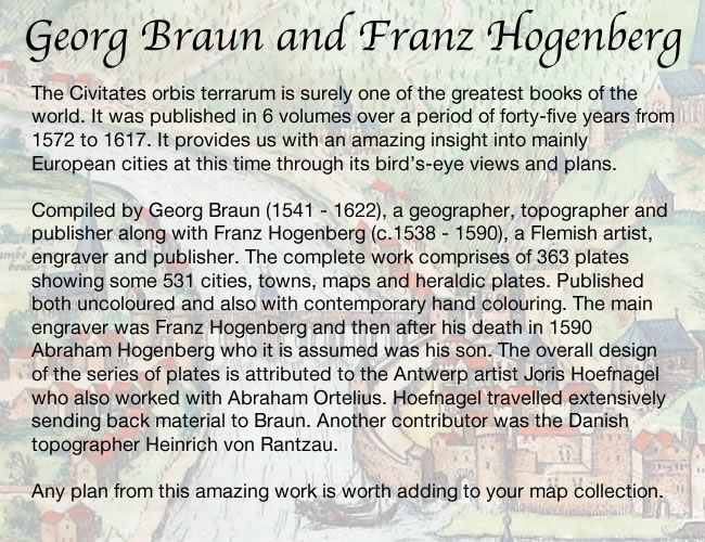
Aalst, Georg Braun and Franz Hogenberg, c.1600

27149 Aalst, Georg Braun and Franz Hogenberg, c.1579. Price: 330.00
ALOSTUM, URBS FLANDRIAE IMPERATORIAE FIRMISSIMA
A fine 16th century bird’s eye view of the town. Decorative title cartouche. Figure of a soldier holding a coat of arms. 16 3/4 x 13 inches, 422 x 330 mm. French text on verso. SUPERB ORIGINAL HAND COLOURING. Good clean condition with wide blank margins.
From: Civitates Orbis Terrarum
16th Century - Town Plan
-

Philippeville, Luigi Guicciardini, 1582

29523 Philippeville, Luigi Guicciardini, 1582. Price: 29.00
PHILIPPEVILLE
An interesting small early bird’s eye plan of the town. Decorative title cartouche. 6 1/2 x 4 3/4 inches. Uncoloured. Good clean undamaged condition.
From: Description de Touts les Pais-Bas autrement appelles la Germamie Inferieure ou Basse Allemagne
19th Century
-

Belgium and Luxemburg, George Washington Bacon, 1891

31140 Belgium and Luxemburg, George Washington Bacon, 1891. Price: 19.50
BELGIUM AND LUXEMBOURG
A good detailed map embellished with two inset maps. Environs of Brussels and Environs of Antwerp. 17 x 11 3/4 inches. Colour printed. Good blank margins. Good condition.
From: Complete Atlas of the World
17th Century
-

Nieuwerke, Belgium plan by Joan Blaeu 1649

33328 Nieuwkerke, Joan Blaeu 1649. Price: 70.00
NIEUKERCKE
An early bird’s eye view of the village of Nieuwkercke showing the church and village. Embellished with three coats of arms. Title panel and a blank panel. 9 x 5 1/4 inches. Latin text on verso. Attractive and well executed hand colouring. Fine condition.
From: Novum ac Magnum Theatrum Urbium Belgicae Foederate
Late 17th Century Battle Plan
-

Wontergem, Nicolaes Visscher, c.1705

33456 Wontergem, Nicolaes Visscher, c.1705. Price: 450.00
PLAN DE CAMP QUE PRIT L’ARMÉE DES ALLIES COMMANDEE PAR SON ALTESSE MR. LE PRINCE DE VAUDEMONT.........
A fine example of this battle plan of Wontergem showing the positions of the Allied and French troops in West Flanders in June and July of 1685. Large title banner dated 1695 and the panoramic explanation banner with figures that stretches right across the base of the map. 22 1/2 x 16 1/2 inches. Superb early hand colouring. Original centre fold. Plain on verso.
From Visscher Atlas Minor
17th Century Bird's Eye View
-

Blankenberge, Belgium Antonius Sanderus, 1649

33462 Blankenberge, Joan Blaeu, 1649. Price: 90.00
Blancoberga Maritimum Flandriae oppidulum Piscatione et propugnaculo Regio famosum
A 17th century bird’s eye view of the town of Blankenberge by Antonius Sanderus. Title cartouche. Ships on the sea area. 5 3/4 x 7 1/4 inches. Uncoloured. Latin descriptive text on verso. Good clean condition.
From: Novum ac Magnum Theatrum Urbium Belgicae Foederate.
17th Century Bird's Eye View
-

17th century view of the Belgian town of Torhout by Joan Blaeu

33463 Torhout, Joan Blaeu, 1649. Price: 68.00
Thoraltum vulgo Thorout, Antiquissimum Flandriae oppidum
A 17th century bird’s eye view of the town of Torhout in West Flanders by Antonius Sanderus. Decorative title cartouche. Panel with a key listing four places of interest. Two coats of arms. 9 x 6 inches. Uncoloured. Part of a Latin descriptive text on verso. Good clean condition.
From: Novum ac Magnum Theatrum Urbium Belgicae Foederate.
17th Century Bird's Eye View
-

Bird's Eye View of Gistel, Belgium by Joan Blaeu 1649

33464 Gistel, Joan Blaeu, 1649. Price: 110.00
Gistella Oppidum in ditione Franconatum Baronatus titulo nobile
A 17th century bird’s eye view of the town of Gistel in West Flanders by Antonius Sanderus. Decorative title cartouche. Inset view f an abbey and a panel with a key listing 8 places of interestThree coats of arms in the sky area. 9 x 5 3/4 inches. Uncoloured. Part of a Latin descriptive text on verso. Good clean condition.
From: Novum ac Magnum Theatrum Urbium Belgicae Foederate.
17th Century Bird's Eye View
-

Lichtervelde , Belgium Joan Blaeu 1649
33465 Lichtervelde , Belgium, Joan Blaeu 1649. Price: 65.00
Lichtervelde antiqui nominis pagus in Ditione Franconatum
A 17th century bird’s eye view of the town of Lichtervelde in West Flanders by Antonius Sanderus. Decorative title panel and an inset view. Panel with a key listing four places of interest. Coats of arms. 9 x 6 inches. Uncoloured. Part of a Latin descriptive text on verso. Good clean condition.
From: Novum ac Magnum Theatrum Urbium Belgicae Foederate.
18th Century Battle Plan
-

An old plan of the battle of Tanieres or Malplaquet, Claude de Bosc c.1740

33529 Battle of Tanieres or Malplaquet, Claude de Bosc, c.1740. Price: 35.00
PLAN OF THE BATTLE OF TANIERES OR MALPLAQUET DRAWN ON THE SPOT BY ORDER OF PRINCE EUGENE
An interesting engraved battle plan which occurred on 11th Septemeber, 1709 near Mons. A rococco cartouche displays the exppanation. Original centre fold. 17 1/4 x 13 1/2 inches. Uncoloured. Good clean condition.
18th Century Battle Plan
-

Battle of Wynendale, Isaac Basire c.1645

33577 Battle of Wyendale, Isaac Basire c.1745. Price: 24.00
PLAN OF YE BATTLE OF WYNENDALE, BETWEEN YE TROOPS OF YE ALLIES COMANDED BY MAJOR GEN. WEBB, AND THOSE OF FRANCEM UNDER COUNT DE LA MOTTE, SEPT. 28, 1708
An engraved 18th century battle plan embellished with a large decorative cartouche displaying the Explanation.18 1/2 x 13 24 inches. Uncoloured. Original centre fold. A little water staining in the bottom blank margin. Small split at the bottom of the centre fold. Otherwise good.
Fro: Mr. Tindal’s Continuation of Mr. Rapin’s History of England
Late 17th Century
-

Cambrai, Vincenzo Maria Coronelli, c.1696

33607 Cambrai, Vincenzo Maria Coronelli, c.1696. Price: 190.00
CONTANDO D’ HANNONIA E VESCOUATO D CAMBRAI...
A fine large engraved map centred on the City of Mons with the province of Hainaut and extending to include Cambrai in the lower left hand corner of the map. The title is shown on an animal skin cartouche with a panel below showing 5 scales and dated 1690. A small blank cartouche shows on the left hand side. 23 3/4 x 17 3/4 inches. Original centre fold. Good clean undamaged condition.
Late 16th Century
-

Plan of Mariebourg in Belgium by Luigi Guicciardini 1582

33704 Mariebourg, Belgium. Luigi Guicciardini 1582, Price: 40.00
MARIEBOURG
An early engraved bird’s eye view of the town. Title cartouche. Two figures of soldiers in the bottom left hand corner. 6 1/4 x 4 1/2 inches. Uncoloured. 6 1/4 x 4 3/4 inches. Uncoloured. Good condition.
From: Description de Touts les Pais-Bas autrement appelles la Germamie Inferieure ou Basse Allemagne
17th Century Text
-

Text for Belgium map by Pieter van den Keere 1668

33705 Belgium Text, Pieter van den Keere, 1668. Price: 12.00
THE DESCRIPTION OF BELGIA
Pages 109 to 118 Text to accompany the map of Greece from A Prospect o the Most Famous Parts of the World published by Roger Rea in 1668. Page size 6 1/2 x 4 inches. page, otherwise good condition.


RICHARD NICHOLSON
of CHESTER
Stoneydale
Pepper Street
Christleton
Chester
CH3 7AG
Telephone
01244 336004
International 44 1244 336004

I have been buying and selling antique maps since the early 1960's during which time I had a gallery in Watergate Street, Chester for 30 years. I am now able to offer through my websites a personal service to map and print collectors.

