Antique Maps of Namur
Overijssel - Utrecht - Zeeland
Richard Nicholson of Chester

Established in 1961
A World of Antique Maps and Prints

The maps on this page are guaranteed to be genuine early specimens published in or around the year stated
NAMUR
Early 18th Century - Original Hand Colouring
-

Namur, Nicolaes Visscher c.1700

4674 Namur, Nicolaes Visscher c.1700. Price: 190.00
COMITATUS NAMURCI Emendata Delineatio...
An engraved map centred on the town of Namur, Includes Charleroi and Dinant. Decorative cartouche with putti. Explanation stone with putti supporting a coat of arms. 22 x 18 inches, 565 x 460 mm. Hand coloured. Good condition.
Late 17th Century
-

Town plan of Namur, Belium by Nicolas Visscher c.1700

4959 Namur Town Plan, Nicolaes Visscher, c.1700. Price: 250.00
PLAN DE LA VILLE & CHATEAU DE NAMUR AVEC LES ATAQUES A fine engraved plan of the town and fortifications of Namur. The title appears across the top of the map whilst the explanation and key are shown on a large banner with garlands, putti and the English Royal Arms. 22 x 16 inches, 565 x 420 mm. Attractive later hand colouring. Good condition.
17th Century
-

Namur, Willem & Joan Blaeu 1645

5097 Namur, Willem & Joan Blaeu 1645. Price: 165.00
NAMURCUM COMITATUS Auctore Johann Surhonio
A fine engraved map centred on Namur. Includes Dinant and Huy. The title is displayed within a cartouche surmounted by coat of arms and putti. The cartouche bears an attribution to the 16th century cartographer, goldsmith and engraver Jean Surhon. Unusual compass with figure of a gentleman. French text on verso. 20 x 16 inches, 525 x 410 mm. Hand coloured. Fine condition.
17th Century
-

Namur, Willem and Joan Blaeu, 1638

5425 Namur, Willem and Joan Blaeu, 1638. Price: 140.00
NAMURCUM COMITATUS....
A map centred on Namur. Includes Dinant and Huy. Decorative title cartouche surmounted by coat of arms and putti. Attribution to the 16th century cartographer, goldsmith and engraver Jean Surhon. Compass with figure of a gentleman. French text on verso. 20 x 16 inches, 525 x 410 mm. Uncoloured. Good condition.
17th Century - Early Hand Colouring
-

Namur, Jan Jansson, c.1649

5426 Namur, Jan Jansson, c.1649. Price: 190.00
NAMURCUM COMITATUS Auctore Johann Surhonio
An engraved map centred on the town of Namur. The title is displayed within a decorative cartouche surmounted by putti and coat of arms. The cartouche bears an attribution to the 16th century cartographer, goldsmith and engraver Jean Surhon. Scale cartouche. Direction indicator with a figure of a gentleman. Latin text on verso. 20 x 16 inches, 520 x 410 mm. Original hand colouring. Good condition.
Early 18th Century - Original Hand Colouring
-

Namur, N. Visscher, c.1700

5428 Namur, Nicolaes Visscher, c.1700. Price: 195.00
COMITATUS NAMURCI Emendate Delineatio...
An engraved map centred on the town of Namur. Includes the towns of Huy, Charleroi and Dinant. The title and scales are displayed within a decorative uncoloured cartouche with putti. Explanation with coat of arms and putti. 22 x 18 inches, 560 x 470 mm. Original outline and wash colouring. Small slit at the bottom of the centre fold, otherwise good. Location table on verso.
18th Century
-

Namur, Frederick de Wit c.1740

5429 Namur, Frederick de Wit, c.1740. Price: 155.00
LE COMTE DE NAMUR....
An engraved map centred on the town of Namur. Uncoloured cartouche with putti and coat of arms displaying the title and scales. The cartouche bears the name of the cartographer F. de Wit as well as the imprint of R. & J. Ottens. 22 x 18 inches, 570 x 470 mm. Original outline and wash colouring. Lovely fine condition.
From Atlas Minor by R & J. Ottens.
16th Century
-

Namur, Abraham Ortelius, 1595

15409 Namur, Abraham Ortelius, 1595. Price: 180.00
NAMURCUM
Engraved map from the Theatrum. Decorative title cartouche, compass pointer and a further cartouche bearing the date of 1579 and an attribution to the 16th century cartographer Jean Surhon. 20 x 15 inches, 510 x 385 mm. Latin text on verso. Uncoloured. Very small rust hole on the lft of the map. Clean crisp condition.
From: Theatrum
18th Century Town Plan
-

Plan of Namur by Paul de Rapin - Thoyras, c.1745

26251 Namur, Paul de Rapin - Thoyras, c.1745. Price: 45.00
THE CITY OF NAMUR WITH THE CASTLE AND OTHER FORTIFICATIONS
A detailed town plan engraved by J. Basireshowing the Meuse and Sambre rivers. embellished with a decorative explanation cartouche with coat of arms. The title appears beneath the map with a key. 19 x 15 1/2 inches. Uncoloured. Some folding creases. Little to no blank margin on the right hand side. The other blank margins are small. Small split near the bottom of the centre fold. Clean condition with no foxing.
From: Continuation of Mr. Rapin's History by Nicolas Tindal
16th Century Town Plan - Early Hand Colouring
-

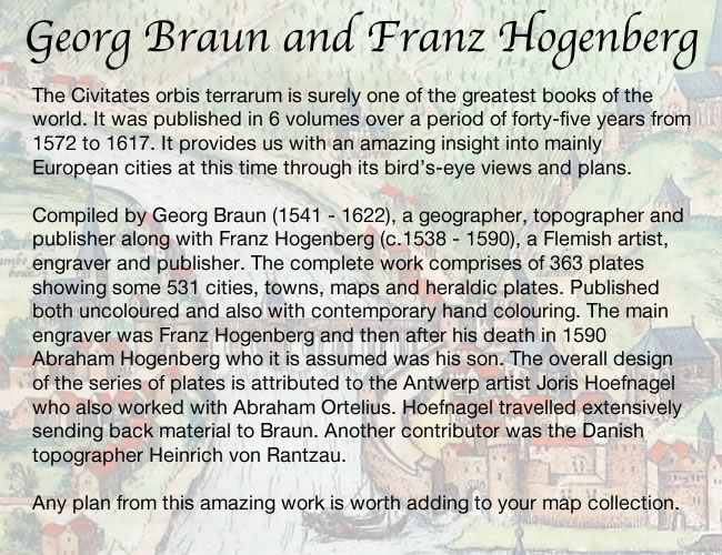
Huy, George Braun and Franz Hogenberg, c.1600

27135 Huy, George Braun and Franz Hogenberg, c.1600. Price: 360.00
HUUM OPP. CONDRUSORUM CAPUT....
A fine 16th century bird’s eye view plan of the town with costumed figures in the foreground. The map is further embellished with two cartouches and two coats of arms. 18 x 12 inches, 460 x 305 mm. Superb early hand colouring. French text on verso.
From: Civitates Orbis Terrarum
Late 16th Century
-

Map of Namur, Lodovico Guicciardini, 1582

33392 Namur, Lodovico Guicciardini, 1582. Price: 85.00
NAMUR COMITATUS
A fine early engraved map. Decorative title cartouche. Scale. 112 1/2 x 9 1/4 inches. Original centre fold. Attractive hand colouring. Repair to small split at the top of the centre fold otherwise good condition.
From: Description de Touts les Pais-Bas autrement appelles la Germamie Inferieure ou Basse Allemagne
16th Century - French Text
-

Namur, Abraham Orelius, c.1598. Price: 165.00

33600 Namur, Abraham Ortelius, c.1598. Price: 165.00
NAMURCUM
An early engraved map centred on Namur. Decorative title cartouche, compass pointer and a further cartouche bearing the date of 1579 and an attribution to the 16th century cartographer Jean Surhon. 20 x 15 1/4 inches, 510 x 385 mm. French text on verso. Uncoloured. Small split at the bottom of the centre fol repaired otherwise a nice clean crisp specimen.
From: Theatrum
Early 18th Century
-

Map of Namur by Namur, Nicolas de Fer, 1705.

33608 Namur, Nicolas de Fer, 1705. Price: 50.00
LES ENVIRONS DE NAMUR DE HUY, ET DE CHARL-ROY OU SE TROUVE ENCORE LA HASBAYE
An engraved map showing the River Sambre with the town of Charleroi extending to Namur and the River Meuse. Interesting to see jow Liege has been included in the top right hand corner outside the boundary of the map. A foliage vartouche displays the title, key to 14 places of interest and the scale. 23 1/4 x 9 iches. Uncoloured. Rough edge to blank margin on left and part of the top margin edge rough. Some light creasing as the map is folded into the atlas.
From: L'Atlas Curieux
OVERIJSSEL
Early 18th Century - Original Hand Colouring
-

Overijssel, Nicolaes Visscher, c.1700

7184 Overijessel, Nicolaes Visscher, c.1700. Price: 210.00
Transisalania Provincia Vulgo OVER-YSSEL...
An engraved map with a decorative uncoloured title cartouche with a figure of a fisherman and coat of arms. Attribution to Nicholas Ten-Have. 22 x 17 inches, 560 x 440 mm. Original outline and wash colouring. Slit at the bottom of the centre fold repaired, some light creasing, otherwise good.
17th Century
-

Map of Overijssel o the Netherlands by Jan Jansson, c.1647

26588 Overijssel, Jan Jansson, c.1647. Price: 96.00
DITIO TRANS-ISULANA
An engraved map of the region orientated with west at the top. Extends from Zutphen to Groningen. Three decorative cartouches display the title, scale and explanation. 19 1/2 x 15 inches. Uncoloured. Dutch text on verso. 6 inch split at the bottom of the centre fold, otherwise good condition.
From: Nieuwen Atlas.
UTRECHT
17th Century
-

Utrecht, Jan Jansson, 1647

5513 Utrecht, Jan Jansson, 1647. Price: 150.00
Episcop. ULTRAIECTINUS...
An engraved map centred on the towns of Utrecht and Amersfoort. Decorative title cartouche. The scale is held by the figure of a gentleman. 19 x 14 inches, 482 x 370 mm. Dutch text on verso. Uncoloured. Slit at the bottom of the centre fold repaired, otherwise good.
From: Nieuwen Atlas, Ofte Weerelt-Beschrijvinghe
17th Century
-

Utrecht, Jan Jansson, c.1647

7179 Utrecht, Jan Jansson, c.1647. Price: 200.00
Episcop ULTRAIECTINUS...
A map centred on the towns of Utrecht and Amersfoort. Decorative title cartouche bearing an attribution to Balthasar van Berckenrode (1562-1616). The scale is held by a figure of a gentleman. 19 x 14 inches, 480 x 370 mm. Hand coloured. Good condition.
ZEELAND
17th Century Town Plan
-

Tholen, Joan Blaeu, 1649

7175 Tholen, Joan Blaeu, 1649. Price: 240.00
TOLEN
A fine 17th century bird's eye view town plan of Tholen embellished with two coats of arms. 20 x 16 inches, 500 x 415 mm. Latin text on verso. Fine hand colouring. Good condition.
From: Novum ac Magnum Theatrum Urbium Belgicae Foederate


RICHARD NICHOLSON
of CHESTER
Stoneydale
Pepper Street
Christleton
Chester
CH3 7AG
Telephone
01244 336004
International 44 1244 336004

I have been buying and selling antique maps since the early 1960's during which time I had a gallery in Watergate Street, Chester for 30 years. I am now able to offer through my websites a personal service to map and print collectors.

