RICHARD NICHOLSON of CHESTER
A WORLD OF ANTIQUE MAPS AND PRINTS

The Cartographer
JOHN OGILBY
The first printed Road Maps of England and Wales
-

Map of England and Wales 1675

John Ogilby's map of England and Wales showing the roads radiating from London. Published in 1675
-
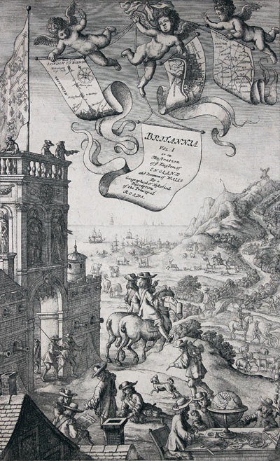
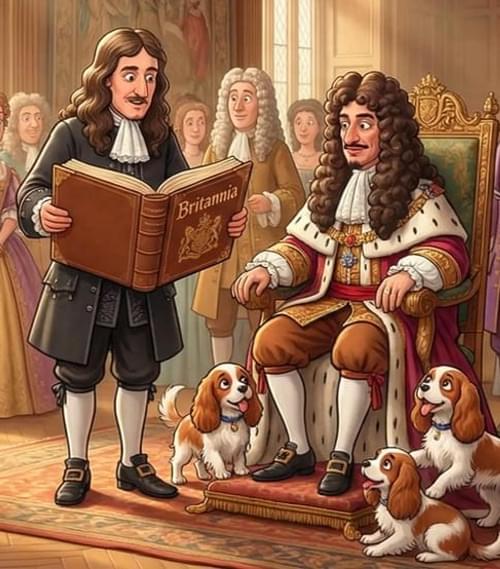
Frontispiece to Britannia by John Ogilby
-
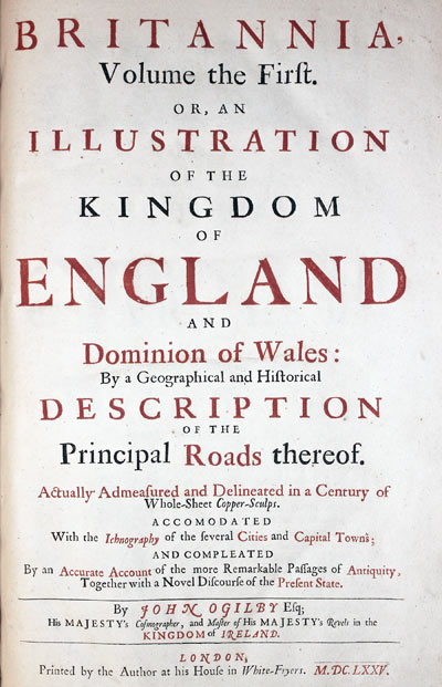
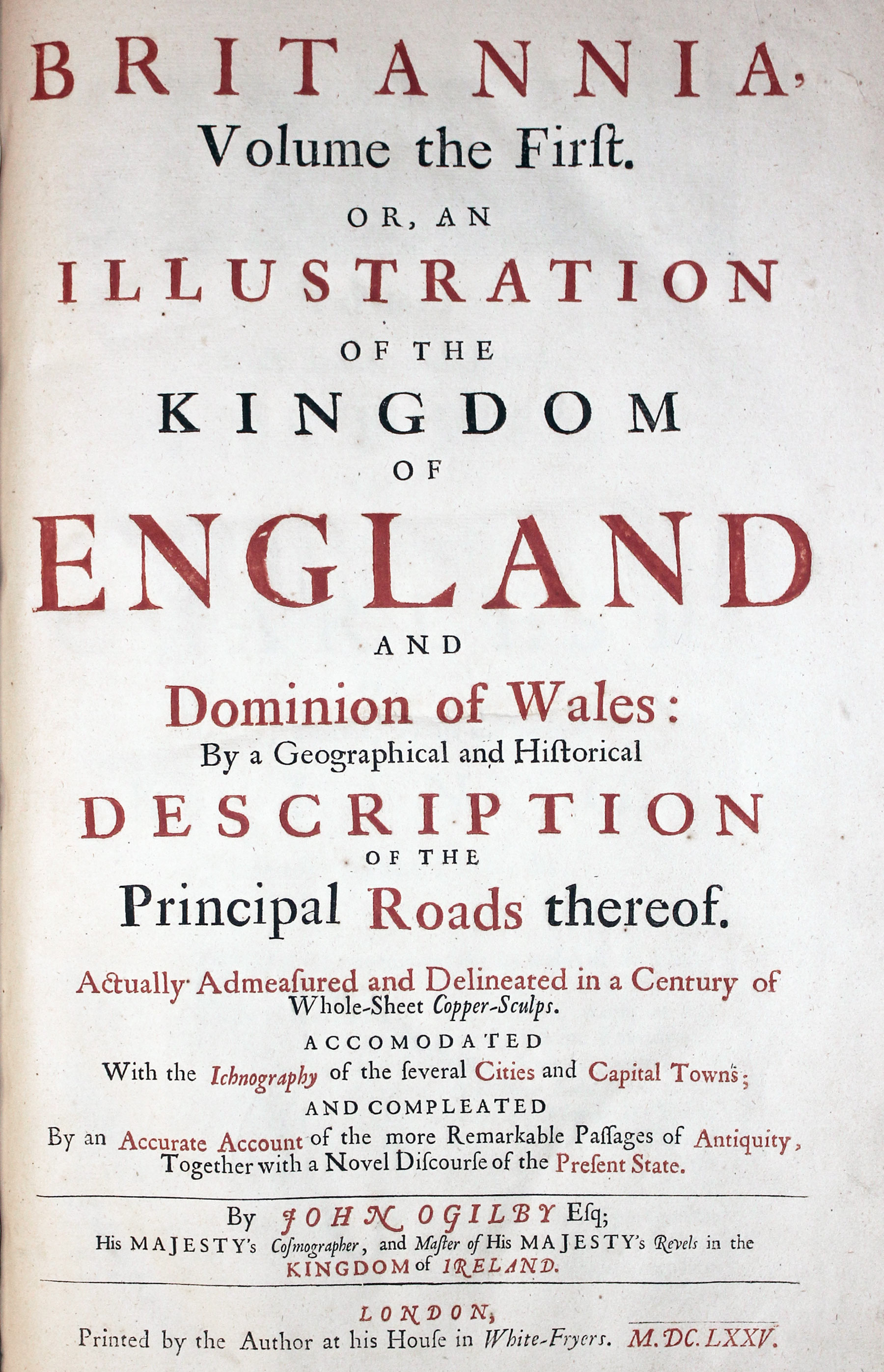
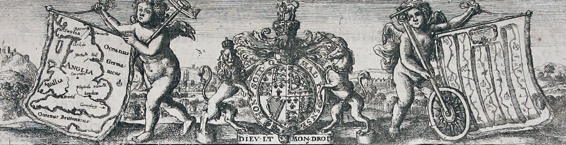
Britannia Title page for John Ogilby's Britannia 1675

The scenic frontispiece from John Ogilby's Britannia showing the road surveyors going whilst back at home the geographers look at a globe which according to Alan Erieira contains a coded message. And the title page to Britannia
-
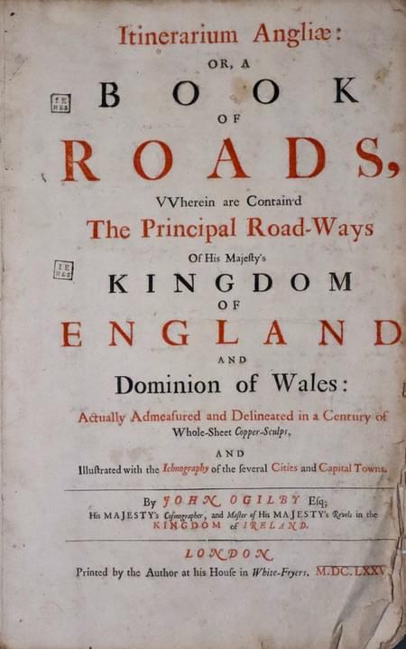
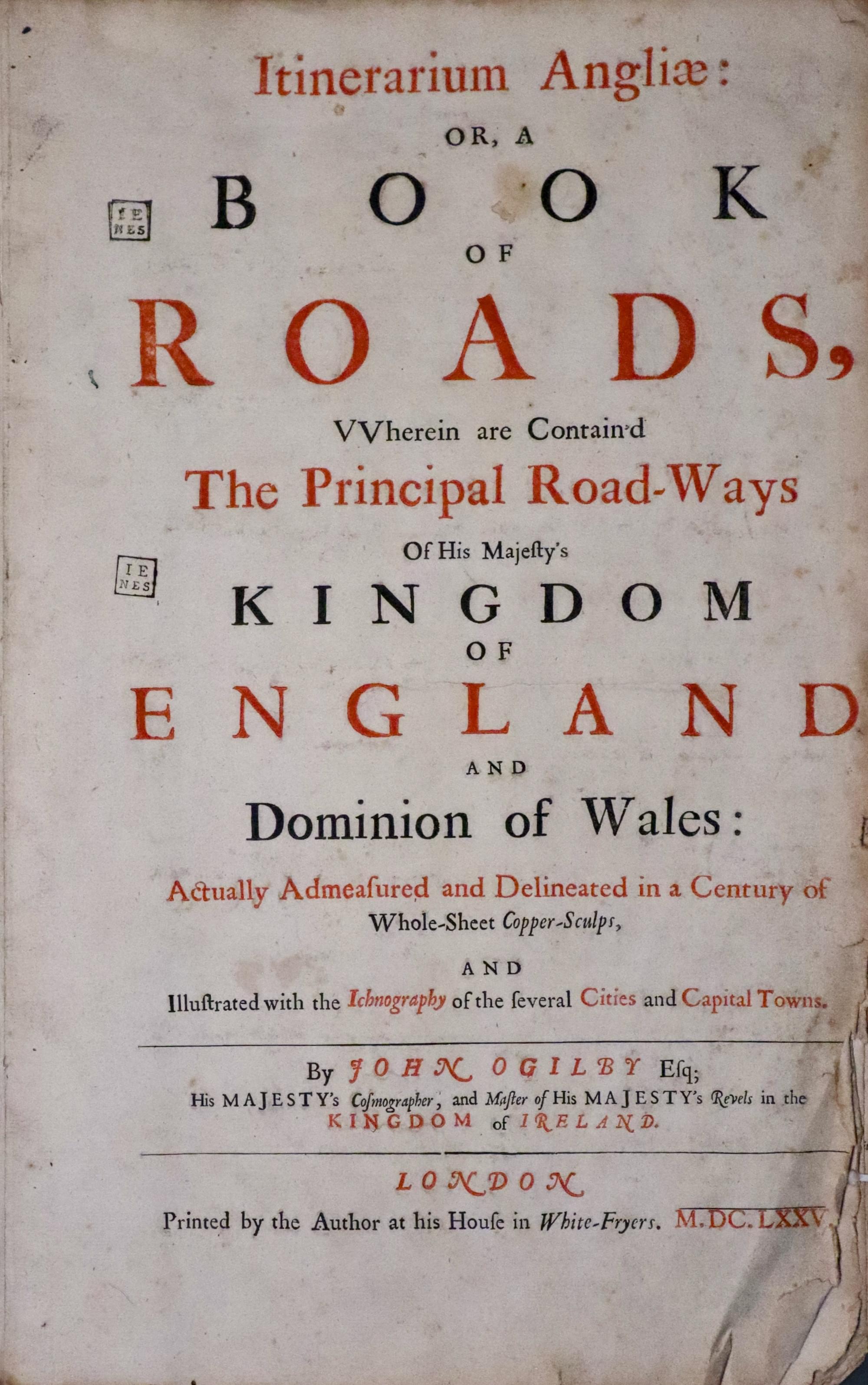
Itinerarium Angliae title page for John Ogilby's Britannia second state 1675
-

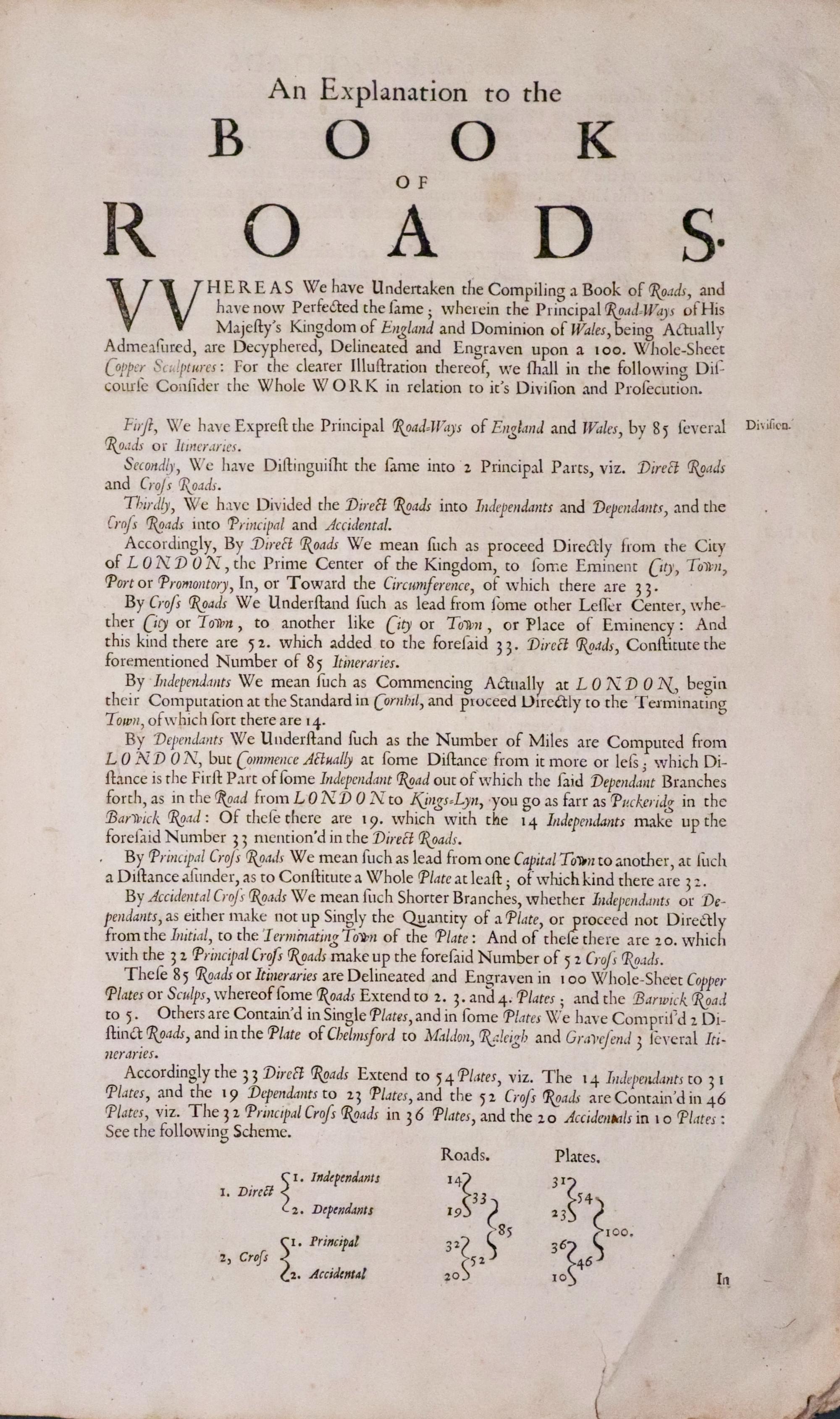
Explanation page for John Ogilby's Britannia 1698
-

Explanation page two for John Ogilby's Britannia 1698

EARLY DAYS
John Ogilby was born in Kellemeune, ten miles north of Dundee in 1600. The publishing of Britannia, his road atlas of England and Wales in 1675 was a crowning success to an energetic, eventful and varied life. He came from a good family his education was not completed. His father, a member of the Merchant Taylors Company wasted his estate and was sent to prison for debt. John then aged about twelve supported his mother and himself by selling trinkets. John bought one or more lottery tickets at 2s.6d. each from the Virginia Company and he won one of the minor prizes and was able to pay his father's debts. Later John purchased an apprenticeship with a dancing master, John Draper of Gray's Inn Lane. He did well, having a natural talent for dancing and perhaps with the earnings from the illegal practice of apprentices giving lessons he was able to buy himself an early completion of his apprenticeship and set up a dancing school of his own. His continuing success and reputation brought important and influential pupils from far and wide.
MISFORTUNE
At a masque arranged by the Duke of Buckingham to celebrate the Kings's gift to Buckingham of the estate at Burley-on-the-Hill, Rutland misfortune struck. During a dancing routine John made a false step, which caused him to fall to the ground and strain his leg. He was unable to dance again and was lame for the rest of his life. In his late twenties his many contacts made through his dancing career were to become most useful and he secured a position teaching the two sisters of Sir Ralph Hopton to dance at Hopton's house in Somerset. Sir Ralph taught John military science which stood him in good stead when he served in Ireland in a troop of guards in the 1630's under Viscount Wentworth, later Earl of Strafford and Lord Deputy of Ireland. To help establish a life style in Dublin similar to that being enjoyed in London it was decided that a theatre was required. This was the first theatre in Ireland situated in Werburgh Street. .It was the responsibility of John Ogilby to administer the theatre and persuade well known actors of the day to leave the comforts of London for the relative isolation of Dublin.
REVELS, RIOT AND RUIN
In about 1637 John was appointed Master of the Revels in Ireland and for the four years from 1637 to 1641 that the theatre was open it was a great success. The Irish Rebellion in October of 1641 caused the theatre to close. In 1642 John narrowly missed being blown up and in 1644 he left Ireland being shipwrecked on his homeward journey. He arrived back in England penniless and without a patron, Strafford having been executed. He spent the next four years in Cambridge and with the help his friend James Shirley he worked on the translations of the Bible and the classics of Virgil, Homer and Aesop. In 1648 he returned to London and on 14th March 1650 he married the widow Christian Hunsdon who had three children by her earlier marriage, Elizabeth, Thomas and Ellen, The eldest daughter Elizabeth was married to a Mr. Morgan.
RESTORATION
The Morgans had seven children, the eldest being a son named William The next few years for John Ogilby were spent in translating and the opening of a publishing business in London, where he produced a number of fine books. The Restoration of Charles II brought favour back to John Ogilby with a commission to help in the arrangements for the coronation in 1660 with the composing of speechs and songs. The increasing work load demanded an assistant and John was pleased to have the help of his promising wife's grandson William Morgan. A year later John was again made Master of the Revels in Ireland and he set about the building of a new theatre in Smock Alley, Dublin. By 1665 John Ogilby and William Morgan had returned to London to continue their work with books.
FIRE FORTUNE
Disaster struck in 1666 but Ogilby was not alone in losing his premises and entire stock as the Great Fire raged through London. John and William received a commission from the Lord Mayor and were appointed 'sworn viewers' or Surveyors of the preparation of a map of the City of London. The map was published ten years later by William Morgan on a scale of twenty five inches to the mile. It measured 9 x 7 feet and was dedicated to the Lord Mayor, Aldermen and Sheriffs of London. The preparation of the map brought John into contact with many influential persons of the day also concerned with the rebuilding of London such as the City Surveyor Robert Hooke, Sir Christopher Wren and John Evelyn. John Ogilby, now in his seventies, was to start the most original and ambitious achievement of his career. The mapping of the roads of England and Wales. As well as the awesome physical task of surveying the roads carried out by a number of assistants whose work was checked on its return to London John's time and expertise must have been directed towards the large financial cost of such a project.
ROYAL 'FAVOUR'
He turned to many people for money and support and received a number of promises one being for the sum of £1,000 from King Charles and Queen Catherine of Braganza. The money, however never really changed hands as the import duty on the paper for the printing of the Britannia amounting to some £1,000 was waived by royal consent and to be considered as a substitute for the contribution. Royal favour was bestowed in another way, however, in 1674 when John Ogilby received the title of 'His Majesty's Cosmographer and Geographick Printer' with a salary of £13.6s.8d per annum. In September of 1675 John Ogilby saw his dream fulfilled, the publication of the Britannia, dedicated 'To His Most Serene and Sacred Majesty The High and Mighty Prince, Charles Il of England, Scotland, France and Ireland, King, Defender of the Faith, &c.' with its magnificent frontispiece engraved by Wencelaus Hollar (1607 - 1677), a General map of England and Wales showing the roads and one hundred strip road maps each embellished with a decorative title cartouche with some bearing the royal arms, accompanied by a double sided page of text giving additional advice for use with the road map. There was no universal length in the British Isles at this time but Ogilby wisely chose the statute mile of 1,760 yards for his maps. The scale of the road maps is one inch to one mile and these are marked and numbered on each map, the miles further being divided into furlongs.
PREFACE
The Britannia proved to be most popular with the gentry and with travellers who were now able to plan their journeys with more certainty, knowing the distances between towns and what was involved. Some owners of the magnificent folio went as far as tearing out individual maps to carry with them on their travels through the kingdom. Owing to the demand for the volume a second issue of the road maps soon appeared titled Itinerarium Angliae illustrated with the 100 road maps to which were added useful plate numbers in the bottom right hand corner. A second edition appeared in 1698.
PRINTING PIRACY
The following year 1676 saw the publication of the latest edition of John Speed's Theatre of the Empire of Great Britain and John Ogilby was most distressed to see the pirating of his work by the publishers Thomas Bassett and Richard Chiswell who added tables of towns and distances to the Theatre. John Ogilby was not to see the further developments of his survey, however, for on 4th September, 1676 he died and was buried at St. Brides, one of Sir Christopher Wren's new churches. Mrs. Christian Ogilby died the following year. William Morgan who succeeded to the titles of Cosmographer Royal and Master of the Revels in Ireland carrying on Ogilby's work and in 1682 his magnificent large scale plan of London, Westminster and Southwark was published. William Morgan died in about 1690 and in 1698 the final edition of the Briltannia was published without the decorative Hollar frontispiece and without the individual pages of text.
A BRIEF OUTLINE OF THE 100 ROUTES THAT APPEAR IN BRITANNIA
Use this list to check which John Ogilby Road Maps pass through your county
Bedfordshire. 21, 41, 45, 47, 61, 80
Berkshire. 10, 14, 15, 79, 81, 83
Buckinghamshire. 12, 14, 21, 80
Cambridgeshire. 5, 43, 46, 61, 73, 80
Cheshire. 23, 57, 63, 89, 90, 98
Cornwall. 28, 34, 69
Cumberland. 38, 62, 86, 96
Derbyshire. 40, 48, 82, 90
Devon. 27, 33, 34, 58, 65, 68, 69, 94
Dorsetshire. 26, 53, 60, 83, 94, 97
Durham. 8, 9, 99
Essex. 19, 54, 75, 92, 93
Gloucestershire. 13, 15, 44, 55, 56, 59, 70, 71, 79, 85
Hampshire. 25, 26, 30, 32, 39, 51, 53, 81, 97
Herefordshire. 1, 2, 56, 71, 72
Hertfordshire. 5, 21, 43, 45, 46, 47
Huntingdonshire. 5, 6, 36, 41, 45, 61, 73
Kent. 18, 20, 31, 93
Lancashire. 37, 38, 88, 89, 90
Leicestershire. 40, 48, 72, 82
Middlesex. 5, 10, 12, 14, 18, 21, 25, 29
Norfolk. 43, 46, 52, 54, 74, 75, 76
Northamptonshire. 6, 12, 21, 22, 40, 41, 45, 47, 61
Northumberland. 9, 62, 86, 99
Nottinghamshire. 6, 7, 48, 78
Lincolnshire. 6, 36, 41, 42, 78
Middlesex. 5, 10, 12, 14, 18, 21, 25, 29
Norfolk. 43, 46, 52, 54, 74, 75, 76
Northamptonshire. 6, 12, 21, 22, 40, 41, 45, 47, 61
Northamptonshire. 6, 12, 21, 22, 40, 41, 45, 47, 61
Northumberland. 9, 62, 86, 99
Nottinghamshire. 6, 7, 48, 78
Oxfordshire. 1, 12, 13, 55, 79, 80, 82, 83, 85
Rutlandshire. 6, 45, 47, 48
Shropshire. 44, 50, 57, 98
Somerset. 11, 26, 27, 32, 33, 35, 58, 59, 60, 65, 71
Staffordshire. 22, 23, 37, 50
Suffolk. 46, 52, 54, 73, 74, 92
Surrey. 20, 25, 29, 30, 39, 51
Sussex. 29, 31, 39, 81
Warwickshire. 13, 22, 50, 61, 70, 72, 82
Westmorland. 38
Wiltshire. 10, 11, 26, 32, 35, 51, 53, 79, 83, 85
Worcestershire. 1, 13, 44, 59, 72
Yorkshire. 7, 8, 42, 48, 49, 88, 89, 95, 99, 100
Anglesey. 24
Breconshire. 64, 77, 84
Caernarvonshire. 24, 87
Cardiganshire. 2, 66, 91
Carmarthenshire. 17, 77, 84, 91
Denbighshire. 24, 63, 67, 98
Flintshire. 24, 67, 98
Glamorganshire. 16, 17, 64
Merionethshire. 67, 87, 96
Monmouthshire. 16, 56, 77
Montgomeryshire. 44, 50, 63, 67, 71, 87
Pembrokeshire. 17, 66, 91
Radnorshire. 2, 64, 71, 84
Scotland. 62
Map Gallery
-
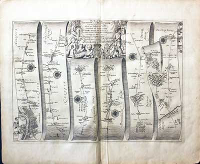
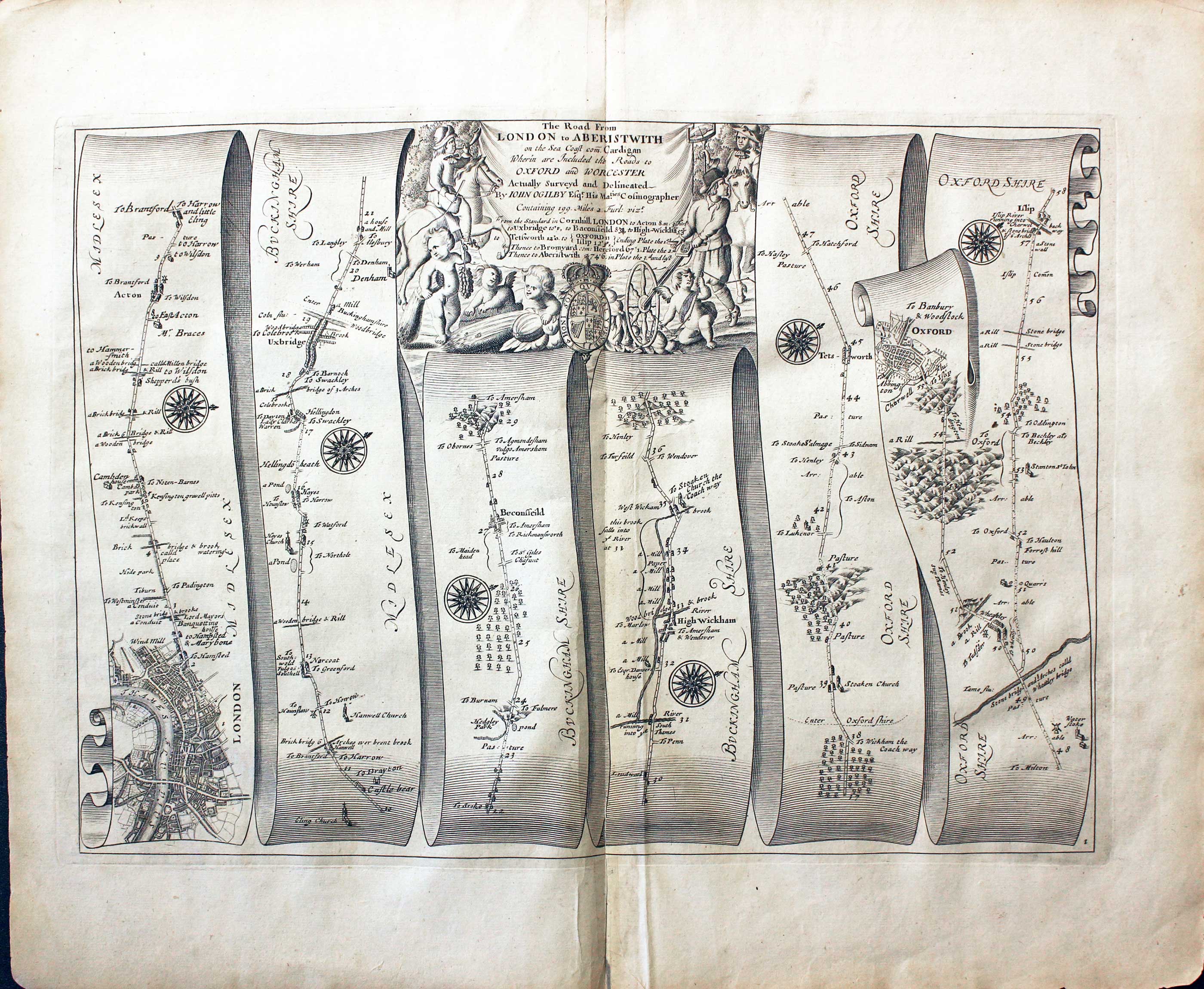
Plate 1 London to Islip by John Ogilby 1675
-

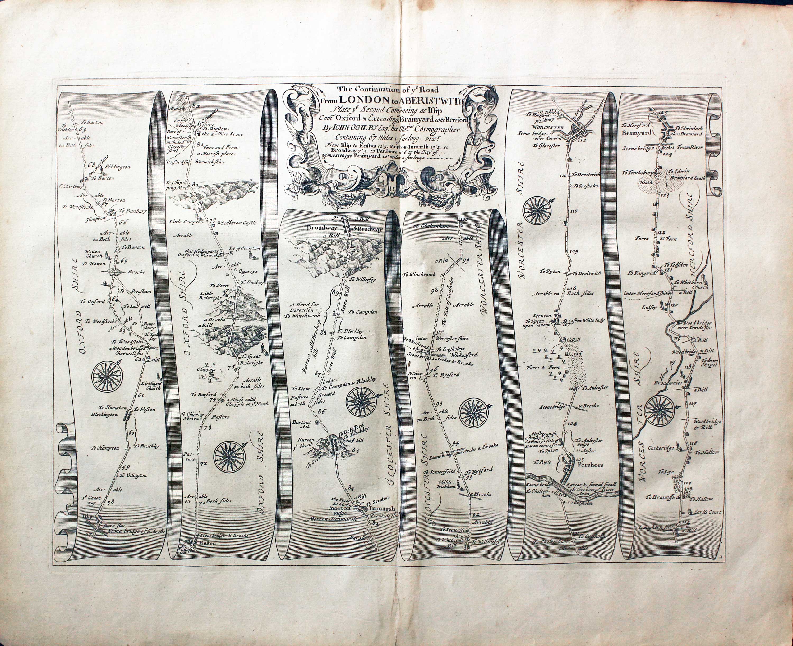
Plate 2 Islip to Worcester by John Ogilby 1675
-

Plate 4 Arundel to Chichester by John Ogilby 1675
-

Plate 6 London to Tuxford by John Ogilby 1675
-

Plate 7 Tuxford to York by John Ogilby 1675
-

Plate 8 York to Chester-le-Street by John Ogilby 1675
-

Plate 9 Chester-le-Street to Berwick by John Ogilby 1675
-

Plate 10 London to Marlborough by John Ogilby 1675
-

Plate 11 Marlborough to Huntspil by John Ogilby 1675
-

Plate 12 London to Banbury by John Ogilby 1675
-

Plate 13 Banbury to Camden by John Ogilby 1675
-

Plate 14 London to Abingdon by John Ogilby 1675
-

Plate 15 Abingdon to Monmouth John Ogilby 1675
-

Plate 16 Monmouth to Burton John Ogilby 1675
-

Plate 17 Burton to St. David's John Ogilby 1675
-

Plate 18 London to Dover John Ogilby 1675
-

Plate 19 London to Harwich John Ogilby 1675
-

Plate 20 London to Hythe John Ogilby 1675
-

Plate 21 London to Towcester John Ogilby 1675
-

Plate 23 Lichfield to Chester John Ogilby 1675
-

Plate 24 Chester to Holyhead
-

Plate 31 The Road from London to Rye by John Ogilby 1675
-

Plate 32 The Road from London to Bridgwater by John Ogilby 1675
-

Plate 33 The Road from London to Hatherleigh by John Ogilby 1675


Dating
The first edition of 1675 is easy to date as there are no plate numbers in the bottom right hand corner. The second issue in the same year shows the addition of plate numbers. This issue also has the individual pages of descriptive text with each map. The 1698 edtion has the plate numbers but the maps were not accompanied with the page of text. So unless the page of text is with the map you are not going to be able to ascertain the edition. I think I have noticed with some editions of the 1698 Britannia that the blank margins are not as generous as those found in the 1675 edition but this is not a sure way to identify.
Just my personal opinion
We are so lucky to actually have a late 17th century atlas of the roads of England and Wales. All thanks to a gentleman who led a colourful life, named John Ogilby. These maps have always been amongst my favourite maps so I have tried to offer a good selection of them over the years. The pages of text that describe the routes come from just the 1675 edition. In 1698 when Britannia was republished the pages were for some reason not included. So there are more copies of each map than copies of the text. Its nice when you can even match a 1698 edition with a page of text. But this may prove to be difficult. But like all collecting the excitment can be in the chase. Don't forget the series of smaller road maps which started to appear in 1719 based on Ogilby's historical survey.
RICHARD NICHOLSON
of CHESTER
Stoneydale
Pepper Street
Christleton
Chester
CH3 7AG
Telephone
01244 336004
International 44 1244 336004

I have been buying and selling antique maps since the early 1960's during which time I had a gallery in Watergate Street, Chester for 30 years. I am now able to offer through my websites a personal service to map and print collectors.

