RICHARD NICHOLSON of CHESTER
A WORLD OF ANTIQUE MAPS AND PRINTS

The Cartographers
GEORGE COLE and JOHN ROPER
1810 - English & Welsh County Maps.
Plans of English Towns
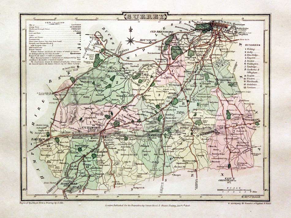
The names of Cole and Roper just seem to go together for collectors of British county maps. George Cole was the cartopgrapher and artist and John Roper the engraver. They collaborated to produce The British Atlas published in 1810. You maybe a little confused by the date a reputable map dealer will put on the maps as most of the maps bear a date earlier from 1804 to 1809 beneath together with the imprint of the publishers Vernor, Hood and Sharp. This is because the maps were prepared for Britton and Brayley's 'The Beauties of England and Wales' which was published in seperate parts and published over a period of years. You are not going to be able to determine which work your map came from as the publishers imprint on each map is identical.
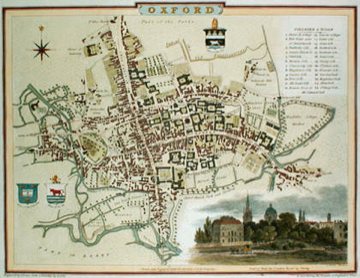
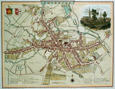
When The British Atlas was published in 1810 it also contained a fine series of 21 engraved town plans.
I thinks I can say that all the copies of The British Atlas I have seen over the years have the county maps with original outline and wash hand colouring. This is usually very well executed and I have noticed the paper is of a good weight. All copies of the atlas in their original state have the town plans uncoloured.
The maps appear again in English Topography published by Joseph Nightingale. The imprints beneath have been removed.
The maps were also inluded in Dugdale's Curiosities of Great Britain published 1838 - 41. Uncoloured and again the imprints have been rmoved
The British Atlas contains a series of 56 maps of the English and Welsh counties plus a series of 21 town plans as listed below
Bedford
Cambridge
Canterbury
Carlisle
Chester
Colchester
Coventry
Derby
Durham
Exeter
Gloucester
Hereford
Liverpool
Manchester and Salford
Newcastle upon Tyne and Gateshead
Northampton
Norwich
Oxford
St. Albans
Winchester
Worcester
George Cole was a cartographer and draughtsman. John Roper an engraver
Map Gallery
-

Map of Bedfordshire by George Cole and John Roper, 1810. Early Hand colouring
-

Map of Cambridgeshire by George Cole and John Roper 1810
-

Map of Cheshire by George Cole and John Roper, 1810. Early Hand Colouring.
-

Map of Derbyshire by G. Cole and J. Roper 1810. Early hand colouring
-

Map of Herefordshire by G. Cole and J. Roper 1810. Early hand colouring
-

Map of Hertfordshire by G. Cole and J. Roper 1810. Early hand colouring
-

Map of Huntingdonshire by G. Cole and J. Roper 1810. Early hand colouring
-

Map of the Isle of Wight by G. Cole and J. Roper 1810. Early hand colouring
-

Map of Lancashire by G. Cole and J. Roper 1810. Early hand colouring
-

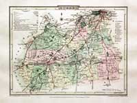
Map of Lincolnshire by G. Cole and J. Roper 1810
-

Map of Northumberland by G. Cole and J. Roper 1810
-

Map of Nottinghamshire by G. Cole and J. Roper 1810. Early hand colouring
-

Map of Oxfordshire by G. Cole and J. Roper 1810. Early hand colouring
-

Map of Rutlandshire by G. Cole and J. Roper 1810
-

Map of Staffordshire by G. Cole and J. Roper 1810
-

Map of Suffolk by G. Cole and J. Roper 1810
-
-

Map of Sussex by G. Cole and J. Roper 1810
-

Map of Somerset by G. Cole and J. Roper 1810. Early hand colouring
-

Map of Warwickshire by G. Cole and J. Roper 1810
-

Map of Wiltshire by G. Cole and J. Roper 1810
-

Map of Westmorland by G. Cole and J. Roper 1810
-

Map of Yorkshire - Part of East and West Ridings by G. Cole and J. Roper 1810
-

Map of Yorkshire - Part of the North Riding by G. Cole and J. Roper 1810


-

Plan of Chester, Cole and Roper 1810

Just my personal opinion
It is a pity that the colourists who executed the splendid hand colouring you find on these county maps did not carry on their good work by hand colouring the town plans. Fortunately I have had colourists over the years that could make a spendid job of this. So much so that I can often spot the work of a particular colourist if a plan comes back into stock. If you have a choice of an uncoloured specimen of a town plan or one with colouring that has not been carefully executed I myself would go for the uncoloured one.

RICHARD NICHOLSON
of CHESTER
Stoneydale
Pepper Street
Christleton
Chester
CH3 7AG
Telephone
01244 336004
International 44 1244 336004

I have been buying and selling antique maps since the early 1960's during which time I had a gallery in Watergate Street, Chester for 30 years. I am now able to offer through my websites a personal service to map and print collectors.

