Antique Map of Westmorland
Richard Nicholson of Chester

A World of Antique Maps and Prints
Established in 1961

The maps on this page are guaranteed to be genuine early specimens published in or around the year stated
19th Century - Early Hand Colouring
-

Westmorland, Archibald Fullarton, c.1843

30063 Westmorland, George Cole and John Roper, 1810. Price: 27.00
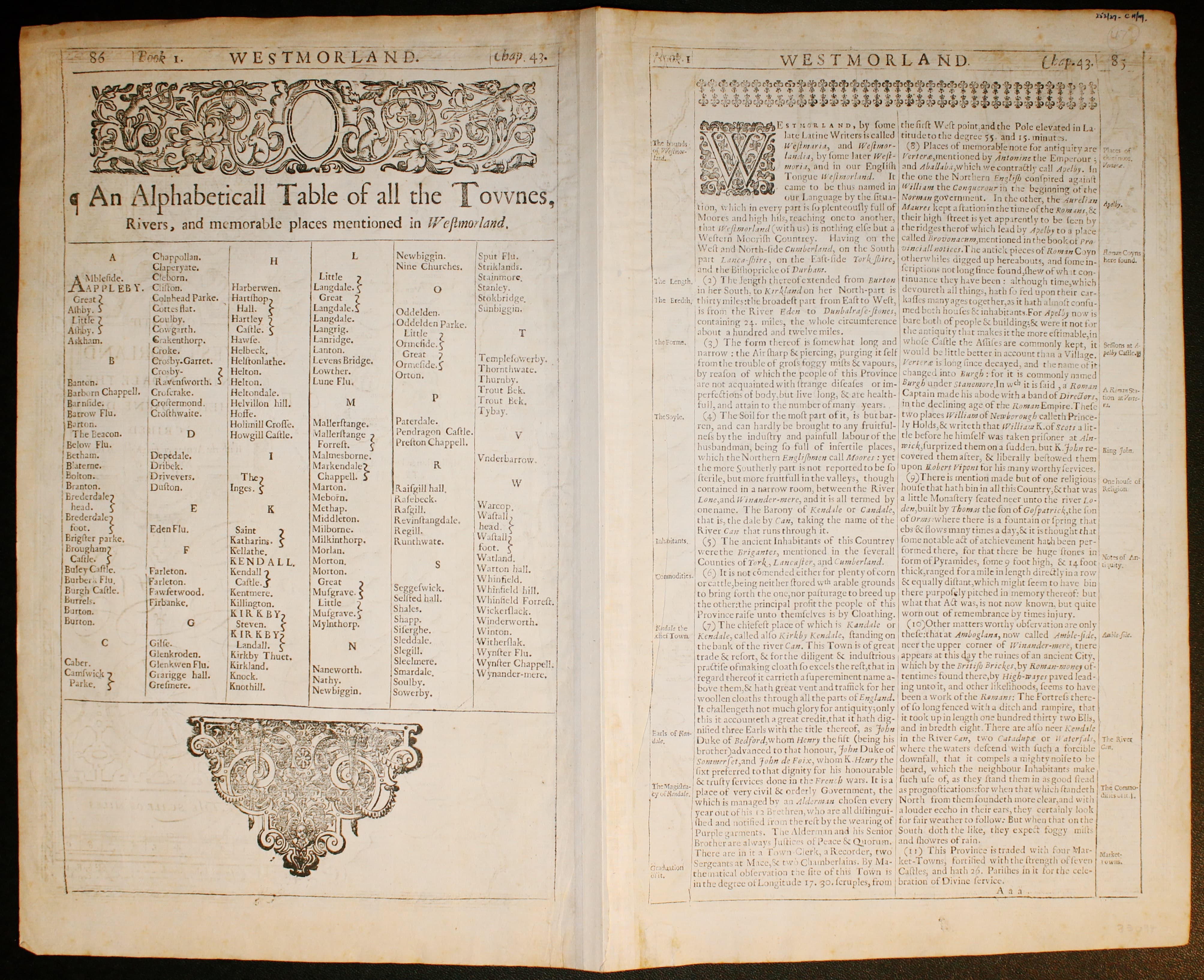
WESTMORLAND
A detailed map of the county engraved by J. Roper from a drawing by G. Cole. Publishers imprint beneath dated 1807. Explanation and list of hundreds. Compass rose.7 x 7 inches. Original wash colouring colouring. A little light foxing and toning.No tears or repairs.
From: The British Atlas
19th Century
-

Westmorland, Archibald Fullarton, c.1843

28733 Westmorland, Archibald Fullarton, c.1843. Price: 28.00
WESTMORLAND
A detailed engraved county map embellished with a vignette view of Brough Castle. 9 x 7 inches. Uncoloured.
From: The Parliamentary Gazetteer
Early 19th Century - Original Hand Colouring
-

Westmorland, George Cole and John Roper, 1810

30063 Westmorland, George Cole and John Roper, 1810. Price: 33.00
WESTMORLAND
A detailed map of the county engraved by J. Roper from a drawing by G. Cole. Publishers imprint beneath dated 1807. Explanation and list of hundreds. Compass rose.7 x 7 inches. Original wash colouring colouring. Fine condition with wide blank margins. Straight from the atlas and not sold as a single map before.
From: The British Atlas
19th Century
-

Westmorland, Joshua Archer, c.1845

30363 Westmorland, Joshua Archer, c.1845. Price: 18.50
WESTMORELAND A detailed engraved map with explanation and list of divisions. 9 x 7 inches. Uncoloured. Good condition.
From: Dugdale’s England and Wales Delineated
19th Century
-

Westmorland, Joshua Archer, c.1845

30646 Westmorland, Joshua Archer, c.1845. Price: 18.00
WESTMORELAND
A detailed engraved map with explanation and list of divisions. 9 x 7 inches. Uncoloured. Good condition.
From: Dugdale’s England and Wales Delineated
Early 19th Century - Early Hand Colouring
-

Westmorland, John Cary, 1809

30727 Westmorland, John Cary, 1809. Price: 36.00
WESTMORELAND
A good engraved map of the county. Title panel with compass rose. Publisher’s imprint beneath dated 1809. 10 1/4 x 8 1/4 inches. Attractive original outline hand colouring. Good condition. With this map is the original pages of descriptive text. Straight from the atlas and not sold as a single map before.
From: Cary's New and Correct English Atlas
19th Century - Early Hand Colouring
-

Westmorland, James Pigot / Isaac Slater, c.1857

30801 Westmorland, James Pigot / Isaac Slater, c.1857. Price: 49.00
WESTMORELAND
A good engraved map of the county with title, scale, explanation and list of Wards. Embellished with an uncoloured view of Kendal Church. 14 X 8 3/4 inches. Original outline hand colouring. On stout paper. Good undamaged condition.
From: I. Slater’s New British Atlas
18th Century - Early Hand Colouring
-

Westmorland, John Cary 1793

31009 Westmorland, John Cary 1793. Price: 34.00
WESTMORLAND
A detailed engraved map of the county. Title panel and compass rose combined. Cary's imprint beneath dated 1793. 10 1/4 x 8 1/4 inches. Centre fold. Old manuscript numbering in blank margin 160 and 161. Original outline hand colouring. Good condition.
From: Cary’s New and Correct English Atlas
19th Century
-

Westmorland, Thomas Moule, c.1850

31318 Westmorland, Thomas Moule, c.1850. Price: 14.00
WESTMORLAND
A decorative engraved Victorian map of the county. Embellished with vignette views of Brougham Hall and the Keep of Appleby Castle. Three coast of arms. 10 x 8 inches. Uncoloured. Some tears in top blank margin.
From: Barclay’s Dictionary
19th Century
-

Westmorland, Joshua Archer, c.1845

31328 Westmorland, Joshua Archer, c.1845. Price: 5.00
WESTMORELAND A detailed engraved map with explanation and list of divisions. 9 x 7 inches. Uncoloured. A few marginal nicks and tears in blank margins, none of the reaching the engraved area.
From: Dugdale’s England and Wales Delineated
19th Century - Early Hand Colouring
-

Westmorland Joshua Archer c.1845

31412 Westmorland, Joshua Archer c.1845. Price: 19.00
WESTMORELAND
A detailed engraved map with explanation and list of divisions. 9 x 7 inches. Original early wash colouring. Very light toning. Good condition.
From: Dugdale’s England and Wales Delineated
19th Century - Early Hand Colouring
-

Westmorland, Samuel Lewis 1845

31622 Westmorland, Samuel Lewis, 1845. Price: 14.00
WESTMORLAND
A county map drawn by R. Creighton and engraved by J. & C. Walker. Reference to the Unions. Scale and compass rose. 6 3/4 x 9 inches. Original outline hand colouring. Good clean condition. Straight from the atlas and not sold as a single map before now.
From: Lewis' Atlas to the Topographical Dictionaries of England and Wales
19th Century
-

Westmorland, Sudney Hall, 1822

31629 Westmorland, Sidney Hall. Price: 5.00
WESTMORLAND
A engraved map of the county. 9 3/4 X 7 3/4 inches. Uncoloured. Part of the bottom blank margin missing. Otherwise good condition. Useful for reference
Early 19th Century - Original Hand Colouring
-

Westmorland, John Cary, 1802

31724 Westmorland, John Cary, 1802. Price: 36.00
WESTMORELAND
A well engraved detailed map of the county with title panel and compass rose combined. Scale. Imprint of John Cary dated 1793. With original page of descriptive text. 10 1/4 x 8 1/4 inches. Original outline hand colouring. Good condition. I have dated this map 1802 because the paper is watermarked 1802. The title page of the atlas is dated 1793.
From: Cary's New and Correct English Atlas
19th Century
-

Westmorland, John Cary, 1793

32322 Westmorland, Archibald Fullarton, c.1845. Price: 24.00
WESTMORLAND
A detailed engraved county map embellished with a vignette view of Brough Castle. 9 x 7 inches. Uncoloured. Two original vertical folding creases.
19th Century - Early Hand Colouring
-

Westmorland, John Cary, 1793


32324 Westmorland, John Cary, 1793. Price: 30.00
WESTMORLAND
A good detailed engraved map of the county. Title panel and compass rose combined. Cary's imprint beneath dated 1793. 10 1/4 x 8 1/4 inches. Original outline hand colouring just visible. Small single worm hole in the bottom blank margin otherwise good condition.
From: Cary’s New and Correct English Atlas
18th Century - Early Hand Colouring
-

Westmorland, John Cary, 1793

32325 Westmorland, John Cary, 1793. Price: 33.00
WESTMORELAND
A good detailed engraved map of the county. Title panel and compass rose combined. Cary's imprint beneath dated 1793. 10 1/4 x 8 1/4 inches. Original outline hand colouring just visible. Good condition.
From: Cary's New and Correct English Atlas
18th Century - Early Hand Colouring
-

Westmorland, John Cary, 1787

32326 Westmorland, John Cary, 1793. Price: 37.00
WESTMORLAND
The FIRST EDITION of this good detailed engraved map of the county. Title panel and compass rose combined. Cary's imprint beneath dated 1793. 10 1/4 x 8 1/4 inches. Original outline hand colouring plus additional later hand colouring. Extremely light creaase across the bottom left hand corner otherwise good condition.
From: Cary’s New and Correct English Atlas
19th Century - Early Hand Colouring
-

Westmorland, H. G. Collins 1868

32327 Westmorland, Henry George Collins, 1868. Price: 25.00
WESTMORLAND
The lithograph edition of this map first published in 1850. Published by John Heywood in Manchester. 6 x 7 1/2 inches. Original outline and wash hand colouring. Good clean condition with wide blank margins condition.
From: The Travelling Atlas
18th Century - County and Road Map
-

Westmorland, John Owen and Emanuel Bowen 1755
-

Road Map York to Pickering, John Owen and Emanuel Bowen 1755


32341 Westmorland, John Owen and Emanuel Bowen, 1755. Price: 30.00
A MAP OF WESTMORLAND
An engraved county map with a description, surmounted by a decorative baroque cartouche. Road map on verso from York to Pickering. 4 x 7 inches. Hand coloured just on the county map side. Good condition.
From: Britannia Depicta
Late 18th Century - Early Hand Colouring
-

Map of Westmorland, John Cary, 1792

32551 Westmorland, John Cary, 1792. Price: 14.00
WESTMORELAND
A small engraved map of the county. Tile panel surmounted by half compass rose. Panel at bottom with list of distances from London. Publisher’s imprint beneath dated 1792. 3 1/2 x 4 3/4 inches. Thin paper. Original outline hand colouring. Good condition.
From: Cary’s Traveller’s Companion
Titlepage dated 1791, maps dated 1792. The atlas was formerly in the Mumbee family library - titlepage stamped V. Munbee
Provenance
-

Cary Titlepage and Munbee Bookplate

19th Century
-

Plan of Kendal by Creighton & Walker c.1840

32551 Kendal, R. Creighton & J. & C. Walker, c.1840. Price: 14.00
KIRKBY KENDAL
An interesting engraved plan of Kendal and the surrounding area once knows as Kirkby in Kendal or Kirkby Kendal. Original pink outline colouring which is explained in the key below as the boundary of the borough. Scale. Patterned border. 6 3/4 x 8 3/4 inches. Good condition.
From: A Topographical Dictionary of England by Samuel Lewis
19th Century - Early Hand Colouring
-

Westmorland James Pigot c.1831

32863 Westmorland, James Pigot, c.1831. Price: 46.00
WESTMORELAND
An engraved map of the county with title, scale, explanation and list of Wards. Embellished with an uncoloured view of Kendal Church. Imprint of the publishers Pigot & Co. 1 Basing Lane & 18 Fountains St. Manchester beneath. 14 X 8 3/4 inches. Original outline hand colouring. Small repair on verso to tear in the bottom right hand blank margin. Otherwise a nice clean specimen of this map
From: British Atlas
19th Century - Early Hand Colouring
-

Map of Westmorland, Samuel Lewis 1848

32942 Westmorland, Samuel Lewis, 1848. Price: 18.50
WESTMORLAND
A county map drawn by R. Creighton and engraved by J. & C. Walker. Reference to the Unions. Scale and compass rose. 6 3/4 x 9 inches. Original outline hand colouring. Good clean condition. Straight from the atlas and not sold as a single map before now.
From Lewis' Atlas to the Topographical Dictionaries of England and Wales
19th Century
-

Map of Westmorland by Thomas Letts

32991 Westmorland, Thomas Letts, 1884. Price: 22.00
WESTMORELAND
A detailed chromolithograph map of the county. Explanation plus statistics concerning Population, Area, Inhabited Houses, Poor Rate and Paupers. 15 x 12 1/2 inches. Original centre fold. Imprint of Letts & Son beneath. Fine clean condition. Straight from the atlas so never previously been sold as a single map.
From: Lett’s Popular County Atlas
Early 18th Century
-

Map of Westmorland by Robert Morden c.1701

33066 Westmorland, Robert Morden, c.1720. Price: 40.00
WESTMORLAND By Robt. Morden
An engraved map being from Morden’s smaller series of county maps. Title cartouche, scale and compass pointer. 6 1/8 x 8 inches. Uncoloured. Original fold crease. Good condition.
From: Magna Britannia
18th Century
-

Map of Westmorland by Robert Morden, 1722

33073 Westmorland, Robert Morden, 1722. Price: 80.00
WESTMORLAND by Robt. Morden
A good clearly engraved map of the county embellished with a decorative title cartouche. Three scales. Imprint of the publishers Abel Swale Awnsham & John Churchill. Watermark of a crowned eagle 16 x 14 inches. Uncoloured. Good clean crisp condition. Nice specimen.
From: Camden's Britannia.
17th Century
-

Map of Westmorland by John Speed, c.1665

33094 Westmorland, John Speed, c.1665. Price: 300.00
THE COUNTIE WESTMORLAND AND KENDALE THE CHIEF TOWNE DESCRIBED With the Armes of such Nobles as have bene Earles of either of them
A decorative map of the county embellished with an inset town plan of Kendal with key. Three decorative cartouches display the title, scale, compass rose, coats of arms and the imprint of the publisher Roger Rea. Description of the county and list of towns on verso. 20 x 15 inches. Uncoloured. Original centre fold. Left hand blank margin tapers at the top. Very thin crease on the left of the centre fold otherwise a nice clean specimen.
From Theatre of the Empire of Great Britain
18th Century
-

Map of Westmorland by Robert Morden, 1722

33101 Westmorland, Robert Morden, 1722. Price: 70.00
WESTMORLAND by Robt. Morden
A good clearly engraved map of the county embellished with a decorative title cartouche. Three scales. Imprint of the publishers Abel Swale Awnsham & John Churchill. Watermark of a horse within a circle. 16 x 14 inches. Original centre fold. Very small repair at the top of the left hand blank margin. A few marks on the edge of the bottom blank margin. The right hand blank margin is much wider than the left hand margin. Hand coloured.
From: Camden's Britannia
Early 19th Century
-

Map of Westmorland by John Cary & John Stockdale, 1808

33123 Westmorland, John Cary & John Stockdale, c.1808. Price: 42.00
A MAP OF WESTMORELAND FROM THE BEST AUTHORITIES
A good detailed map of the county with publisher’s imprint dated 1805. 19 x 15 1/2 inches. Few small worm hoes in the bottom blank margin otherwise good clean condition with wide blank margins. Originally bound on edge so there is no centre fold but there is a light fold crease up the centre of the map. Paper watermarked 1808. Later hand colouring.
From: New British Atlas published by John Stockdale, Piccadilly. ly.
19th Century
-

Wstmorland, James Pigot c.1831

33161 Westmorland, James Pigot, c.1831. Price: 46.00
WESTMORELAND
An engraved map of the county with title, scale, explanation and list of Wards. Embellished with an uncoloured view of Kendal Church. Imprint of the publishers Pigot & Co. 1 Basing Lane & 18 Fountains St. Manchester beneath. 14 X 8 3/4 inches. Hand coloured. Framed many years ago in a black and gilt hogarth moulding which is still in quite good condition.
For collection from Christleton only. Please note the yellowing on on the right hand side of the photo is due to photographing without flash and is not evident on the map.
From: British Atlas
19th Century
-

Wstmorland, Cole/Roper c.1840

33270 Westmorland. Cole & Roper c.1840. Price: 12.50
WESTMORLAND
The later edition of this good detailed engraved map of the county divided into hundreds. Bears the Explanation. 8 3/4 x 6 3/4 inches. Uncoloured. Good condition.
From: Dugdale’s Curiosities
19th Century
-
Wstmorland, Cole/Roper c.1840
33270 Westmorland. Cole & Roper c.1840. Price: 12.50
WESTMORLAND
The later edition of this good detailed engraved map of the county divided into hundreds. Bears the Explanation. 8 3/4 x 6 3/4 inches. Uncoloured. Good condition.
From: Dugdale’s Curiosities
19th Century
-

Wesmorland, Samuel Lewis

33297 Westmorland, Samuel Lewis, c.1845. Price: 12.00
WESTMORLAND
A county map drawn by R. Creighton and engraved by J. & C. Walker. Reference to the Unions. Scale and compass rose. 6 3/4 x 9 inches. Uncoloured. Heavy paper. Good clean condition.
From: Lewis' Atlas to the Topographical Dictionaries of England and Wales
18th Century - Early Hand Colouring
-

Westmorland. John Cary 1787

33299 Westmorland. John Cary, 1787. Price: 38.00
WESTMORLAND
The FIRST EDITION of this detailed engraved map of the county. Title panel and compass rose combined. Cary's imprint beneath dated 1787. 10 1/4 x 8 1/4 inches. Original outline and wash hand colouring. I little very light dust soiling but good condition. The unusual feature about this specimen is finding what appears to be original outline and wash hand colouring on a 1787 edition of the map. I cannot recall having seen this before.
From: Cary’s New and Correct English Atlas
19th Century
-

Westmorland, G & W B Whittaker 1824

33307 Westmorland. G. & W. B. Whittaker, 1824. Price: 9.00
WESTMORELAND
An engraved county map. Title panel. Statistics list regarding towns, inhabitants etc.. Publisher's imprint dated 1824. 7 x 4 inches. Uncoloured. Good condition.
Plate XXXVII from Capper's A Topographical Dictionary of the United Kingdom.
18th Century - County and Road Map
-

Westmorland map by John Owen and Emanuel Bowen c,1730

33310 Westmorland, John Owen and Emanuel Bowen, c.1730. Price: 14.00
A MAP OF WESTMORLAND
An engraved county map with a description, surmounted by a decorative baroque cartouche. Road map on verso from York to Pickering. 4 x 7 inches. Uncoloured. Requires some marginal repairs. SPECIAL PRICE.
From Britannia Depicta.
Early 19th Century - Large
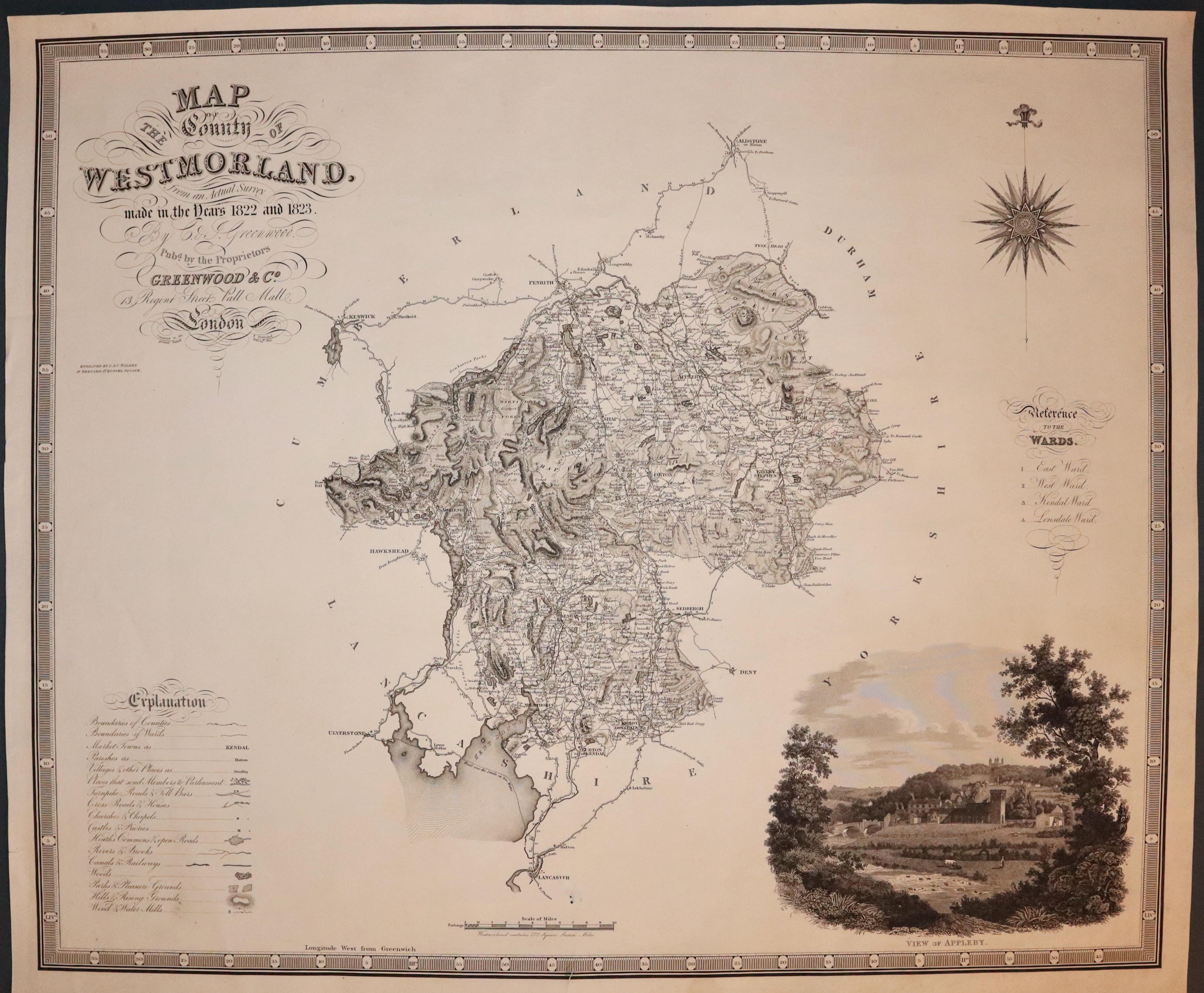
33406 Westmorland, C. & J. Greenwood, 1834. Price: 55.00
MAP OF THE COUNTY OF WESTMORLAND FROM AN ACTUAL SURVEY SURVEY MADE IN THE YEARS 1822 AND 1823...
A large detailed engraved map embellished with a large uncoloured vignette view of Appleby. Explanation, list of wards and polling places. 27 x 22 inches. Uncoloured. Single tear in the bottom blank margin which just reaches the printed border, repaired. Above this are two tiny worm holes. Otherwise good condition.
From: Atlas of the Counties of England.
17th Century
-

Westmorland, John Speed 1676

33423 Westmorland, John Speed 1676. Price: 125.00
THE COUNTIE WESTMORLAND AND KENDALE THE CHIEF TOWNE DESCRIBED With the Armes of such Nobles as have bene Earles of either of them
A decorative map of the county embellished with an inset town plan of Kendal with key. Three decorative cartouches display the title, scale, compass rose, coats of arms and the imprint of the publishers Thomas Basset and Richard Chiswell. Description of the county and list of towns on verso. 20 x 15 inches. Later hand colouring. Original centre fold. The map has been cut down with small blank margins on three sides and very small margin on the top. Laid down on a sheet of card with margins and framed in a black and gold hogarth moulding many years ago. The frame is still in good condition.
From: The Theatre of the Empire of Great Britaine
SPECIAL PRICE
ONLY AVAILABLE BY COLLECTION FROM CHRISTLETON
18th Century - First Edition
-

Westmorland, Robert Morden 1695

33518 Westmorland, Robert Morden 1695. Price: 38.00
WESTMORLAND by Robt. Morden
The FIRST EDITION of this good engraved map of the county embellished with a decorative title cartouche. Three scales. Imprint of the publishers Abel Swale with Awnsham and John Churchill.16 x 14 inches. Uncoloured. A few nicks on the edges and a small area of the printed edge of the border in the bottom left hand corner missing. Original centre fold. Uncoloured. Nice crisp paper. This map has been taken straight from the atlas and therefore not previously offered for sale as a single map.
This map should respond nicely to some restoration. SPECIAL PRICE
From: Camden's Britannia
17th Century Text
-

Westmorland Text, Pieter van den Keere 1666

33702 Westmorland & Cumberland, Pieter van den Keere 1666. Price: 8.00
WESTMORLAND & CUMBERLAND
Three sheets (six pages) of text for the counties from England Wales Scotland and Ireland Described. The second page of Westmoreland (the first page appears on the verso of the map of Cumberland and Verso) together with two concluding pages, plus first three pages for Cumberland. The last four lines for Cumberland appear on the verso of the Northumberland map. Page size 6 1/2 x 4 inches. Good condition.

RICHARD NICHOLSON
of CHESTER
Stoneydale
Pepper Street
Christleton
Chester
CH3 7AG
Telephone
01244 336004
International 44 1244 336004

I have been buying and selling antique maps since the early 1960's during which time I had a gallery in Watergate Street, Chester for 30 years. I am now able to offer through my websites a personal service to map and print collectors.

