Antique Maps of Poland, Ukraine & Lithuania
Richard Nicholson of Chester

Established in 1961

The maps on this page are guaranteed to be genuine early specimens published in or around the year stated
18th Century - Early Hand Colouring
-

Sheet 1 Part of Lithuania map, Franz Johann von Reilly 1789
-

Sheet 2 Part of Lithuania map, Franz Johann von Reilly 1789
-

Sheet 3 Part of Lithuania map, Franz Johann von Reilly 1789
-

Sheet 4 Part of Lithuania map, Franz Johann von Reilly 1789


24008 Parts of Lithuania, Poland, Prussia and Ukraine. Franz Johann von Reilly, 1789. Price: 260.00
Das Grosherzogthums Litauen ostsüdlicher Theil Nro. 47
Das Grosherzogthums Litauen nordöstlicher Nro. 48
Das Grosherzogthums Litauen nordwestlischer Nro. 49
Das Grosherzogthums Litauen westsüdlicher Nro. 50
A set of four maps showing pars of Lithuania, Prussia, Poland, Ukraine and Belarus. Each map has its own decorative cartouche and scale. Each measures 11 1/2 x 9 inches. Some early outline and wash hand colouring. Fine condition having come straight from an atlas and not perviously sold as single maps.
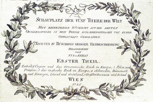
From: Schauplatz der funf Theile der Welt
18th Century - Early Hand Colouring
-

Map of Poland, Joseph von Reilly 1789

24012 Poland, Franz Johann Joseph von Reilly, 1789. Price: 98.00
Das Königreichs Preussen nord westlicher Theil mit der vreyen Stadt Danzig No: 54.
An interesting late 18th century map of Prussia, now Poland. The title is dispayed with a leave cartouche with coat of arms. 11 1/4 x 8 1/4 inches. Original outline and wash hand colouring. Early wash hand colouring. Fine condition having been taken from the atlas and therefore not previously sold as a single map.
From: Schauplatz der funf Theile der Welt
18th Century - Early Hand Colouring
-

North East Poland, Joseph von Reilly 1789

24013 North East Poland, Franz Johann Joseph von Reilly, 1789. Price: 70.00
Des Königreichs Preussen ostsüdlicher Theil Nro.52
A clearly engraved map of the northeastern part of Poland embellished with a pictorial title cartouche. 11 x 9 1/8 inches. Original outline hand colouring. Early wash hand colouring. Fine condition having been taken from the atlas and therefore not previously sold as a single map.
From: Schauplatz der funf Theile der Welt
18th Century - Early Hand Colouring
-

Die souveraine Grafschaft Glatz Nro. 113, von Reilly 1789

24014 North Poland, Franz Johann Joseph von Reilly, 1789. Price: 70.00
Das Königreich Preussen westsüdicher Teil mit der freyen Stadt Thorn
An engraved map showing the northern area of Poland embellished with a pictorial title cartouche. 11 x 9 inches. Original outline and wash hand colouring. Fine condition having been taken from the atlas and therefore not previously sold as a single map.
From: Schauplatz der funf Theile der Welt
18th Century - Early Hand Colouring
-

Baltic coast and Gdansk von Reilly 1789

24015 Baltic Coast and Gdansk, Franz Johann Joseph von Reilly, 1789. Price: 110.00
Des Koenigreschs Preussen nordwestlicher Theil mit der freyem Stadt Danzig Nro. 54
An interesting detailed engraved map showing part of the coastline of the Baltic with Gdansk and Kaliningrad. The title is displayed within a pictorial scroll cartouche. Two scales. 11 x 9 incnes. Early wash hand colouring with the towns coloured in red. Good condition. This map has come stricht from the atlas then therefore not been sold previously as a single map.
From: Schauplatz der funf Theile der Welt
18th Century - Early Hand Colouring
-

Die souveraine Grafschaft Glatz Nro. 113 von Reilly1789

24070 Die souveraine Grafschaft Glatz Nro. 113. Franz Johann Joseph von Reilly, 1789. Price: 55.00
Die souveraine Grafschaft Glatz Nro. 113.
An engraved map of South west Poland in the region of Lower Silesia. Centred on the town of Klodzko or Glatz. Decorative title cartouche. 11 x 8 1/4 inches. Good clean condition with early hand colouring.
From: Schauplatz der funf Theile der Welt
18th Century - Early Hand Colouring
-

Part of Ukraine, Antoni Zatta c.1782

33656 Part of Ukraine, Antonio Zatta, c.1782. Price: 125.00
Li Palatinati della Russia Rossa Podolia e Wolhynia
An interesting engraved map showing the so-called Red Ruthenia. Includes the towns of Volhynia, Podolia and Lutsk. Te title is displayed with a decorative pictorial cartouche bearing the date of 1781 and name of Zatta. 16 1/4 x 12 1/2 inches. Original early hand colouring. Fine clean csrip condition.
This map has been taken from straight from the atlas the therefore not previously sold as a single map.
From: Atlante Novissimo
RICHARD NICHOLSON
of CHESTER
Stoneydale
Pepper Street
Christleton
Chester
CH3 7AG
Telephone
01244 336004
International 44 1244 336004

I have been buying and selling antique maps since the early 1960's during which time I had a gallery in Watergate Street, Chester for 30 years. I am now able to offer through my websites a personal service to map and print collectors.

