Antique Maps of Japan
Richard Nicholson of Chester

Established in 1961

The maps on this page are guaranteed to be genuine early specimens published in or around the year stated
Late 19th Century
-

Japan, George Washington Bacon, 1891
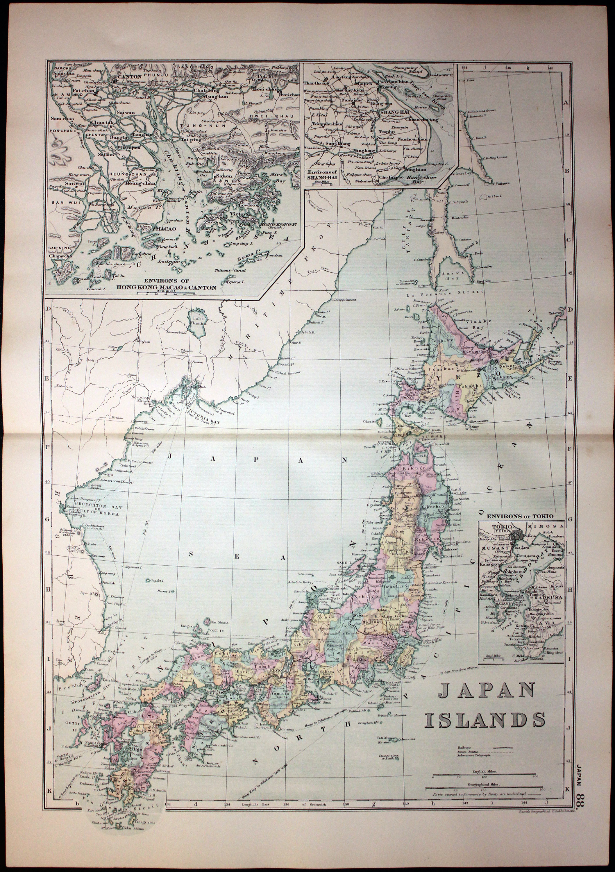
30843 Japan, George Washington Bacon, 1891. Price: 29.00
JAPAN ISLANDS
A detailed colour printed map of the country. Two inset maps of Environs of Hong Kong, Macao & Canton and Environs of Shanghai. 12 x 16 3/4 inches. inches. Good blank margins. Good clean condition.
From: Complete Atlas of the World
19th Century
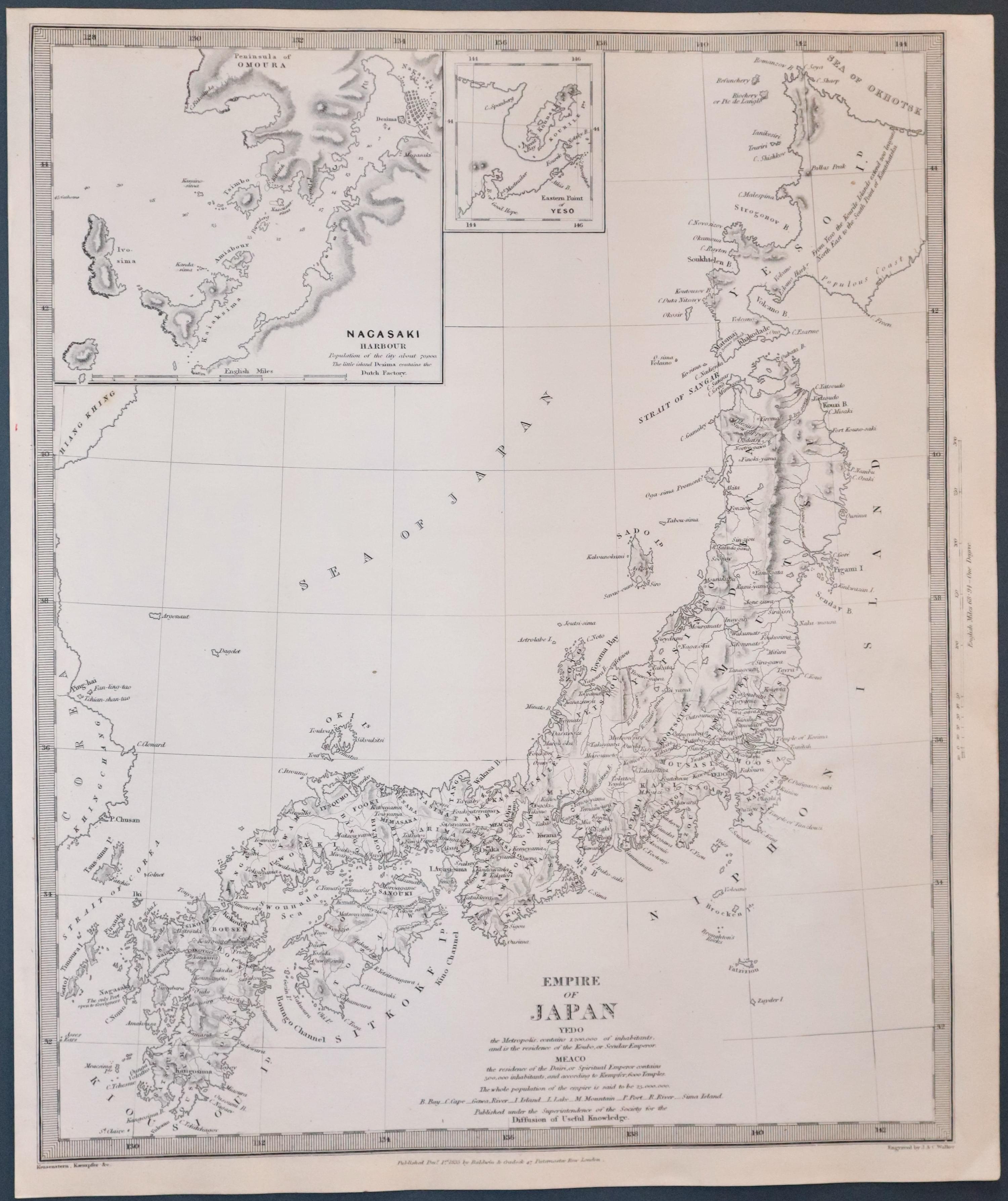
33396 Japan, S.D.U.K. c.1844. Price: 87.00
EMPIRE OF JAPAN
A detailed engraved map of the country engraved by J. & C. Walker with two inset maps of Nagasaki Harbour and Eastern Point of Yeso. Imprint of Baldwin & Craddock below dated 1835. 12 1/2 x 15 1/4 inches. Uncoloured. Plain on verso. Good condition. Straight from the atlas and not offered previously as a single map.
Published by Society for Diffusion of Useful Knowledge.
Early 18th Century
-

China and Japan, Nicolas de Fer 1705

33731 China and Japan, Nicolas de Fer, 1705. Price: 200.00
LA PARTIE ORIENTALE DE L’ASIE OU SE TROUVENT LE GRAND EMPIRE DES TARTARES CHINOIS ET CELUY DU JAPON.. A fine engraved map which includes most of China with Japan based on information from Jesuit missionaries. Title panel dated 1705. Small compass rose. 13 x 9 inches. Uncoloured. Fine clean condition.
From L'Atlas Curieux.
RICHARD NICHOLSON
of CHESTER
Stoneydale
Pepper Street
Christleton
Chester
CH3 7AG
Telephone
01244 336004
International 44 1244 336004

I have been buying and selling antique maps since the early 1960's during which time I had a gallery in Watergate Street, Chester for 30 years. I am now able to offer through my websites a personal service to map and print collectors.

