Antique Maps of the Isle of Wight
Richard Nicholson of Chester

Established in 1961
A World of Antique Maps and Prints

The maps on this page are guaranteed to be genuine early specimens published in or around the year stated
19th Century - Imperfect
-

Isle of Wight, Thomas Moule

2464 Isle of Wight, Thomas Moule c.1850. Price: 6.00
ISLE OF WIGHT
Imperfect specimen of Thomas’s Moule’s map of the island. 10 x 7 3/4 inches. Uncoloured. Staining on left and right margins. Flaws in top and bottom margins. Possible restoration job or just for reference. Special price due to condition.
From: Barclay’s Dictionary
19th Century - Early Hand Colouring
-

Isle of Wight, George Cole and John Roper, 1810

30010 Isle of Wight, George Cole and John Roper, 1810. Price: 42.00
ISLE OF WIGHT
A good detailed map of the island with explanation. Inset uncoloured town plan of Newport. 9 x 7 inches. Original wash hand colouring. Fine clean condition with wide blank margins. Straight from the atlas and not sold as a single map before.
From: British Atlas
19th Century - Early Hand Colouring
-

Isle of Wight, John Cole and John Roper, 1810

30517 Isle of Wight, George Cole and John Roper, 1810. Price: 42.00
ISLE OF WIGHT
A good detailed engraved map of the island. Inset uncoloured plan of Newport. Bears the publishers imprint dated of 1805. Explanation. 8 3/4 x 6 3/4 inches. Original wash and outline hand colouring. Good condition. Straight from the atlas and not sold as a single map before. With original page of descriptive text.
From: The British Atlas
-

Cover
-

-

Isle of Wight by George Brannon
-

-

-

-

Newport Isle of Isle of Wight, G. Brannon

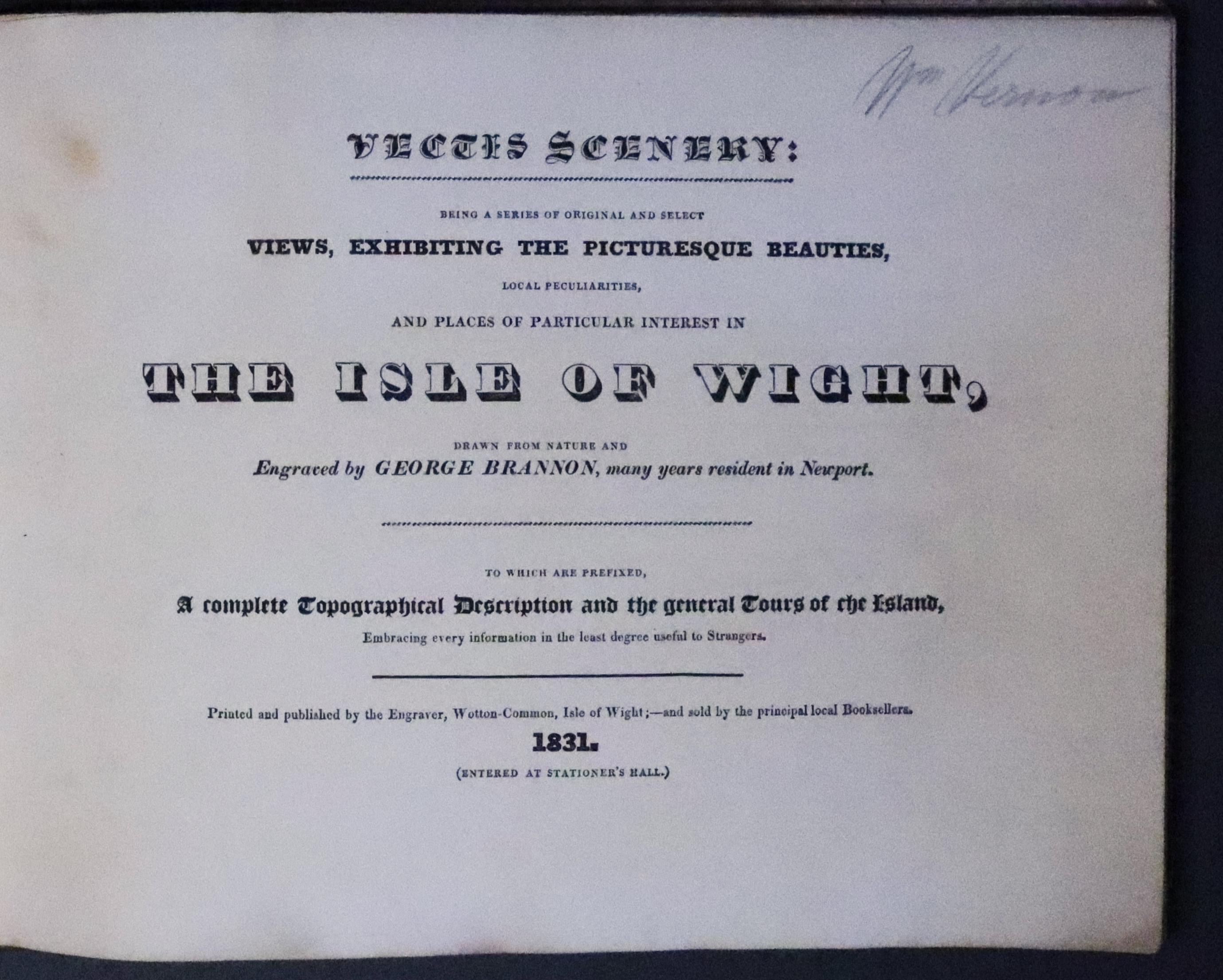

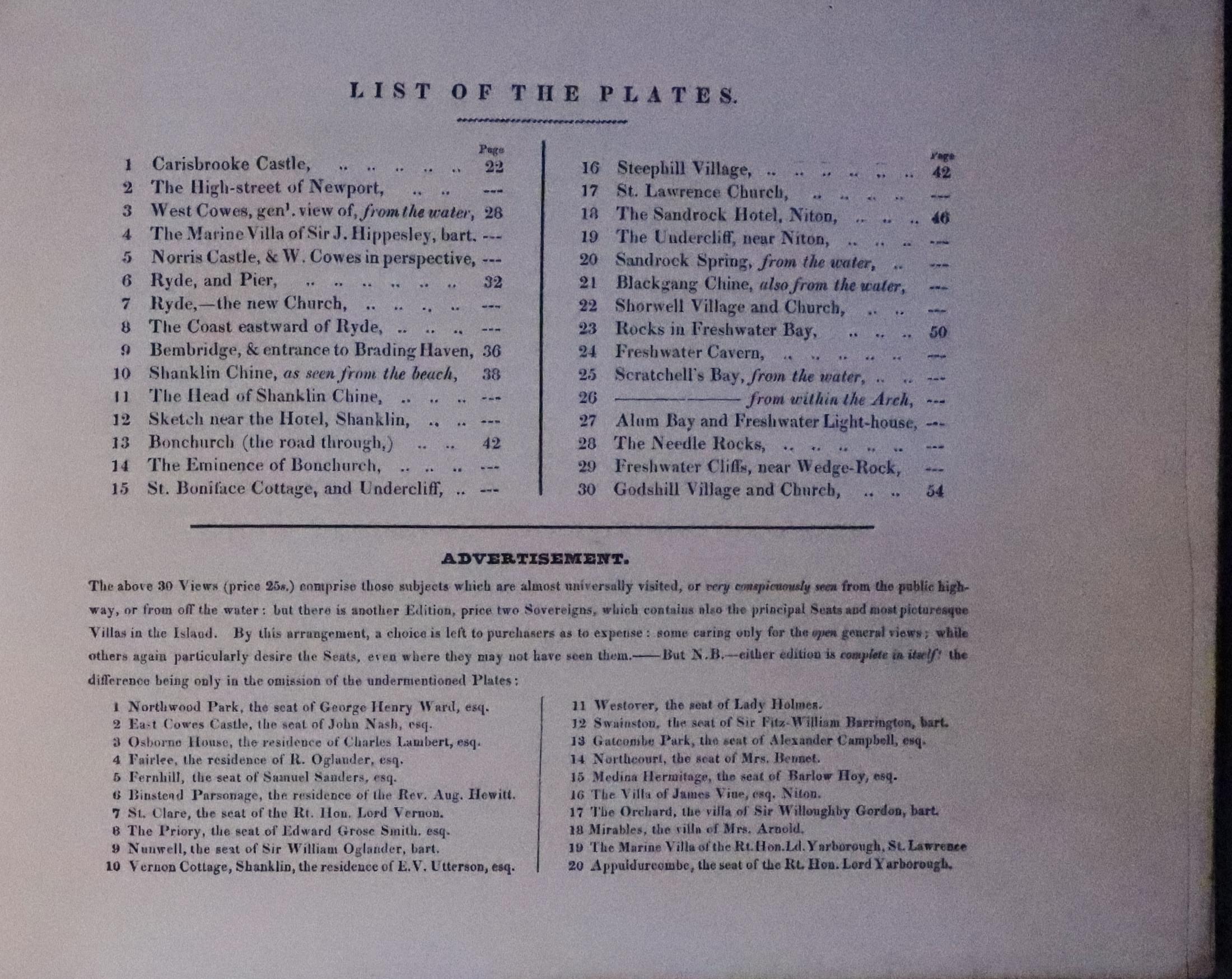
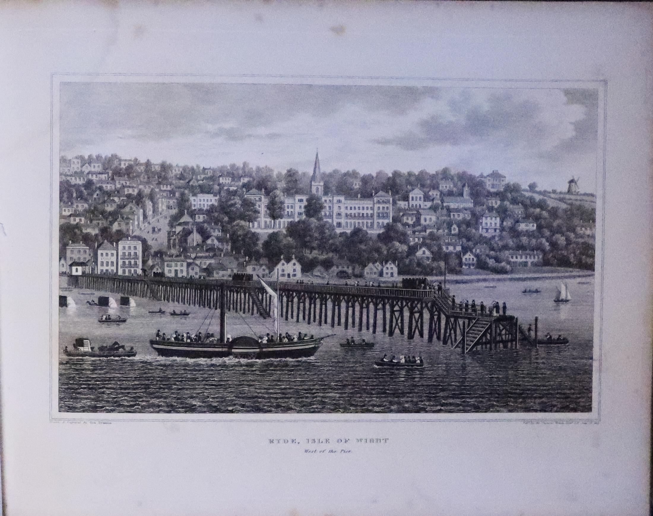
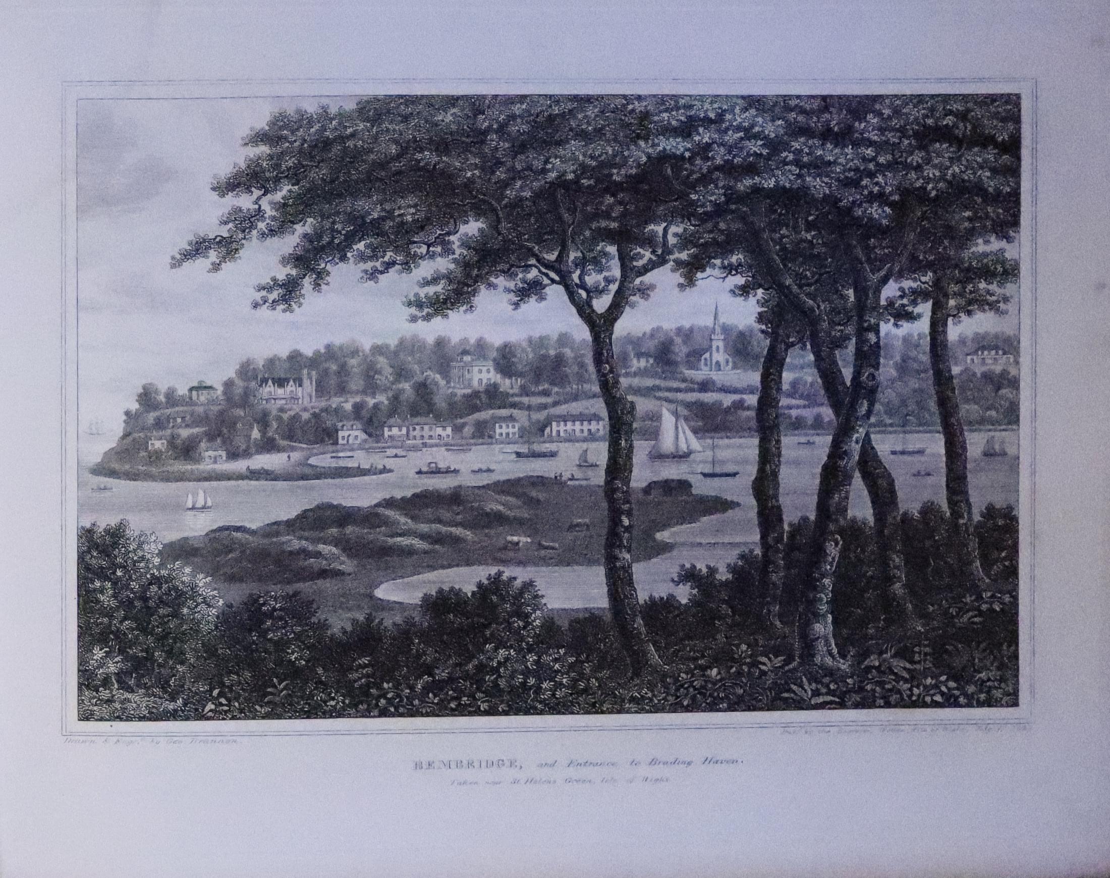

33278 Isle of Wight, George Brannon, 1831. Price: 185.00
Vectis Scenery: / Being a serie of original and select / Views, Exhibiting the Picturesque Beauties. /Local peculiatities, / and places of particular interest in / THE ISLE OF WIGHT..... 1831
Hand coloured engraved map of the Isle of Wight and 30 engraved views. Oblong 4to. Original marbled boards, worn, with original damaged label. Text and plates generally very good with some occasional light scattered foxing.
18th Century
-

Isle of Wight, Holy Island and Scilly Isles, Herman Moll 1724

33411 Isle of Wight / Holy Island / Scilly Isles, Herman Moll 1724 . Price: 65.00
THE ISLE OF WITHT/ HOLY ISLAND, FAIRN ISLANDS AND STAPLES &c. / SCILLY ISLES
Three maps on one sheet which together measure 12 x 8 inches, 310 x 195 mm. Uncoloured. Small brown stain in the top left hand blank margin and another very small on the edge of the right hand blank margin. 2 inch tear, repaired, into the Scilly Isles map which is hardly noticeable. Otherwise good condition.
SEE ALSO

RICHARD NICHOLSON
of CHESTER
Stoneydale
Pepper Street
Christleton
Chester
CH3 7AG
Telephone
01244 336004
International 44 1244 336004

I have been buying and selling antique maps since the early 1960's during which time I had a gallery in Watergate Street, Chester for 30 years. I am now able to offer through my websites a personal service to map and print collectors.

