Road Maps of England and Wales
by John Ogilby 1675 - 1698
Richard Nicholson of Chester
A World of Antique Maps and Prints

Established in 1961
Plates 26 - 50

The maps on this page are guaranteed to be genuine early specimens published in or around the year stated
The following John Ogilby's Road Maps are currently in stock. They are all guaranteed to be genuine early specimens All in good clean condition and attractively hand coloured unless otherwise stated.
Also listed are some specimens of the original text for each road map that were only published in the first edition of Britannia
Plates 26 - 50
Each measuring about 17 x 13 inches
Published in 1675 and 1698

First Edition - 1675

-

Plate 26 John Ogilby Road Map 1675

31782 Plate 26. The Road from London to Lands End. Andover, Salisbury, Shaftsbury, Sherborne, Crewkerne. Price: 260.00
The first edition of this 17th century strip road map. Uncoloured. Embellished with a decorative pictorial title cartouche. 19 1/8 x 13 inches. Good condition with wide blank margins. Nice dark impression. Straight from the atlas so has never previously been sold as a single map
From: Britannia
TEXT: The original double sided page of text from Britania to accompany this map is available to the purchaser at a reduced price of 25.00 if bought with the map.
BUYING: The purchase of this map can be by direct payment to my bank account. Or by telephoning me with your credit/debit card details. Please telephone me first to check the map is available - 01244 336004. If paying to my bank please email me afterwards advising and giving me your name and address as to where the map is to be sent.
First Edition - 1675
-

Plate 27 John Ogilby Road Map 1675

31784 Plate 27. The Road from London to Lands End. Crewkerne, Honiton, Exeter, Ashburton, Plymouth. Price: 280.00
The first edition of this 17th century strip road map. Uncoloured. Embellished with a decorative pictorial title cartouche. 19 1/14 x 13 inches. Split at the bottom of centre fold just reaching engraved area. Otherwise good condition with wide blank margins. Uncoloured. Nice dark impression. Straight from the atlas so has never previously been sold as a single map
From: Britannia
TEXT: The original double sided page of text from Britania to accompany this map is available to the purchaser at a reduced price of 25.00 if bought with the map.
BUYING: The purchase of this map can be by direct payment to my bank account. Or by telephoning me with your credit/debit card details. Please telephone me first to check the map is available - 01244 336004. If paying to my bank please email me afterwards advising and giving me your name and address as to where the map is to be sent.
First Edition - 1675
-

Plate 32 John Ogilby Road Map 1675

31789 Plate 32. The Road from London to Barnstaple. Andover, Warminster, Bridgwater. Price: 230.00
The first edition of this 17th century strip road map. Embellished with a decorative pictorial title cartouche depicting a hunting scene. 17 x 14 inches. Good condition with wide blank margins. Uncoloured. Nice dark impression. Straight from the atlas so has never previously been sold as a single map
From: Britannia
TEXT The original double sided page of text from Britannia to accompany this map is available to the purchaser at a reduced price of 25.00 if bought with the map.
The purchase of this map can be by direct payment to my bank account. Or by telephoning me with your credit/debit card details. Please telephone me first to check the map is available - 01244 336004. If paying to my bank please email me afterwards advising and giving me your name and address as to where the map is to be sent.
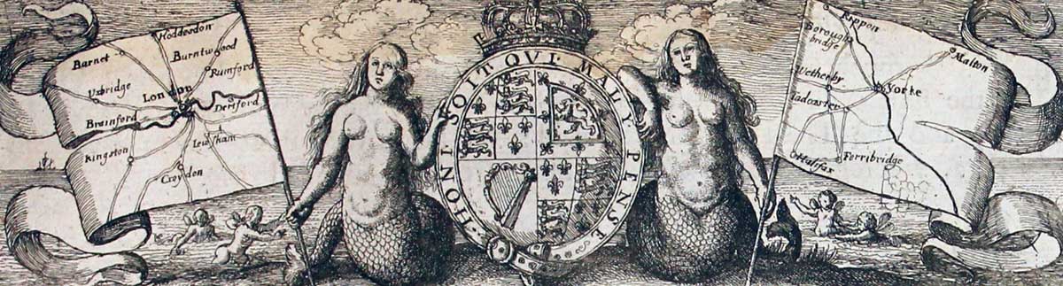
Rare Ogilby Text
-

Text Plate 32 John Ogilby Road Map 1675

28488 Plate 32. Andover, Warminster, Bridgwater. Text only. Price: 32.00
The rare double sided page of folio text published in 1675 describing the route in great detail. A rare opportunity as it is very unlikely that I shall able to offer this again. This is one of the few pages of text to be decorated with a banner showing two sea nymphs supporting the royal arms. Some light damp staining - see illustratioon.
From: Britannia
Rare Ogilby Text - 1675
-

Plate 32 text John Ogilby Road Map 1675

28610 Plate 32. Andover, Warminster, Bridgwater. Text only. Price: 35.00
The rare double sided page of folio text published in 1675 describing the route in great detail. A rare opportunity as it is very unlikely that I shall able to offer this again. This is one of the few pages of text to be decorated with a banner showing two sea nymphs supporting the royal arms
From: Britannia
First Edition - 1675
-

Plate 35 London to Bath and Wells John Ogilby Road Map 1675

31792 Plate 35. London to Bath and Wells. Chippenham, Bath, Wells, Marlborough, Devizes, Trowbridge, Wells. Price: 230.00
The first edition of this 17th century strip road map. Embellished with a decorative title cartouche. 17 1/2 x 13 1/4 inches. Good condition with wide blank margins. Uncoloured. Nice dark impression. Straight from the atlas so has never previously been sold as a single map
From: Britannia
TEXT The original double sided page of text from Britannia to accompany this map is available to the purchaser at a reduced price of 25.00 if bought with the map.
The purchase of this map can be by direct payment to my bank account. Or by telephoning me with your credit/debit card details. Please telephone me first to check the map is available - 01244 336004. If paying to my bank please email me afterwards advising and giving me your name and address as to where the map is to be sent.
17th Century Road Map
-

Chippenham, Bath, Wells, Marlborough, Devizes, Trowbridge, Wells, John Ogilby 1698

30648 Plate 35. Chippenham, Bath, Wells, Marlborough, Devizes, Trowbridge, Wells. Price: 95.00
An uncoloured specimen of the 1698 edition. Medium toning all over. Tear near the centre fold about two inches from the bottom. Second tear in the blank margin top right hand side repaired. Barely visible.
From: Britannia
First Edition - 1675
-

Plate 37 London to Carlisle John Ogilby Road Map 1675

31794 Plate 37. The Road from London to Carlisle. Darleston, Newcastle, Brewerton, Holmes Chapel, Lostock Gralam, Great Budworth, Whitley, Streeton, Warrington, Newton-le-Willows, Wigan, Standish, Charnock Richard, Leyland, Preston, Garstang. Price: 230.00
The first edition of this 17th century strip road map. Embellished with a decorative title cartouche with costumed figures and cattle. 16 1/4 x 13 inches. Light water stain in the left and right bottom blank margin. Otherwise good condition with wide blank margins. Uncoloured. Nice dark impression. Straight from the atlas so has never previously been sold as a single map
From: Britannia
TEXT The original double sided page of text from Britannia to accompany this map is available to the purchaser at a reduced price of 25.00 if bought with the map.
The purchase of this map can be by direct payment to my bank account. Or by telephoning me with your credit/debit card details. Please telephone me first to check the map is available - 01244 336004. If paying to my bank please email me afterwards advising and giving me your name and address as to where the map is to be sent.
First Edition - 1675
-

Plate 38 London to Carlisle John Ogilby Road Map 1675

31796 Plate 39. The Road from London to Chichester. Guildford, Midhurst, Chichester/ Midhurst, Petersfield, Winchester. Price: 380.00
The first edition of this 17th century strip road map. Embellished with a decorative title cartouche. 16 x 12 3/4 inches. Good condition with wide blank margins. Uncoloured. Nice dark impression. Straight from the atlas so has never previously been sold as a single map
From: Britannia
TEXT The original double sided page of text from Britannia to accompany this map is available to the purchaser at a reduced price of 25.00 if bought with the map.
The purchase of this map can be by direct payment to my bank account. Or by telephoning me with your credit/debit card details. Please telephone me first to check the map is available - 01244 336004. If paying to my bank please email me afterwards advising and giving me your name and address as to where the map is to be sent.
First Edition - 1675
-

Plate 41 London to Flamborough Head John Ogilby Road Map 1675

31798 Plate 41. The Road from London to Flamborough Head. Temsford, Stilton, Peterborough, Market Deeping, Sleaford, Lincoln. Price: 220.00
The first edition of this 17th century strip road map. Embellished with a decorative title cartouche. 17 x 13 1/2 inches. Tiny split at the bottom of the centre fold otherwise good condition with wide blank margins. Uncoloured. Nice dark impression. Straight from the atlas so has never previously been sold as a single map
From: Britannia
TEXT The original double sided page of text from Britannia to accompany this map is available to the purchaser at a reduced price of 25.00 if bought with the map.
The purchase of this map can be by direct payment to my bank account. Or by telephoning me with your credit/debit card details. Please telephone me first to check the map is available - 01244 336004. If paying to my bank please email me afterwards advising and giving me your name and address as to where the map is to be sent.
Rare Ogilby Text - 1675

-

Plate 42 text for Road Map John Ogilby 1675

28620 Plate 42. The Road from London to Flamborough Plate 2. Lincoln, Barton, Hull, Beverley, Flamborough. Price: 30.00
The rare double sided page of folio text published in 1675 describing the route in great detail. A rare opportunity as it is very unlikely that I shall able to offer this again.
From: Britannia
17th Century Road Map
-

London to Flamborough Plate 2. Lincoln, Barton, Hull, Beverley, Flamborough John Ogilby

29409 Plate 42. The Road from London to Flamborough Plate 2. Lincoln, Barton, Hull, Beverley, Flamborough. Price: 120.00
An uncoloured specimen of the 1698 edition although it has no plate number 42 in the bottom right hand corner. Lightly toned.
From: Britannia
First Edition - 1675
-

Plate 42 Continuation London to Flamborough Head John Ogilby Road Map 1675

31799 Plate 42. The Continuation of the Road from London to Flamborough Head. Lincoln, Barton, Hull, Beverley, Flamborough. Price: 180.00
The first edition of this 17th century strip road map. Embellished with a decorative pictorial title cartouche showing Neptune and a Sea goddess with dolphins.. 17 x 13 3/4 inches. Some light vertical creasing to the right of the centre fold otherwise good condition with wide blank margins. Uncoloured. Nice dark impression. Straight from the atlas so has never previously been sold as a single map
From: Britannia
TEXT The original double sided page of text from Britannia to accompany this map is available to the purchaser at a reduced price of 25.00 if bought with the map.
The purchase of this map can be by direct payment to my bank account. Or by telephoning me with your credit/debit card details. Please telephone me first to check the map is available - 01244 336004. If paying to my bank please email me afterwards advising and giving me your name and address as to where the map is to be sent.
Rare Ogilby Text - 1675
-

Plate 43 text for Road Map John Ogilby 1675

28621 Plate 43. Puckeridge, Cambridge, Ely, Downham, King's Lynn. Text only. Price: 30.00
The rare double sided page of folio text published in 1675 describing the route in great detail. A rare opportunity as it is very unlikely that I shall able to offer this again.
From: Britannia
Rare Ogilby Text - 1675
-

Plate 43 text for Road Map John Ogilby 1675

32293 Plate 43. Puckeridge, Cambridge, Ely, Downham, King's Lynn. Text only. Price: 30.00
The rare double sided page of folio text published in 1675 describing the route in great detail. A rare opportunity as it is very unlikely that I shall able to offer this again.
From: Britannia
17th Century Road Map
-

Four shire stone, Chipping Campden, Worcester, Ludlow, Montgomery. John Ogilby

29411 Plate 44. Four shire stone, Chipping Campden, Worcester, Ludlow, Montgomery. Price: 130.00
An uncoloured specimen of the 1698 edition. Nice specimen.
From: Britannia
First Edition - 1675
-

Plate 44 London to Montgomery John Ogilby Road Map 1675

31801 Plate 44. The Road from London to Montgomery. Four shire stone, Chipping Campden, Worcester, Ludlow, Montgomery. Price: 185.00
The first edition of this 17th century strip road map. Embellished with a decorative title cartouche. 17 x 13 3/4 inches. Small ink mark in bottom right hand blank margin otherwise good condition with wide blank margins. Uncoloured. Nice dark impression. Straight from the atlas so has never previously been sold as a single map
From: Britannia
TEXT The original double sided page of text from Britannia to accompany this map is available to the purchaser at a reduced price of 25.00 if bought with the map.
The purchase of this map can be by direct payment to my bank account. Or by telephoning me with your credit/debit card details. Please telephone me first to check the map is available - 01244 336004. If paying to my bank please email me afterwards advising and giving me your name and address as to where the map is to be sent.
First Edition - 1675
-

Plate 46 London to Norwich John Ogilby Road Map 1675

31803 Plate 46. The Road from London to Norwich. Puckeridge, Newmarket, Thetford, Attleborough, Windham, Norwich. Price: 230.00
The first edition of this 17th century strip road map. Embellished with a decorative title cartouche. 16 1/4 x 13 3/4 inches. Good condition with wide blank margins. Uncoloured. Nice dark impression. Straight from the atlas so has never previously been sold as a single map
From: Britannia
TEXT The original double sided page of text from Britannia to accompany this map is available to the purchaser at a reduced price of 25.00 if bought with the map.
The purchase of this map can be by direct payment to my bank account. Or by telephoning me with your credit/debit card details. Please telephone me first to check the map is available - 01244 336004. If paying to my bank please email me afterwards advising and giving me your name and address as to where the map is to be sent.
Rare Ogilby Text - 1675
-

Plate 46 text for Road Map John Ogilby 1675

28624 Plate 46. Puckeridge, Newmarket, Thetford, Attleborough, Windham, Norwich. Text only. Price: 30.00
The rare double sided page of folio text published in 1675 describing the route in great detail. A rare opportunity as it is very unlikely that I shall able to offer this again. From: Britannia
Rare Ogilby Text - 1675
-

Text Plate 47 Road Map John Ogilby 1675

28503 Plate 47. The Road from London to Norwich in Norfolk. St. Albans, Luton, Bedford, Wellingborough, Kettering, Oakham. Text only. Price: 30.00
The rare double sided page of folio text published in 1675 describing the route in great detail. A rare opportunity as it is very unlikely that I shall able to offer this again. Some water staining. From: Britannia
First Edition - 1675
-

Plate 48 Oakham to Banrsley John Ogilby Road Map 1675

31805 Plate 48. The Road from London to Oakham. Oakham, Melton Mowbray, Nottingham, Mansfield, Rotherham, Barnsley. Price: 200.00
The first edition of this 17th century strip road map. Embellished with a decorative title cartouche. 16 1/4 x 13 3/4 inches. Good condition with wide blank margins. Uncoloured. Nice dark impression. Straight from the atlas so has never previously been sold as a single map
From: Britannia
TEXT The original double sided page of text from Britannia to accompany this map is available to the purchaser at a reduced price of 25.00 if bought with the map.
The purchase of this map can be by direct payment to my bank account. Or by telephoning me with your credit/debit card details. Please telephone me first to check the map is available - 01244 336004. If paying to my bank please email me afterwards advising and giving me your name and address as to where the map is to be sent.
17th Century Road Map
-

Oakham, Melton Mowbray, Nottingham, Mansfield, Rotherham, Barnsley John Ogilby

29413 Plate 48. Oakham, Melton Mowbray, Nottingham, Mansfield, Rotherham, Barnsley. Price: 130.00
An uncoloured specimen of the 1698 edition. Two small rust spots in blank margins and lightly toned.
First Edition - 1675
-

Plate 49 Oakham to Banrsley John Ogilby Road Map 1675

31806 Plate 49. The Road from Oakham to Richmond. Oakham. Barnsley, Halifax, Skipton, Middleham, Richmond. Price: 230.00
The first edition of this 17th century strip road map. Embellished with a decorative title cartouche. 17 1/2 x 14 1/4 inches. Good condition with wide blank margins. Uncoloured. Nice dark impression. Straight from the atlas so has never previously been sold as a single map
From: Britannia
TEXT The original double sided page of text from Britannia to accompany this map is available to the purchaser at a reduced price of 25.00 if bought with the map.
The purchase of this map can be by direct payment to my bank account. Or by telephoning me with your credit/debit card details. Please telephone me first to check the map is available - 01244 336004. If paying to my bank please email me afterwards advising and giving me your name and address as to where the map is to be sent.
17th Century Road Map
-

Meriden, Birmingham, Bridgnorth, Shrewsbury, Welshpool

29415 Plate 50. Meriden, Birmingham, Bridgnorth, Shrewsbury, Welshpool. Price: 130.00
An uncoloured specimen of the 1698 edition. Lightly toned and very light foxing.
RICHARD NICHOLSON
of CHESTER
Stoneydale
Pepper Street
Christleton
Chester
CH3 7AG
Telephone
01244 336004
International 44 1244 336004

I have been buying and selling antique maps since the early 1960's during which time I had a gallery in Watergate Street, Chester for 30 years. I am now able to offer through my websites a personal service to map and print collectors.

