TITLE PAGES
Richard Nicholson of Chester
A World of Antique Maps and Prints
Established in 1961
All the documents on this page are guaranteed to be genuine early specimens
pubished in or around the year stated
-

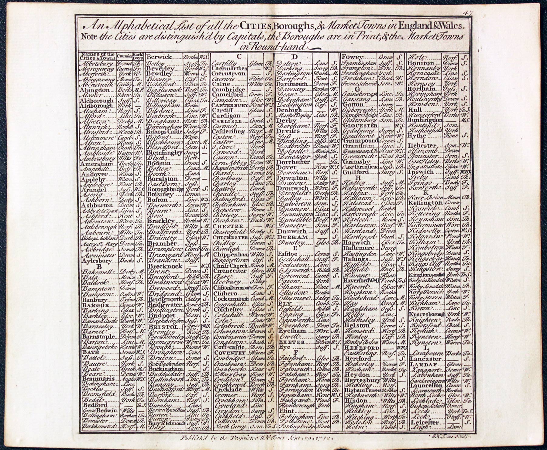
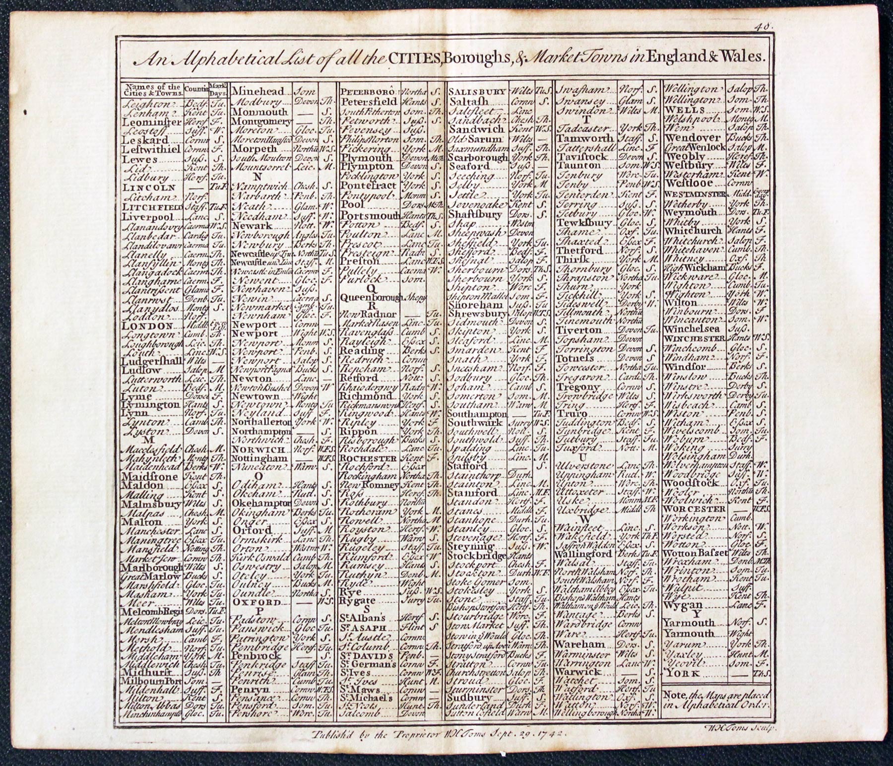
Chorographia Britanniae List of Towns, 1742
-

18th century list of towns

31563 Chorographia Britanniae List of Towns, 1742. Price: 19.00
CHOROGRAPHIA BRITANNIAE
Two pages from the atlas published in 1742. They show in columns a list of towns in alphabetical order with a column for the county they are in and a column for the market days. Sheets measure 7 x 6 1/2 inches. Good condition.
Minimum Order £15.00
POST FREE IN THE U.K.
If the map is to be sent to an address outside the UK. I will send you a PayPal Invoice for the Postage and Packing. This single charge covers any number of items in one order. EUROPE - 14 pounds. REST OF THE WORLD - 25 pounds
-

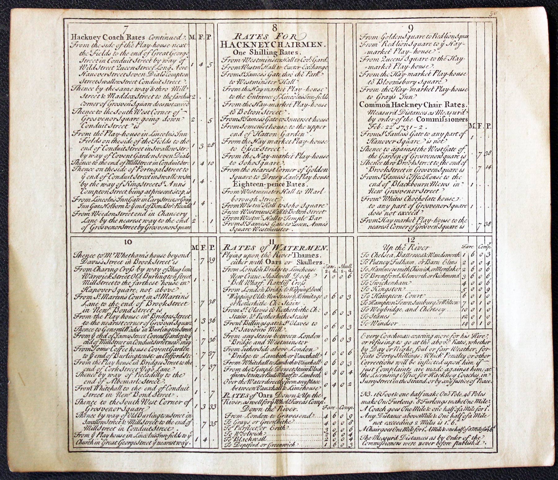
List of Hackney Coach Rates in 1742
-

List of Watermen Charges on River Thames in 17842

31564 Chorographia Britanniae Rates for Hackney Coaches, 1742. Price: 24.00
CHOROGRAPHIA BRITANNIAE
Two pages from the atlas published in 1742. A fascinating insight into Georgian London with the routes and prices for Hackney Coaches. On the second sheet are the rates for Hackney Chairmen and the Rates for Watermen working on the River Thames. Sheets measure 7 x 6 1/2 inches. Good condition.
Minimum Order £15.00
POST FREE IN THE U.K.
If the map is to be sent to an address outside the UK. I will send you a PayPal Invoice for the Postage and Packing. This single charge covers any number of items in one order. EUROPE - 14 pounds. REST OF THE WORLD - 25 pounds
-

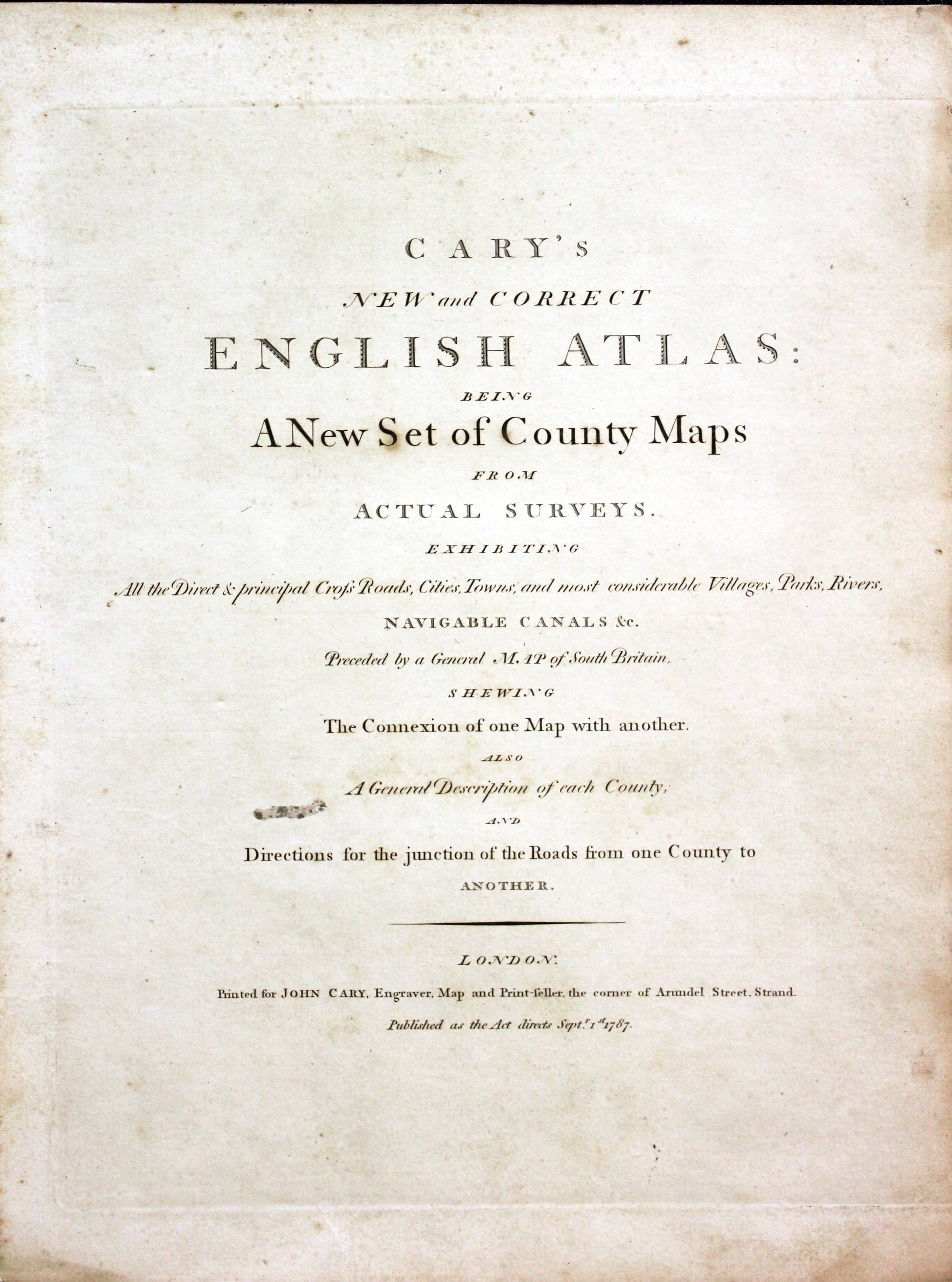
Titlepage New and Correct English Atlas 1787

31632 Title Page, John Cary 1787. Price: 22.00
TITLE PAGE AND CONTENTS PAGE
The title page to the first edition of Cary’s New and Correct English Atlas, published in 1787 .9 1/2 x 12 inches. Good condition. With the title page is also three double sided pages listing the subscribers.
Minimum Order £15.00
POST FREE IN THE U.K.
If the map is to be sent to an address outside the UK. I will send you a PayPal Invoice for the Postage and Packing. This single charge covers any number of items in one order. EUROPE - 14 pounds. REST OF THE WORLD - 25 pounds
-

Titlepage William Morris Charts of Wales 1800

33280 Title Page, William Morris, 1800. Price: 32.00
PLANS OF THE PRINCIPAL HARBOURS, BAYS, & ROADS IN ST, GEORGE’S AND THE BRISTOL CHANNELS
The title page dated 1800 from this work published in Shrewsbury. Plus page to the reader plus 6 interesting pages listing the subscribers, plus 21 printed pages of observations of the places that were charted in the work. 7 1/2 x 10 3/4 inches. Good clean undamaged condition.
Minimum Order £15.00
POST FREE IN THE U.K.
If the map is to be sent to an address outside the UK. I will send you a PayPal Invoice for the Postage and Packing. This single charge covers any number of items in one order. EUROPE - 14 pounds. REST OF THE WORLD - 25 pounds
-

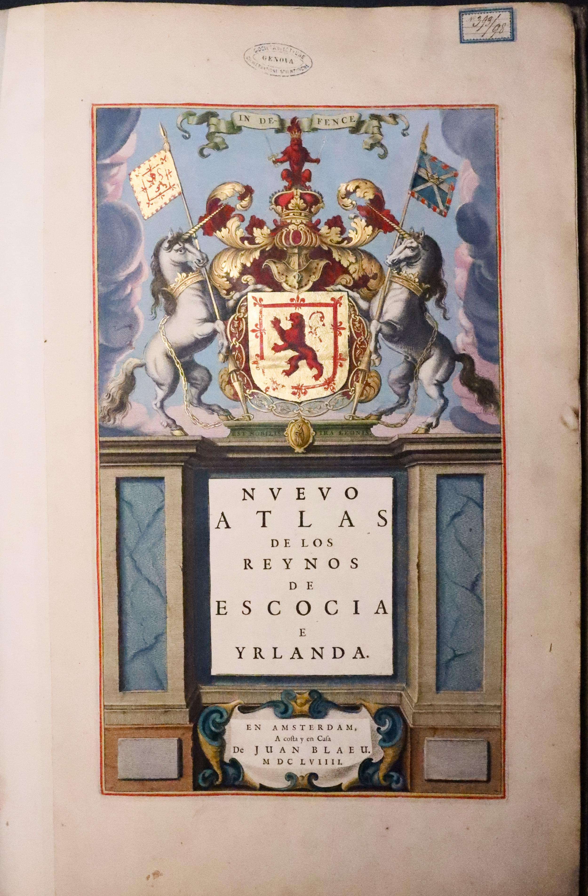
Blaue Atlas of Scotland
33281 Blaeu's Atlas of Scotland, Incomplete, 1659. Price: 200.00
NUEVO ATLAS DE LOS REYNOS DE ESCOCIA E YRLANDA
The title page to the 1659 edition of Blaeu’s Atlas of Scotland, still in the atlas which is in the original cream and gold decorated vellum binding. Along with all the remaining pages of Spanish text after the maps have been removed. The text will not be complete as text also appeared on the verso of some of the maps. Folio. Some satins to the binding and some tears to the binding on the spine.
Buyer Collects
-

Blaue Atlas of Scotland
3328 Great Britain's Coasting Pilot, Captain Greenville Collins, 1764. 54.00
GREAT-BRITAIN’S COASTING PILOT IN TWO PARTS.....
The title page to the 1764 edition of this historic work first published in 1693. Collins was commissioned by Samuel Pepys, Secretary to the Admiralty to map of the coastline of the British Isles. The survey took some seven years to complete which resulted in the publication of the first comprehensive sea atlas by an Englishman - Great Britain’s Coasting Pilot. Folio size. Title page and the following 28 pages, still lightly bound together, of descriptive text describing the areas surveyed. One page has a chart showing part of the Northumbrian coast with Warkworth Castle and Coquet Island.
Minimum Order £15.00
POST FREE IN THE U.K.
If the map is to be sent to an address outside the UK. I will send you a PayPal Invoice for the Postage and Packing. This single charge covers any number of items in one order. EUROPE - 14 pounds. REST OF THE WORLD - 25 pounds


