RICHARD NICHOLSON of CHESTER
A WORLD OF ANTIQUE MAPS AND PRINTS
The Hydrographer
WILLIAM MORRIS
Charts of Wales
Before reading this page about William Morris I would encourage you to read the page about William's father Lewis Morris
To the Reader
As. this performance may be esteemed the only one of the kind ever published in Great-Britain, it may not be improper to give some account of the rise, progress, and nature of the undertaking. The melancholy accounts of shipwrecks and losses on the Coast of Wales, (chiefly occasioned by the very slender. knowledge-and-imperfect description of that coast) pointed out to the Lords of the Admiralty the necessity of an actual survey, and their Lordships were pleased to order my father, the late Lewis Morris, upon that service; but as his surveys extended only from Ormes Head, near Chester Bar, to Milford Haven, they were found inadequate to the desired end; I therefore undertook to extend them to Liverpool, and to Cardiff in the Briftol Channel, and to include the East Coast of Ireland from Dublin to Wexford, which now renders the survey of the Welsh and Irish Coasts in St. George’s and the Bristol Channels complete.
I cannot avoid observing in this place, that some of the English draughts of the Coasts of Wales and Ireland, which are now in the hands of sailors, and which pass for new and correct charts, (I mean such as have come within the compass of my observation,) are evidently no other than very imperfect eye draughts, or else very corrupt copies of ancient surveys; and are upon no account to be depended upon. I am far from censuring the performance of others, but I take it to be the duty of every man to make public a matter which is of so great consequence to the nation. The correctness necessary in undertakings of this kind, by sea and by land, demands extraordinary care and application; and the many observations proper for determining justly the situations and positions of places, time of tide, soundings, &c.require the utmost attention, and much labour and pains, which: ought not, an such cases, to be spared, where the lives and property of so many persons (the most valuable Part of his Majesty’s subjects) are concerned n this survey and publication, besides the close application and hard labour requisite, I found almost insuperable difficulties, and that it required a resolution not easily to be intimidated to go through with it as the chief part of the business was to search carefully for those dangers others have endeavoured as carefully to avoid; and I am firmly of opinion that nothing material hath escaped my observation, that relate to these surveys: this may be seen by comparing other draughts with the General Chart, which is also published from an actual survey, and on which every dependence may be placed.
One observation more I may venture to make as peculiar to this work; and that is, the names of places are inserted according to their orthography; whereas in other charts and maps of the coast they are generally so inaccurately spelt, as not to be known by either natives or inhabitants; and are, for the most part, the spurious productions of ignorant transcribers and careless engravers.
WILLIAM MORRIS
List of Charts
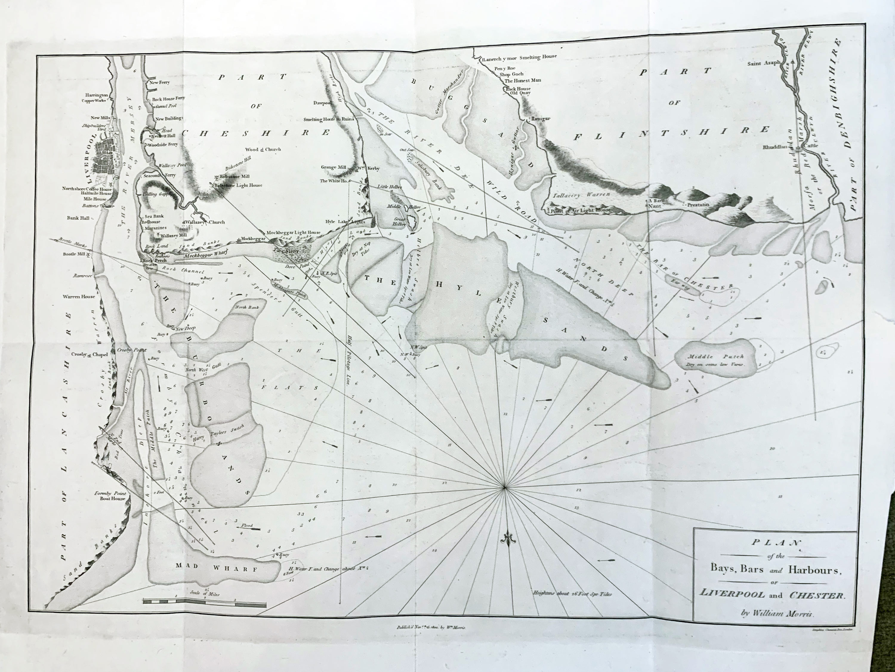
- Plan of the Bays, Bars, and Harbours, of Liverpool by William Morris
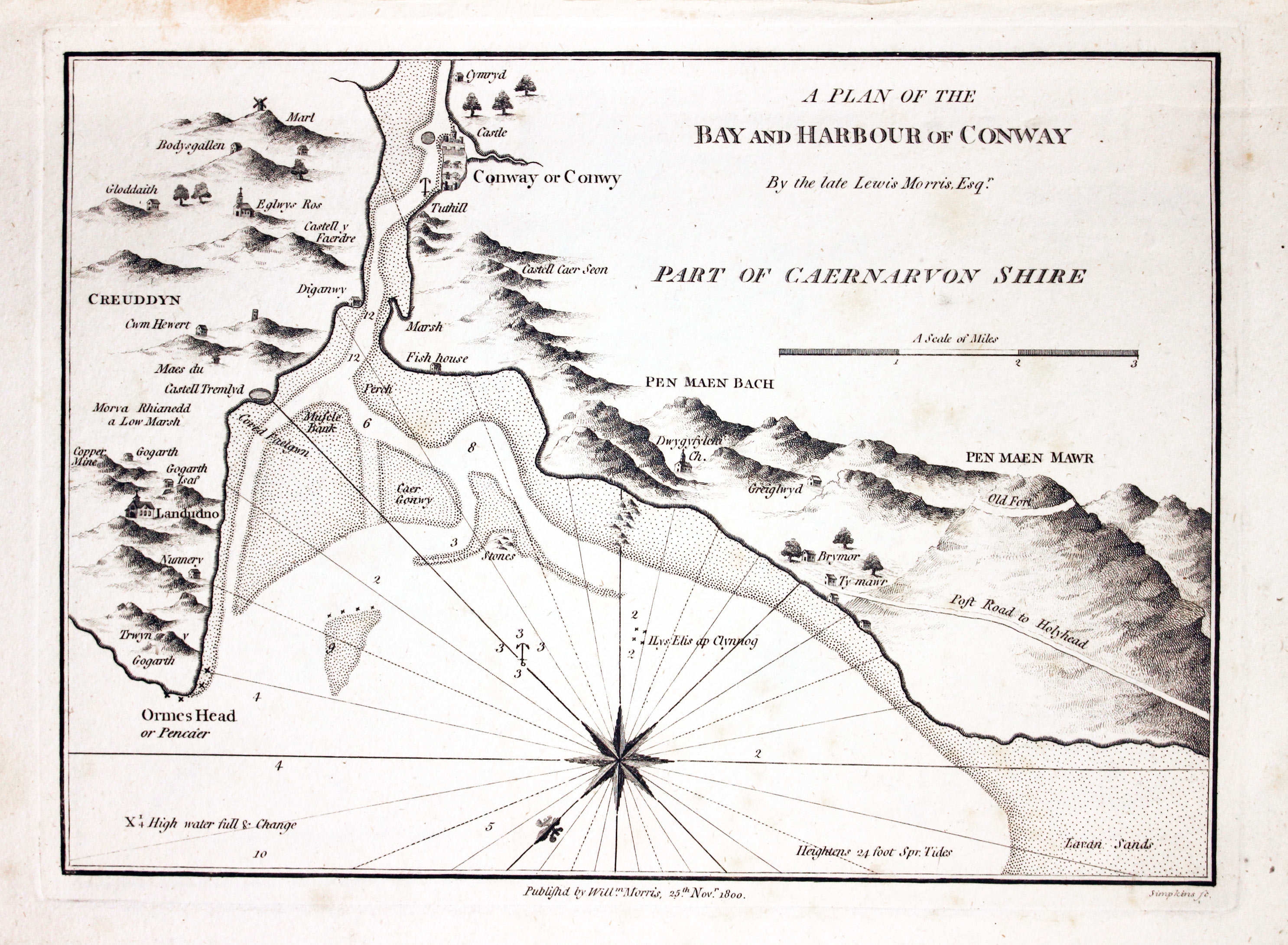
- A Plan of the Bay and Harbour of Conway By the late Lewis Morris, Esqr.
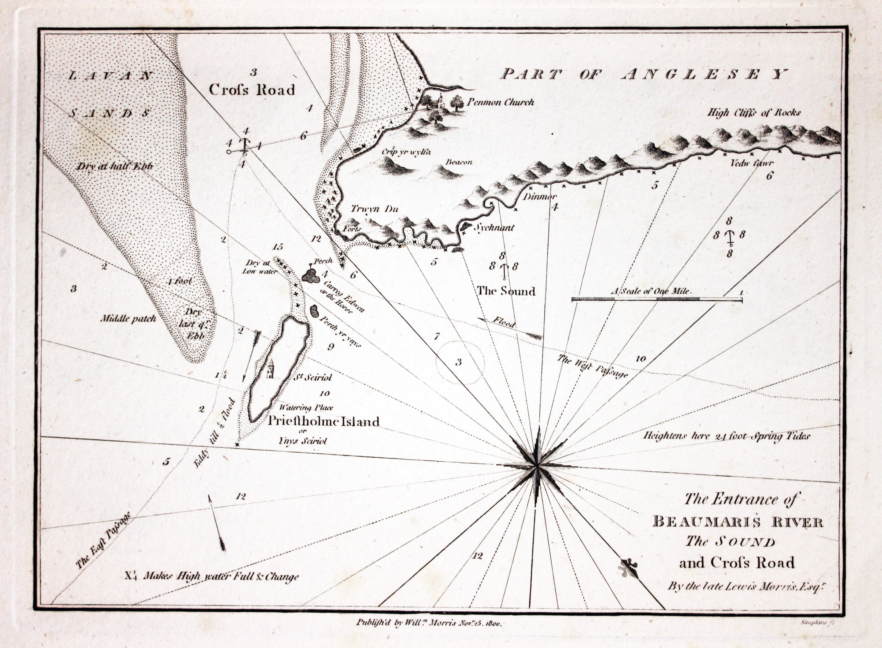
- The Entrance of Beaumaris River The Sound and Cross Road
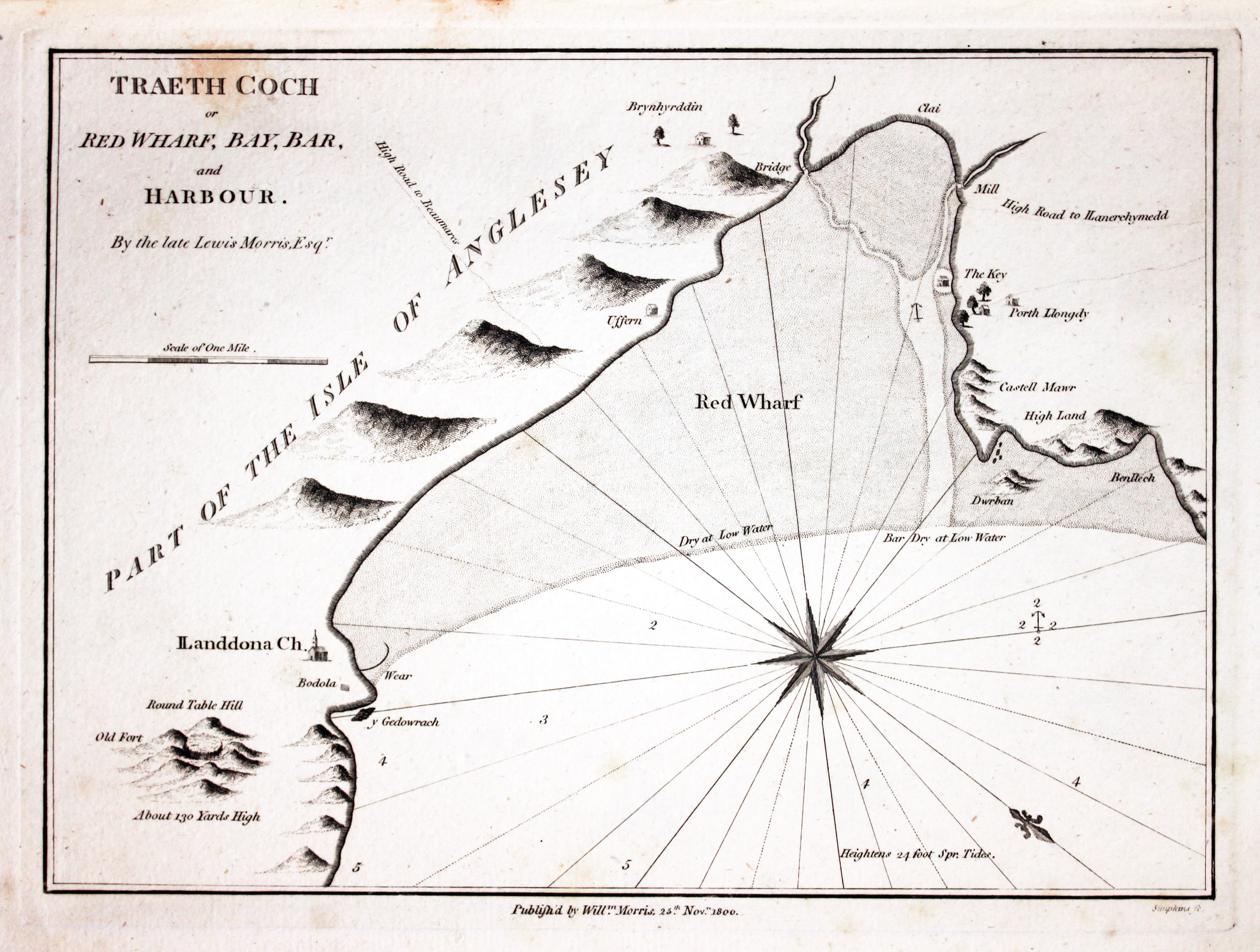
- Traeth Coch or Red Wharf Bay, Bar, and Harbour. By the late Lewis Morris, Esqr.
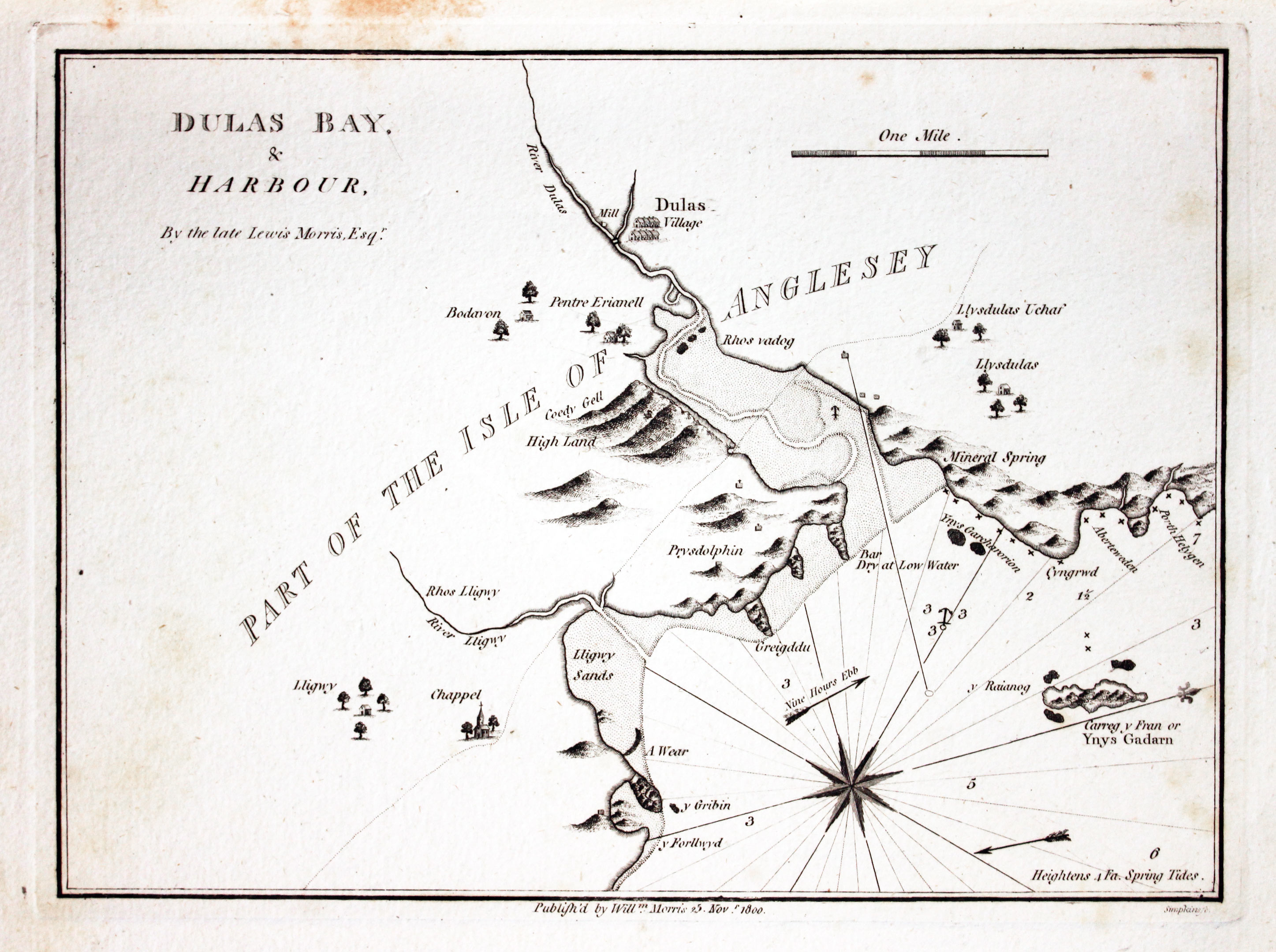
- Dulas Bay and Harbour, by the late Lewis Morris Esqr.
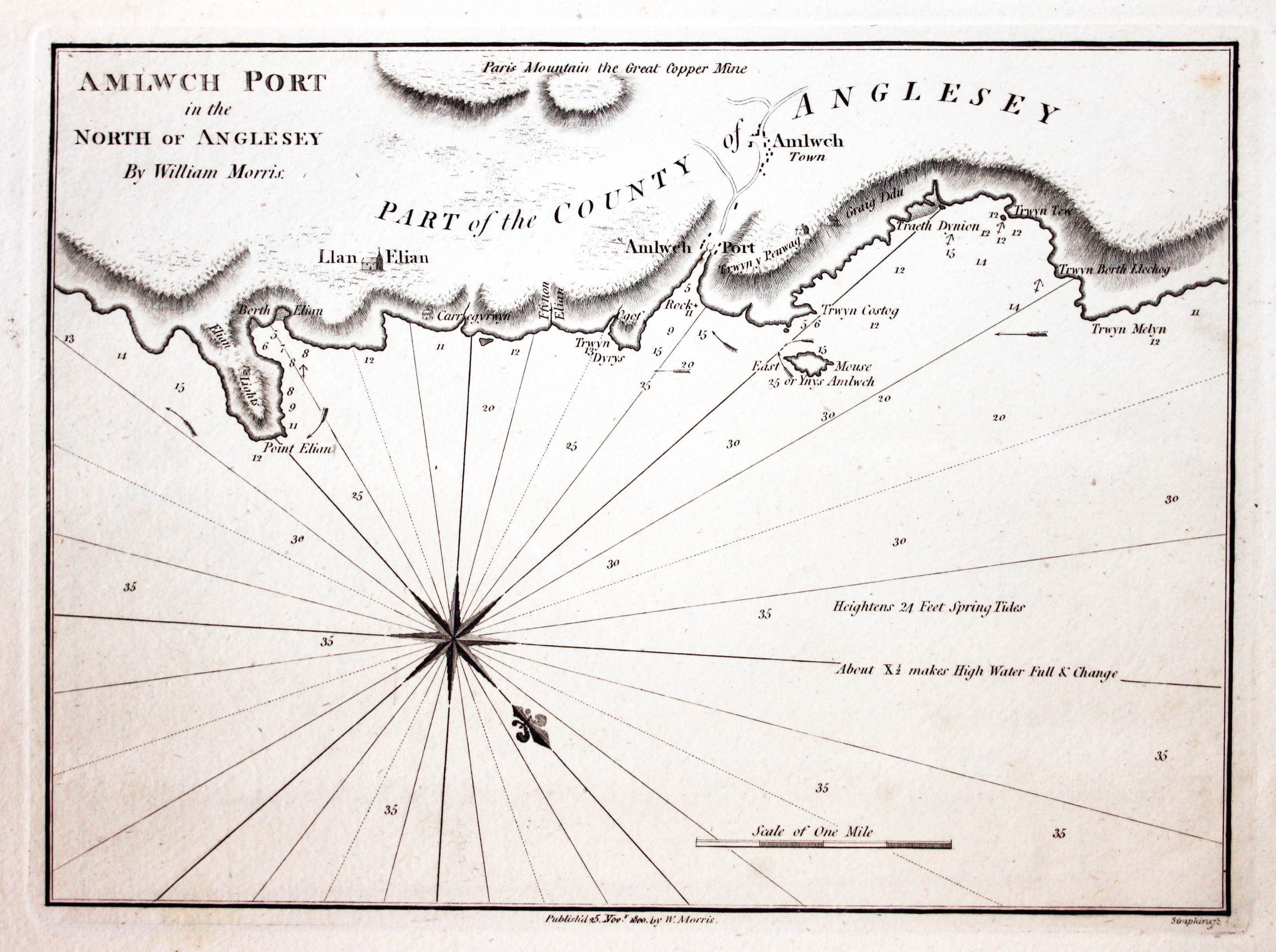
- Amlwch Port in the North of Anglesey By William Morris
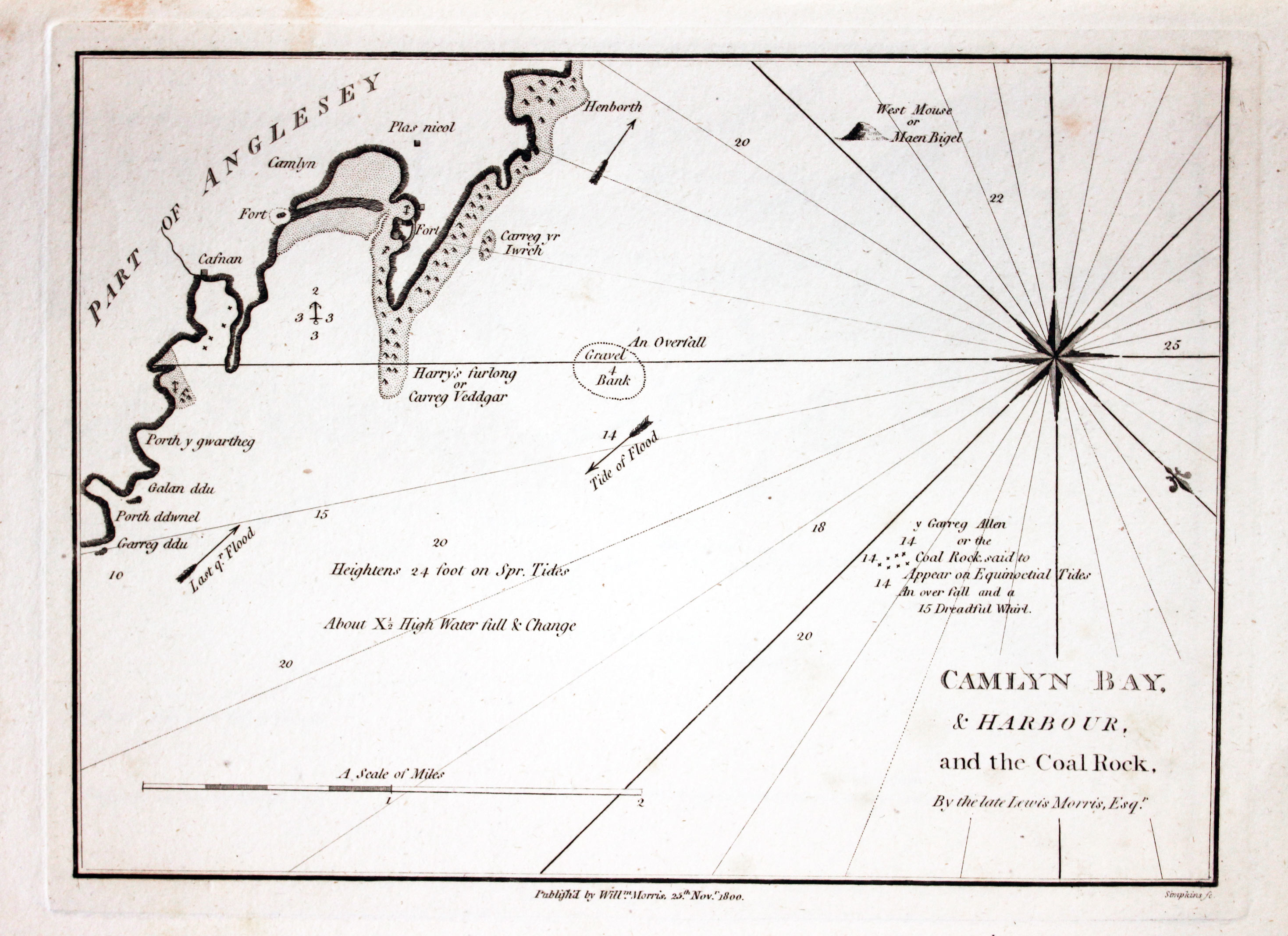
- Camlyn Bay and Harbour and the Coal Rock. By the Late Lewis Morris Esqr.
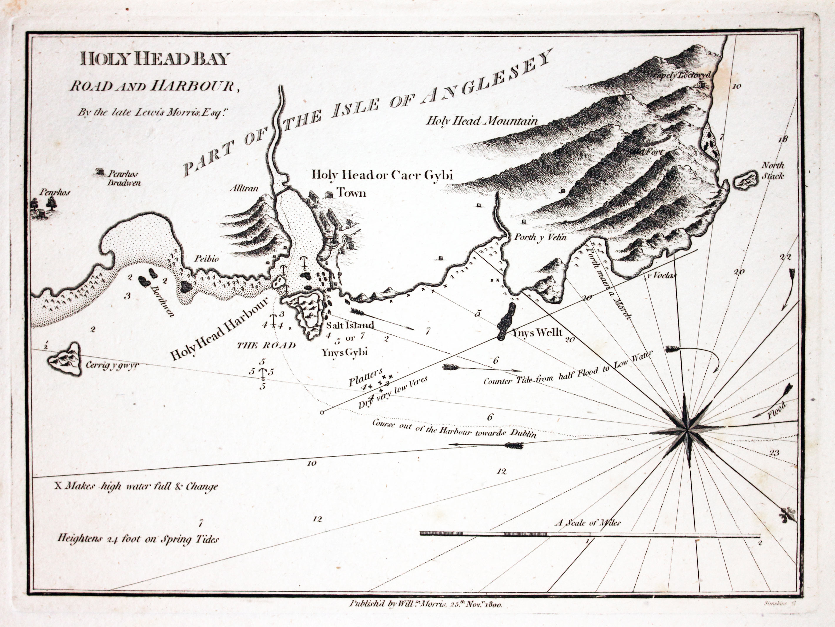
- Holy Head Bay Road and Harbour, By the Late Lewis Morris Esqr.
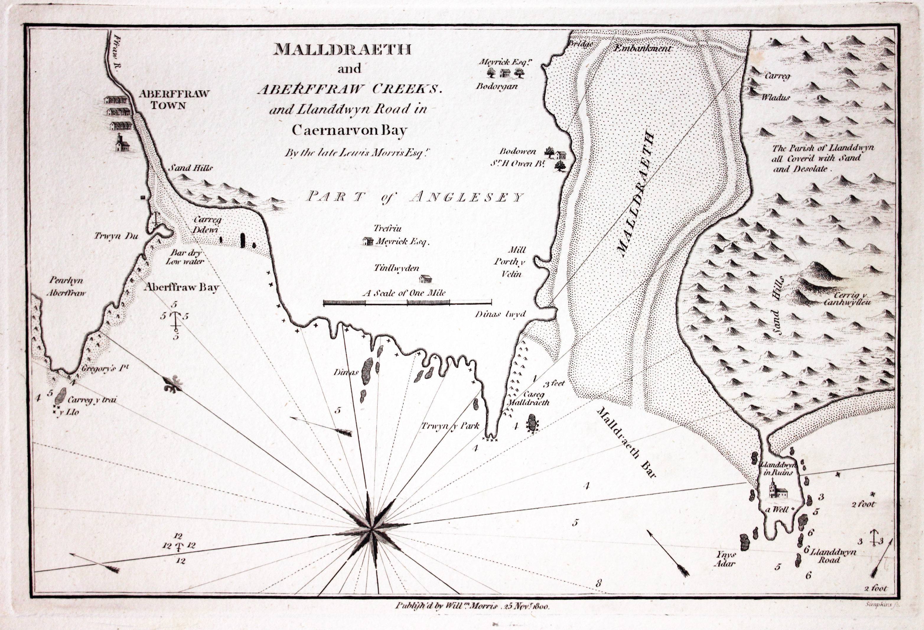
- Malldraeth and Aberffraw creeks and Llanddwyn road in Caernarvon Bay By the late Lewis Morris Esqr.
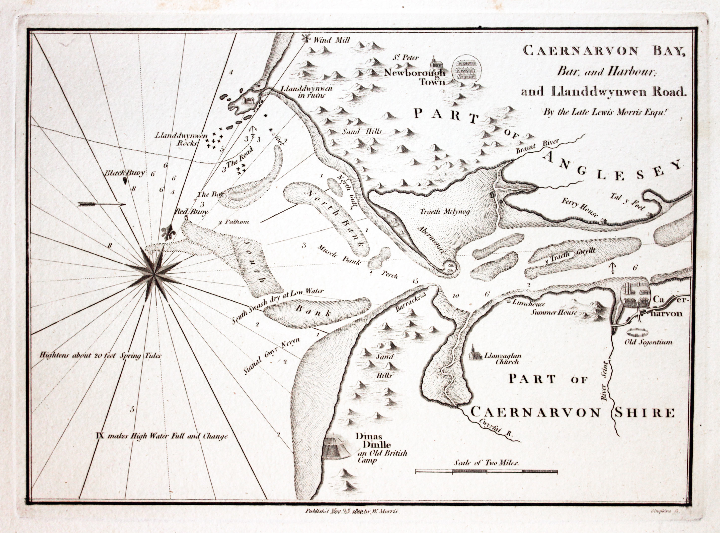
- Caernarvon Bay Bar and Harbour and Llanddwynwen Road. By the Late Lewis Morris Esqur.
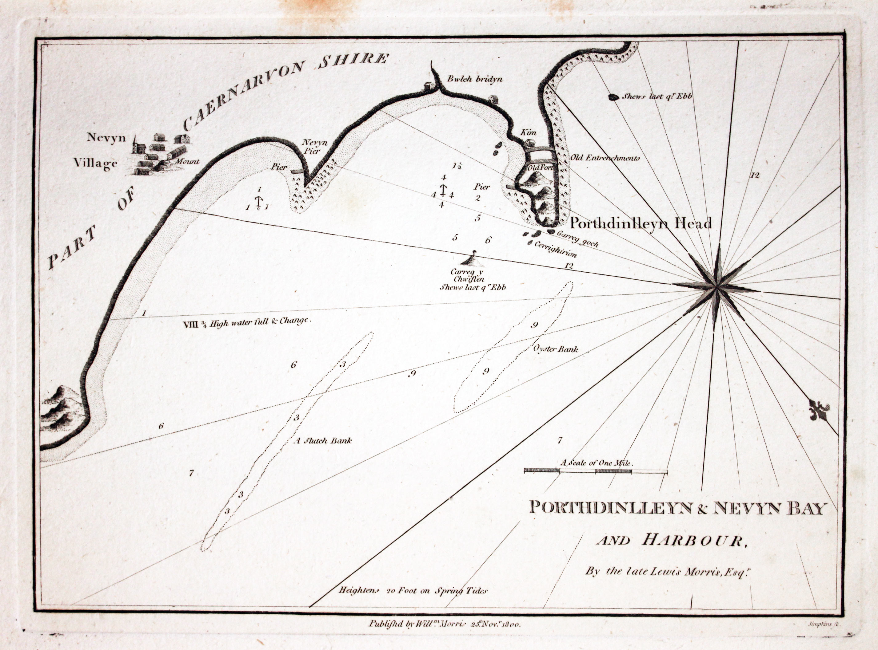
- Porthdinlleyn and Nevyn Bay and Harbour, By the Late Lewis Morris, Esqr.
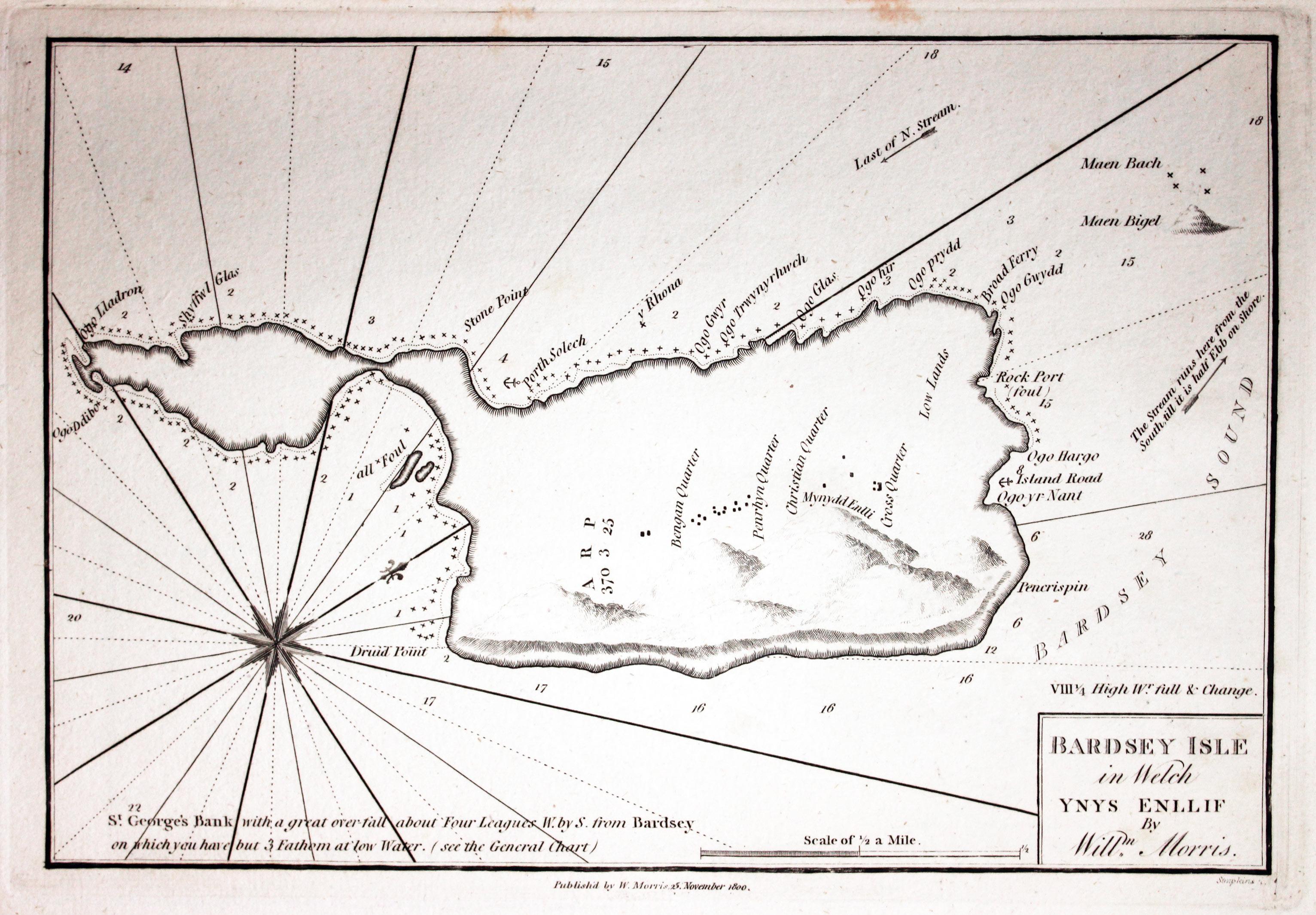
- Bardsey Isle, in Welch Ynys Enllif By Willm. Morris
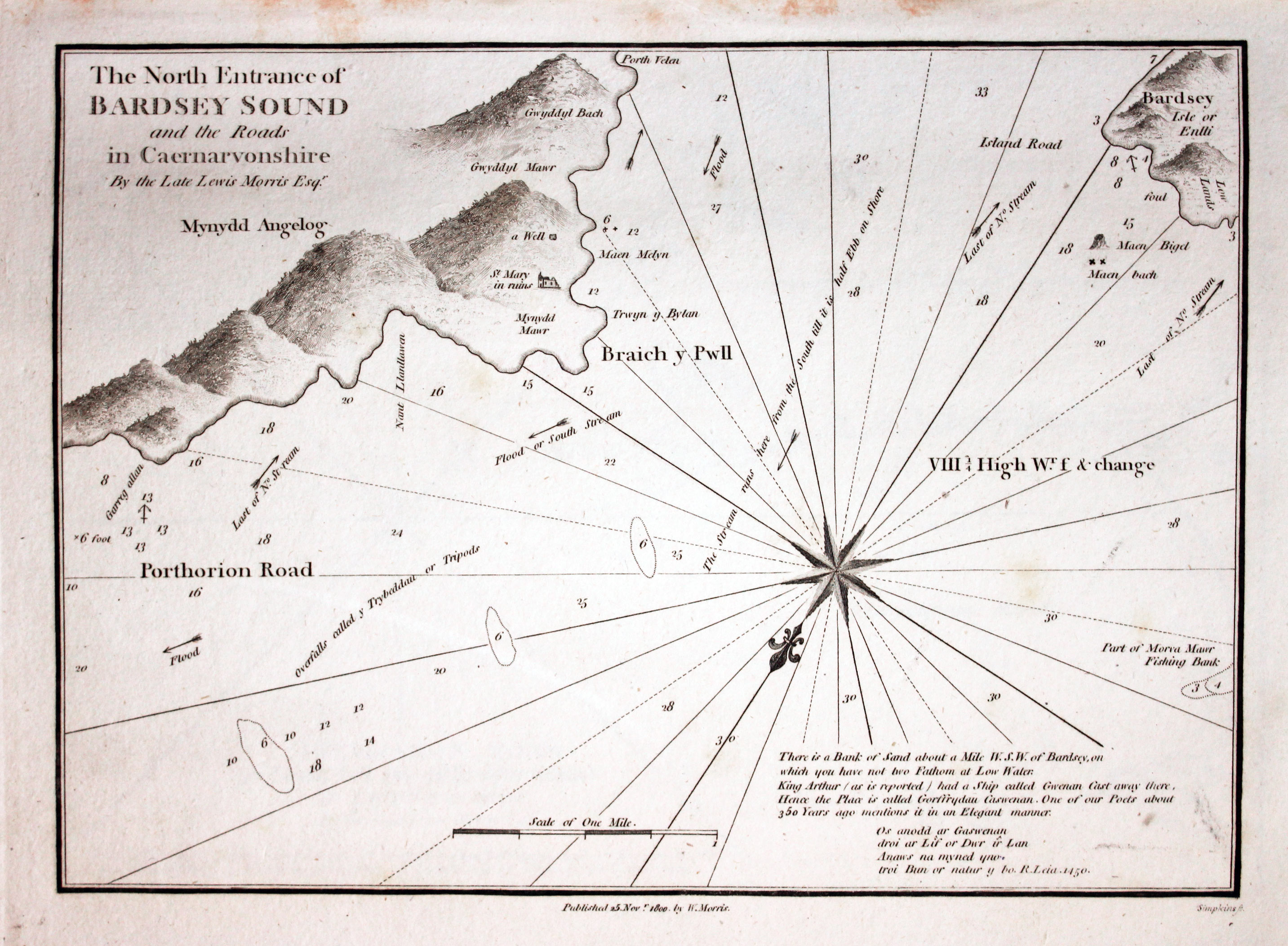
- The North Entrance of Bardsey Sound and the Roads in Caernarvonshire By the Late Lewis Morris Edqr
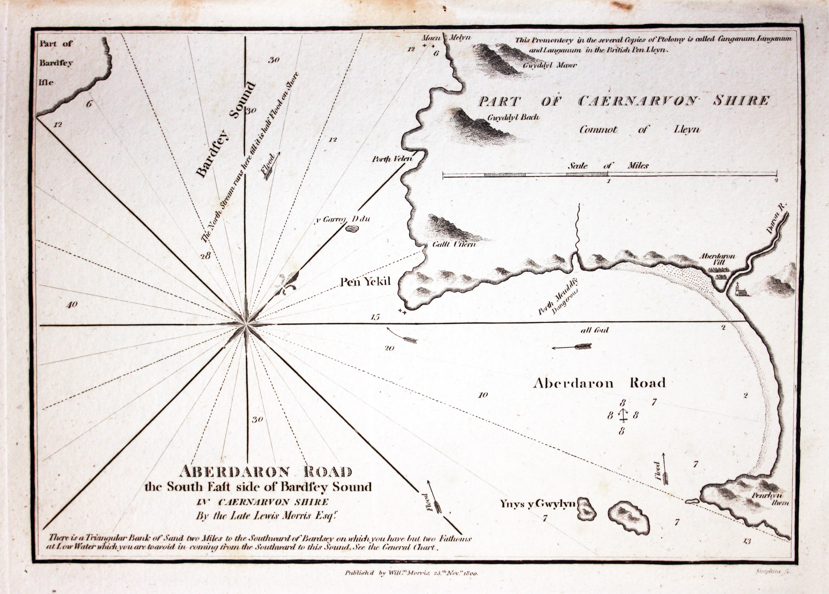
- Aberdaron Road the South East side of Bardsey Sound in Caernarvon Shire By the Late Lewis Morris Esqr.
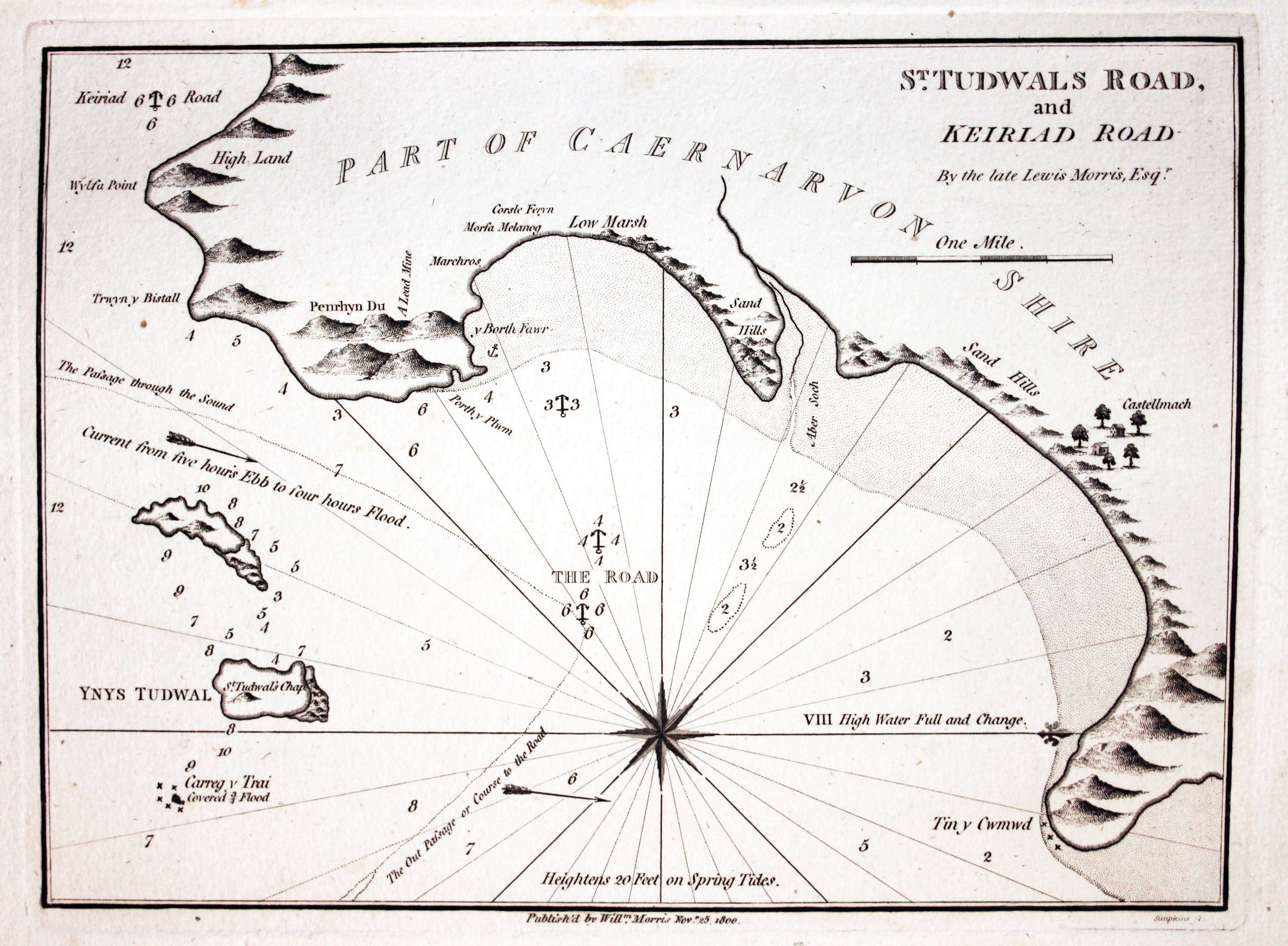
- St. Tudwals Road and Keiriad Road By the late Lewis Morris, Esqr.
- Pwllheli Bay, Bar and Harbour, By the late Lewis Morris Esqr.
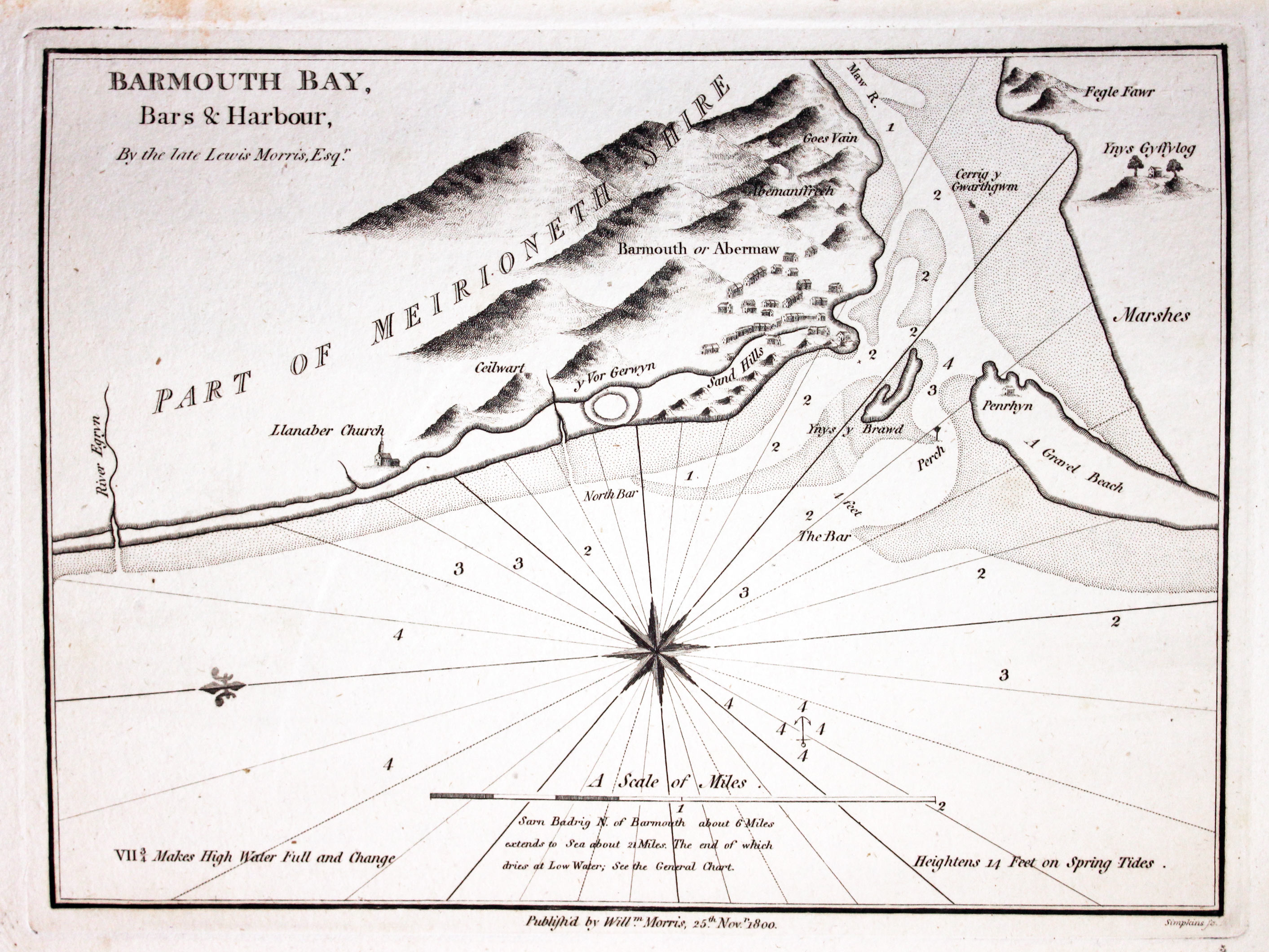
- Barmouth Bay, Bars & Harbour, By the late Lewis Morris, Esqr.
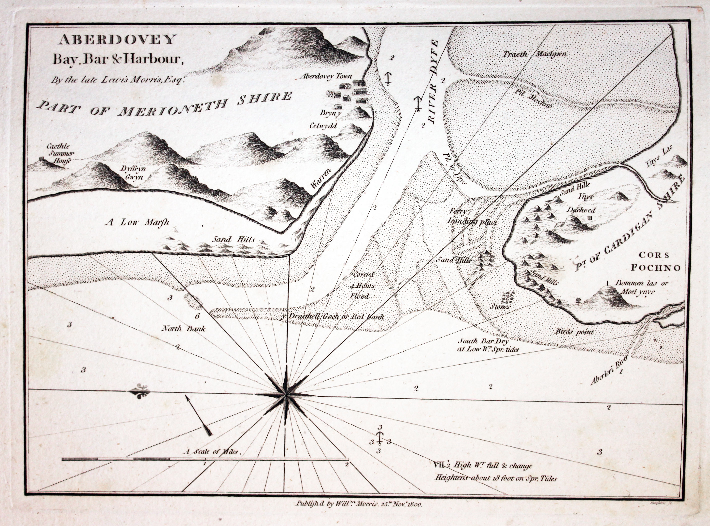
- Aberdovey Bay, Bar & Harbour, By the late Lewis Morris, Esqr.
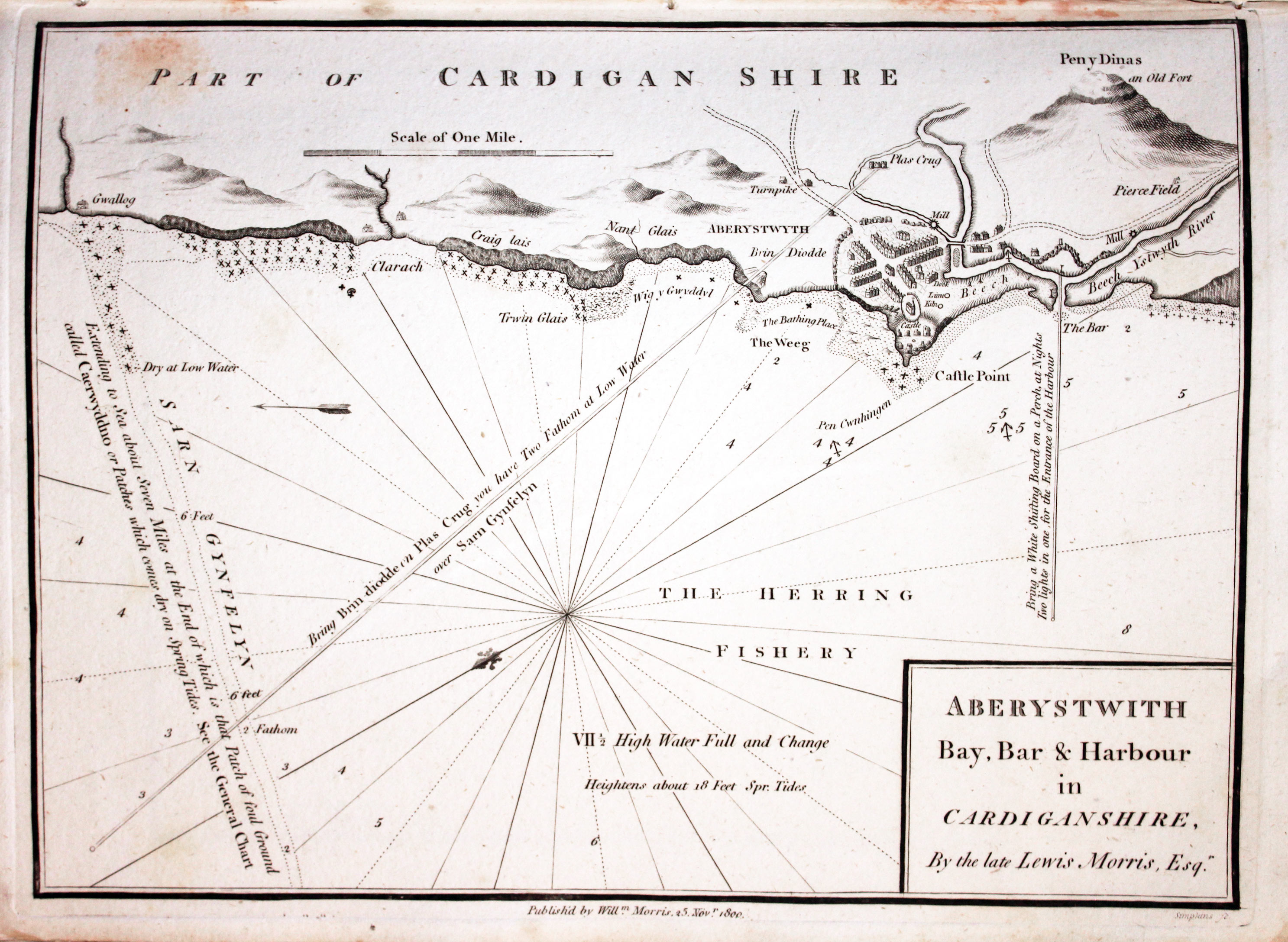
- Aberystwith Bay, Bar & Harbour in Cardiganshire, By the Late Lewis Morris, Esqr.
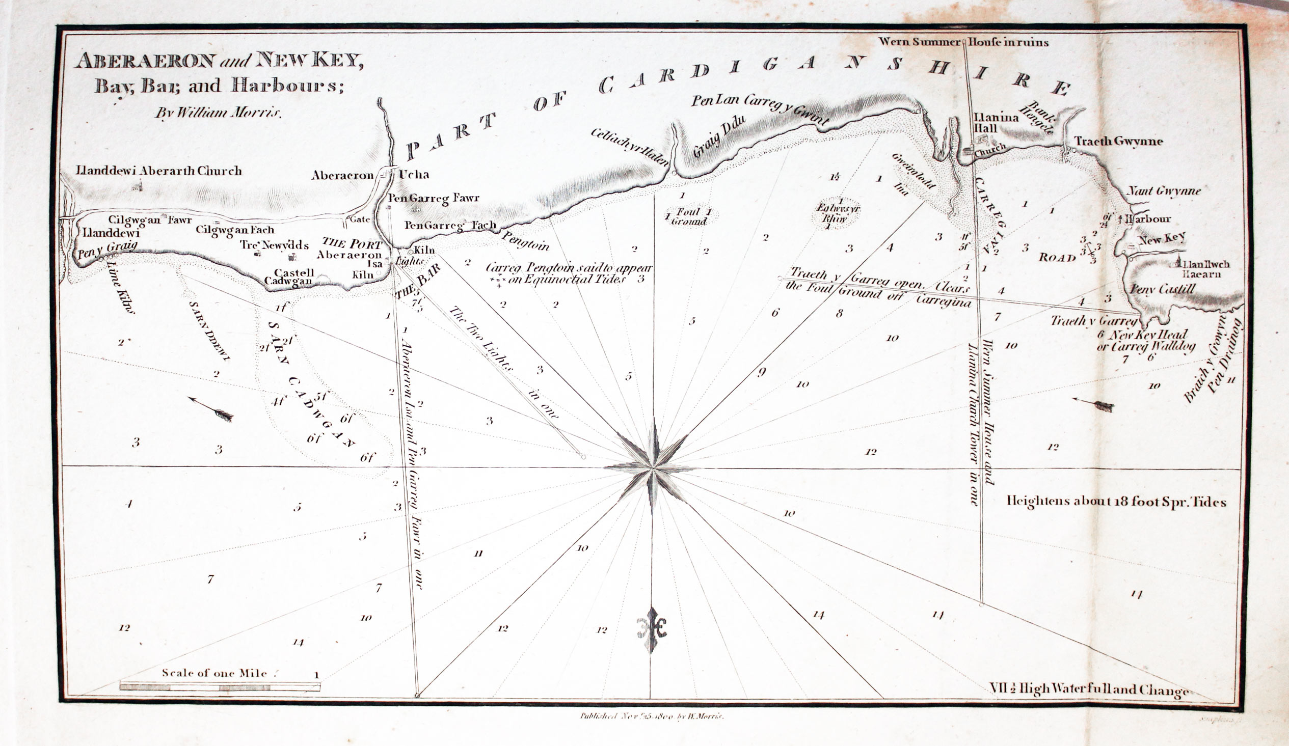
- Aberaeron and New Key, Bay, Bar, and Harbour; By William Morris
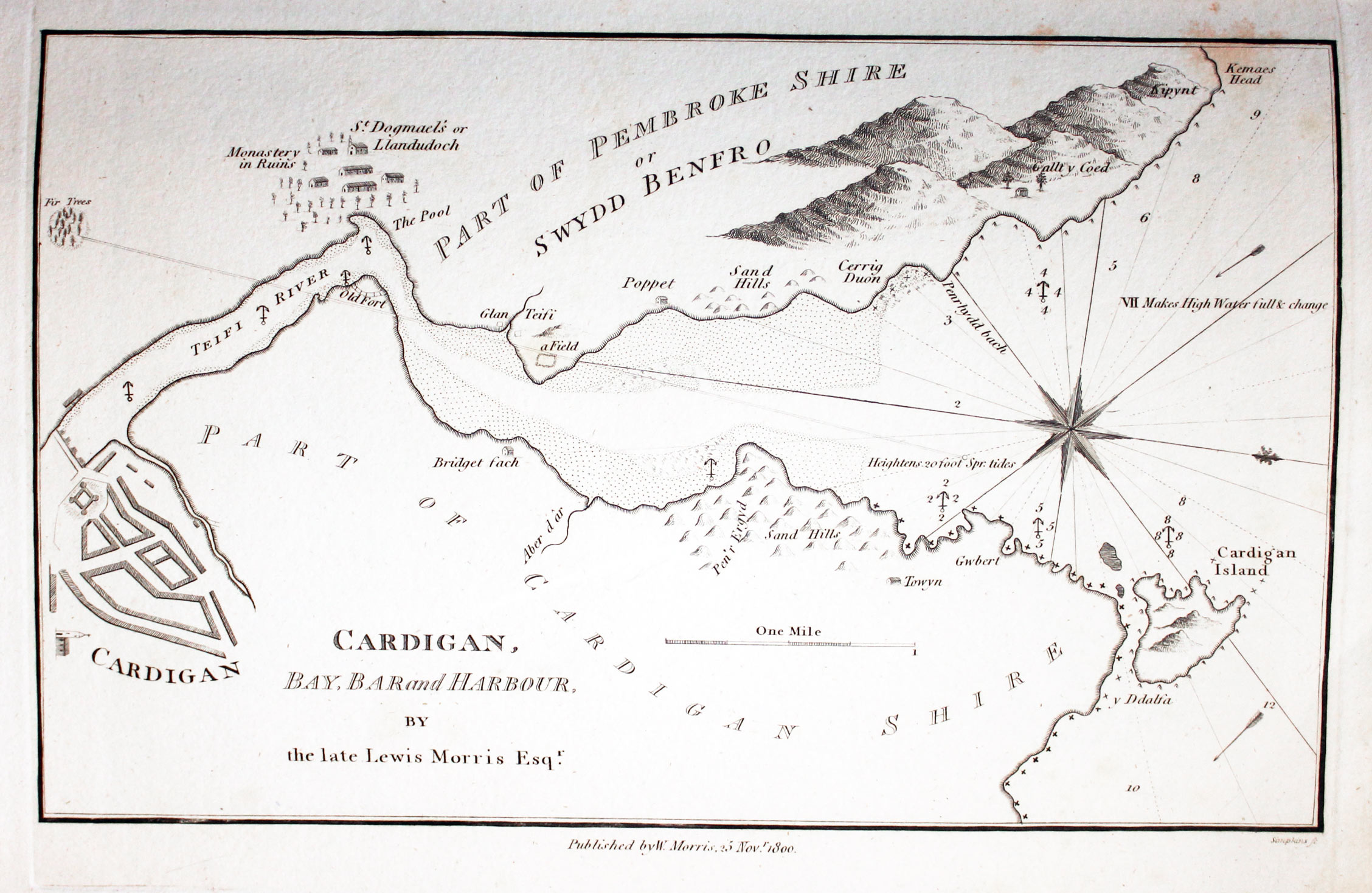
- Cardigan, Bay, Bar and Harbour, By the late Lewis Morris Esqr
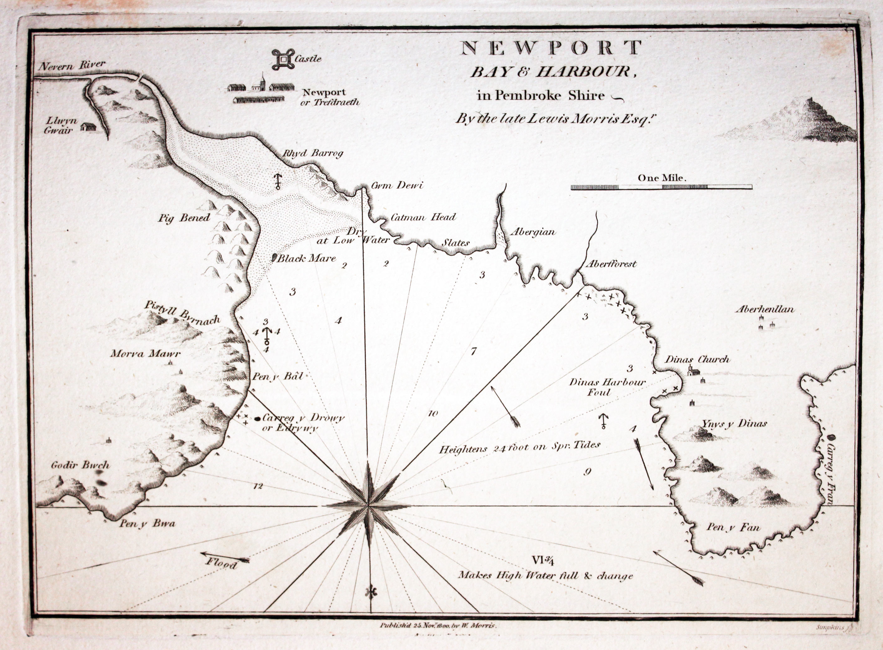
- Newport Bay & Harbour in Pembroke Shire By the late Lewis Morris Esqr.
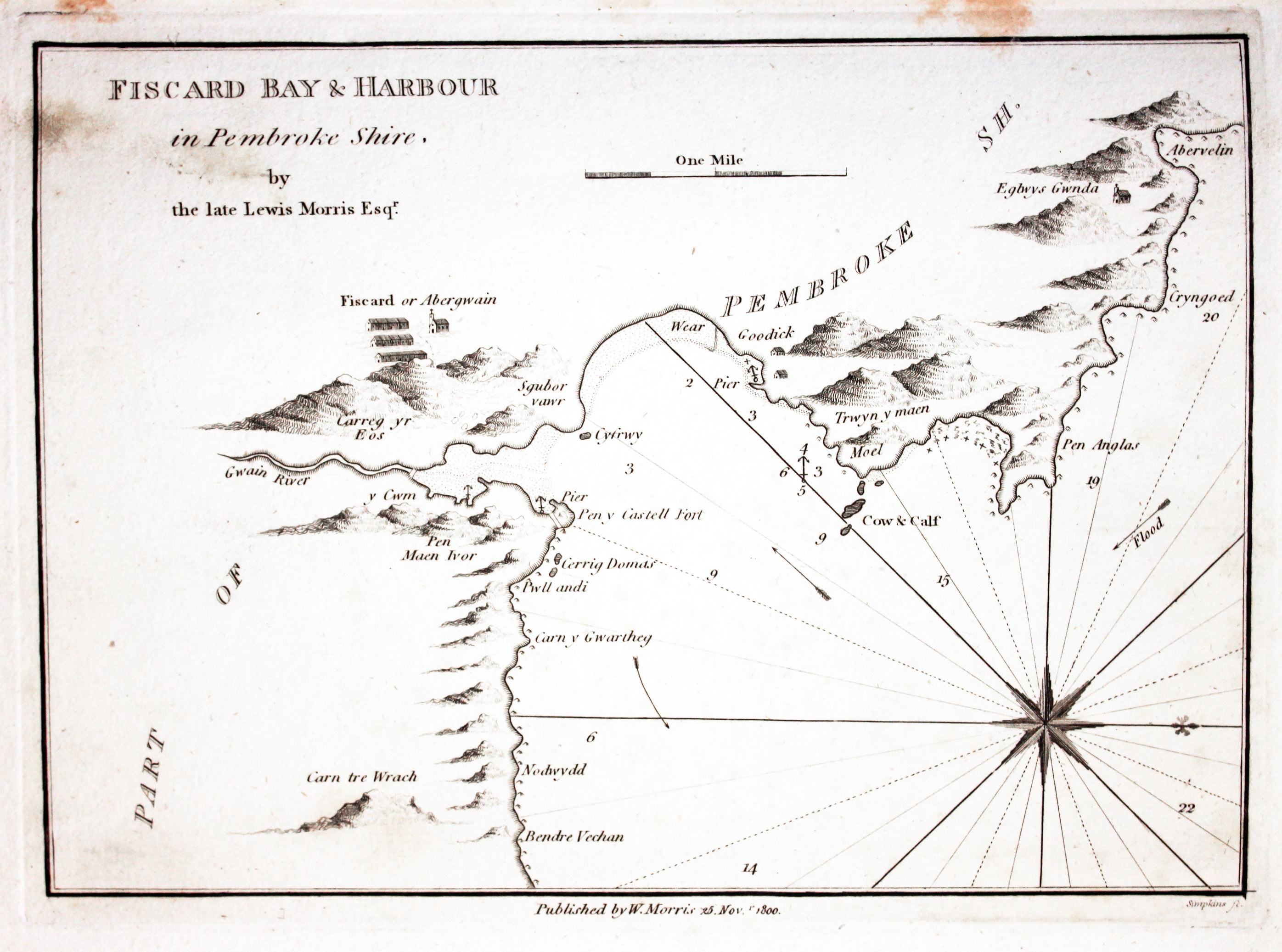
- Fiscard Bay & Harbour by the late Lewis Morris Esqr.
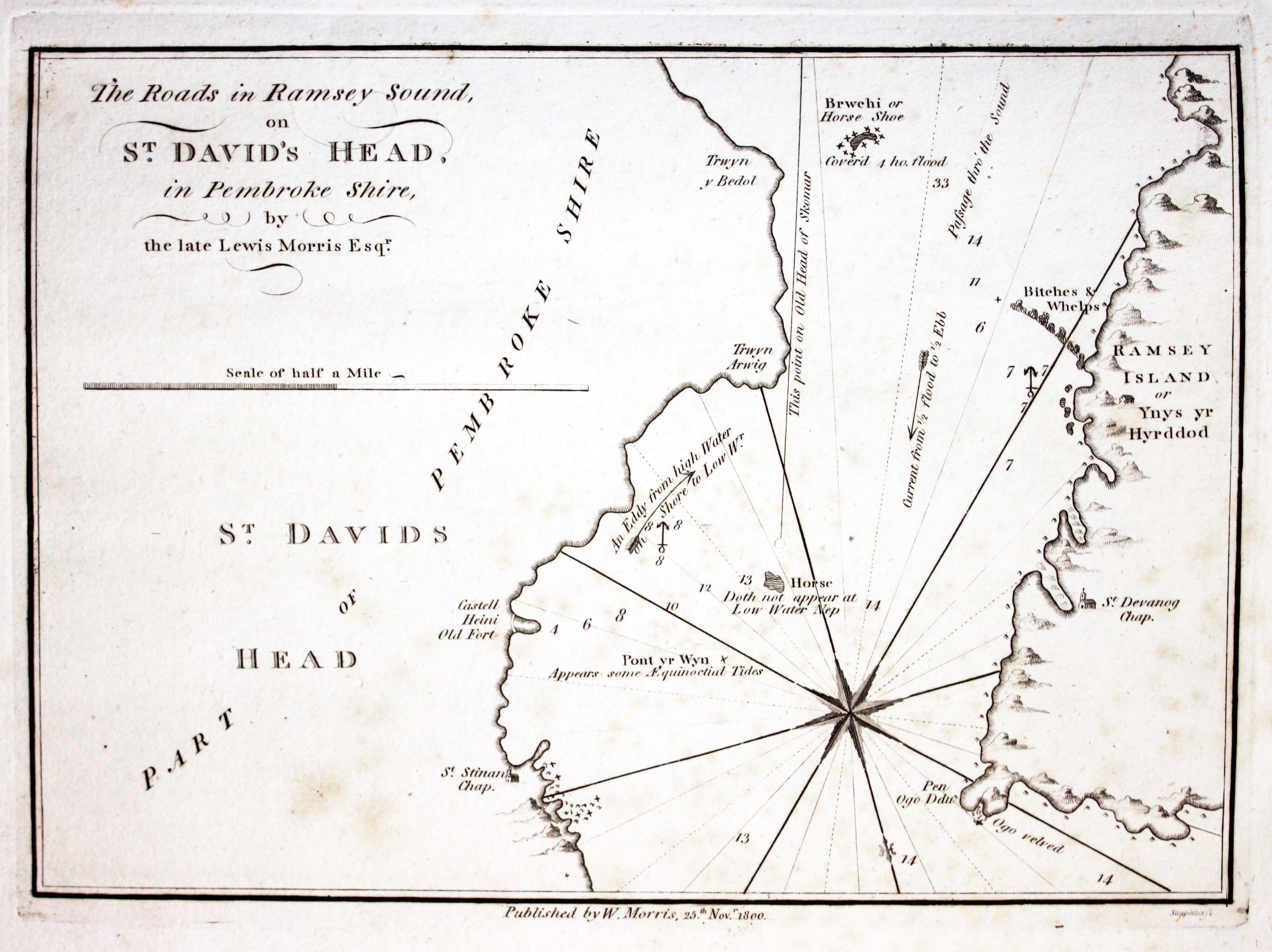
- The Roads in Ramsey Sound on St. David's Head, in Pembrokeshire, by the late Lewis Morris Esqr.
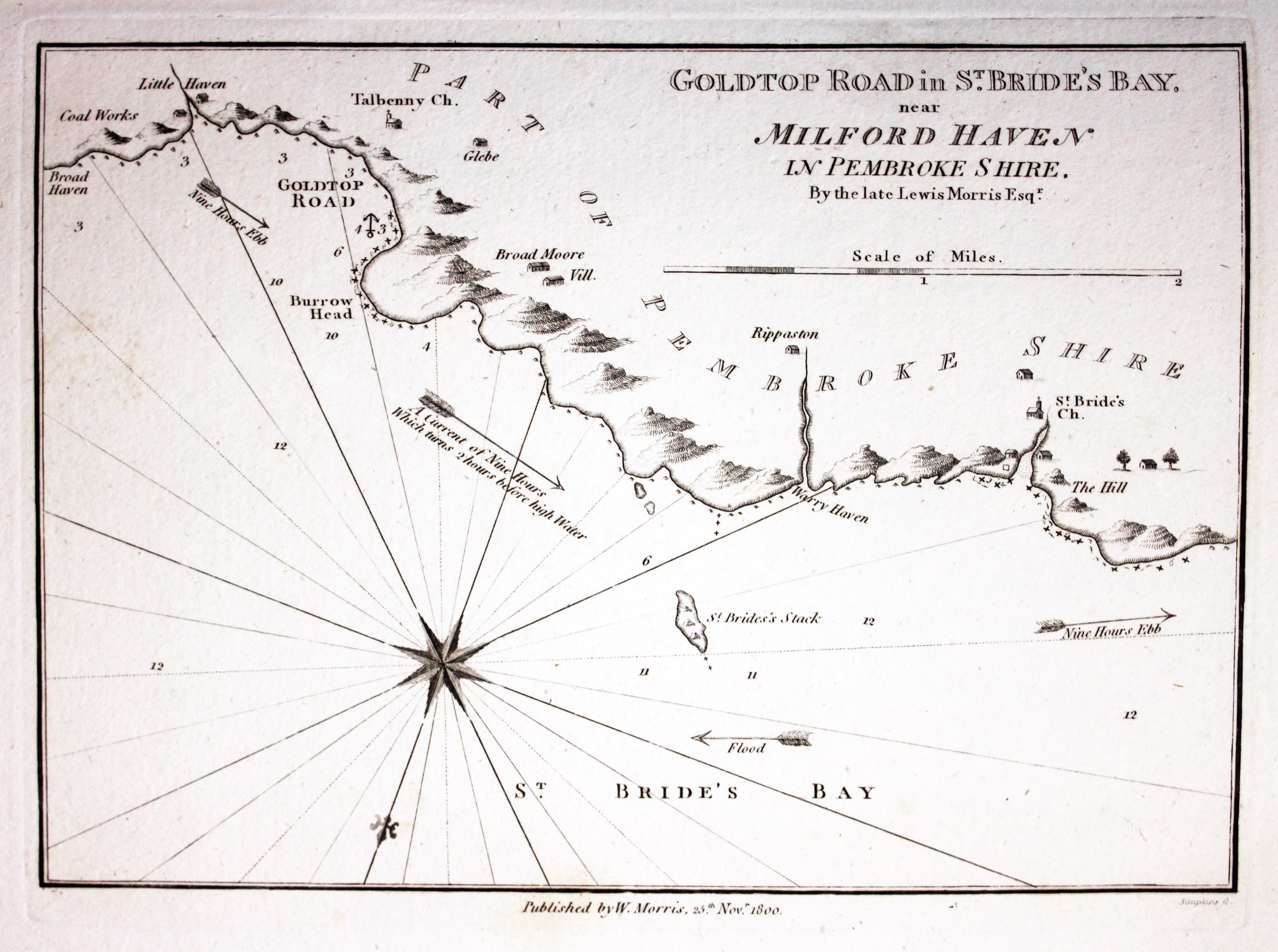
- Goldtop Road in St. Bride's Bay, near Milford Haven in Pembrokeshire, By the late Lewis Morris Esqr.
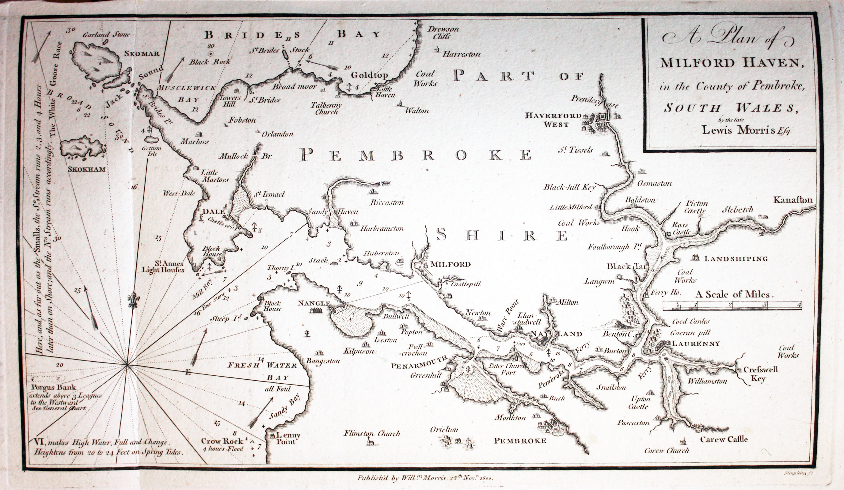
- A Plan of Milford Haven, in the County of Pembroke, South Wales, by the late Lewis Morris Esq
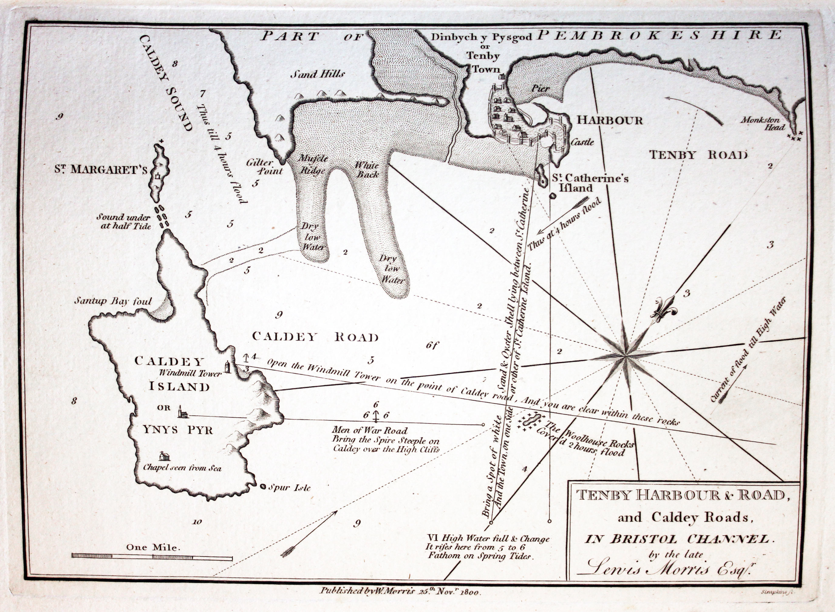
- Tenby Harbour & Road and Caldey Roads, in Bristol Channel.by the late Lewis Morris Esqr.
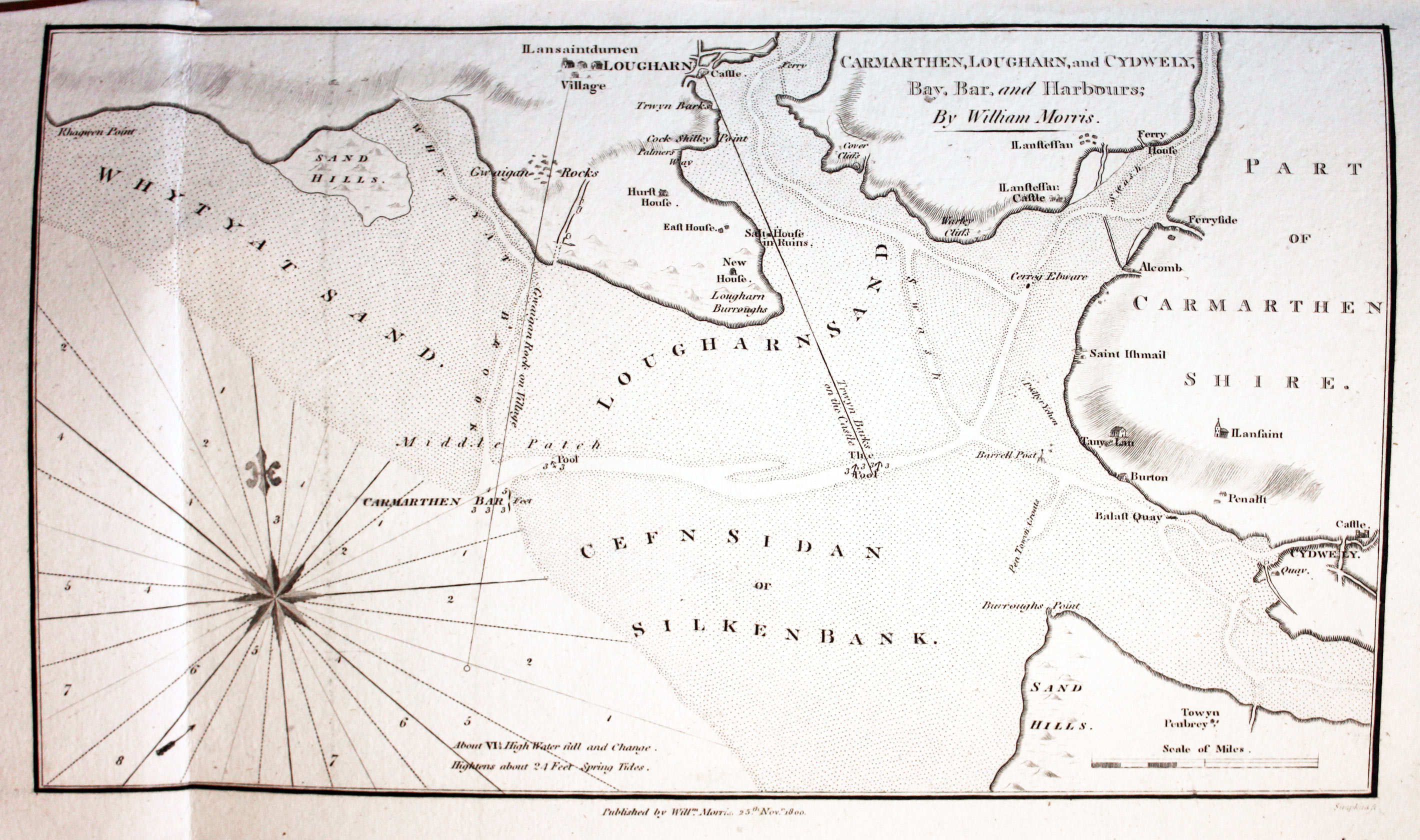
- Carmarthen, Lougharn, and Cydwely, Bay, Bar, and Harbours; By William Morris
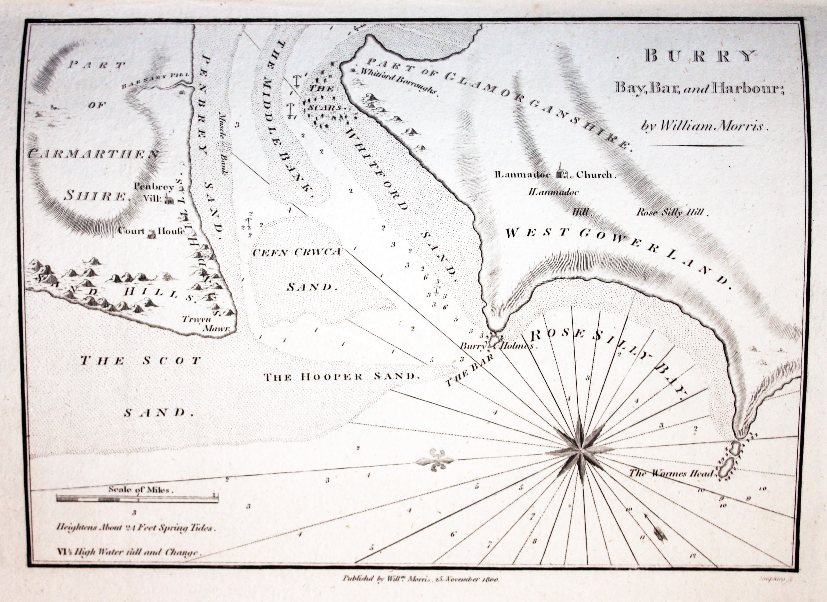
- Burry Bay, Bar and Harbour; by William Morris
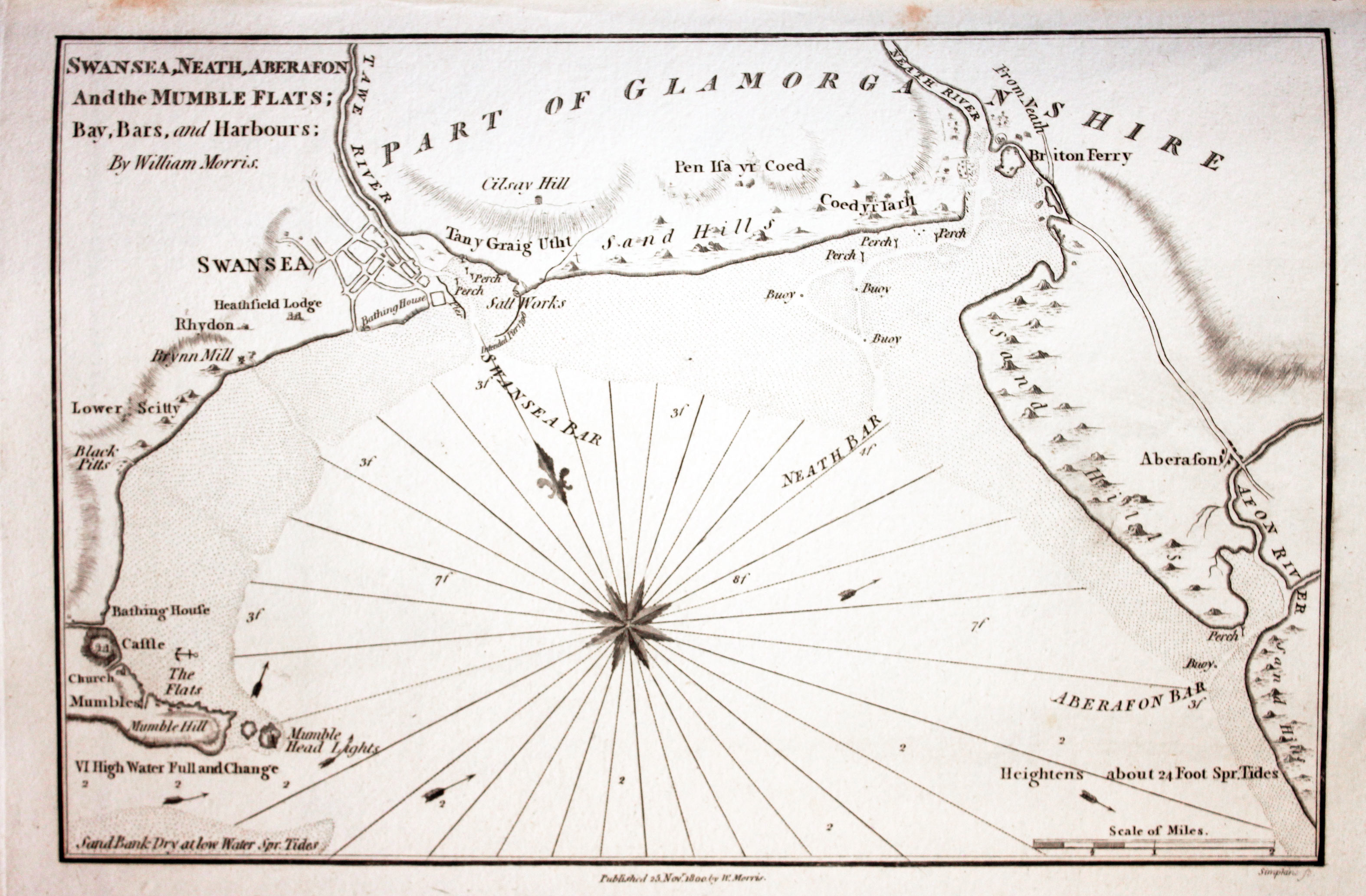
- Swansea, Neath, Aberafon And the Mumble Flats; Bay, Bars, and Harbours; by William Morris
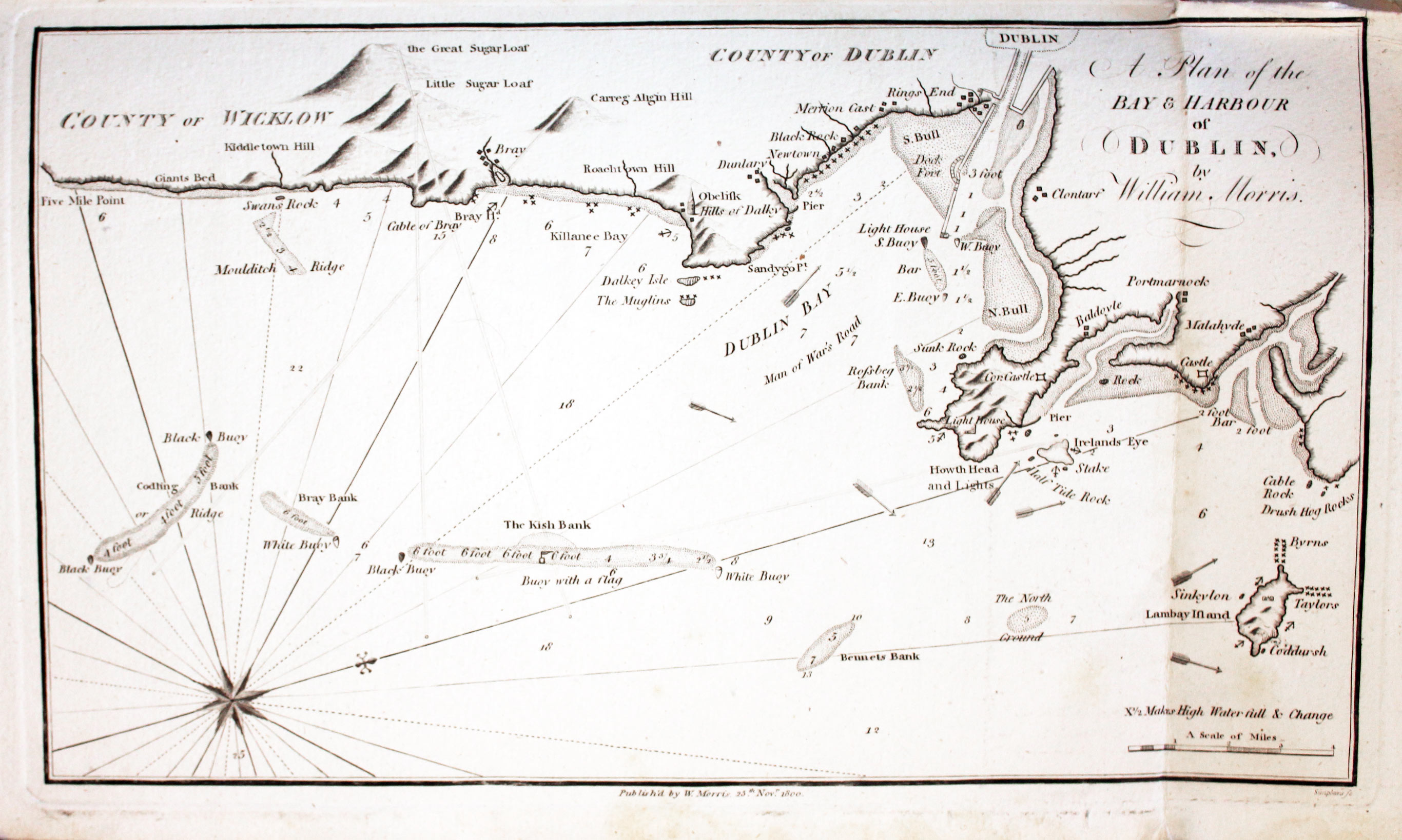
- A Plan of the Bay & Harbour of Dublin by William Morris

Tile Page and Dedication
-

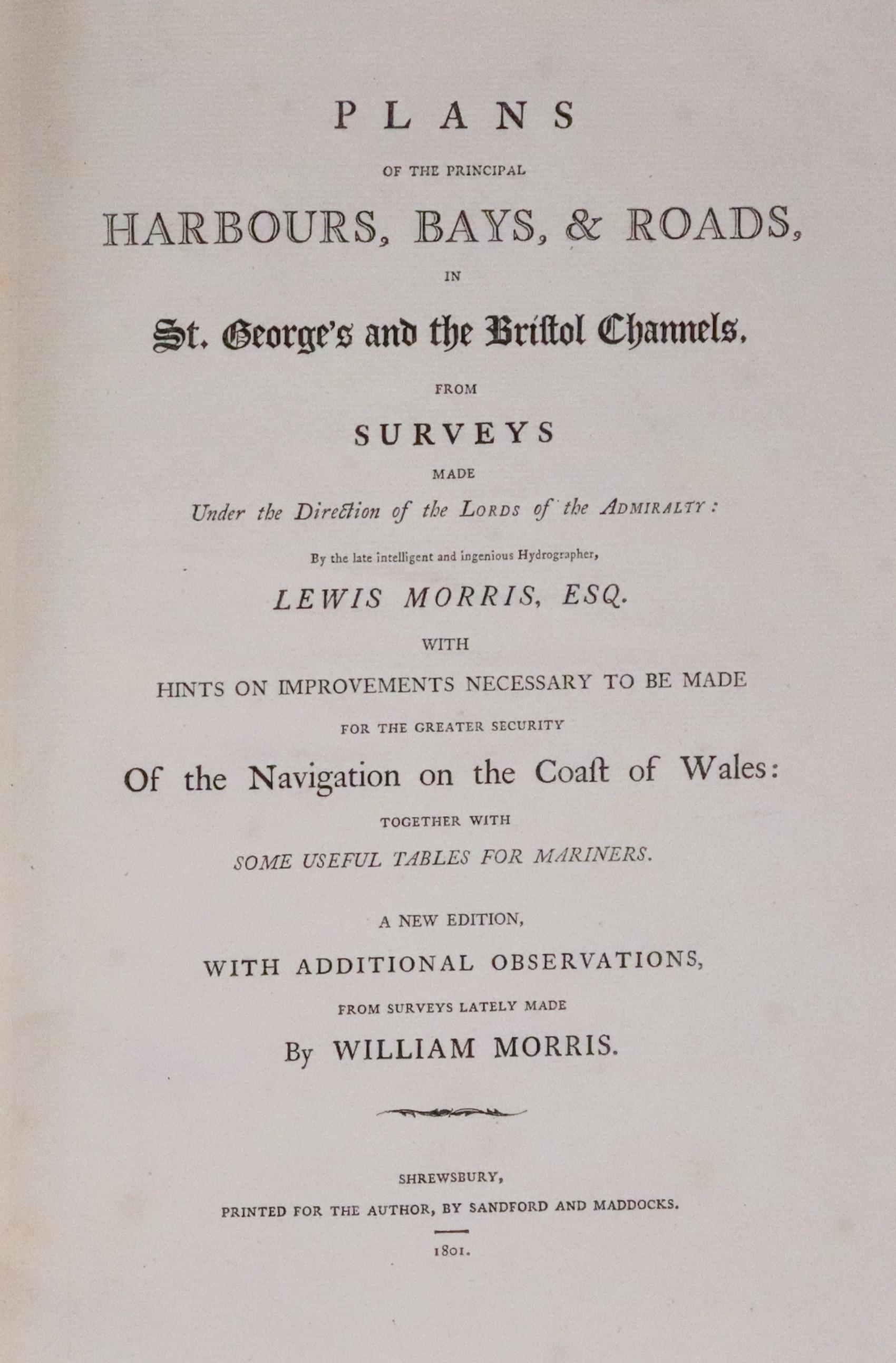
Ritle page to Plans opf the Principal, Bays, & Roads in St. Georg's amd the Bristol Channels
-

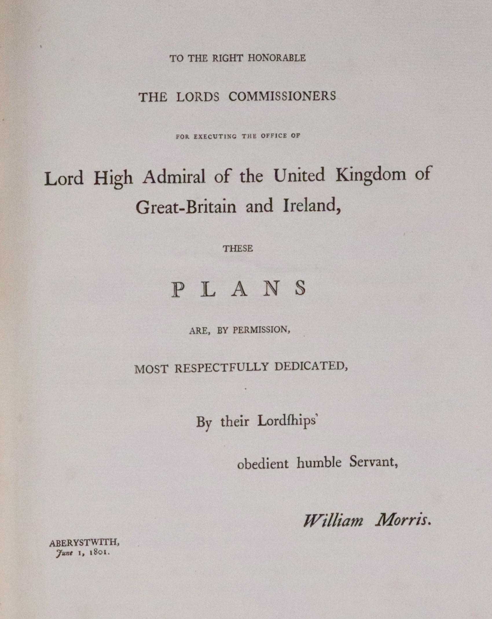
Dedication Page to the Lord High Admiral 1800
The Charts
-

A Plan of the Bay and Harbours of Liverpool and Chester published by William Morris 1801
-

A Plan of the Bay and Harbour of Conway published by William Morris 1801
-

Entrance to Beaumaris River published by William Morris 1801
-

Red Wharf Bay published by William Morris 1801
-

-

Dulas Bay and Harbour published by William Morris 1801
-

Amlwch Por, Angelsey published by William Morris 1801
-

Chart of Holyhead Bay published by William Morris 1801
-

Chart of Malltraeth, Anglesey published by William Morris 1801
-

Char of Caernarvon Bay published by William Morris 1801
-

Chart of Camlyn Bay, Anglesey published by William Morris 1801
-

Chart of Bardsey Island, North Wales published by William Morris 1801
-

Chart of the Eantrance to Bardsey Sound, North Wales published by William Morris 1801
-

Chart of Aberdaron, Caernarvonshire published by William Morris 1801
-

Chart of St. Tudwals, Caernarvonshire published by William Morris 1801
-

Chart of Pwllheli, Caernarvonshire published by William Morris 1801
-

Chart of Barmouth, Merionethshire published by William Morris 1801
-

Chart of Aberdyfi, Merionethshire published by William Morris 1801
-

Chart of Aberystwyth, Cardiganshire published by William Morris 1801
-

Chart of Aberaeron published by William Morris 1801
-

Chart of Cardigan published by William Morris 1801
-
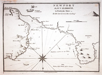
Chart of Newport Bay, Pembrokeshire published by William Morris 1801
-

Chart of Fishguard Bay, Pembrokeshire published by William Morris 1801
-

Chart of St. David's Head, Pembrokeshire published by William Morris 1801
-

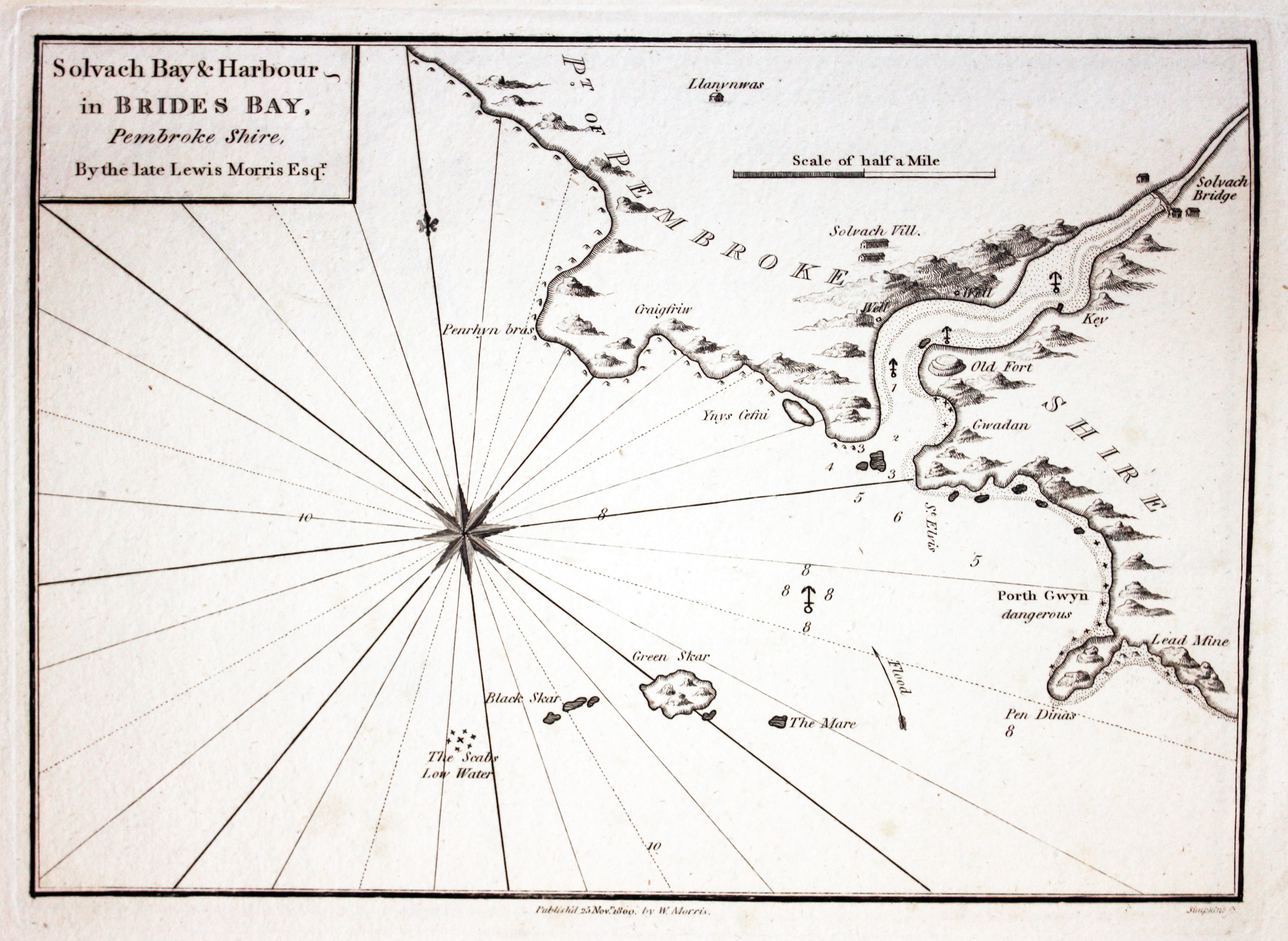
Chart of Bride's Bay Pembrokeshire published by William Morris 1801
-

Chart of Goldtop Road in St. Bride's, Pembrokeshire published by William Morris 1801
-
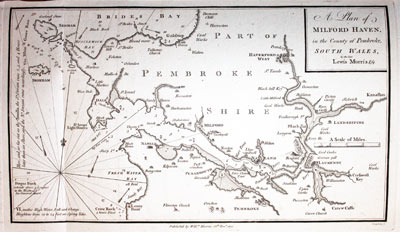
Chart of St. Milford Haven, Pembrokeshire published by William Morris 1801
-

Chart of Tenby Harbour, Pembrokeshire published by William Morris 1801
-

Chart of Carmarthen published by William Morris 1801
-

Chart of Barry published by William Morris 1801
-

Chart of Swansea and Neath published by William Morris 1801
-

Chart of Bay and Harbour of Dublin published by William Morris 1801
Subscribers
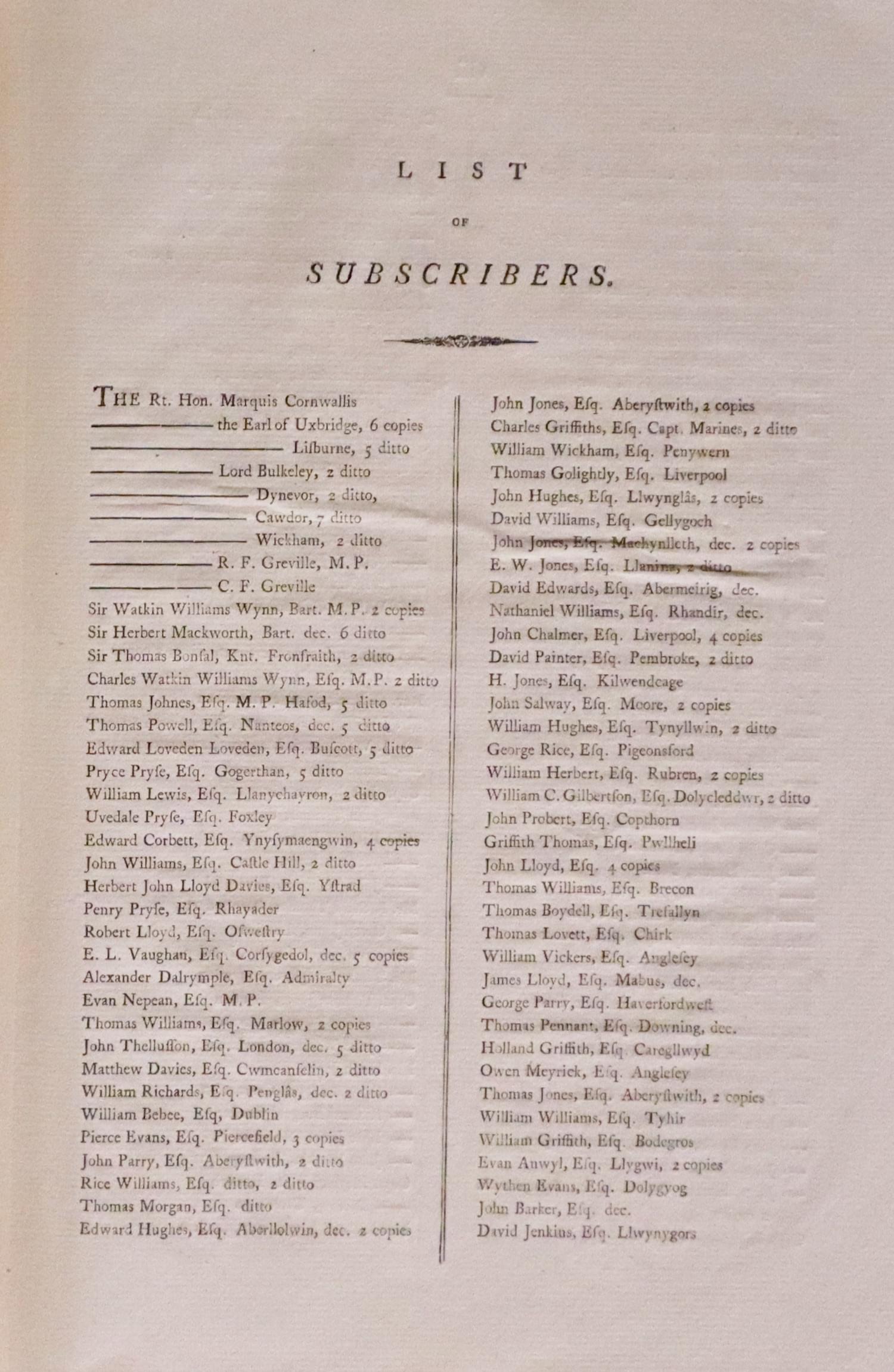
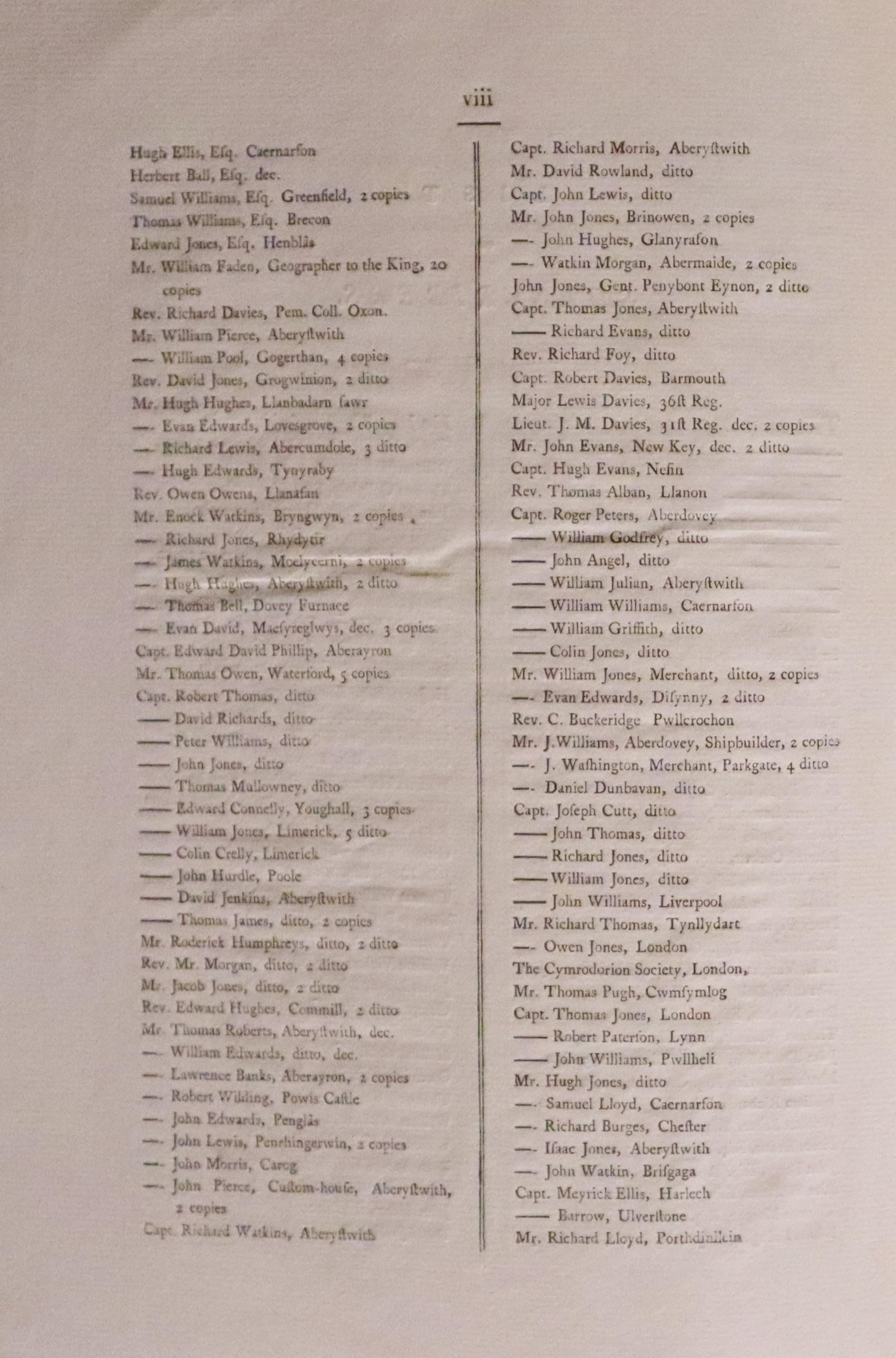
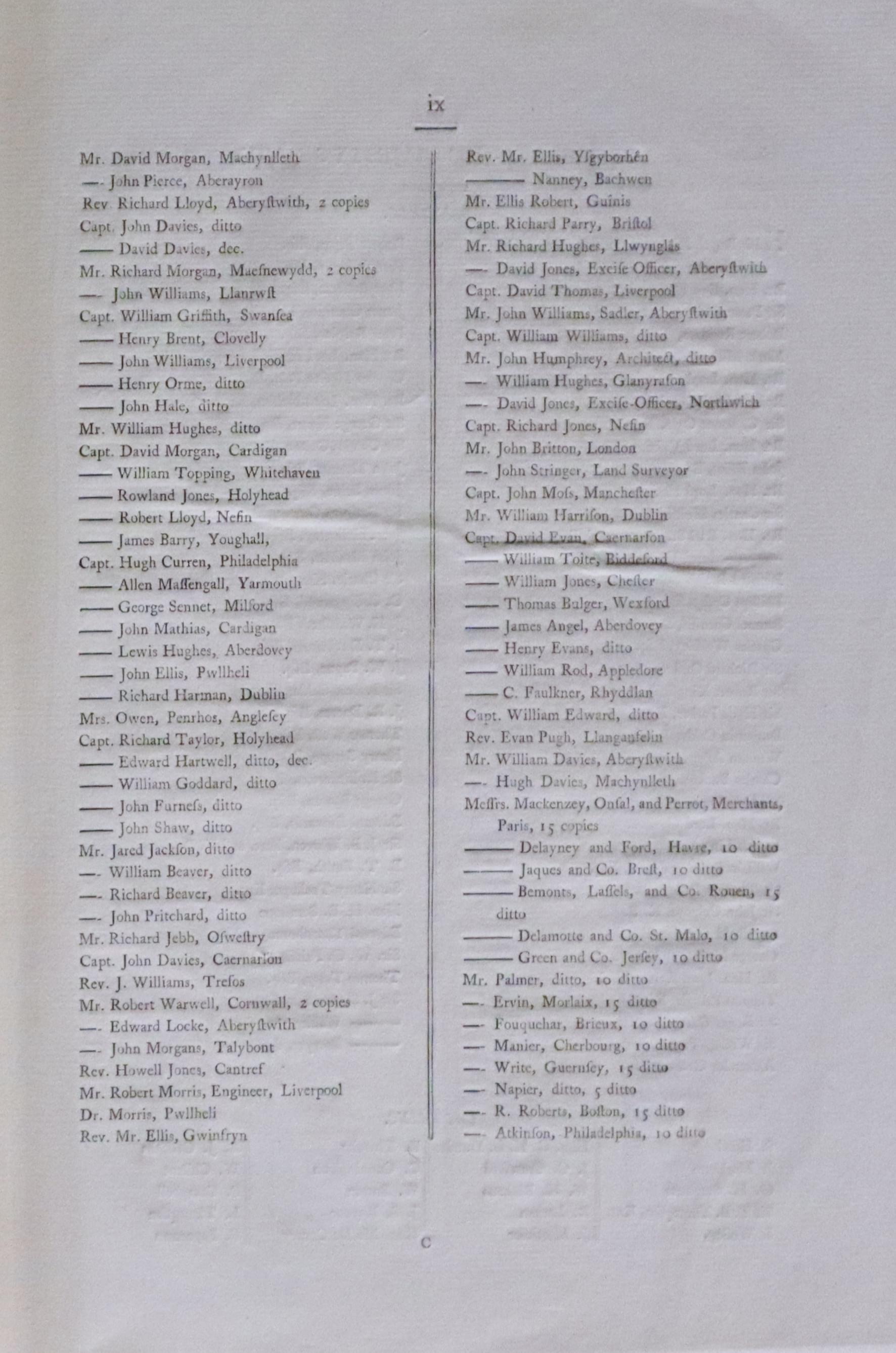
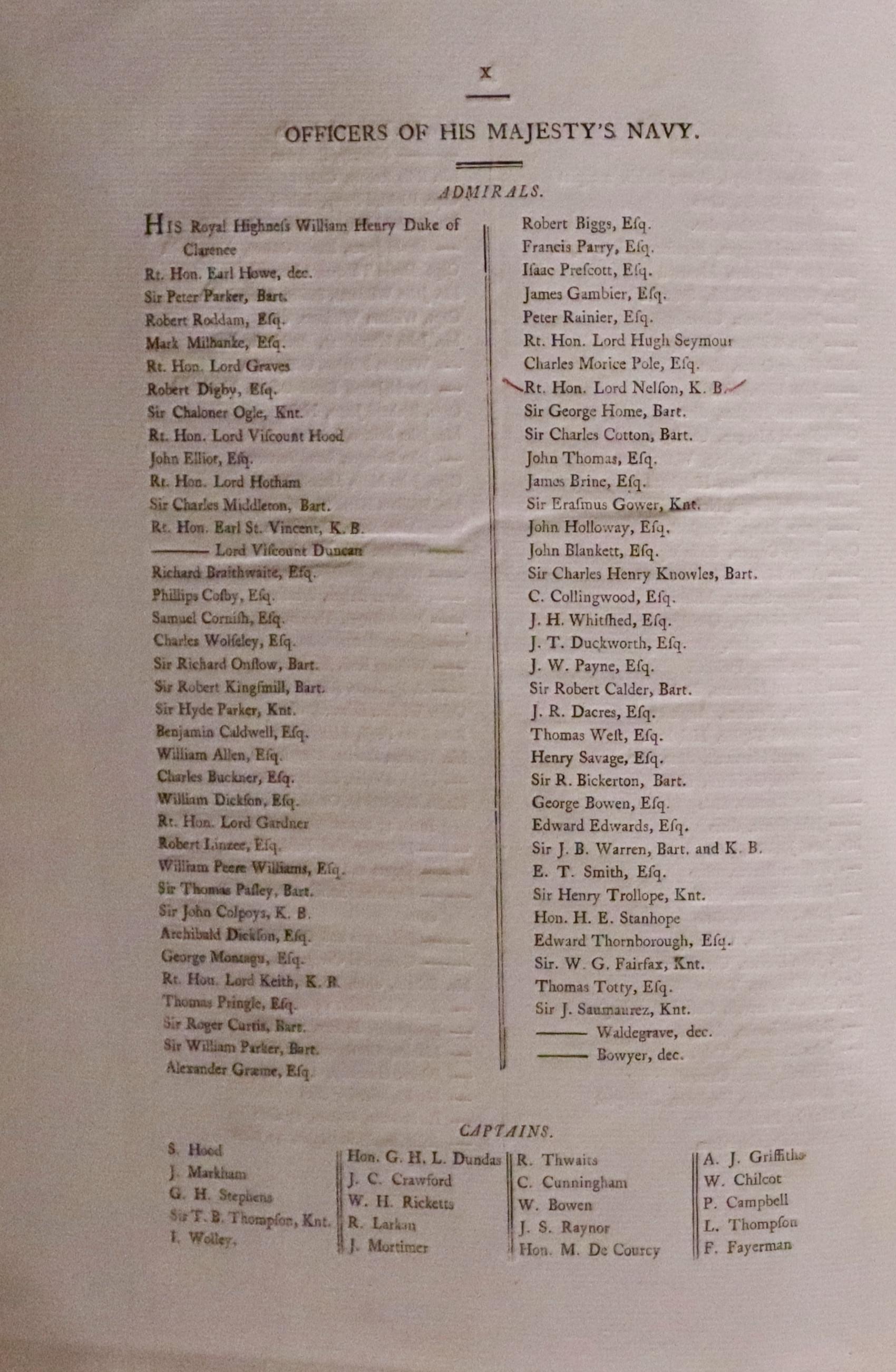
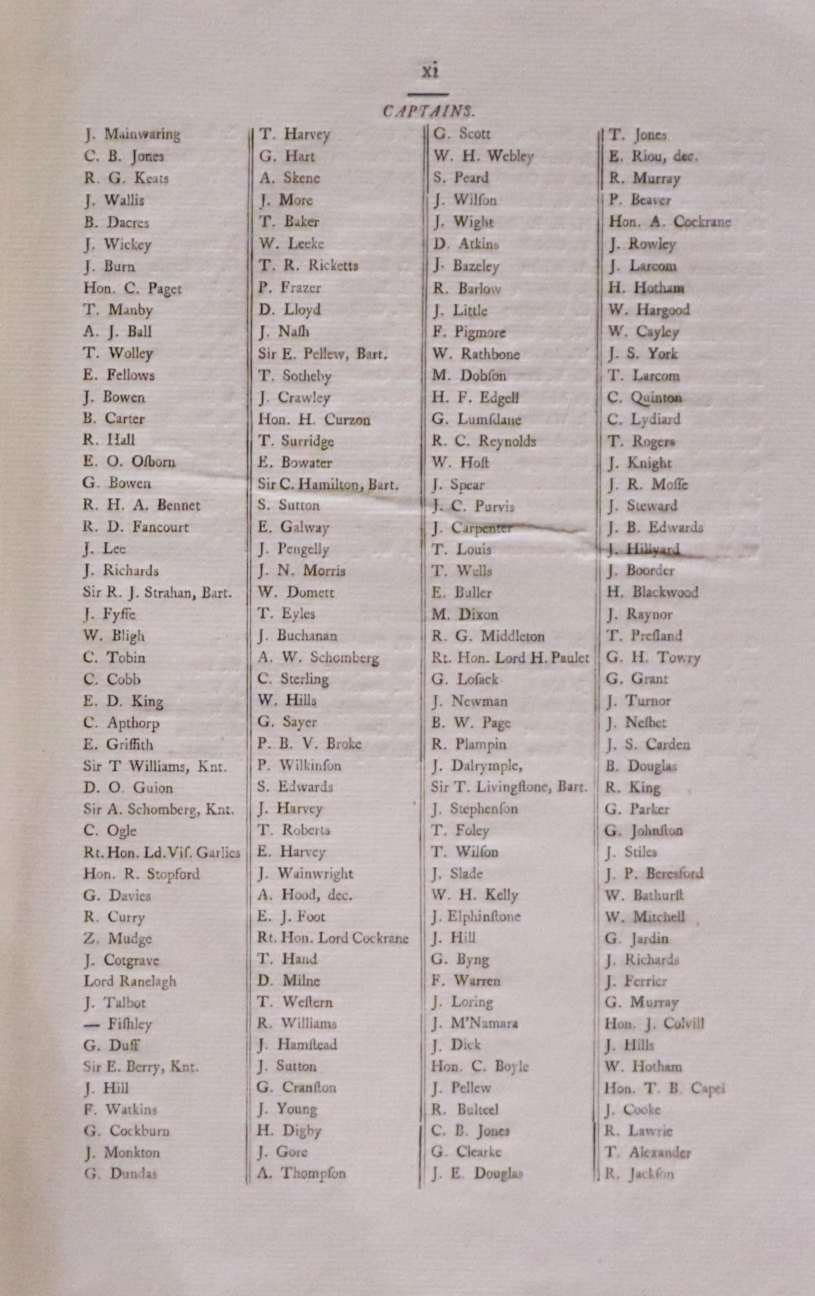
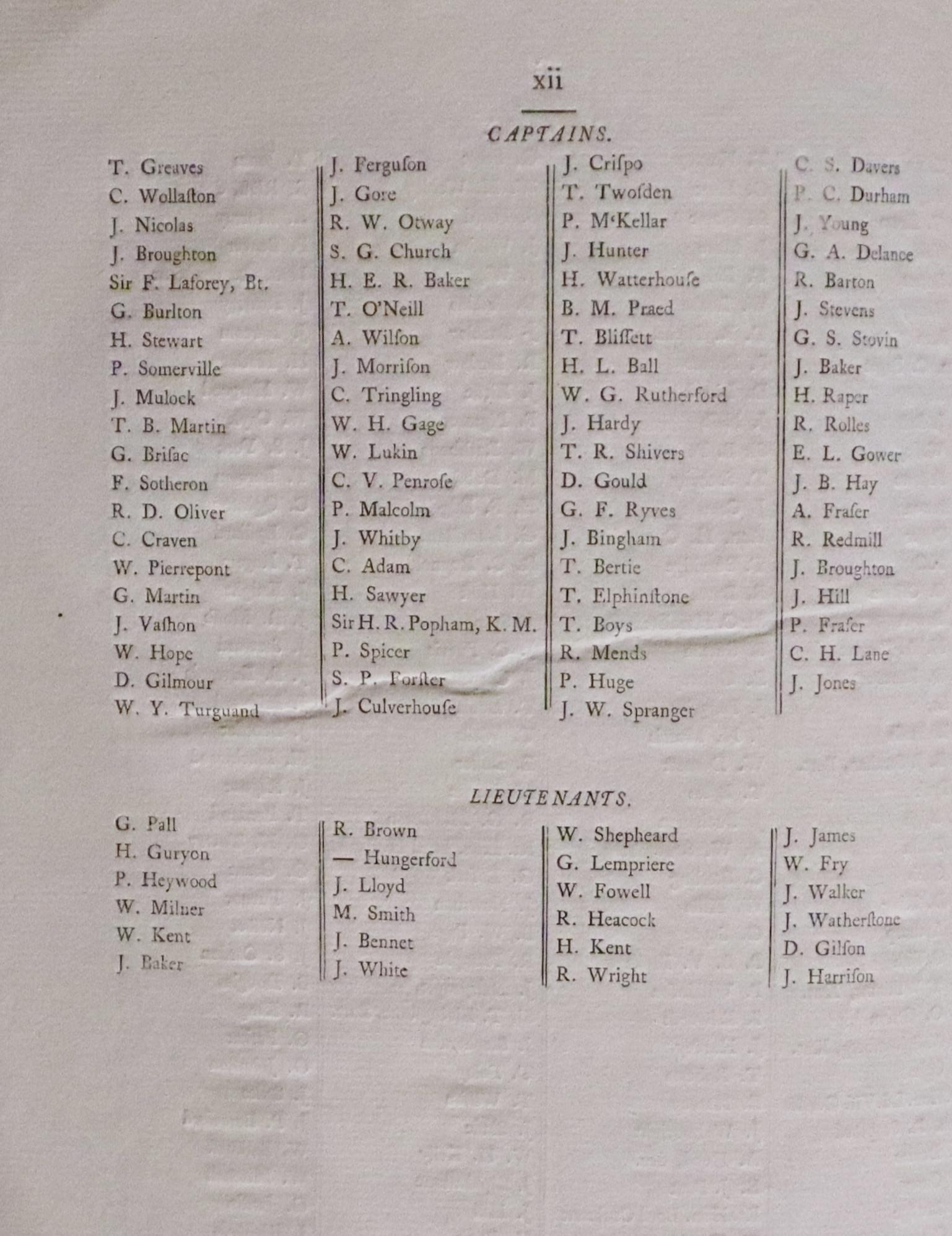
The last of subscribers listed on is pages at the end of the volume makes interesting reading. It is divided into the gentry followed by Offiers of His Majesty's Navy divided into Admirals, Captains and Lieutenants. Under the admirals there appears the name of Rt. Hon. Lord Nelson, K.B. amongst other famous names.
-

Subscribers to volume of charts of Wales by William Morris published in 1800
-

List of gentry being subscriber to volume of charts of Wales by William Morris published in 1800
-

List of gentry being subscribers to a volume of charts of Wales by William Morris published in 1800
-

List of Naval Officers including Lord Nelson who subscribed to William Morris' Charts of Wales, 1800
-

List of Naval Captains who subscribed to William Morris' Charts of Wales, 1800
-

List of Naval Captains and Lieutenants who subscribed to William Morris' Charts of Wales, 1800

References:
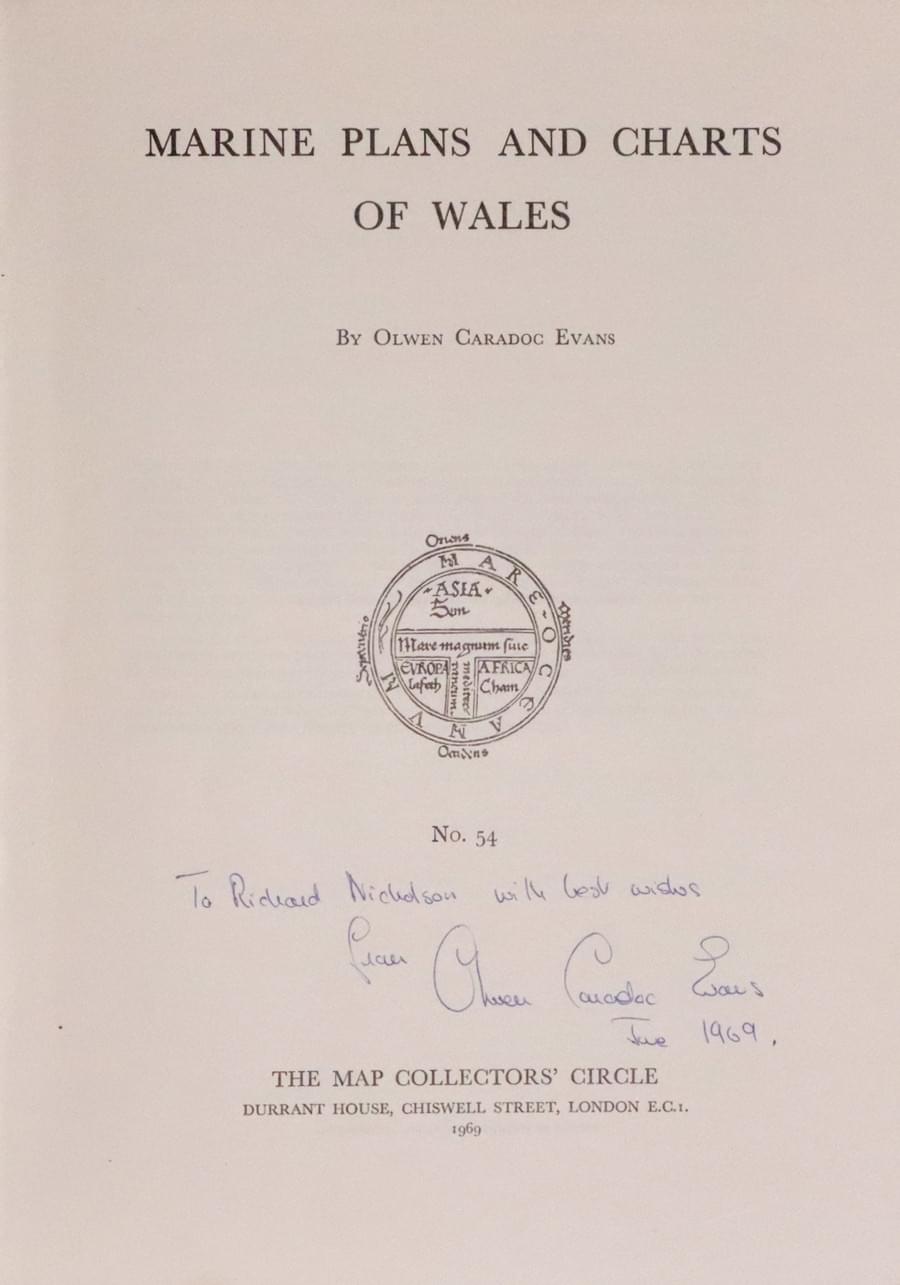
- Map Collectors' Circle. No 54 Marine Plans and Charts of Wales by Owen Caradoc Evans
-

Marine Plans of Wales by Olwen Caradoc Evans
Back in 1969 Olwen Caradoc Evans was kind enough to send me a gift of her work on Marine Plans of Wales. All my other Map Collector's Circle publications are bound in cream coloured card. Olwen's copy is bound in green coloured card so I am wondering if the authors were given these as special publications. She had an antique map and print shop in Conway and you may come across items bearing her label. She died in 1998.
