RICHARD NICHOLSON of CHESTER
A WORLD OF ANTIQUE MAPS AND PRINTS
The Cartographer
THOMAS OSBORNE
County Maps of England and Wales - 1748
GEOGRAPHIA MAGNAE BRITANNIAE. OR CORRECT MAPS OF ALL THE COUNTIES IN ENGLAND, SCOTLAND, AND WALES, AND OF SEVERAL ADJACENT ISLANDS...
Two of the maps are signed Thomas Hutchinson but the rest are unsigned. Ever since I started selling maps they have usually been catalogued under the name of T. Osborne. His name is the first amongst a list of names which appear on the atlas title-page, illustrated above, under the heading Printed for The other names are D. Browne, J. Hodges, A. Miller, J. Robinson, W. Johnson, P. Davey and B. Law.
The title-page, designed by Sameul Wale (died in 1786) is dated 1748. An edition published circa 1756 with a revised title-page has been recorded. Its life was short, however, overtaken by sales of new atlases by Bowen and Kitchin. A pleasing series and getting a bit more difficult to find.
References:
County Atlases of The British Isles, Donald Hodson Vol. II
-

Titlepage to Geographia Magnae Britabbiae 1748
Atlas Title Page
List of Maps
Geographia Magnae Britanniae
England and Wales
Roads of England and Wales
Bedfordshire
Berkshire
Buckinghamshire
Cambridgeshire
Cheshire
Cornwall
Scilly Isles
Cumberland
Derbyshire
Devonshire
Dorsetshire
Durham
Essex
Gloucestershire
Hampshire
Herefordshire
Hertfordshire
Huntingdonshire
Isle of Man
Isle of Wight
Guernsey and Alderney
Jersey
Kent
Lancashire
Leicestershire
Lincolnshire
Norfolk
Northamptonshire
Northumberland
Nottinghamshire
Oxfordshire
Rutlandshire
Shropshire
Somersetshire
Staffordshire
Suffolk
Surrey
Sussex
Warwickshire
Westmorland
Wiltshire
Worcestershire
Yorkshire
Yorkshire West Riding
Yorkshire East Riding
Yorkshire North Riding
Anglesey
Caernarvonshire
Denbighshire
Flintshire
Merionethshire
Montgomeryshire
Breconshire
Cardiganshire
Carmarthenshire
Glamorganshire
Monmouthshire
Pembrokeshire
Radnorshire
MAP GALLERY
-

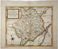
Monmouthshire by Thomas Osborne
-

Rutlandshire by Thomas Osborne 1748
-

Worcestershire by Thomas Osborne 1748
-

Berkshire by Thomas Osborne 1748
-

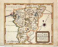
Merionethshire by Thomas Osborne 1748
-

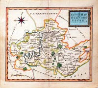
Bedfordshire by Thomas Osborne 1748
-

Yorkshire East Riding by Thomas Osborne 1748
-

Huntingdonshire by Thomas Osborne 1748
Just my personal opinion
I have very fond early memories of this series of maps. Back in the days when the Exchange & Mart cost 4 1/2p (old currency) and I could read all the small print with no glasses. A gentleman was offering a copy of the atlas Geographia Magnae Britanniae. I did not have enough money to buy it but he so kindly offered to spread the cost over a few months. I managed to complete the purchase before the last payment was due. I remember really enjoying hand colouring all the maps.
Not rare but I think I have had more Badeslade & Toms maps than Osborne maps over the years. A very distinct design which I do like.


