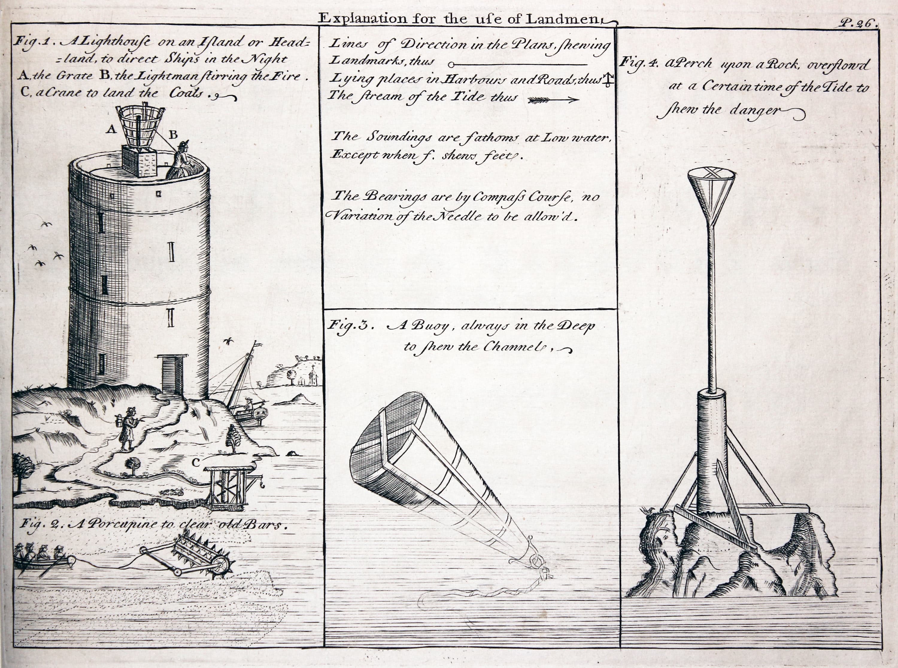
RICHARD NICHOLSON of CHESTER
A WORLD OF ANTIQUE MAPS AND PRINTS
The Hydrographer
LEWIS MORRIS
A beautiful series of Charts of Wales
With the deplorable state of the roads in Wales there was a need in the first part of the 18th century for charts of the Welsh coast to aid the passage of goods and people. To the rescue came an amateur British hydrographer named LEWIS MORRIS.
In 1729 Lewis Morris was appointed as 'Searcher and Customs Officer' to Beaumaris and Holyhead. After receiving permission from the Lords Commissioners of the Admiralty to survey the coast from Llandudno he started with a waywiser in July 1737. This preliminary work lasted 76 days for which he was paid nineteen pounds. It was a further two years before a suitable vessel was provided by the Admiralty so that Morris could take soundings.
It was another 9 years before the work was ready for publication and because of Admiralty delay Lewis Morris decided to publish the small volume of 25 charts himself in 1748.
Over 1,230 people subscribed and the charts were sold out by 1761.
In addition Lewis Morris published a large single chart A Chart of the Coast of Wales in St. George's Channel.
The whole work was updated and republished by Lewis Morris' son, William Morris in 1801.
Examples of both these series should be acquired by serious collectors of maps and charts of Wales.
References: Map Collectors' Series No. 54. Marine Plans and Charts of Wales. Olwen Caradoc Evans. Published in 1969.
In the words of Lewis Morris
As this Performance may be esteemed the only one of the Kind thereto made public in England, it may not be improper to give some Account of the Rose, Progress, and Nature of the Undertaking The melancholy Accounts of Shipwrecks, and Losses, so frequent on the Coast of Wales (chiefly occasioned undoubtedly, by the very slender Knowledge had, and most imperfect Description hitherto given, of those Parts) made it necessary for the Board of the Admiralty to take the same into consideration, and determine, that an actual Survey of that Coast should be made: And in the Year 1737 they were pleased to order me upon that Service; which was begun at Orme's-head in Norths, near Chester-Bar. The Work of on Year being produced, Orders were given me to proceed; but not being sufficiently accommodated with proper and necessary Materials to go on, the Survey was delay'd till the year 1742: When their Lordships allowed me a Vessel well euipp'd; by which Means, with great Care and Exactness, I carried on the Survey to the Entrance of Bristol Channel: But in the Year 1744. the War with France coming on, the Business was postpon'd, and I have since finish'd my Plans, and delivered my Survey into the Admiralty. The Draughts of Harbours, &c. now engraved, and exibited in this Treatise, were drawn up in a small Volume, for my own private Use; which Method I found necessary, to refresh my Memory in Case of Storms, or other sudden Disasters when on my Survey: But happening to shew them to the Lords of the Admiralty; together with some Hints that were drawn up by me cocerning the Improvements that might be made in those Harbours; it being not thought proper to publish the Survey of the Coast at Large, until it is carried on to the Land's End, to compleat that of Bristol Channel. ................./ From my Knowledge in the Language and Antiquities of the Britains, one Thing, I may venture to assert, is peculiar to these Draughts, and perhaps to be found in very few, if in any other; which is, that the Names of Places are set down according to their true Orthography; whereas in other Charts and Maps of this Coast, the Names are generally such, as the Natives and Inhabitants of those Places never hears of; and for the most Part are only the spurious Productions of ignorant Transcribers and careless Engravers.
London, Feb. 2, 1748

List of Maps
Plate 2. A plan of the bay and harbour of Conway in Caernarvon Shire
Plate 3. The entrance of Beaumaris River and Cross Road
Plate 4. Traeth Coch or Red Wharf Bay and harbour in the north of Anglesey
Plate 5. A plan of Dulas Bay and harbour in ye north of Anglesey
Plate 6. Kemlyn Bay & Harbour in ye North of Anglesey
Plate 7. Holy Head Bay and harbour in Anglesey
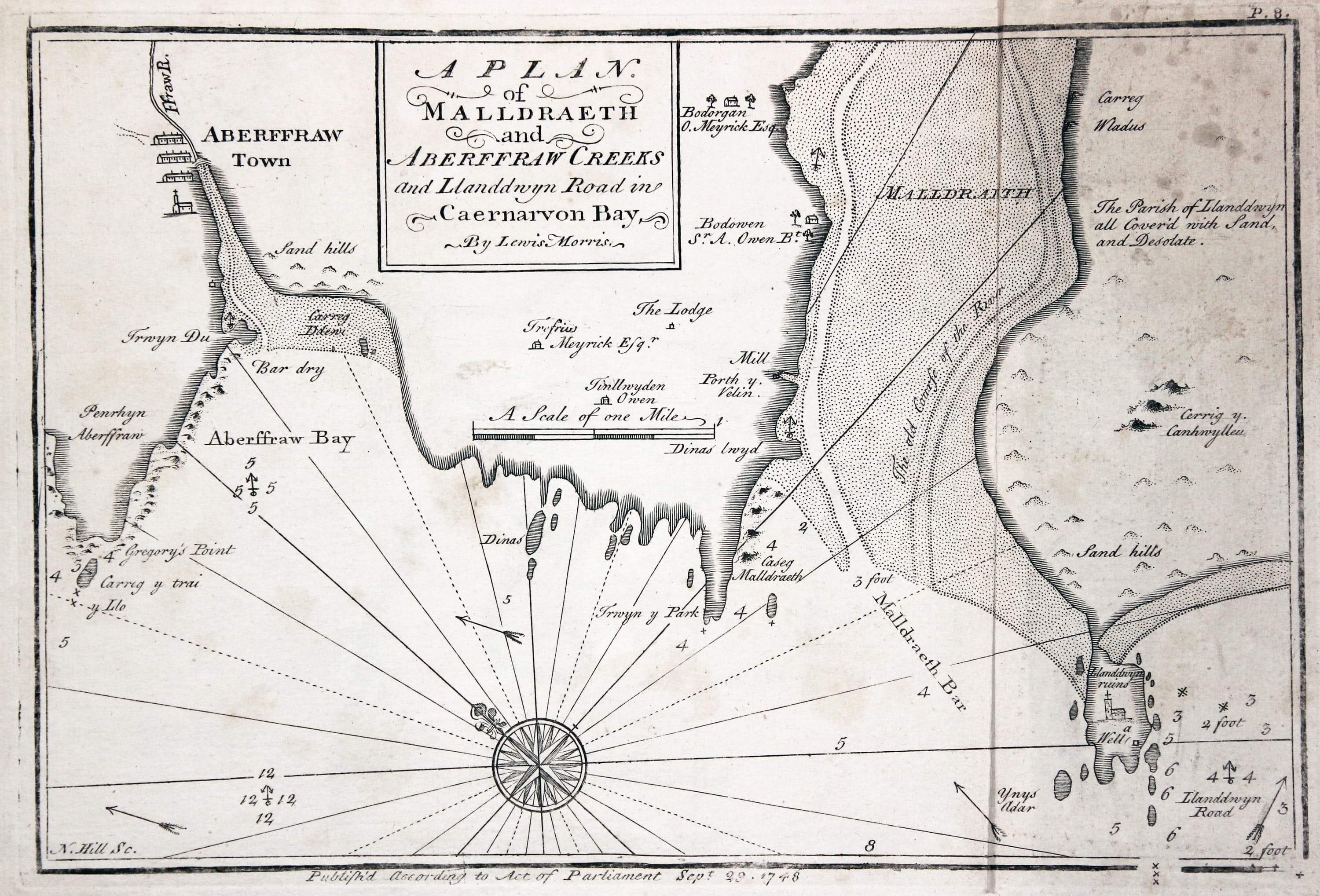
Plate 8. A plan of Malldraeth and Aberffraw creeks and Llanddwyn road in Caernarvon Bay
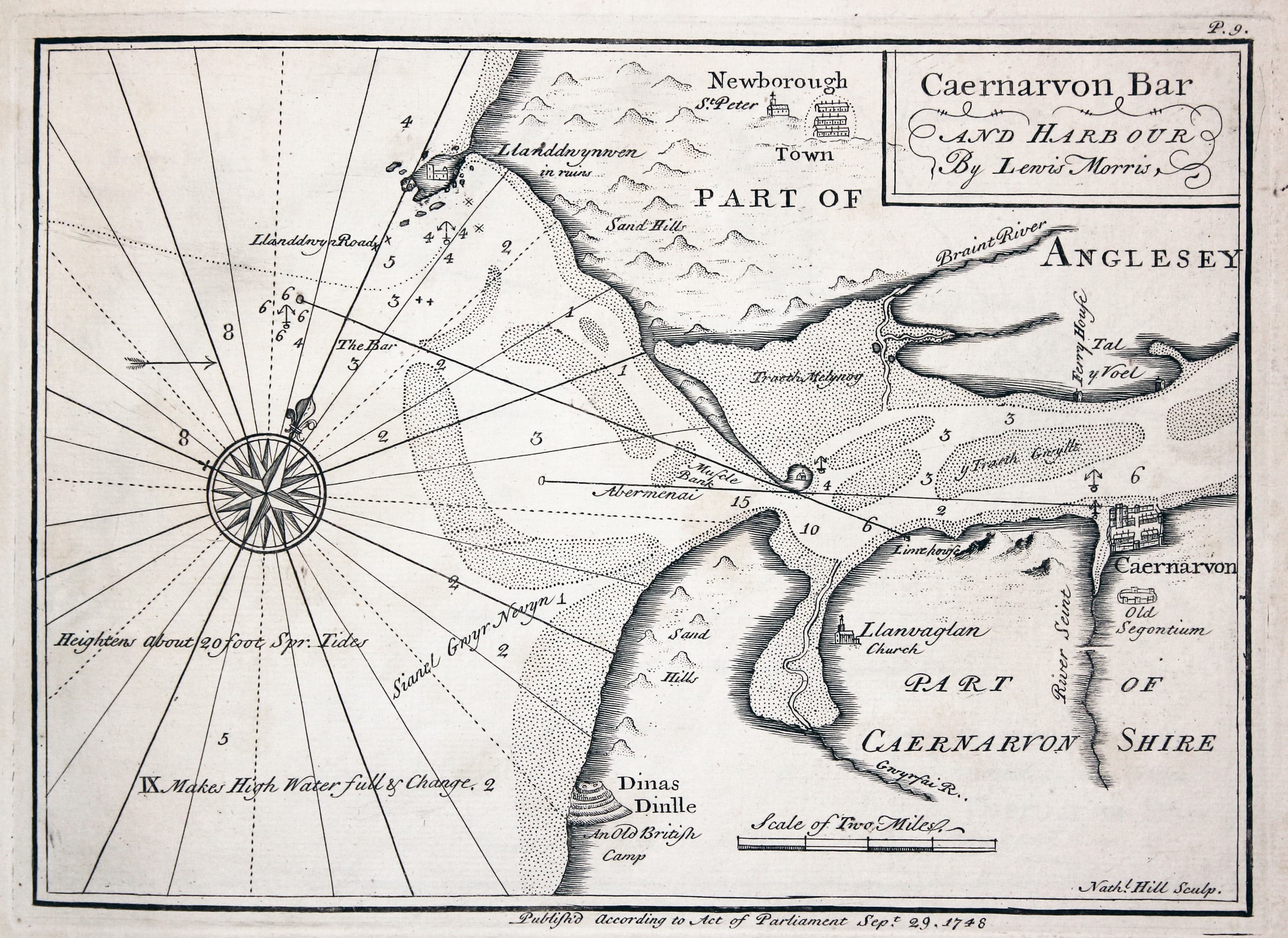
Plate 9. Caernarvon bar and harbour
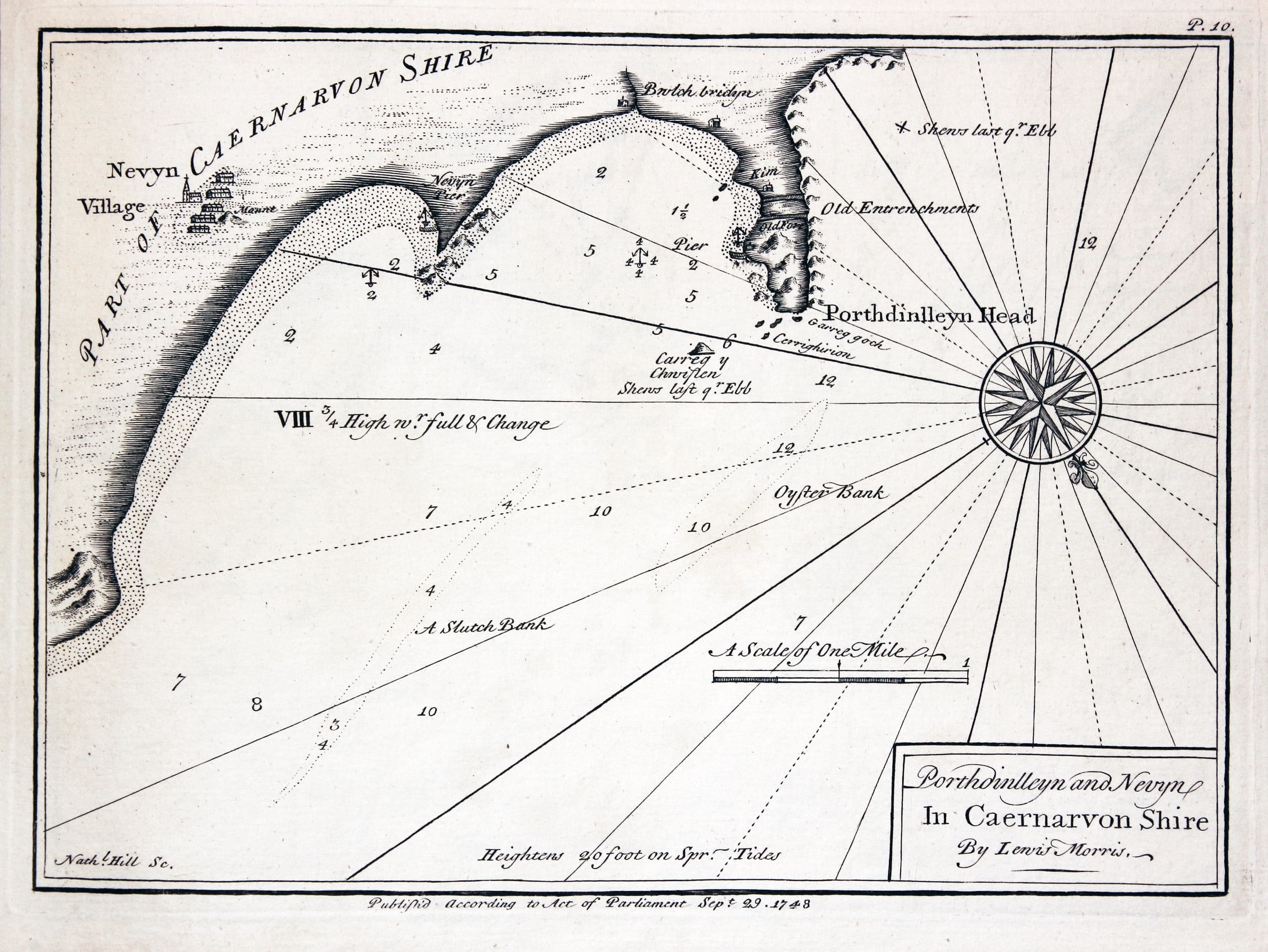
Plate 10. Porthdinlleyn and Nevyn in Caernarvonshire
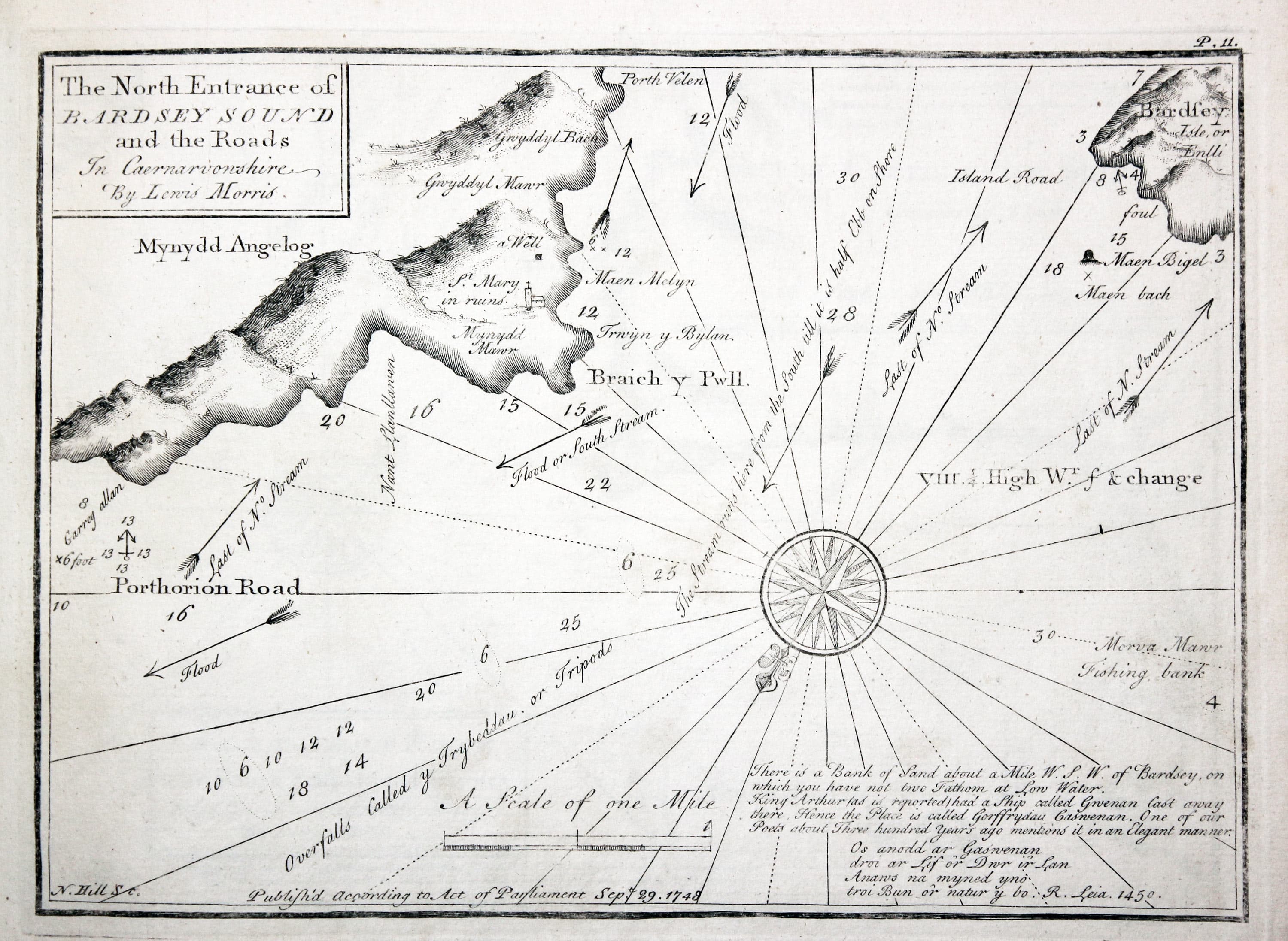
Plate 11. The North Entrance of Bardsey Sound and the Roads in Caernarvonshire
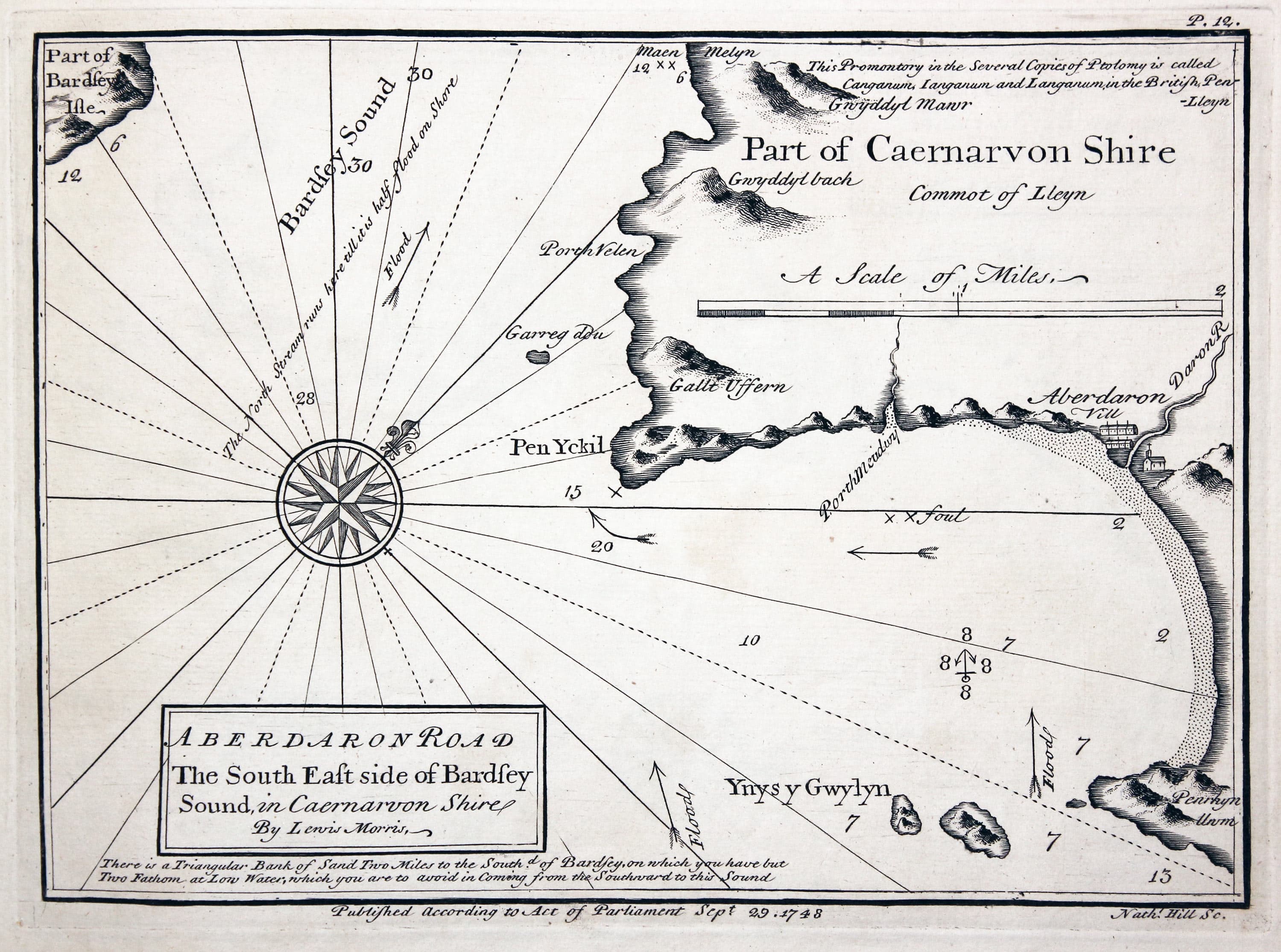
Plate 12. Aberdaron road the south east side of Bardsey Sound in Caernarvon Shire
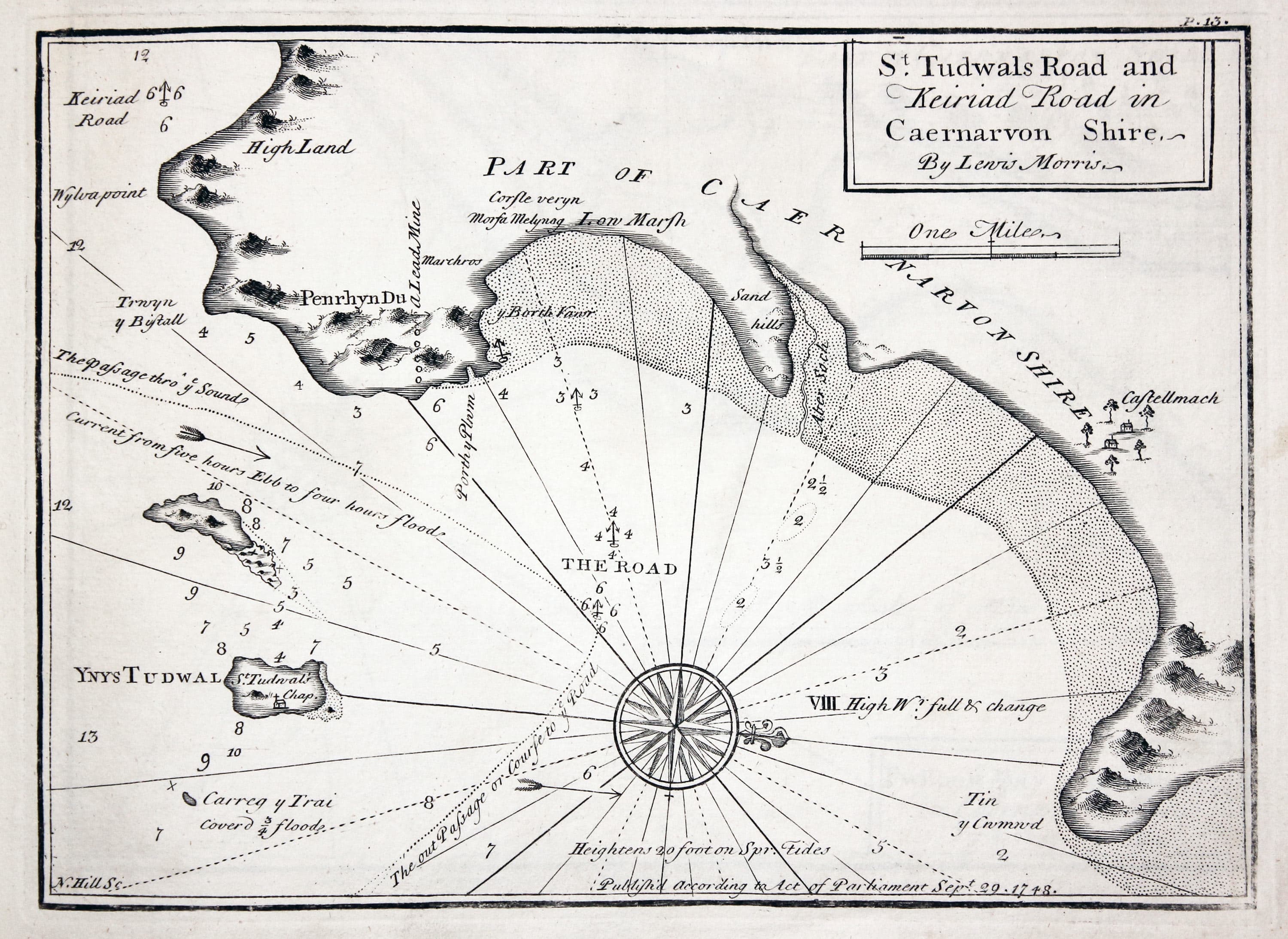
Plate 13. St. Tudwals road and Keiriad road in Caernarvon Shire
Plate 14. Pwllheli Bay and harbour in Caernarvon Shire
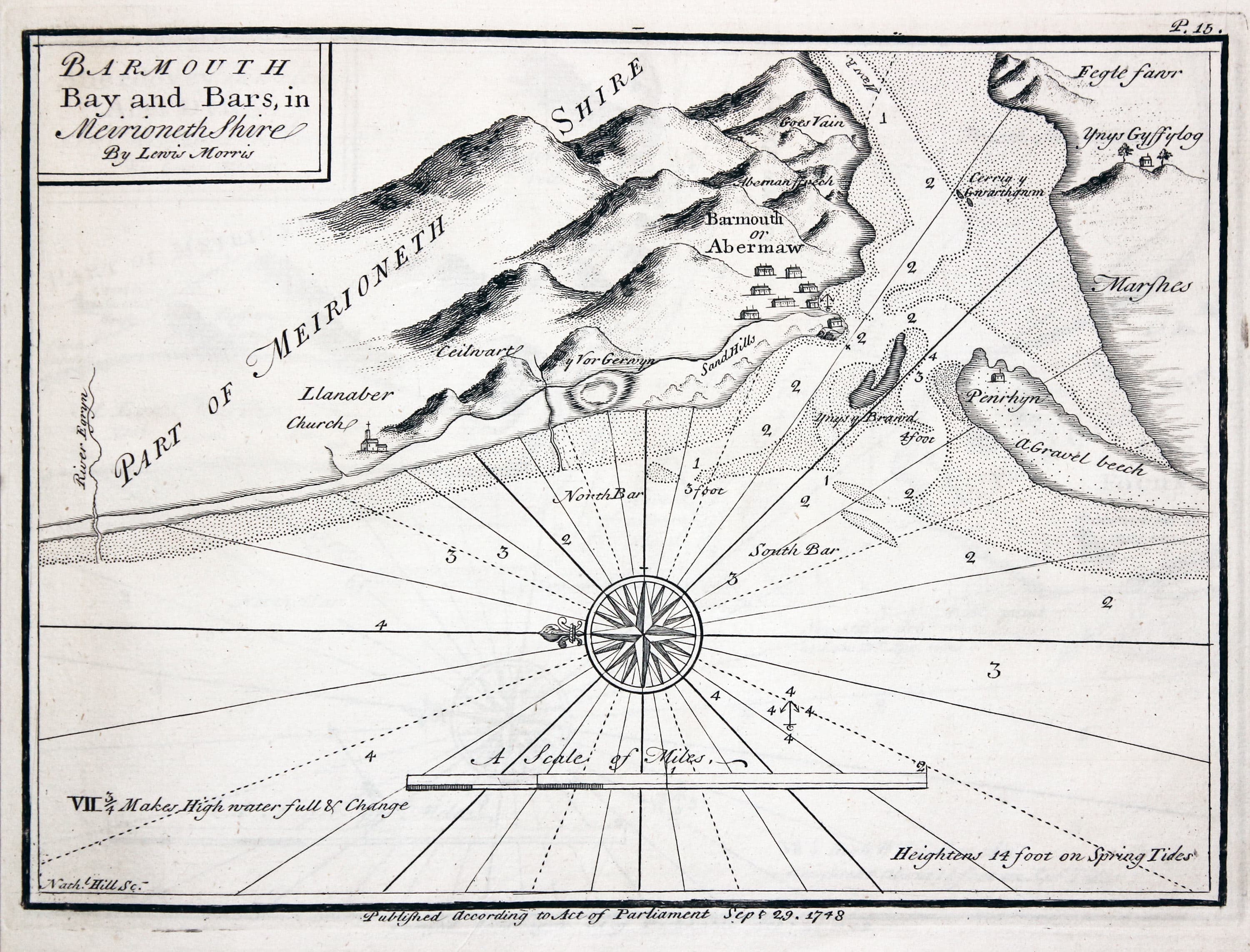
Plate 15. Barmouth Bay and bars in Meirioneth Shire
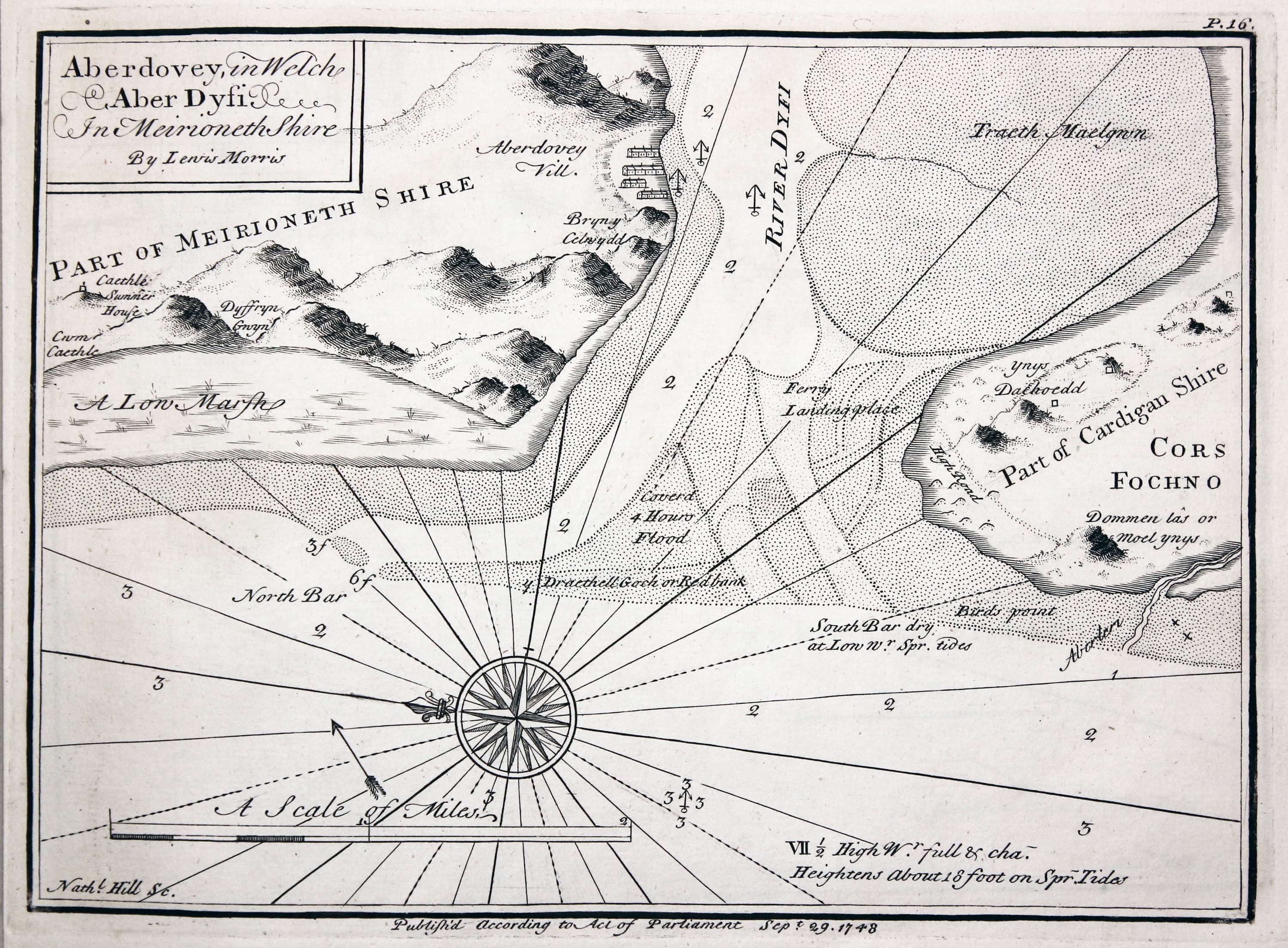
Plate 16. Aberdovey in Welch Aber Dyfi in Meirioneth Shire
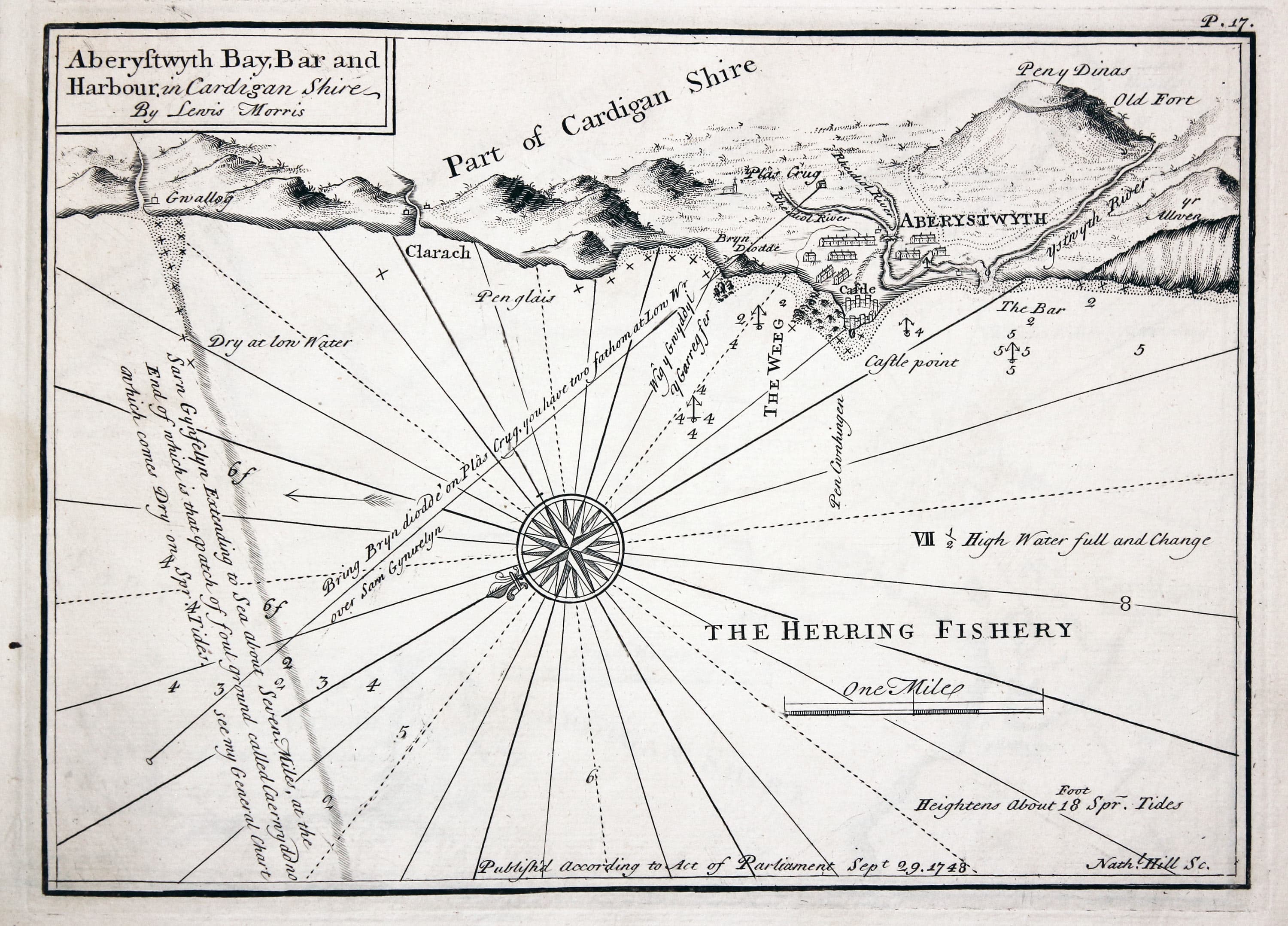
Plate 17. Aberystwyth Bay bar and harbour in Cardigan Shire
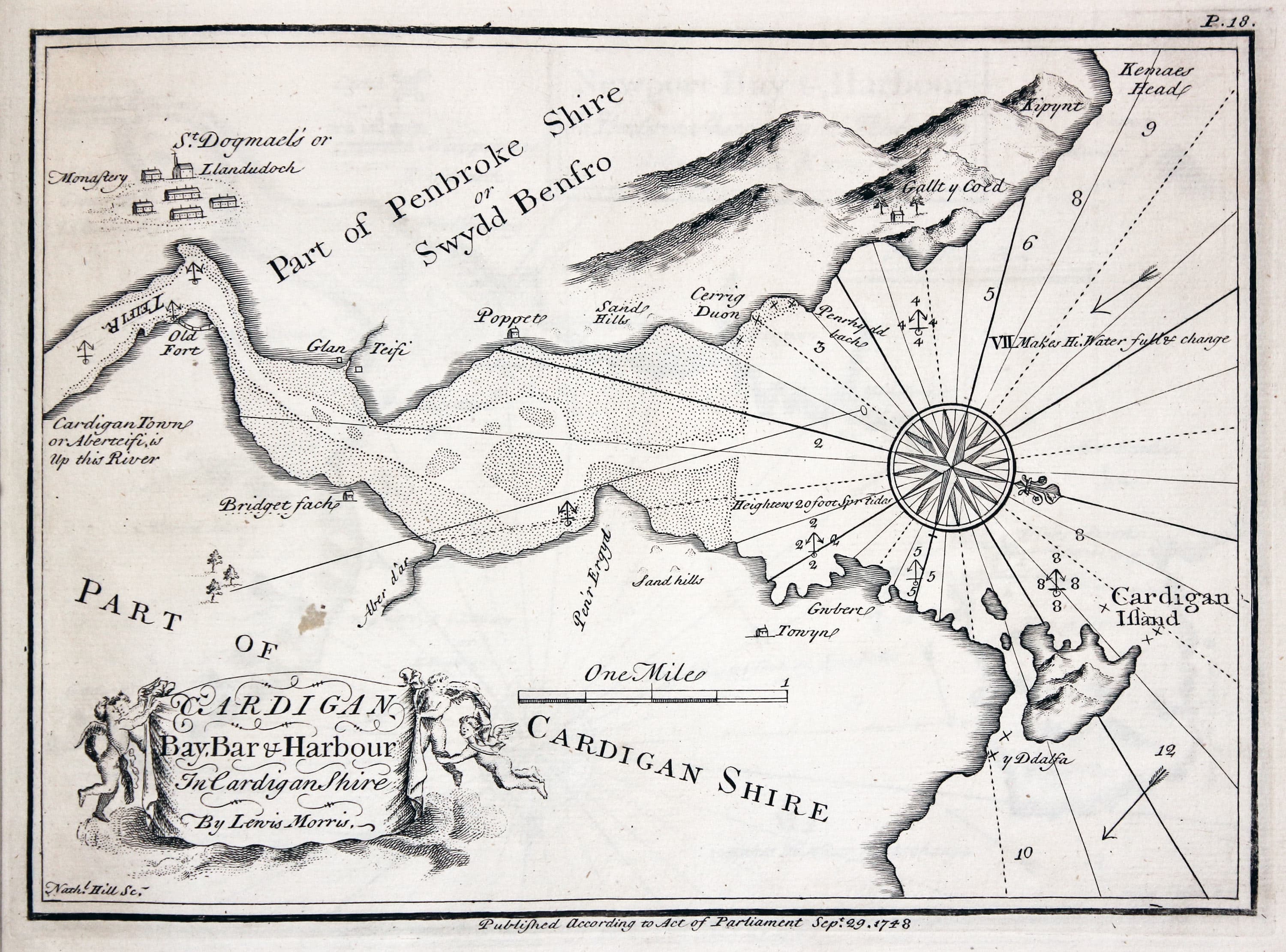
Plate 18. Cardigan Bay bar and harbour in Cardigan Shire
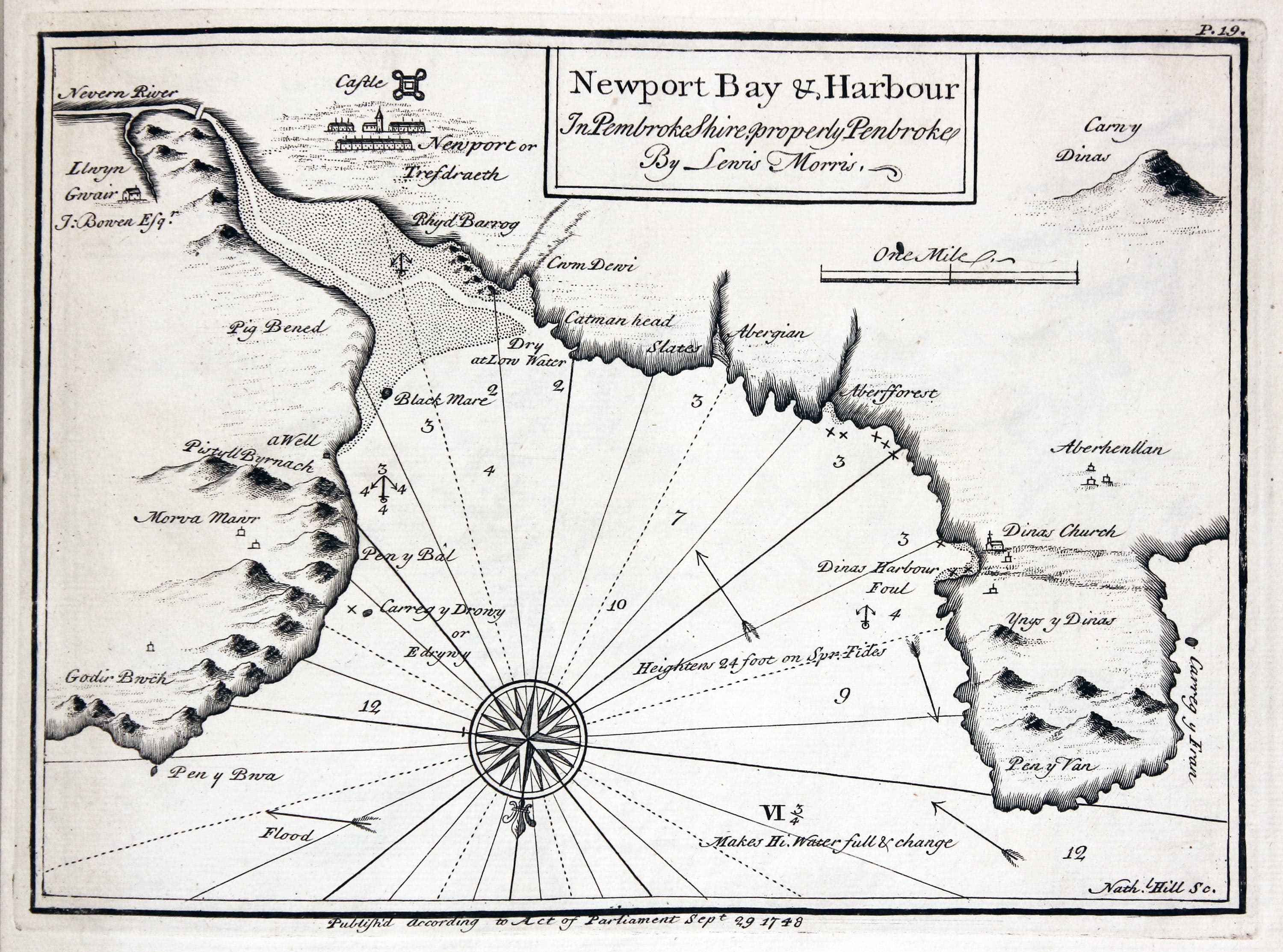
Plate 19. Newport Bay and harbour in Pembroke Shire properly Penbroke
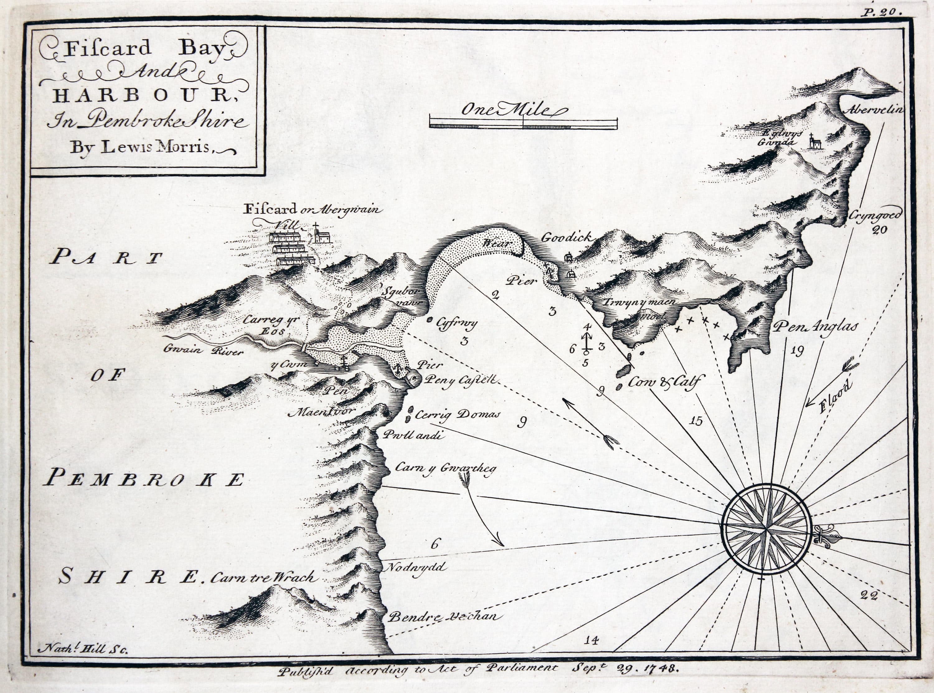
Plate 20. Fiscard Bay and harbour in Pembroke Shire
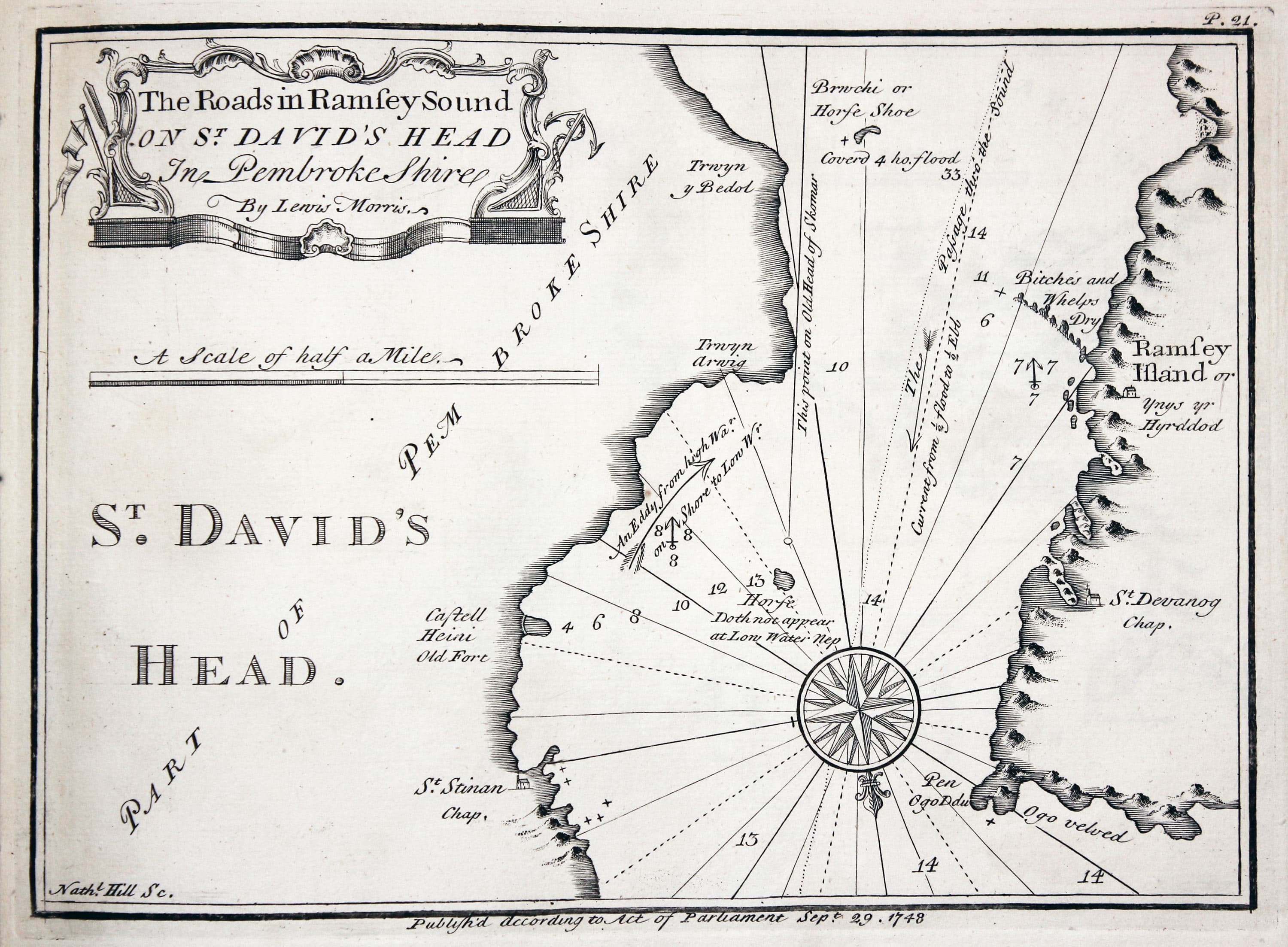
Plate 21. The roads in Ramsey Sound on St. David's Head in Pembroke Shire
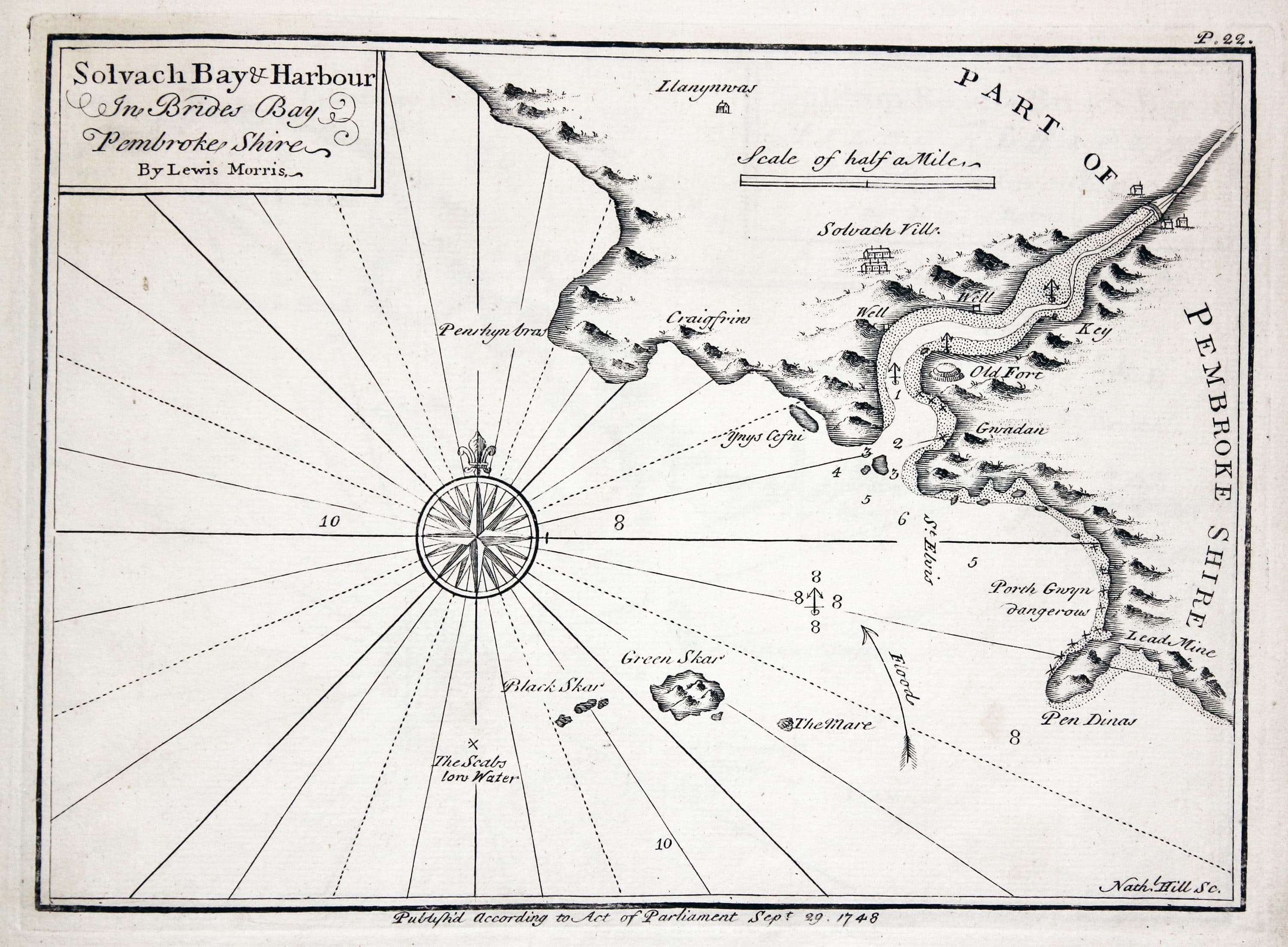
Plate 22. Solvach Bay and harbour in Brides Bay Pembroke Shire
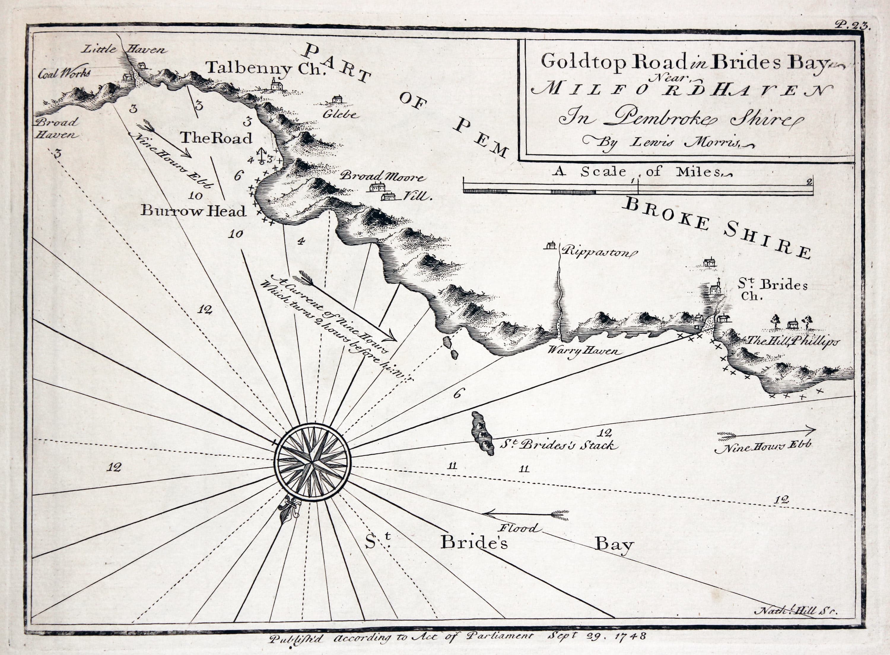
Plate 23. Goldtop road in Brides Bay near Milford Haven in Pembroke Shire
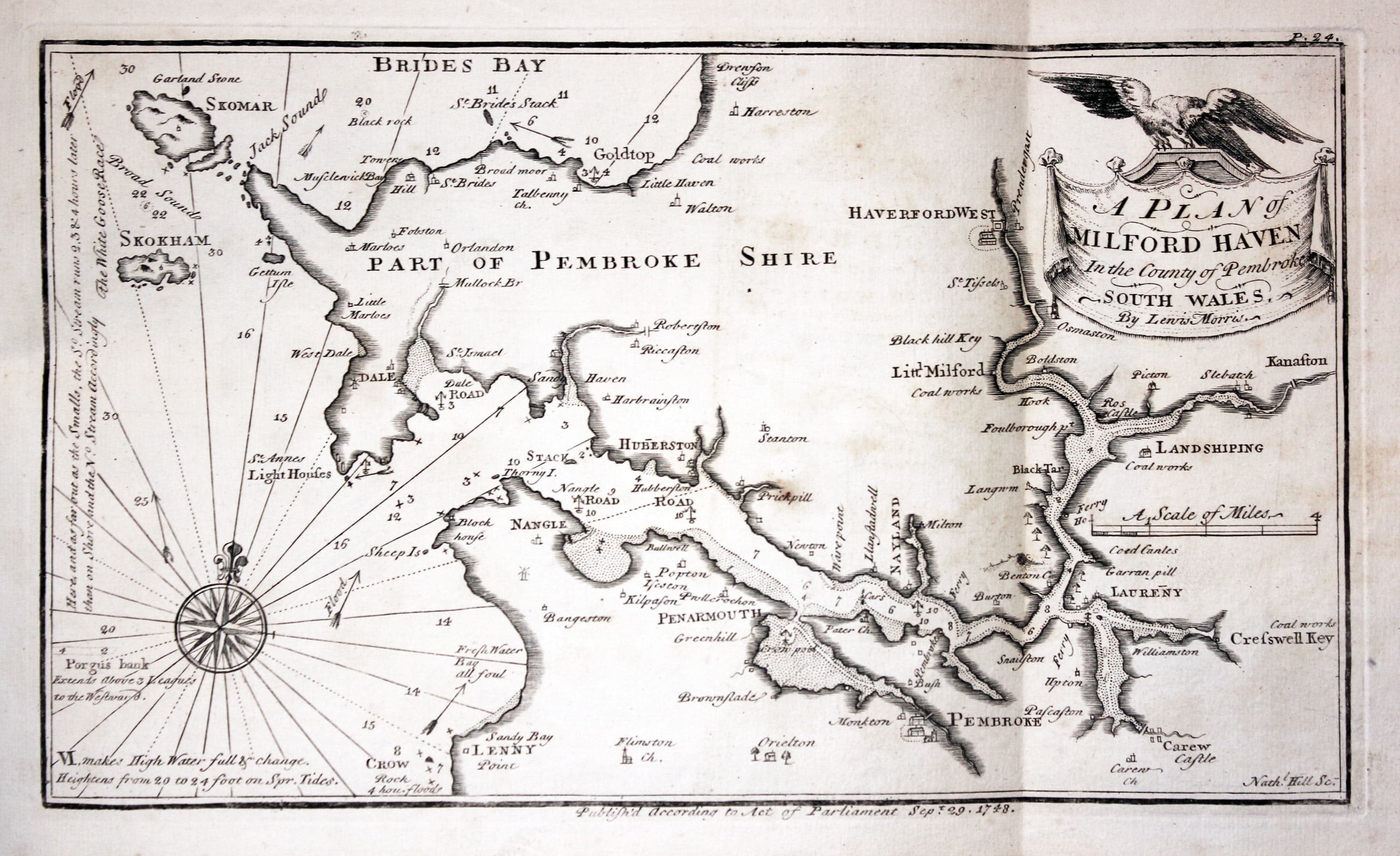
Plate 24. A plan of Milford Haven in the county of Pembroke south Wales
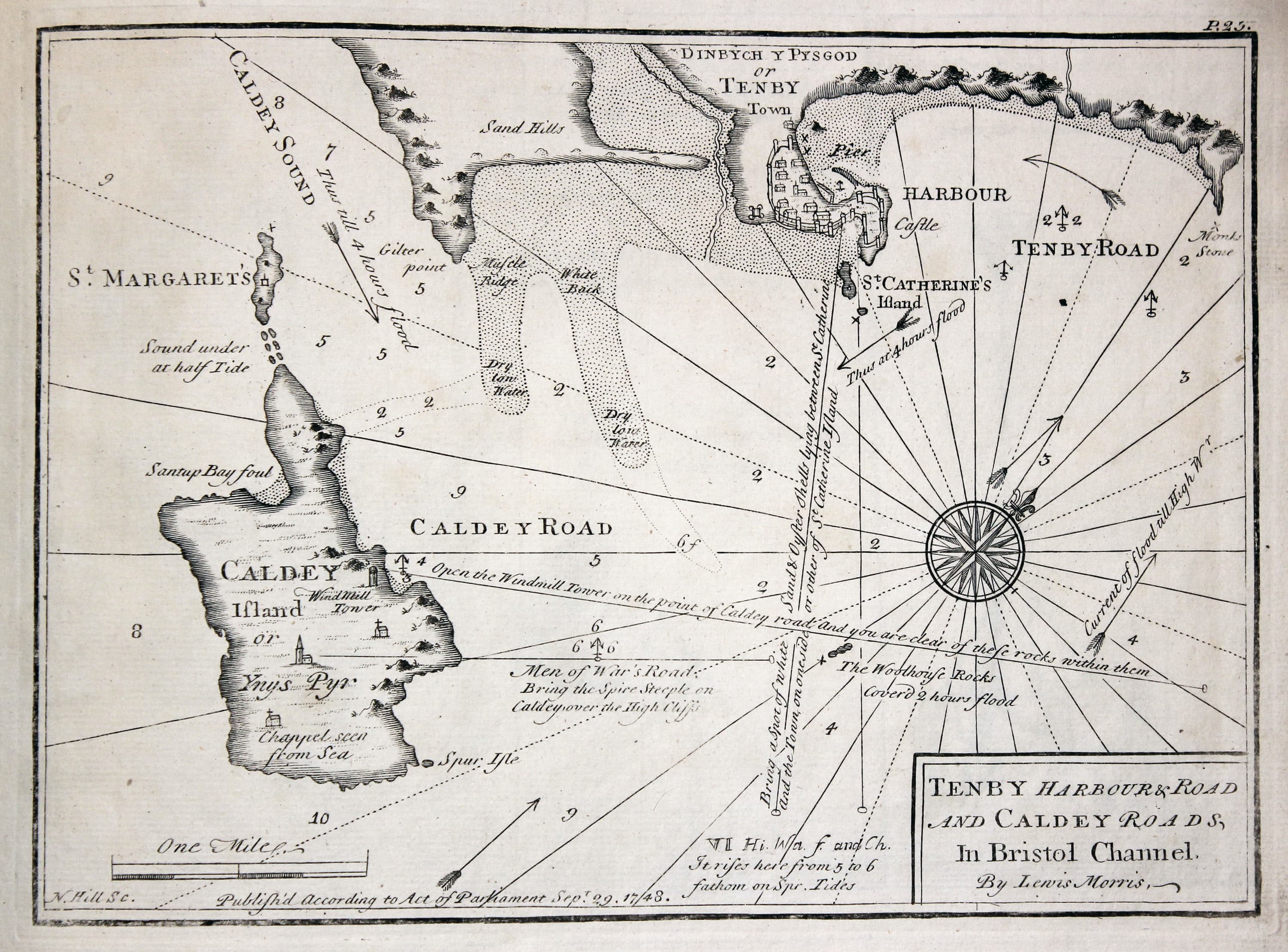
Plate 25. Tenby harbour and road and Caldey roads in Bristol Channel
Frontispiece and Titlepage
-

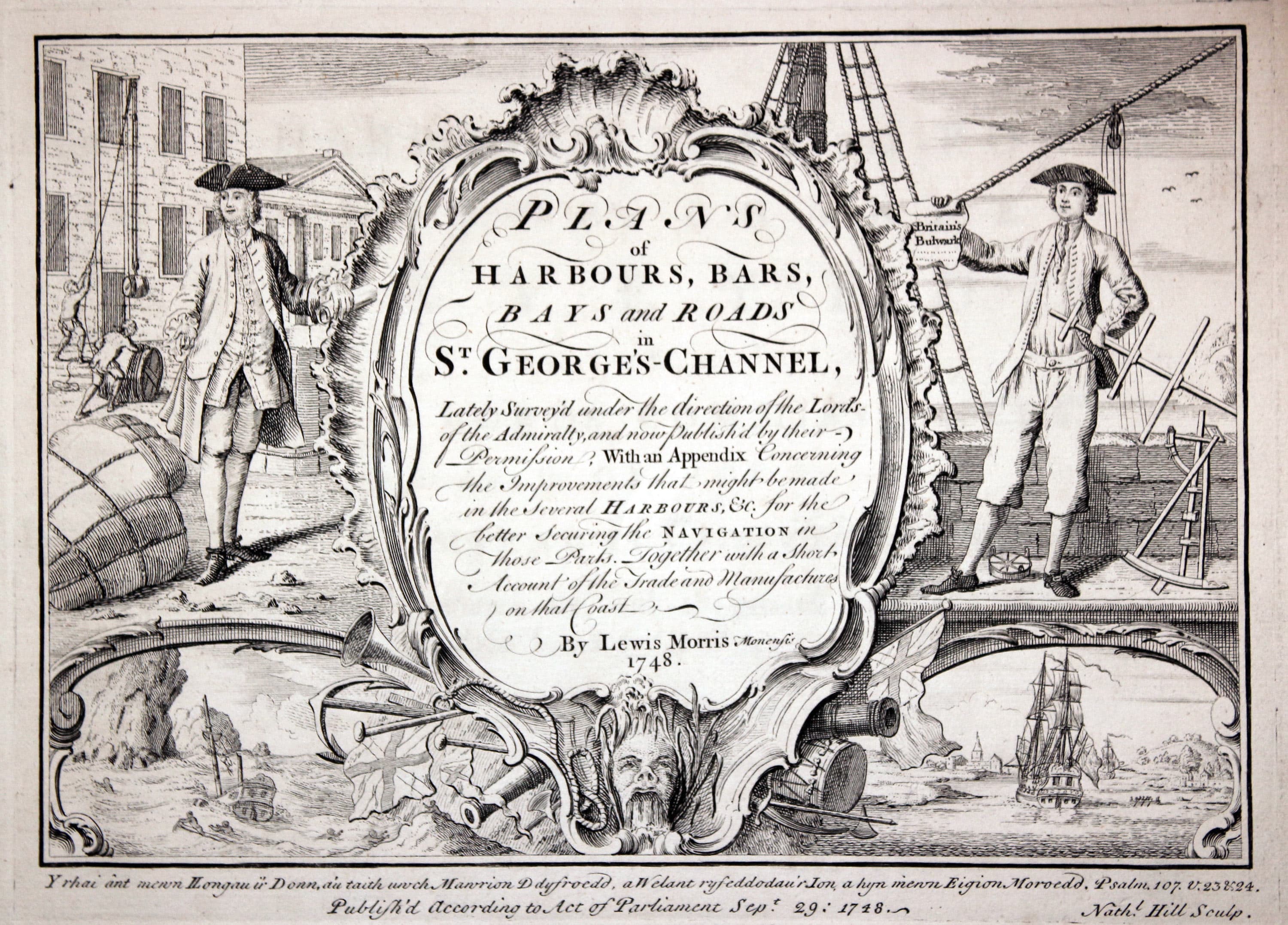
Pictorial frontispiece to Lewis Morris Charts of Wales dated 1748
-

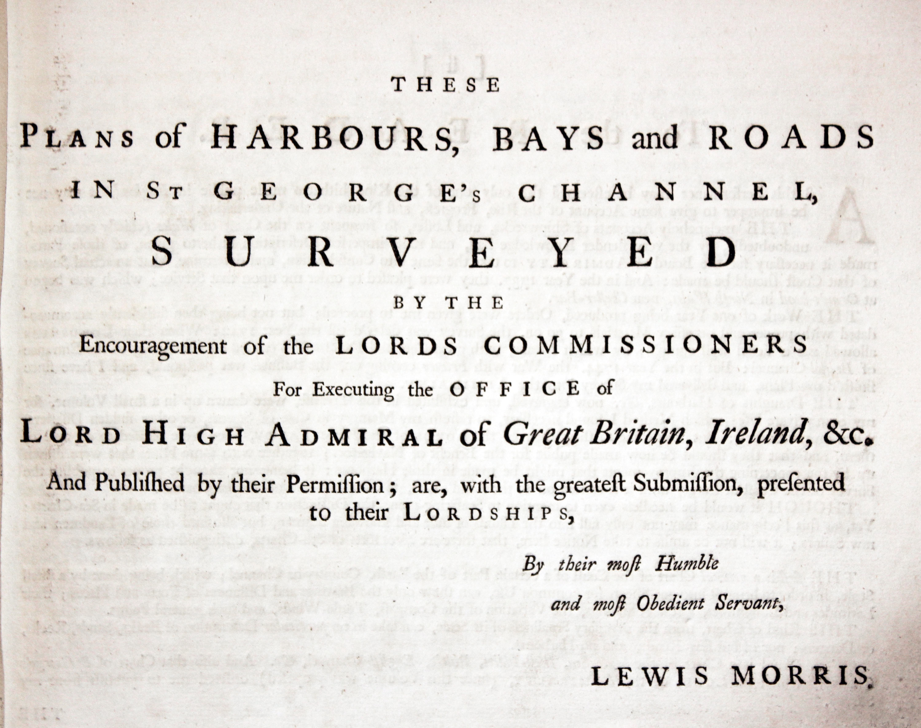
Titlepge to Lewis Morris Charts of Wales 1748
Chart Gallery
-

Chart of Conway by Lewis Morris, 1748
-

Chart of Beaumaris River and Puffin Island by Lewis Morris 1748
-

Chart of Red Warf Bay, Anglesey by Lewis Morris 1748
-

Chart of Dulas Bay, Anglesey, by Lewis Morris 1748
-
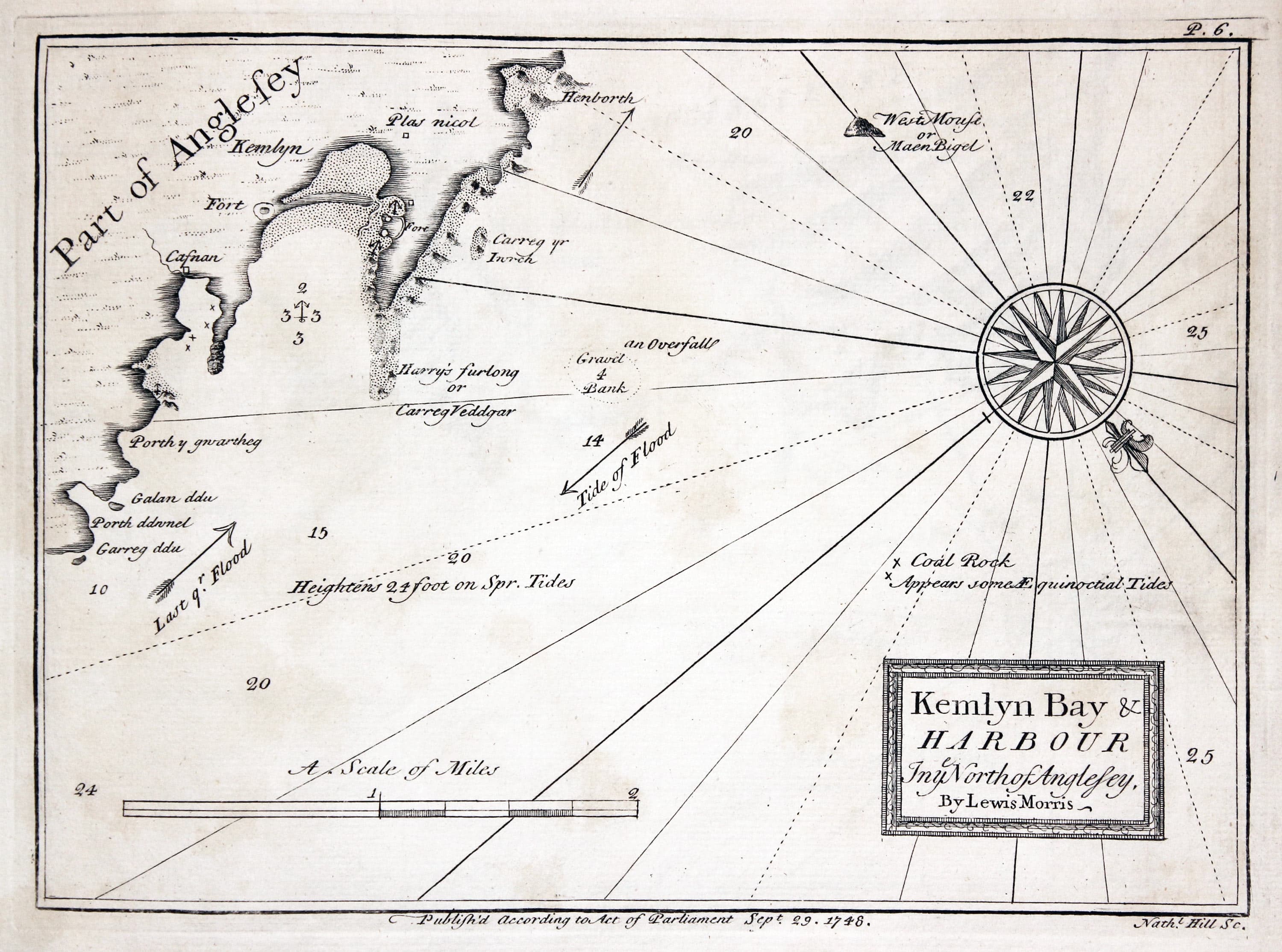
Chart of Cemlyn Bay, Anglesey by Lewis Morris 1748
-

Chart of Holyhead, Anglesey by Lewis Morris 1748
-

Chart of Malltraeth, Anglesey by Lewis Morris 1748
-

Chart of Caernarvon, North Wales by Lewis Morris 1748
-
Chart of Nevin and Porthdinllaen, North Wales by Lewis Morris 1748
-

Chart of Bardsey Sound, North Wales by Lewis Morris 1748
-

Chart of Aberdaron, North Wales by Lewis Morris 1748
-
Chart of Saint Tudwals, North Wales by Lewis Morris 1748
-

Chart of Pwllheli, North Wales by Lewis Morris 1748
-

Chart of Barmouth, North Wales by Lewis Morris 1748
-

Chart of Aberdovey, North Wales by Lewis Morris 1748
-
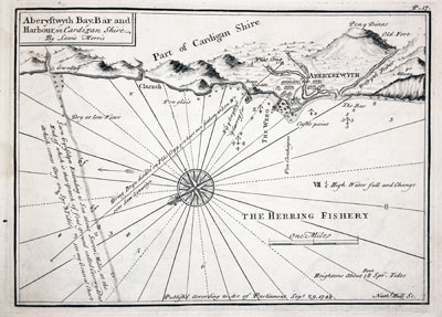
Chart of Aberystwyth, North Wales by Lewis Morris 1748
-

Chart of Cardigan and and Harbour, North Wales by Lewis Morris 1748
-

Chart of Newport, Pembrokeshire by Lewis Morris 1748
-

Chart of Fishguard, Pembrokeshire by Lewis Morris 1748
-

Chart of Ramsey Sound, Pembrokshire by Lewis Morris 1748
-

Chart of Solva in Pembrokeshire by Lewis Morris 1748
-

Chart of St. Brides Bay, Pembrokeshire by Lewis Morris 1748
-

Chart of Milford Haven, Pembrokeshire by Lewis Morris 1748
-
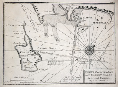
Chart of Tenby, Pembrokeshire by Lewis Morris 1748
-
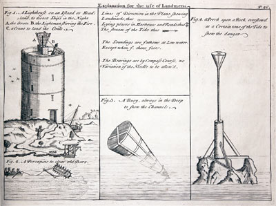
The Use of Landmen by Lewis Morris 1748

