RICHARD NICHOLSON of CHESTER
A WORLD OF ANTIQUE MAPS AND PRINTS

The Cartographer
HERMAN MOLL
A Dutch Engraver and Cartographer
Herman Moll was a Dutch engraver and cartographer who came from Holland to London, England in 1670's. It is likely that he was of German origin. He was also an important engraver of the day working for many well known mapmakers such as Moses Pitt, John Adair and Greenville Collins. He later started to trade in about 1695 as a mapseller and publisher. First at Vanley's Court, Blackfriars before later moving to Devereux Court between Temple Bar and St.Clements Church in the Strand.
He produced larger number of atlases of many parts of the world but the collector of British Maps will be more interested in his county maps of England, Wales, Scotland and Ireland. The English county maps are easily recognised for the engravings of antiquities excavated in the county including coins, statues and Roman altars. A Set of Fifty New and Correct Maps of England and Wales published with others by J. and T.Bowles in 1724. In the first year there was a reprint in which a plate number appeared within brackets in the top left hand border of each map. The following year in 1725 A Set of Thirty-six New and Correct Maps of Scotland was published by Thomas Bowles, Print and Map-Seller near the Chapter House in St.Paul's Churchyard and by John Bowles, Print and Map-seller over against Stocks Market at his shop in Mercers Hall, Cheapside.
A Set of Thirty Six New and Correct Maps of Scotland
-

Thirty Six New and Correct Maps Titlepage Herman Moll
-

Scotland by John Adair


Scotland
-

Ancient Scotland by Herman Moll, 1725
-

Scotland by Herman Moll
-

Wigton and Kircudbright by Herman Moll
-

West Galloway and Wigton by Herman Moll 1725
-

Middle part of Galloway by Herman Moll 1725
-

East part of Galloway by Herman Moll 1725
-

North Part of Roxburgh and Selkirk by Herman Moll 1725
-

Dumfries and Nithisdale by Herman Moll 1725
-

Annandale and Easkdale by Herman Moll 1725
-

Berwickshire by Herman Moll 1725
-

Lothian by Herman Moll 1725
-

Tweeddale and Peebles by Herman Moll 1725
-

Clydsdale and Lanarkshire by Herman Moll 1725
-

South Ayr, Kyle and Carrick by Herman Moll 1725
-

Renfrew and Cunningham by Herman Moll 1725
-

Bute, Arran and Kintyre by Herman Moll 1725
-

Argyllshire by Herman Moll 1725
-

Dunbarton by Herman Moll 1725
-

Stirling and Clackmannan by Herman Moll 1725
-

Fife and Kinross by Herman Moll 1725
-

South Perthshire by Herman Moll 1725
-

North Perthshire by Herman Moll 1725
-

Angus and Forfar by Herman Moll 1725
-

South Aberdeenshire by Herman Moll 1725
-

Murray and Nairn by Herman Moll 1725
-

Banff and Aberdeenshire by Herman Moll 1725
-

Lochaber by Herman Moll 1725
-

Lochaber by Herman Moll 1725
-

Ross and Cromarty by Herman Moll 1725
-

Caithness and Sutherland by Herman Moll 1725
-

Orkney Islands by Herman Moll 1725
-

Shetland Islands by Herman Moll 1725
-

Western Islands by Herman Moll 1725
-

Isle of Mull by Herman Moll 1725
-

Isle of Jura by Herman Moll 1725
-

Isle of Islay by Herman Moll 1725


England and Wales
-

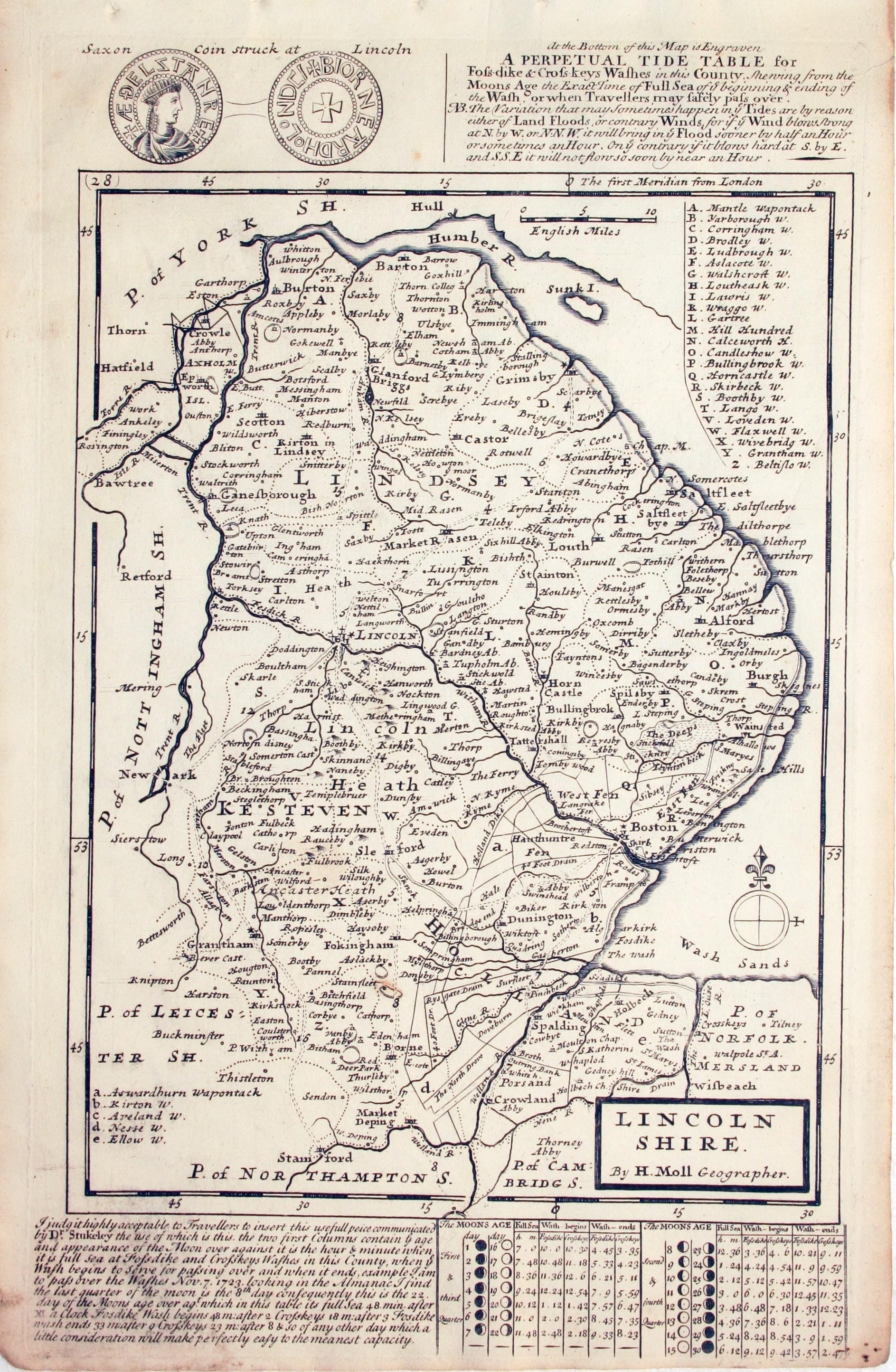
Lincolnshire by Herman Moll
-
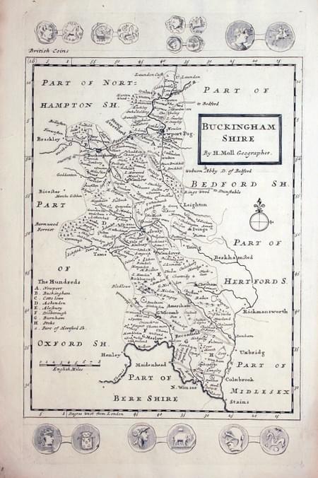
Buckinghamshire by Herman Moll
-

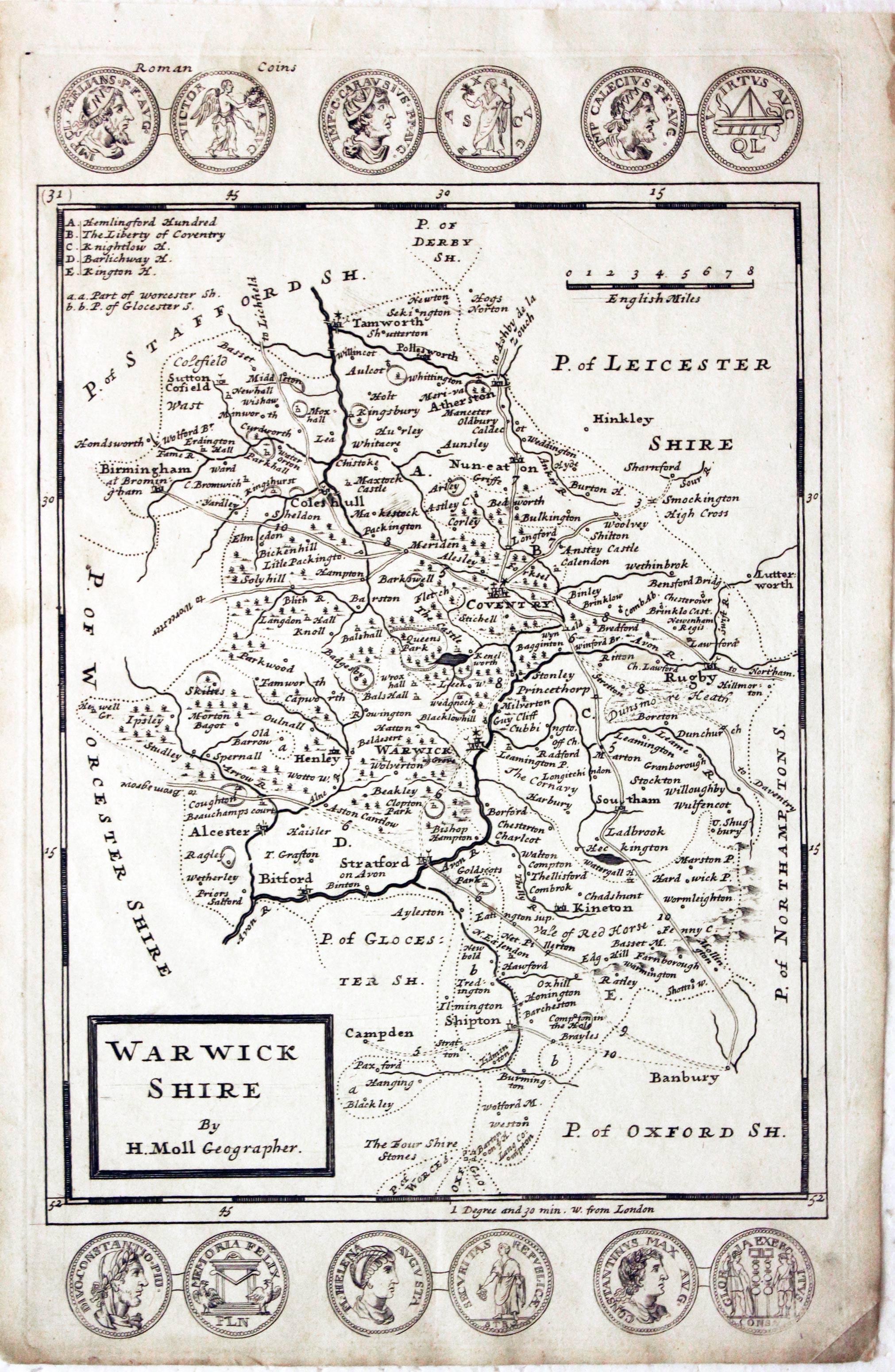
Warwickshire by Herman Moll
-

Bedfordshire by Herman Moll
-

Worcestershire by Herman Moll
-

Cheshire by Herman Moll
-

Staffordshire by Herman Moll
-

Herefordshire by Herman Moll
-

Monmouthshire by Herman Moll
-

North Wales by Herman Moll
-

Map of Yorkshire by Herman Moll
-

Huntingdonshire by Herman Moll


Rest of the World Maps
-

Independent Tartary, Herman Moll c.1711


RICHARD NICHOLSON
of CHESTER
Stoneydale
Pepper Street
Christleton
Chester
CH3 7AG
Telephone
01244 336004
International 44 1244 336004

I have been buying and selling antique maps since the early 1960's during which time I had a gallery in Watergate Street, Chester for 30 years. I am now able to offer through my websites a personal service to map and print collectors.
