RICHARD NICHOLSON of CHESTER
A WORLD OF ANTIQUE MAPS AND PRINTS

The Hydrographer
CAPTAIN GREENVILLE COLLINS
1693 - Coastal charts of the British Isles.
List of Charts in The Coasting Pilot
The North Sea
England - East Coast
River Dee
Fowey & Mounts Bay
Lands End & Scilly
Scilly Isles
Falmouth
Fowey & Mount's Bay
Dartmouth
Plymouth
Torbay
Harwich. Essex
The Thames
The Downs, Kent
Yarmouth, Norfolk
Blakeney, Norfolk
Holy Island & Farne
Newcastle on Tyne
Bristol Channel
The River Avon
Rye, Sussex
Bridlington/Scarborogh
North West Coast & Isle of Man
The River Humber
Holyhead, Anglesey
The Menai Straits
Milford Haven and the adjacent islands
Leith, Scotland
The Orkneys
Edinburgh Firth
Dundee & Aberdeen
Carlingford Lough
Cork
Dublin Bay
Kinsale, Co. Cork
St. George's Channel
Weymouth & Portland
Isle of Wight
Belfast Lough
Coast of Wales
Moray Firth
Orkneys - Harbours
South Part of the Isles of Shetland
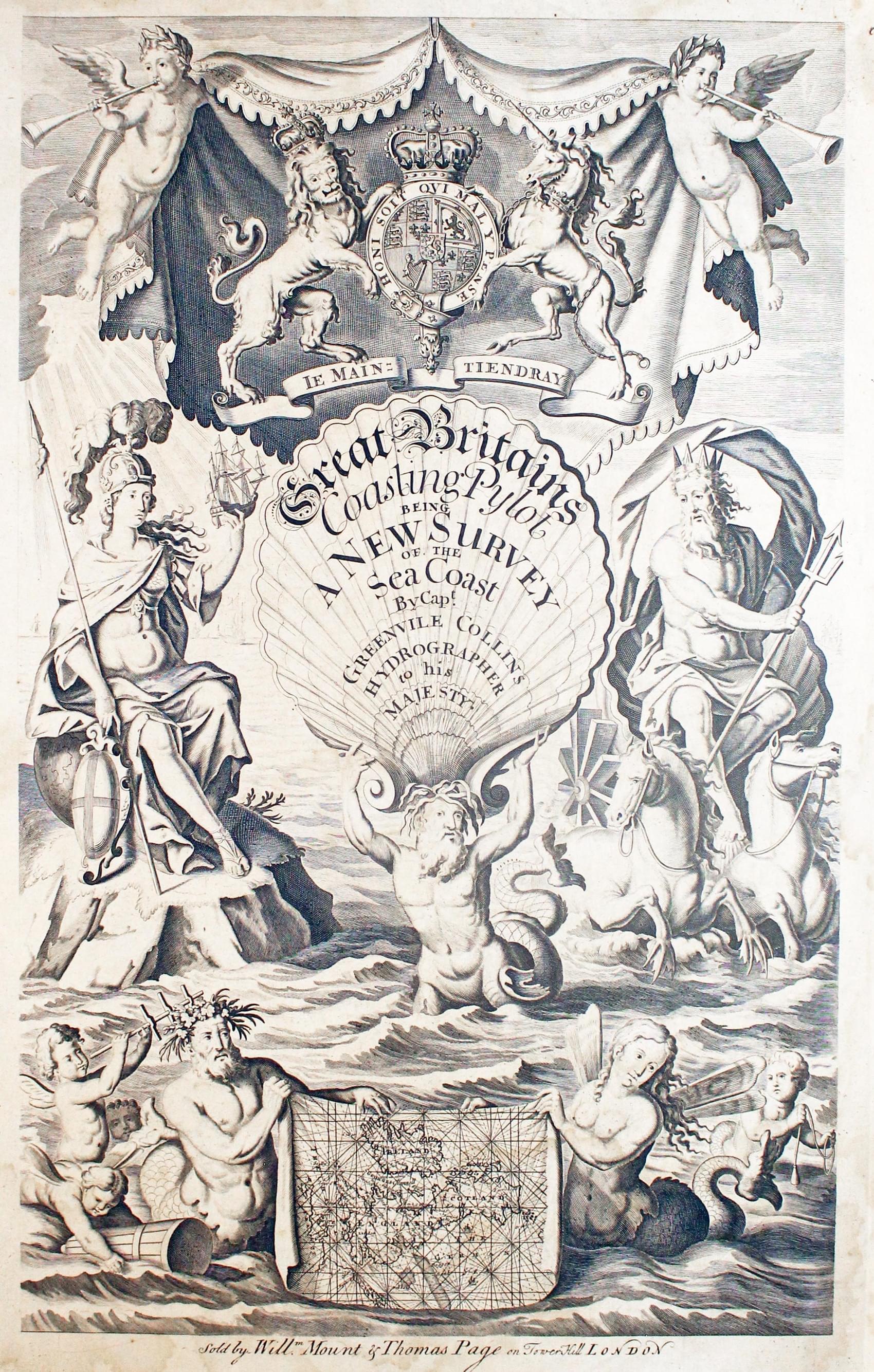
Frontispiece
Map Gallery
-

Chart of Milford Haven in Pembrokeshire by Captain Greenville Collins
-

Chart of the Isle of Man by Captain Greenville Collins
-

Chart of the Milford Haven by Captain Greenville Collins
-

Chart of the the River Avon by Captain Greenville Collins
-

Chart of the East Coast of England by Captain Greenville Collins
-

Chart of Cork in Ireland by Captain Greenville Collins
-

Chart of the River Dee by Captain Greenville Collins
-

Chart of the North Sea by Captain Greenville Collins
-

Chart of the Menai Straits, North Wales by Captain Greenville Collins
-

Chart of Cork Harbour, Ireland by Captain Greenville Collins
-

Fowey and Mounts Bay in Cornwall by Captain Greenville Collins
-

Chart of St.George's Channel by Captain Greenville Collins


More Information to Come
RICHARD NICHOLSON
of CHESTER
Stoneydale
Pepper Street
Christleton
Chester
CH3 7AG
Telephone
01244 336004
International 44 1244 336004

I have been buying and selling antique maps since the early 1960's during which time I had a gallery in Watergate Street, Chester for 30 years. I am now able to offer through my websites a personal service to map and print collectors.
