Antique Maps of the World
Richard Nicholson of Chester

Established in 1961
A World of Antique Maps and Prints

The maps on this page are guaranteed to be genuine early specimens published in or around the year stated
19th Century Hemisphere Map with Original Hand Colouring
-

Western Hemisphere, Sidney Hall, 1830

20174 Western Hemisphere, Sidney Hall, 1830. Price: 110.00
WESTERN HEMISPHERE
A detailed circular map. 16 inches diameter. Original outline hand colouring. Good condition.
From: A New General Atlas
Old Map of the Northern Hemisphere
-

Northern Hemisphere by William Faden 1802

22527 Northern Hemisphere, William Faden, 1802. Price: 90.00
NORTHERN HEMISPHERE
An interesting detailed map circular map. The title appear across the top and at the base of the map is the publishers imprint dated 1802. The margins are very tight here which is quite normal with a small amount of trimming at the base. 22 1/2 inches diameter. Wide blank side margins. Original centre fold. Good heavy paper. Good clean undamaged condition. Taken from the atlas and therefore not previously sold as a single map.
From: A New General Atlas.
Old Map Showing Australia in 1802
-

Southern Hemiphere by William Faden 1802

22528 South Hemisphere, William Faden 1802. Price: 145.00
SOUTHERN HEMISPHERE
An interesting detailed map circular map. The title appear across the top and at the base of the map is the publishers imprint dated 1802. The margins are very tight here which is quite normal with a small amount of trimming at the base. 22 1/2 inches diameter. Wide blank side margins. Original centre fold. Good heavy paper. Of particular interest of course is the showing of Australia titled New Holland. 5 inch split at the bottom of the centre fold otherwise good condition. Taken from the atlas and therefore not previously sold as a single map.
From: A New General Atlas
Twin Hemisphere World Map
-

World Twin Hemispheres, Gilles Robert de Vaugondy 1748

22380 World - Twin Hemispheres, Gilles Robert de Vaugondy, 1748. Price: 110.00
MAPPE MONDE OU DESCRIPTION DU GLOBE TERRESTRE
An engraved map of the two hemispheres. Dated 1774 beneath title. 11 1/2 x 5 3/4 inches. Original outline hand colouring. Two original vertical folding creases. Good clean condition.
From: Atlas Portatif Universal
17th Century - Twin Hemispheres
-

World Mercator / Jansson 1633
-

Verso World map Mercator / Jansson 1633


31341 World, Mercator/ Jansson, 1633. Price: 720.00
TYPUS ORBIS TERRARUM
An attractive twin hemisphere map within a strapwork border in which the four elements are named in each corner. Within the border is a sphere and ornate compass rose. Beneath are two panels with Latin notes.This map was engraved by Abraham Goos for the Jan Jansson’s small size atlas “Atlas Minor”. Often referred to as a miniature Mercator. California is shown as an island. The unknown southern continent Terra Australis Incognita is shown with an engraved explanation. 8 x 5 3/4 inches. German text on verso. Hand coloured. Traces of sums and numbers in a lightbrown ink in the top blank margin. Otherwise good undamaged condition.
From: Atlas Minor
Old Hemisphere Map in need of Restoration
-

Western Hemisphere, G. F. Cruchley

31540 Western Hemisphere, George Frederick Cruchley, 1848. Price: 14.00
THE WESTERN HEMISPHERE A clearly engraved map bearing the imprint July 1st 1841. Publishers rococo cartouche inscribed Cruchley’s Improved Atlas, for Schools & Families. 13 3/4 inches diameter. Original outline and wash hand colouring. Long splits at the top and bottom of the centre fold with browning. In need of repair.
SPECIAL PRICE
From: Cruchley’s General Atlas for the use of Schools and Private Tuition
18th Century Hemisphere Map with Early Hand Colouring
-

Western Hemisphere William Faden 1775

32232 Western Hemisphere, William Faden, 1775. Price: 180.00
WESTERN HEMISPHERE
An interesting engraved circular map. At the base of the Antarctic the imprint ‘Engraved by Faden and Jefferys Geographer to the King”. The publisher’s imprint beneath reads “ London Published according to Act of Parliament 28th February 1775 by Jefferys and Faden, the Corner of St. Martins Lane”. The map was published just four years after Captain James Cook completed his first voyage to the Pacific in HMS Endeavour. This historic even is shown on the map by an engraved dotted line with early green hand colouring over showing the route. Heading for Cape Horn the line is titled ‘Cook’s Track in 1770’ and later approaching the Azores the line is titled ‘Cook’s Return’. 13 3/4 inches diameter. Early outline hand colouring to the map area. Original centre fold. Some light dust soiling but otherwise good condition with no tears or repairs.
Antique Map of the Ancient World
-

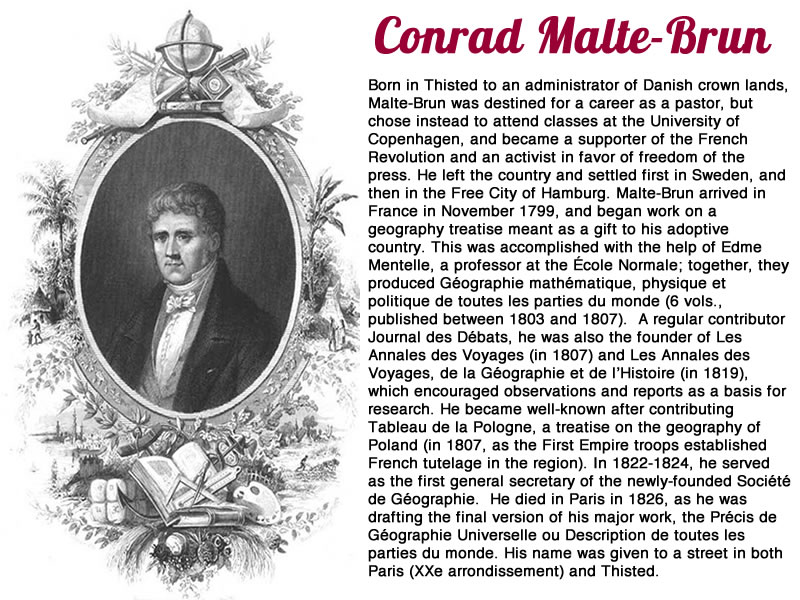
Ancient World Conrad Malte-Brun 1812

32300 The Ancient World, Conrad Malte-Brun,1812. Price: 35.00
GEOGRAPHIE D’HERODOTE
An engraved map depicting the world as known to the ancient Greek historian Heredotus (c.484 - c.425 BC) Uncoloured pictorial title cartouche. 11 3/4 x 8 3/4 inches. Original outline hand colouring. Water stain on edge of left hand blank margin and a spot in the right hand blank margin but otherwise good undamaged condition.
From: Atlas Complete du Précis de la Géographie Universelle
From: Atlas Complete du Précis de la Géographie Universelle
19th Century Map of the Twin Hemispheres of the World
-

The World Conrad Malte-Brun 1812

32316 The World, Conrad Malte-Brun,1812. Price: 185.00
MAPPE-MONDES SUR DIVERSES PROJECTIONS
A twin hemisphere map of the world with five additional oval and circular projectin of the earth. The title is shown on a banner held by two figures representing America and Asia in an uncoloured lakeside scene with other figures. 18 x 12 1/2 inches, 470 x 325 mm. Original outline hand colouring. Some very light browning and foxing mainly around the outer edges of the map. Tiny split at the bottom of the centre fold. Otherwise good condition.
From: Precis de la Geographie universelle, ou description de toutes les parties du monde
Late 18th Century Map of the Twin Hemispheres of the World
-

The World Conrad Malte-Brun 1812

33132 The World, Emanuel Bowen, c.1750.Price: 145.00
THE GLOBULAR PROJECTION OR A MAP OF THE WORLD DRAWN FROM THE BEST AUTHORITIES REGULATED BY ASTRONL.OBSERVATNS
A small interesting engraved map of the twin hemispheres which predates Captain Cook’s discoveries in the Pacific and north west coast of America. Outline showing part of Australia. Some 10 1/2 x 5 1/2 inches with good margins. Light crease across the bottom right hand margin corner. Evidence of two original vertical fold lines. Uncoloured. Good condition.
Antique Map of the World on Mercator's Projection
-

The World Alexander Findlay c.1820

33149 The World, Alexander Findlay, c.1820. Price: 48.00
THE WORLD ON MERCATOR’S PROJECTION
An interesting map of The World engraved by Alexander Findlay and published by Thomas Kelly at 53 Paternoster Row, London. Australia is shown with a partly mapped southern coast and North America is joined to Greenland. 15 3/4 x 9 1/2 inches. Uncoloured. Some light vertical creasing. Repair to the right hand blank margin.
19th Century Map of the Twin Hemispheres
-

The World J. Shury c.1840

33155 The World, J. Shury, c.1840. Price: 20.00
THE WORLD
A twin hemisphere map of the world bearing the name of the engraver John Shury who also engraved maps for the S.D.U.K. About 9 /2 x 5 inches. Uncoloured. Good condition.
Antique Map of the Comparative Lengths of Rivers
-

Pricipal Rivers of the World W H Lizars c.18298

33247 Lengths of the Principal Rivers of the World, W. H. Lizars, c.1828. Price: 140.00
PLAN OF THE LENGTHS OF THE PRINCIPAL RIVERS THROUGHOUT THE WORLD
A visually striking map showing river lengths divided into Europe, Asia, America and Africa. A panel provided more information. Pictorial title cartouche with figure and a view beneath showing the rivers flowing into the sea with sailing ships and lighthouse. Drawn and engraved by W. H. Lizars. Original centre fold. Fine clean crisp condition condition. Straight from the atlas and not previously been sold before as a single map.
From: A New General Atlas by Thomson & Co
Early 19th Century Map of the Twin Hemispheres
-

Twin Hemisphere map of the World by Benjamin Baker 1800

33379 The World, Benjamin Baker, 1800. Price: 72.00
MAP OF THE WORLD FROM THE BEST AUTHORITIES
A map engraved by Benjamin Baker of Islington showing the twin hemispheres of the world. Of particular interest is Australia named as new Holland and showing Tasmania joined. The title is shown within an oval panel. Plate one appears in the top left-hand corner. Some 14 x 7 1/4 inches. Traces of three original vertical fold creases. Good clean condition.
From: A New Geographical, Historical and Commercial Grammar and Present State of the Several Kingdoms of the World
The Ancient World
-

The Ancient World, Dr. Henry Kiepert c.1902

33441 Ancient World, Dr. Henry Kiepert, c.1902. Price: 20.00
ORBIS TERRARUM
A lithograph map of the ancient world in ancient times. Three inset maps. 17 1/4 x 13 1/2 inches. Original centre fold. Good condition.
From: Atlas Antiquus published in Berlin
Turkey in Ancient Times
-

Turkey in Ancient Times, Dr. Henry Kiepert c.1902

33444 Turkey, Dr. Henry Kiepert, c.1902. Price: 19.00
ASIA CITERIOR
A lithograph map showing the regions of Turkey, Cyprus, Palestine and Mesopotamia in ancient times. 17 1/4 x 13 1/2 inches. Original centre fold. Good condition.
From: Atlas Antiquus published in Berlin
Chronological Table
-

The Rise & Progress of Christiantity & Mahomedanism. James Wyld 1839

27994 Chronology Chart - Christianity & Mohomedanisn, James Wild 1839. Price: 34.00
CHRONOLOGICAL CHART EXHIBITING THE RISE & PROGRESS OF CHRISTIANITY & MAHOMEDANISM THROUGHOUT THE WORLD TO THE XIXth CENTURY
An engraved chart with oval title panel. 9 1/4 x 7 1/4 inches. Early hand colouring.
From An Atlas of Maps of Different Parts of the World; designed to show the stations of the Protestant Missionaries By James Wyld, Geographer to the Queen. London: James Wyld, Charing Cross East. MDCCCXXXIX
The Middle Ages
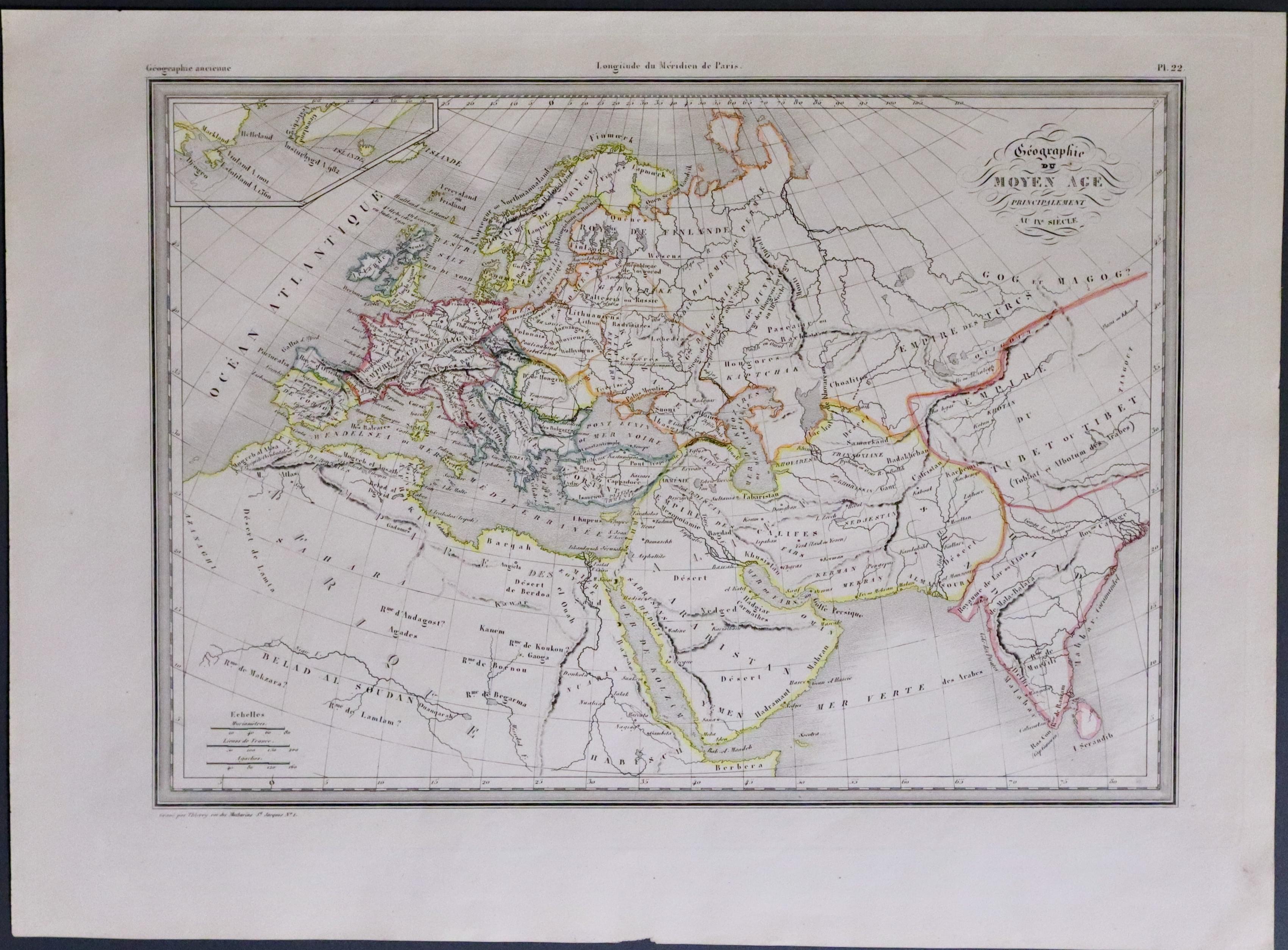
33543 The Moyen Age, Conrad Malte-Brun, c.1837. Price: 24.00
GEOGRAPHIE DU MOYEN AGE PRINCIPALEMEN DDES IX ET X SIEELES
An engraved map Europe and part of Asia in the Middle Ages. Moyen Age is a French term for the period of European History in the 5th to 15th centuries. 12 1/4 x 8 3/4 inches. Original outline hand colouring. Good condition.
From: Atlas Complet du Precis de la Geographie Universelle...
17th Century
-

Antarctic, Henricus Hondius / Jan Jansson, c.1650
-

German text on verso of Antarctic, Henricus Hondius / Jan Jansson, c.1650


33735 Antarctic, Hondius/Jansson, c.1650. Price: 950.00
POLUS ANTARCTICUS
A fascinating engraved map showing us how little we knew about this largely unexplored region halfway through the 17th century. The map by Hondius first appeared in in 1637 and was later used and revised for a period of some 60 years. Centred on the southern polar region it includes the southern parts of South America, South Africa and Madagascar plus Australia based on the recordings of Dutch explorers. The total of four vignette views with figures and animals in the corners are fascinating in their own right. Title cartouche bearing the name of Hondius. A second blank cartouche. 19 1/2 x 17 1/4 inches. Original centre fold. Uncoloured. Expert restoration to a portion of the top right hand blank margin. Some light creasing near the centre fold and to the right hand side. German text on verso.
From: Nieuwen Atlas, Ofte Weerelt-Beschrijvinghe. Amsterdam
Important World Map
-

The World Cornelius Danckerts c.1648
33761 The World, Cornelius Danckerts, c.1648. Price: 750.00
ORBIS TERRARUM TYPUS DE INTEGRO IN PLURIMIS EMENDATUS, AUCTUS, ET INCUNCULIS ILLUSTRATUS
An interesting twin hemisphere map world map. I had been having problems with identifying this map but noted that it was similar in design to a map by Nicolaes Visscher, map 406 in Rodney W. Shirley’s The Mapping of the World. On further investigation I was greatly helped by an entry in Dominic Winter’s auction in September 2024 who had found in the corrigenda to Shirley’s catalogue of world maps that the map was identified and described as a map believed to have been published in 1648. If so it is amongst the first to show both of Tasman's voyages of 1642-3 and 1644. California is shows as an island. There is an outline of Australia and Tasmania is shown. The mapping of Japan is incomplete.
18 3/4 x 12 3/4 inches, 475 x 32m mm. Later hand colouring. Paper lightly toned. Original centre fold and evidence of a vertical fold crease on the left and right hand sides some 1 1/4 inches from the edge of the sheet. Some small areas of restoration in the bottom blank and top blank margins. Otherwise good condition.
Early 19th Century Map Atlas of the World
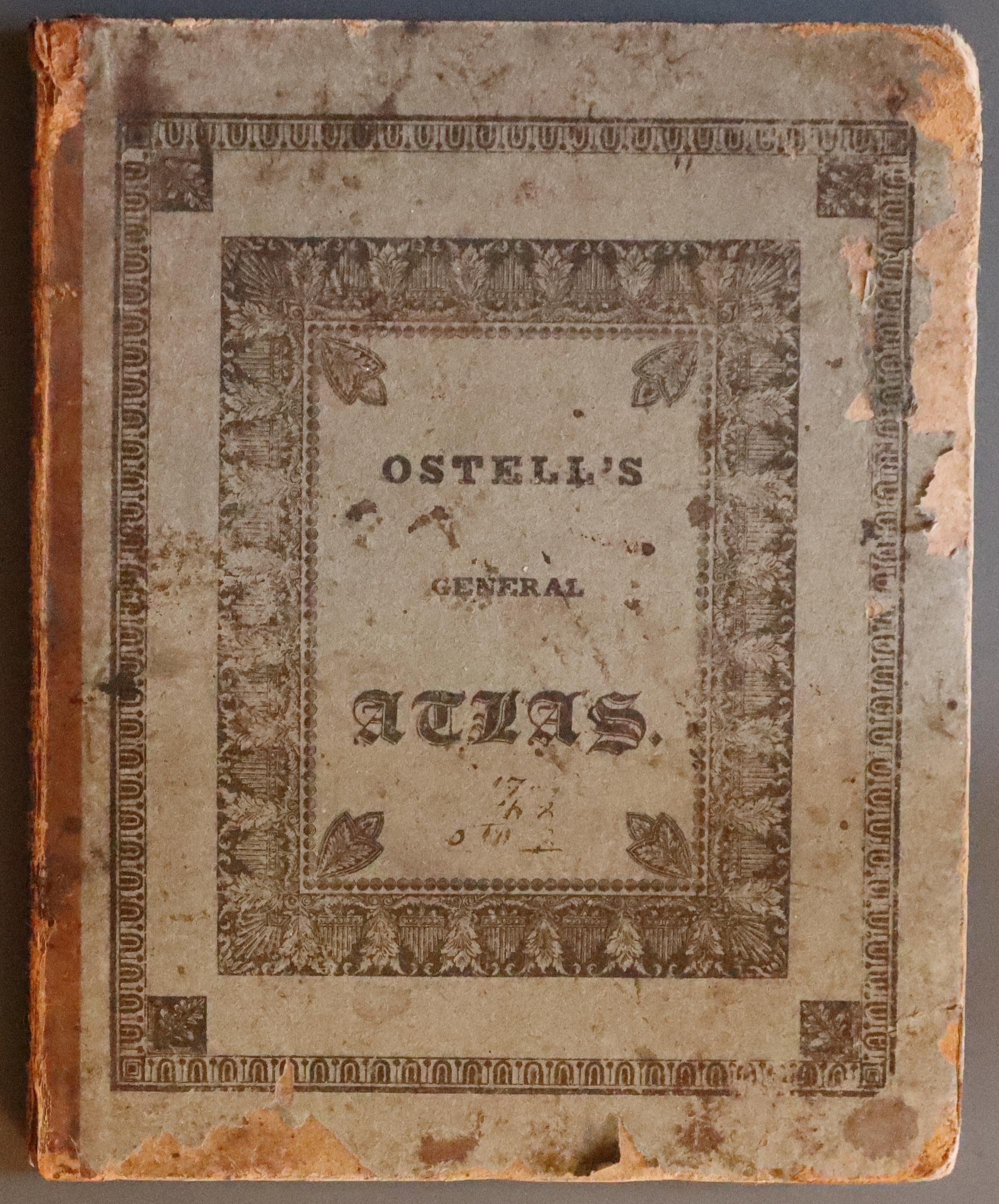
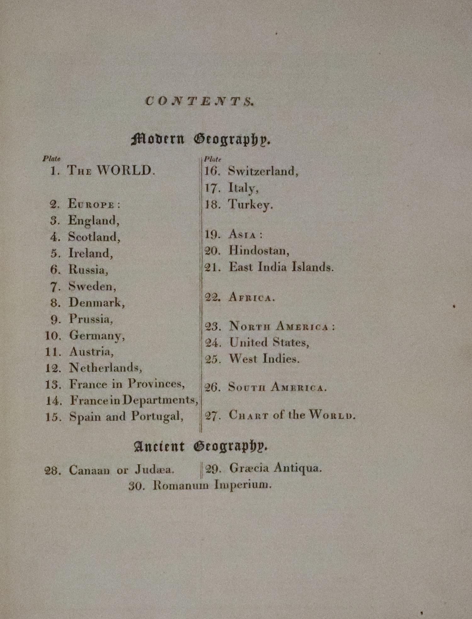
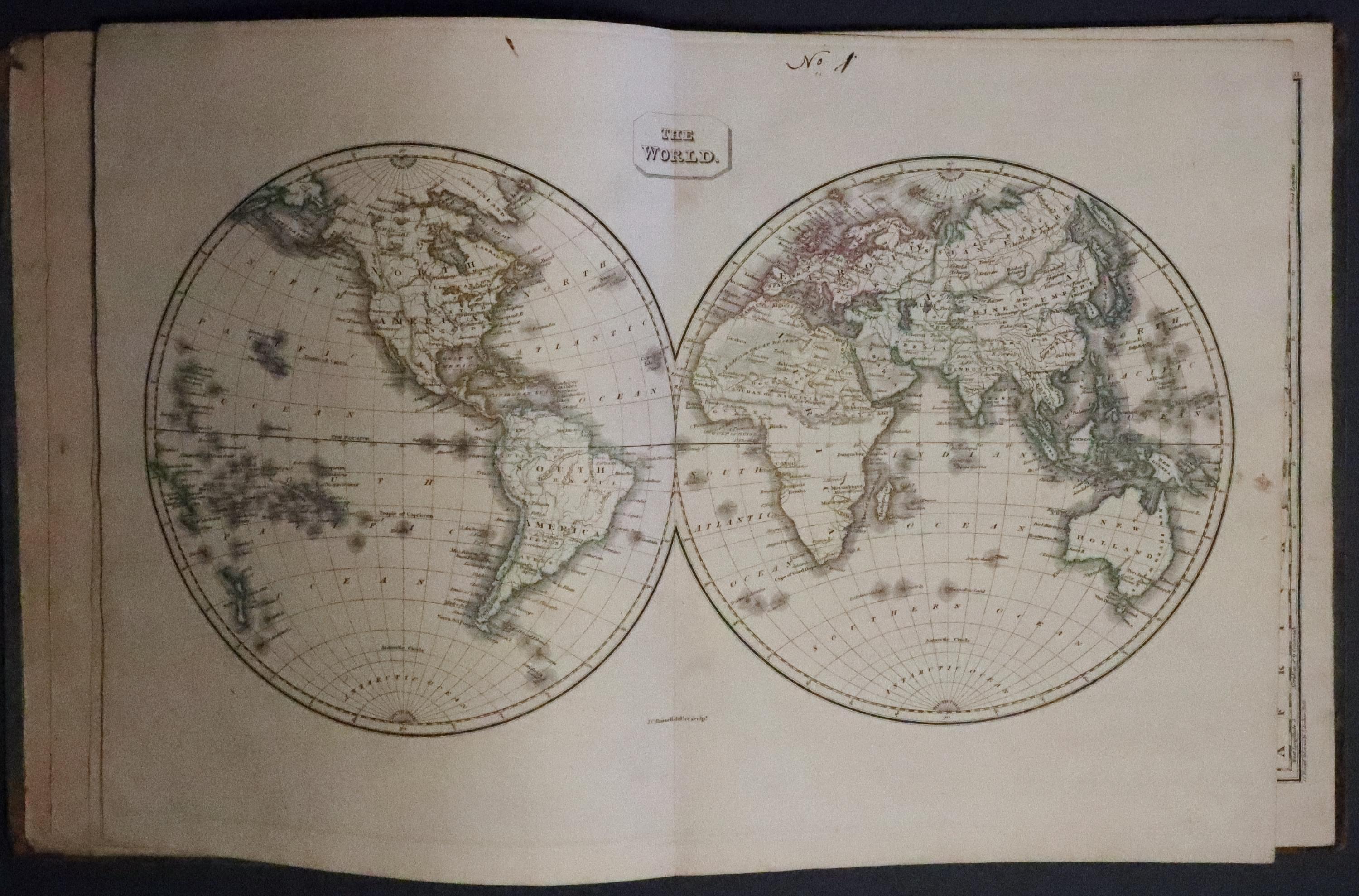
33249 Ostell's New General Atlas, 1825. Price: 195.00
OSTELL’S NEW GENERAL ATLAS CONTAINING DISTINCE MAPS OF ALL THE PRINCIPAL STATES AND KINGDOMS THROUGHOUT THE WORLD FROM THE LATEST AUTHORITIES...A NEW EDITION FROM A SET OF ENTIRELY NEW PLATES, ON AN ENLARGED SCALE. PUBLISHED FOR BALDWIN, CRADDOCK AND JOY, PATERNOSTER ROW 1825
4to, publisher's printed pasteboards, some rubbing, titlepage, contents page with publisher's advert on verso, 30 engraved maps with original outline hand colouring by J .C. Russell (complete), The two world maps are double-page. Manuscipt number in the top blank margin of each map. One or two small wormholes in the bottom blank margin of each map. Maps generally all in good clean condition.
Early 19th Century Atlas of the World with Early Hand Colouring
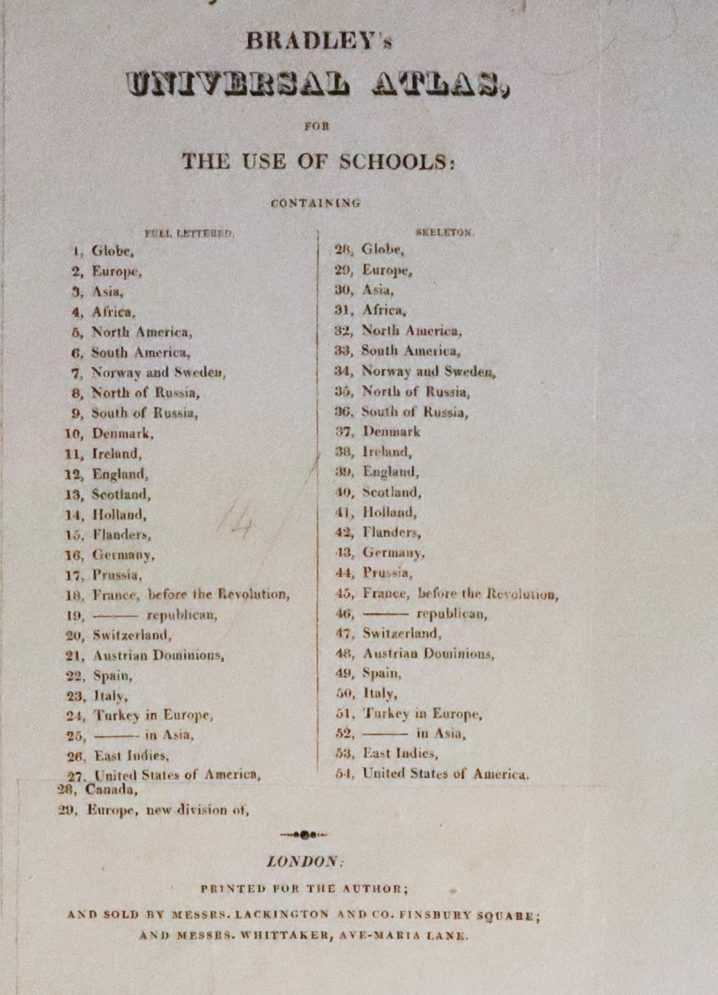

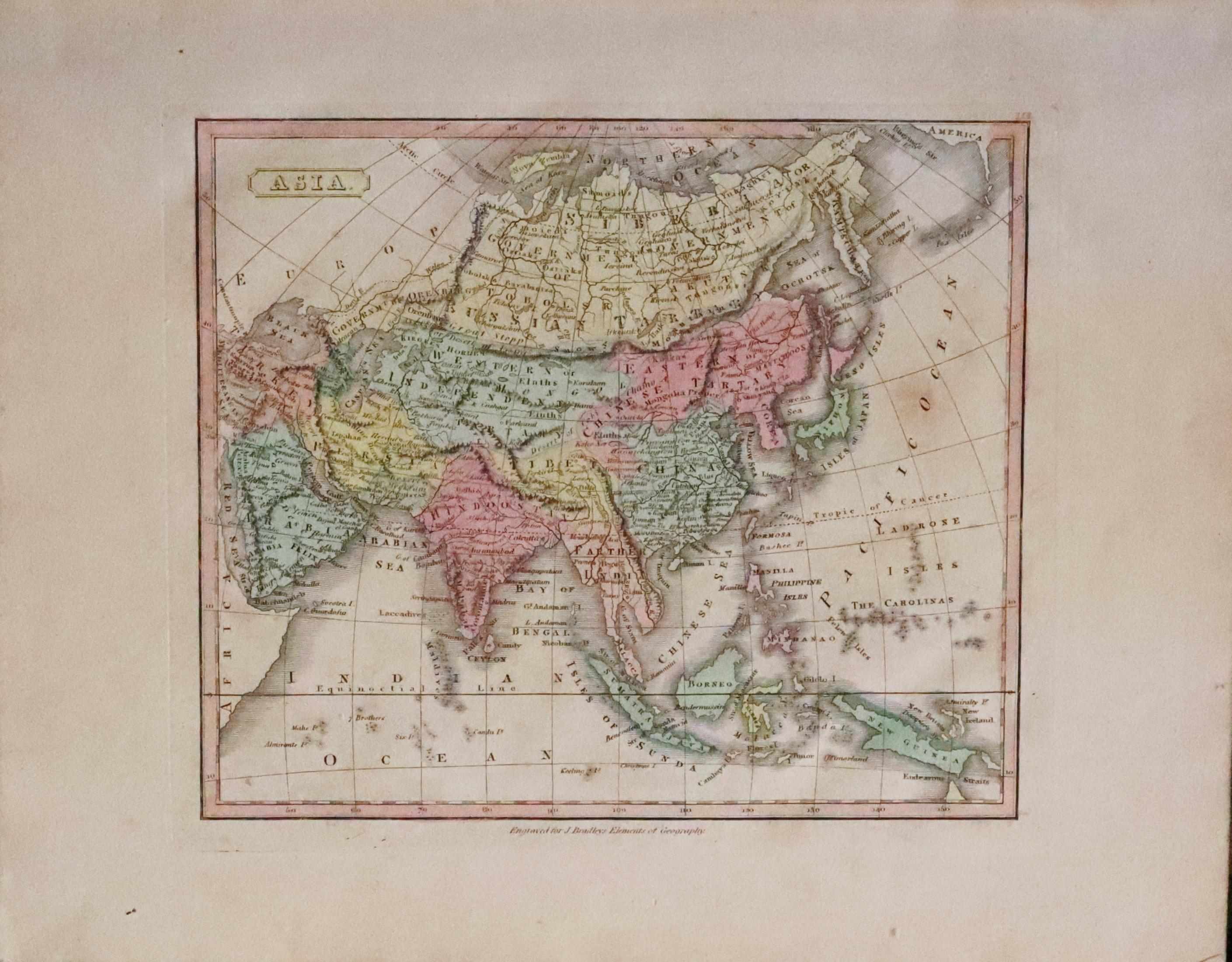
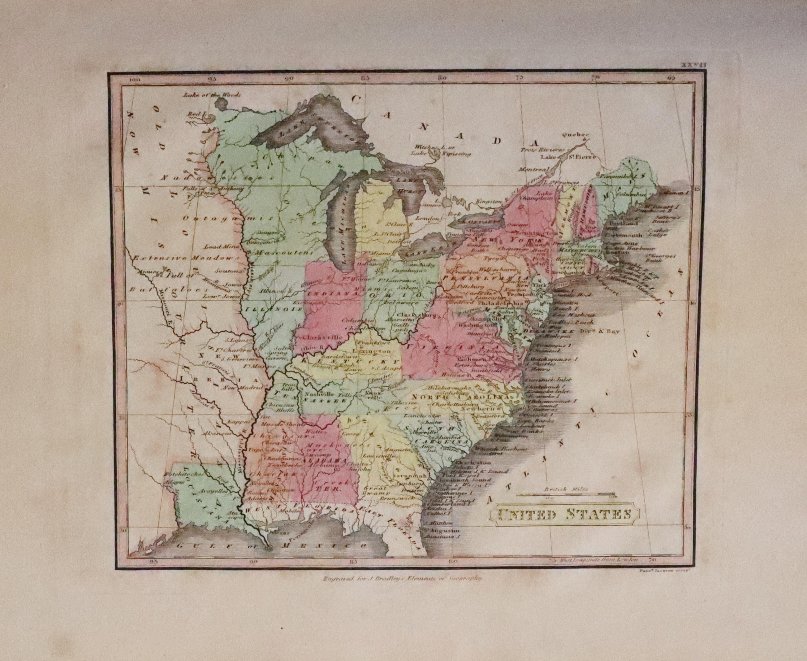
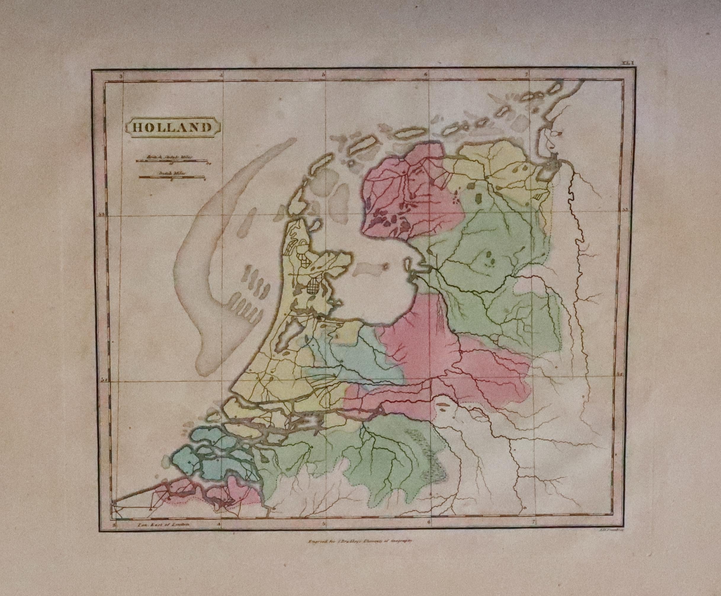
33250 Bradley's Universal Atlas, c.1818. Price: 230.00
BRADLEY’S UNIVERSAL ATLAS FOR THE USE OF SCHOOLS
No title page to this atlas which is possible missing. The title is shown on a pasted page onto the inside of the front board which lists the maps to which an additional piece of printed text has been pasted listing two further maps - Canada and New Division of Europe. Printed for the Author; and Sold by Messers. lackington and Co. Finsbury Square; and Messers. Whittaker, Ave-Maria Lane, London. There are 29 normal hand coloured engraved maps each bearing a publishers imprint “Engraved for J. Bradley’s Elements of Geography. These are followed by 27 hand coloured engraved maps titled but having no place names. Designed for educational use. Small corner missing of the wide blank margin on the Austrian Dominions map. Otherwise the maps are in nice order. Scattered very light browning on some maps but otherwise a nice specimen. Marbled boards with printed text showing through or transfered from with pasted title label. Quarter bound. Bookplate of R. H. Johnstone
Mid 19th Century Atlas of the World
-

The Cabinet Aylas title page
-

-

-

-


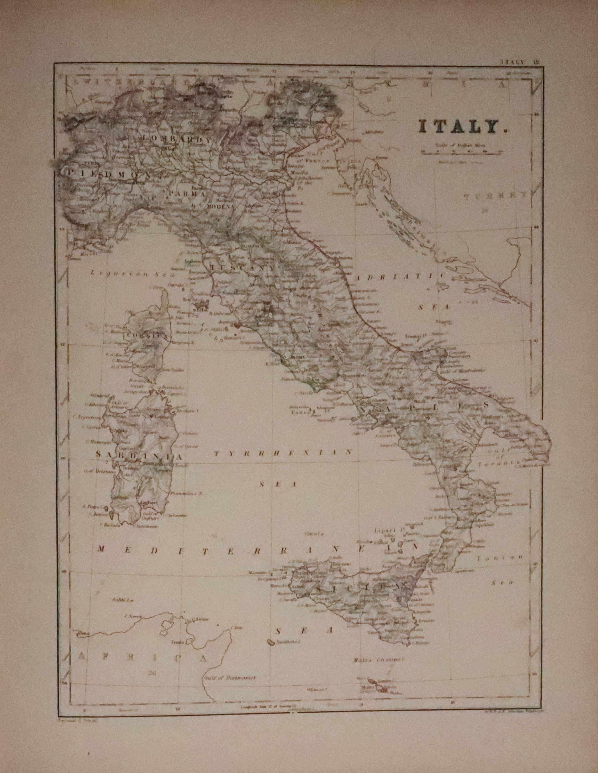
33251 The New Cabinet Atlas, A. J. Johnston, 1865. Price: 110.00
THE NEW CABINET ATLAS OF THE ACTUAL GEOGRAPHY OF THE WORLD With a Complete Index Constructed by A KEITH JOHNSTON, LLD.,FRSE.,FRGS. Geographer to the Queen / Edinburgh W. A. K. Johnston London E. Stanfodf. W. ALLAN & CO. 1865
Titled front board and plain back board, half bound with gilt edges. Some staining and ink marks to the margins of the the World map facing the title page dated 1865 which has some light browning. Contents page. The following 33 colour printed mapasare all in good condition. 4to. Bookplate of R. H. Johnstone

RICHARD NICHOLSON
of CHESTER
Stoneydale
Pepper Street
Christleton
Chester
CH3 7AG
Telephone
01244 336004
International 44 1244 336004

I have been buying and selling antique maps since the early 1960's during which time I had a gallery in Watergate Street, Chester for 30 years. I am now able to offer through my websites a personal service to map and print collectors.

