Antique Maps of the Middle East
Richard Nicholson of Chester

A World of Antique Maps and Prints
Established in 1961
All the Maps on this page are guaranteed to be genuine early specimens
published in or around the year stated
16th Century
-

Middle East Sebastian Munster 1598
-

Middle East Sebastian Munster 1598


14990 Middle East, Sebastian Munster, 1598. Price: 280.00
SYRIA / CYPERN / PALESTINA / MESOPOTAMIA / BABYLONIA
An early woodcut map of the Eastern Mediterranean and the Middle East. It shows the area from northern Syria to the Red Sea and the Persian Gulf. With Cyprus and the Holy Land. The title appears above the map. Two panels of text within the map area. 14 x 12 inches. Uncoloured. Original centre fold. Good clean undamaged condition.
From: A German edition of Sebastian Munster’s Cosmographia published in Basel by Henri Petri
19th Century - Early Hand Colouring
-

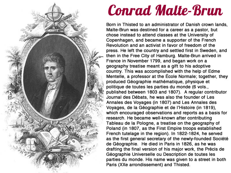
Middle East and Arabia Conrad Malte-Brun 1812

18077 Land of the Hebrews, Conrad Malte-Brun, 1812. Price: 87.00
GÉOGRAPHIE DEL HEBREUX
An engraved map showing Turkey, Holy Land, Arabia and the Red Sea in ancient times. Engraved by Jean-Baptiste-Marie Chamouin who worked in Paris. Uncoloured pictorial title cartouche with tents and a shepherd with sheep and camels. 8 1/2 x 11 3/4 inches. Original outline hand colouring. Brown stain across the top of the upper blank border where the map has been attached to a sunk mount. Otherwise good condition.
From: Precis de la Geographie universelle, ou description de toutes les parties du monde
19th Century - Early Hand Colouring
-

Asia Minor Conrad Malte-Brun 1812

24900 Asia Minor and Syria, Conrad Malte-Brun, 1812. Price: 37.00
ASIE MINEURE, ARMENIE, CAUCASE, SYRIE, ETC
An engraved map of the region in ancient times including the island of Cyprus. Uncoloured pictorial title cartouche. 11 3/4 x 8 1/2 inches. Original early outline hand colouring. Manuscript N10 in the blank margin. Small brown mark in the lower blank margin otherwise good condition.
From: Atlas Complete du Précis de la Géographie Universelle
19th Century - Early Hand Colouring
-

Ancient Palestine Conrad Malte-Brun 1812

24901 Ancient Palestine, Conrad Malte-Brun, 1812. Price: 47.00
PALESTINE / ROYAUME DES ISRAELITES SOUS DAVID ET SOLOMON / LES DOUZE TRIBES
Three engraved maps on one sheet. The largest shows Palestine in ancient times whilst the smaller maps show Israel. 11 3/4 x 8 1/2 inches. Manuscript N11 in the blank margin. Original early outline and colouring. Good condition.
From: Atlas Complete du Précis de la Géographie Universelle
19th Century - Early Hand Colouring
-

Historical Table 1813 to 1816. C. V. Lavoisne, 1830

27531 Historical Table 1813 to 1816. C. V. Lavoisne, 1830: Price: 20.00
GENEALOGICAL, HISTORICAL, & CHRONOLOGICAL MAP OF THE KINGS OF PERSIA AND SYRIA, FROM A.M. 3405 TO 3939
A fascinating table which would make a most interesting wall decoration. 20 1/2 x 16 1/2. Original wash hand colouring. Good condition.
From: Lavoisne’s Complete Genealogical, Historical, Chronological, and Geographical Atlas. The fourth edition printed and published by J. Barfield in London
19th Century - Early Hand Colouring
-

Genealogical Table, C. V. Lavoisne, 1830

27533 Genealogical Table, C. V. Lavoisne, 1830: Price: 21.00
GENEALOGICAL, HISTORICAL, AND CHRONOLOGICAL MAP OF SACRED HISTORY, FROM THE CREATION TO THE REIGN OF SAUL, FIRST KING OF ISRAEL
A fascinating table which would make a most interesting wall decoration. 20 1/2 x 16 1/2. Original wash hand colouring. Good condition.
From: Lavoisne’s Complete Genealogical, Historical, Chronological, and Geographical Atlas. The fourth edition printed and published by J. Barfield in London
19th Century - Early Hand Colouring
-

Canaan, C. V. Lavoisne, 1830

27537 Canaan, C. V. Lavoisne, 1830: Price: 45.00
GEOGRAPHICAL AND HISTORICAL MAPS ILLUSTRATIVE OF SACRED HISTORY. CANAAN, WITH THE PART OF EGYPT, DURING THE RESIDENCE OF THE ISRAELITESM IN THE DESERT | CANAAN, SUSEQUENT TO ITS CONQUEST BY THE ISRAELITES, AND ITS DIVISION AMONG THE TRIBES
Two engraved maps on a folio sheet with a panel beneath in English. 20 1/2 x 16 1/2. Original wash hand colouring. Good condition.
From: Lavoisne’s Complete Genealogical, Historical, Chronological, and Geographical Atlas. The fourth edition printed and published by J. Barfield in London
18th Century - Early Hand Colouring
-

Basra, J. N. Bellin, 1764

26572 Basra, J. N. Bellin, 1764. Price: 47.00
CARTE DES EMBOUCHURES DE L’EUPHRATE
An engraved chart showing the entrance to Basra. Uncoloured rococo cartouche displaying the title and scale.7 x 8 1/4 inches. Original blue outline and wash colouring. Good condition.
From: Le Petit Atlas Maritime Volume 3 Map 9
19th Century - Miniature
-

Judea and Israel, Thomas Starling, 1850

27088 Judea and Israel, Thomas Starling, 1850. Price: 12.50
KINGDOMS OF JUDAH AND ISRAEL ILLUSTRATIVE OF THE BOOKS OF KINGS AND CHRONICLES
A small engraved map with original outline and wash hand colouring. 3 3/4 x 5 3/4 inches. Good condition. Published by Henry G. Bohn, York Street, Covent Garden, London.
19th Century - Miniature
-

David and Solomon, Thomas Starling, 1850

27089 David and Solomon, Thomas Starling, 1850. Price: 13.50
KINGDOM OF DAVID AND SOLOMON
A small engraved map with original outline and wash hand colouring. 3 3/4 x 5 3/4 inches. Good condition. Published by Henry G. Bohn, York Street, Covent Garden, London.
19th Century - Miniature
-

Tribes of Cad and Reuben, Thomas Starling, 1850

27094 Tribes of Cad & Reuben, Thomas Starling, 1850. Price: 13.50
TRIBES OF CAD & REUBEN
A small engraved map with original outline and wash hand colouring. 3 3/4 x 5 3/4 inches. Good condition. Published by Henry G. Bohn, York Street, Covent Garden, London
19th Century - Miniature
-

Judea, Thomas Starling, 1850

27091 Judea, Thomas Starling, 1850. Price: 13.50
JUDEA ACCORDING TO JOSEPHUS
A small engraved map with original outline and wash hand colouring. 3 3/4 x 5 3/4 inches. Good condition. Published by Henry G. Bohn, York Street, Covent Garden, London.
19th Century - Miniature
-

Judea, Thomas Starling, 1850

27092 Judea, Thomas Starling, 1850. Price: 13.50
JUDEA ACCORDING TO THE APOCRYPHICAL BOOKS
A small engraved map with original outline and wash hand colouring. 3 3/4 x 5 3/4 inches. Good condition. Published by Henry G. Bohn, York Street, Covent Garden, London.
19th Century - Miniature
-

Half Tribe of Manasseh, Thomas Starling, 1850

27093 Half Tribe of Manasseh, Thomas Starling, 1850. Price: 13.50
THE HALF TRIBE OF MANASSEH BEYOND JORDAN
A small engraved map with original outline and wash hand colouring. 3 3/4 x 5 3/4 inches. Good condition. Published by Henry G. Bohn, York Street, Covent Garden, London.
19th Century - Miniature
-

Judea or Palestine, Thomas Starling, 1850

27096 Judea or Palestine, Thomas Starling, 1850. Price: 12.50
JUDEA OR PALESTINE ILLUSTRATING THE HISTORY OF THE NEW TESTAMENT AND EXHIBITING THE TRAVELS OF THE LORD JESUS CHRIST
A small engraved map with original outline and wash hand colouring. 3 3/4 x 5 3/4 inches. Good condition. Published by Henry G. Bohn, York Street, Covent Garden, London.
19th Century - Miniature
-

Judea and Israel, Thomas Starling, 1850

27097 Judea and Israel, Thomas Starling, 1850. Price: 13.50
CANAAN SHOWING THE CAPTIVITIES OF JUDEA & ISRAEL
A small engraved map with original outline and wash hand colouring. 3 3/4 x 5 3/4 inches. Good condition. Published by Henry G. Bohn, York Street, Covent Garden, London.
19th Century - Miniature
-

Canaan, Thomas Starling, 1850

27098 Canaan, Thomas Starling, 1850. Price: 13.50
CANAAN SHOWING THE CAPTIVITIES OF JUDEA & ISRAEL
A small engraved map with original outline and wash hand colouring. 3 3/4 x 5 3/4 inches. Good condition. Published by Henry G. Bohn, York Street, Covent Garden, London.
19th Century - Miniature
-

Tribes of Asher and Naphtali, Thomas Starling, 1850

27099 Tribes of Asher and Naphtali, Thomas Starling, 1850. Price: 13.50
TRIBES OF ASHER AND NAPHTALI
A small engraved map with original outline and wash hand colouring. 3 3/4 x 5 3/4 inches. Good condition. Published by Henry G. Bohn, York Street, Covent Garden, London.
19th Century - Early Hand Colouing
-

Historical Table, C. V. Lavoisne, 1830

27535 Historical Table, C. V. Lavoisne, 1830: Price: 20.00
GENEALOGICAL, HISTORICAL, & CHRONOLOGICAL MAP OF THE EMPIRE OF ASSYRIA AND OF THE KINGDOMS OF LYDIA
A fascinating table which would make a most interesting wall decoration. 20 1/2 x 16 1/2. Original wash hand colouring. Good condition.
From: Lavoisne’s Complete Genealogical, Historical, Chronological, and Geographical Atlas. The fourth edition printed and published by J. Barfield in London
18th Century Sea Chart
-

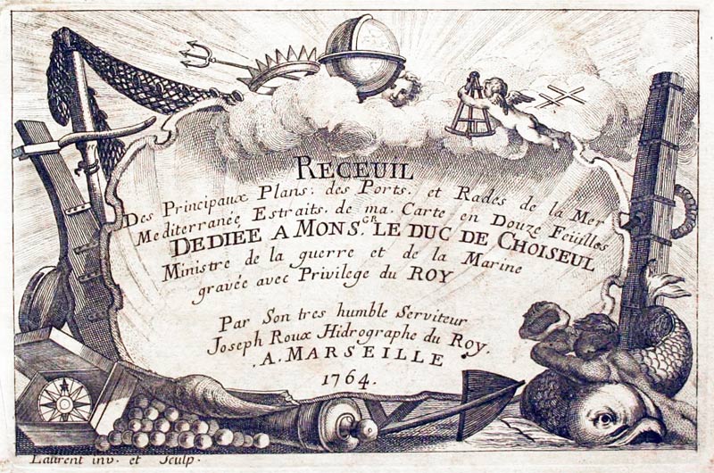
Haifa, Israel, Joseph Roux, 1764

27958 Haifa, Israel, Joseph Roux, 1764. Price: 48.00
GOLFE DE CAIFFE
A small engraved chart showing the bay with Haifa and Acre. Rhumb lines and shows the soundings and anchorage points. 7 3/4 x 5 inches. Uncoloured. Good condition.
Plate 119 From Receuil Des Principaux Plans; des Ports, et Rades de la Mer Mediterranée, Estraits, de ma. Carte Douze Feüilles.... Marselle 1764
18th Century Sea Chart
-

Syria, Joseph Roux, 1764

27959 Syria, Joseph Roux, 1764. Price: 35.00
SYRIE
A small engraved chart orientated with east at the top showing Beirut and part of the coast. . Shows the depth soundings and anchorage points. Scale. 7 1/2 x 5 inches. Uncoloured. Good condition.
Plate: 117 From: Receuil Des Principaux Plans; des Ports, et Rades de la Mer Mediterranée, Estraits, de ma. Carte Douze Feüilles.... Marselle 1764
18th Century Sea Chart
-

Alexandrette, Joseph Roux, 1764

27962 Alexandrette, Joseph Roux, 1764. Price: 30.00
SIRIE
A small engraved chart showing the old Port of Alexandrette and Saudin with Cape Canzir. Shows the depth soundings and anchorage points. Scale. 7 1/2 x 5 inches. Uncoloured. Good condition. Trimming to the top right hand blank margin with loss of the plate number.
Plate: 119 From: Receuil Des Principaux Plans; des Ports, et Rades de la Mer Mediterranée, Estraits, de ma. Carte Douze Feüilles.... Marselle 1764
16th Century
-

Jerusalem, Sebastian Munster, 1598.

29756 Jerusalem, Sebastian Munster, 1598. Price: 400.00
JERUSALEM
A fascinating late 16th century view of Jerusalem at a time when it was controlled by the Turks. It shows the major temples, squares, walls and gates. 15 x 6 1/4 inches. Set within a page of German text. Good clean condition.
This view was originally sold by me in 1990 at which time I had split a copy of Munster’s Cosmography. Those were the days when I used to produce printed catalogues and a special catalogue for the collection of maps from
MUNSTER (SEBASTIAN): COSMOGRAPHEY : DAS IS BESCHREIBING ALLER LANDER HERZSCHAFFTEN UND FUR NEMESTEN STETTEN DES GRANTZEN ERDBODENS... Tekst aber mit allerlen Gedechtnuswirdigen Sachen biss in M.D.XCVIII,
18th Century
-

Dispersion of the Nations, Thomas Stackhouse, 1756

30111 Dispersion of the Nations, Thomas Stackhouse, 1756. Price: 95.00
A MAP SHEWING THE GENERAL DISPERSION AND SETTLING OF THE NATIONS
An unusual engraved map of the Old World, showing the disbursement and settlement of the ancient peoples and tribes. Tribe and place names include Japhet, Ham, Shem, Magog, Madi, Aschenez, Dodanim, Tarshish, Kittim, Omer, Riphath, Phut, Lehabim, Mizraim, Joktan, Bithynia, Lydia, Gether, Cus, Uzal, Sheba, Mesha, Jobab, Ophir and others. Dedicated to the Right Reverand Father of God Richard Ld.Bishop of Litchfield & Coventry. 9 3/4 x 8 inches. Hand coloured. Good condition
From A History Of The New Testament Of Our Lord And Saviour Jesus Christ...
19th Century - Early Hand Colouring
-

Syria, George Frederick Cruchley, 1848

31528 Syria, George Frederick Cruchley, 1848. Price: 44.00
SYRIA
A clearly engraved map bearing the imprint October 1st 1841. Publishers rococo cartouche inscribed Cruchley’s Improved Atlas, for Schools & Families. 13 3/4 x 17 1/4 inches. Original outline and wash hand colouring. Some light browning in the centre fold otherwise good condition.
From: Cruchley’s General Atlas for the use of Schools and Private Tuition

19th Century - Early Hand Colouring
-

Canaan, George Frederick Cruchley, 1848

31533 Canaan, George Frederick Cruchley, 1848. Price: 49.00
CANAAN OR THE LAND OF PROMISE
A clearly engraved map bearing the imprint December 1st 1841. Publishers rococo cartouche inscribed Cruchley’s Improved Atlas, for Schools & Families. 13 3/4 x 17 1/4 inches. Split at one end of the centre fold and some light browning in the centre fold.
From: Cruchley’s General Atlas for the use of Schools and Private Tuition
19th Century - Early Hand Colouring
-

Palestine, George Frederick Cruchley, 1848

31534 Palestine, George Frederick Cruchley, 1848. Price: 40.00
PALESTINE IN THE TIME OF OUR SAVIOUR
A clearly engraved map bearing the imprint January 1st 1842. Addition to 1854. Publishers rococo cartouche inscribed Cruchley’s Improved Atlas, for Schools & Families. 13 3/4 x 17 3/4 inches. Original outline and wash hand colouring. Small slit at one end of the centre fold with a small hole in the fold in the sea area. Some browning in the centre fold. One inch tear on the left hand side of the map extending into the sea area.
From: Cruchley’s General Atlas for the use of Schools and Private Tuition
18th Century - Early Hand Colouring
-

Mesopotania, Christoph Weigel, 1720

31664 Mesopotania, Christoph Weigel, 1720. Price: 110.00
MESOPOTAMIAE, ASSYRIAE, ET BABYLONIAE TABULA
An interesting engraved map of the historical regions of Mesopotania and Babylon in biblical times. Inset map showing a wider area. The title is displayed on a tablet within a an engraved scene showing the Tower of Babel. 15 3/4 x 12 1/4 inches. Original hand colouring. Light brown lines around the edge of the map probably caused by the map being in a mount for some years. Also traces of where the map has been attached to a mount across the top of the blank margin. Otherwise nice undamaged condition.
From: Atlas Descriptio Orbis Antique in XLIV Tabulis
18th Century - Early Hand Colouring
-

Holy Land, Johann Baptist Homann, c.1740

32191 Holy Land, Johann Baptist Homann, c.1740. Price 80.00
JUDAE SEU PALAESTINA .... TERRA SANTA ..... JUDA ET ISRAEL
An interesting engraved folio sized map of the Holy Land divided into its tribes. The title is displayed within a large uncoloured cartouche showing Moses receiving the Tablets on Mount Sinai. In the bottom right hand corner is a second cartouche showing Moses, Aaron and the two spies of Moses bering a bunch of grapes.. 22 x 18 3/4 inches. Original outline and wash hand colouring to the map areas. This is not a perfect specimen of the map but this is reflected in the lower than usual price. There is a repair on the right hand side in the area of the explanation. Strengthening strips have been applied to the reverse side to provide new blank margins.
SPECIAL PRICE
19th Century - Miniature
-

Tribes of Judan and Simeon, Thomas Starling, 1850

32201 Tribes of Judah and Simeon, Thomas Starling, 1850. Price: 13.50
TRIBES OF JUDAH AND SIMEON
A small engraved map with original outline and wash hand colouring. 3 3/4 x 5 3/4 inches. Good condition. Published by Henry G. Bohn, York Street, Covent Garden, London.
19th Century - Miniature
-

Tribes of Issachar and Manassen, Thomas Starling, 1850.

32202 Tribes of Issachar and Manassen, Thomas Starling, 1850. Price: 13.50
TRIBES OF ISSACHAR & MANASSEN
A small engraved map with original outline and wash hand colouring. 3 3/4 x 5 3/4 inches. Good condition. Published by Henry G. Bohn, York Street, Covent Garden, London.
19th Century - Miniature
-

Tribe of Zebulon Thomas Starling, 1850

32203 Tribe of Ephraim Thomas Starling, 1850. Price: 13.50
TRIBE OF EPHRAIM
A small engraved map with original outline and wash hand colouring. 5 3/4 x 3 3/4 inches. Good condition. Published by Henry G. Bohn, York Street, Covent Garden, London.
19th Century - Miniature
-

Descendents of Noah Thomas Starling, 1850

32204 Descendants of Noah Thomas Starling, 1850. Price: 14.50
THE WORLD SHEWING THE PRIMITIVE SETTLEMENTS OF THE DESCENDANT OF NOAH
A small engraved map with an inset map of Paradise. Original outline and wash hand colouring. 5 3/4 x 3 3/4 inches. Good condition. Published by Henry G. Bohn, York Street, Covent Garden, London.
19th Century - Miniature
-

Encampment of the Israelites Thomas Starling, 1850

32205 Israelites, Thomas Starling, 1850. Price: 14.00
JOURNEYINGS & ENCAMPMENTS OF THE ISRAELITES FROM EGYPT TO CANAAN
A small engraved map with a long reference list. Original outline and wash hand colouring. 5 3/4 x 3 3/4 inches. Good condition. Published by Henry G. Bohn, York Street, Covent Garden, London.
19th Century - Miniature
-

Tribe of Zebulon Thomas Starling, 1850

32206 Tribe of Zebulon, Thomas Starling, 1850. Price: 13.50
TRIBLE OF ZEBULON
A small engraved map with an inset map of Paradise. Original outline and wash hand colouring. 5 3/4 x 3 3/4 inches. Good condition. Published by Henry G. Bohn, York Street, Covent Garden, London.
19th Century
-

Map of Syria by John Tallis c.1851

33225 Syria, John Tallis, c.1851. Price: 30.00
SYRIA
An engraved map of of Syria set within a decorative patterned border. The map is embellished with vignette views including Baggage Camels, Arabs and a view of Jerusalem. Original outline hand colouring. 9 3/4 x 12 3/4 inches. There is some child’s pencil drawings on verso. Also the number 38 in pencil in the top blank margin. I have not been able to totally erase this so it would be possible to hide it with a sunk mount before framing.
From: The Illustrated Atlas
Special price
19th Century - Early Hand Colouring
-

Middle East in Ancient Times, R. Wilkinson 1817

32522Middle East in Ancient Times, Robert Wilkinson, 1817. Price: 35.00
IMPERIUM PARTHICUM TEMPORRE ARSACIDUM
An interesting engraved map of the part of the ancient world showing the area of current day Iraq, Iran, Afghanistan and Pakistan. Publishers imprint beneath dated 1807. 11 x 8 3/4 inches. Original outline and wash hand colouring. Fine clean condition with good margins. Straight from the atlas and not previously sold as a single map.
From: Atlas Classica


RICHARD NICHOLSON
of CHESTER
Stoneydale
Pepper Street
Christleton
Chester
CH3 7AG
Telephone
01244 336004
International 44 1244 336004

I have been buying and selling antique maps since the early 1960's during which time I had a gallery in Watergate Street, Chester for 30 years. I am now able to offer through my websites a personal service to map and print collectors.